“Summer’s going fast, night’s growing colder“
Rush wrote that lyric in the song “Time Stand Still”, but it’s appropriate for where we are now, as some cooler weather is on the way as we flip the calendar to September and the beginning of meteorological autumn.
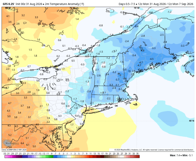
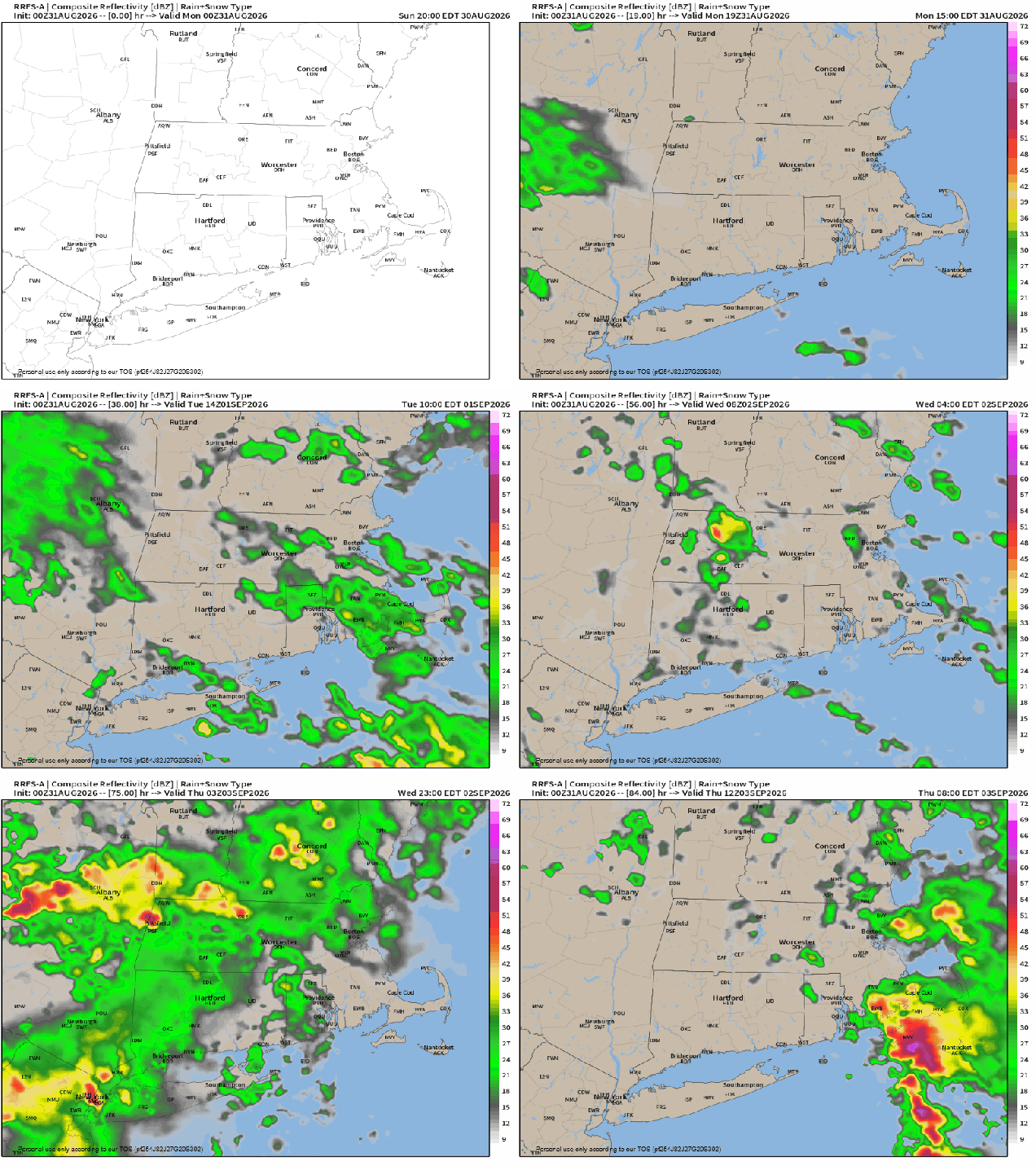
A backdoor cold front will drop southward today, likely stalling out just south and west of the region. The front will be accompanied by just a few clouds, but behind it, cooler air will settle in, especially near the east coast. A couple of waves of low pressure will ride along the front, keeping lots of clouds in place with some episodes of showers and a few thunderstorms at times between Monday night and Thursday. The last wave will lift the front northward as a warm front on Thursday, before a stronger cold front moves through late in the day, with some additional showers and thunderstorms. High pressure then builds in at the surface, but an upper-level low will settle into the Northeast for Friday and Saturday, possibly Sunday as well. The result will be sunshine each morning, some clouds build up, and a few spotty showers developing. For Labor Day, high pressure should result in dry and seasonably mild weather.
Monday: A mix of sun and clouds. High 75-82, cooler near the east coast, especially in the afternoon.
Monday night: Becoming mostly cloudy, showers developing. Low 60-67.
Tuesday: Cloudy with some showers and thunderstorms likely, mostly in the morning. High 68-75.
Tuesday night: Plenty of clouds with a few showers. Low 57-64.
Wednesday: Partly to mostly cloudy, showers and thunderstorms likely, mostly in the afternoon. High 68-75.
Wednesday night: Cloudy with more showers and thunderstorms. Low 59-66.
Thursday: Intervals of clouds and sun with another round of showers and thunderstorms expected. High 75-82.
Thursday night: Showers and storms end in the evening, becoming partly cloudy overnight. Low 60-67.
Friday: Partly sunny, chance for a shower or thunderstorm. High 72-79.
Saturday: Intervals of sun and clouds, a shower or thunderstorm possible in the afternoon. High 68-75.
Sunday: A mix of sun and clouds, chance for an afternoon shower or thunderstorm. High 69-76.
Labor Day: Partly to mostly sunny. High 73-80.

