We’re going to separate fantasy from reality in regards to a potential weekend storm, but first we’ve got some very cold weather to deal with.
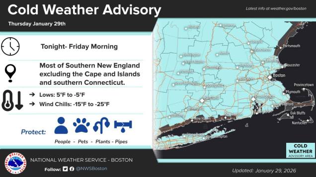
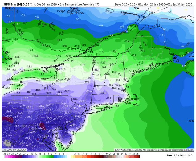
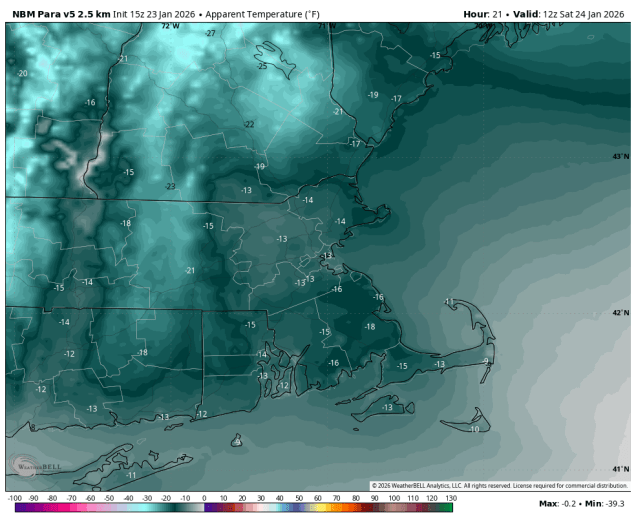
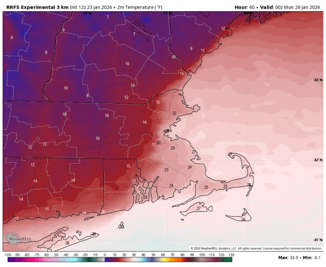
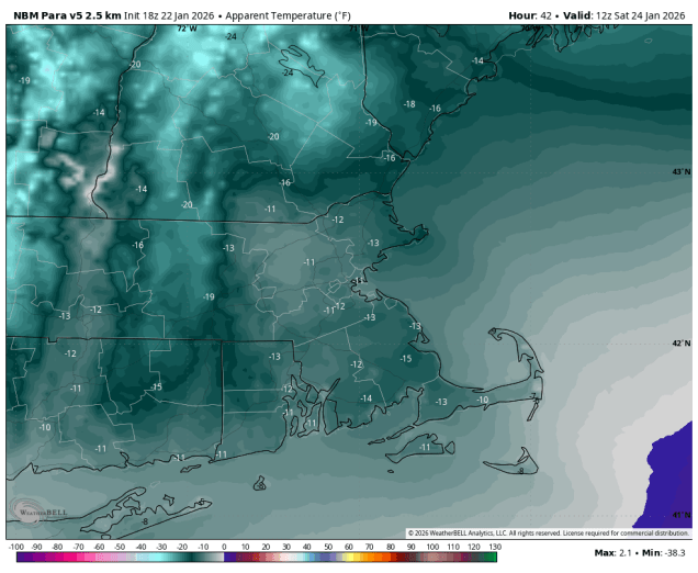
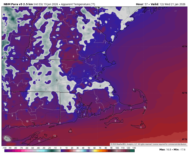
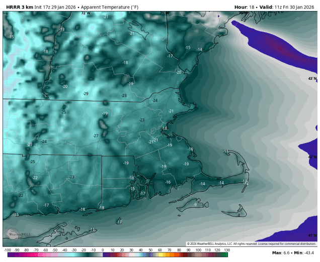
If it hasn’t been cold enough for you this week, then we have good news for you – it’s going to get even cold for the next couple of days. A reinforcing shot of arctic air moves in tonight on gusty north to northwest winds. Temperatures will likely drop below zero across much of the region overnight, but when you factor in the wind, it will feel like 15 to 25 below zero by morning. While the winds will only slowly slacken on Friday, and we’ll have plenty of sunshine, it will remain quite cold, with highs likely staying in the teens. Another very cold night is expected Friday night, and with diminishing winds, some radiational cooling is expected, so we’ll once again drop below zero in much of the region. Saturday will also be chilly, but not as cold as Friday, with highs likely getting into the 20s. We’ll also have more sunshine, but high clouds will start to stream in during the afternoon and evening ahead of a low pressure system developing off the Southeast coast.
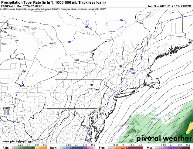
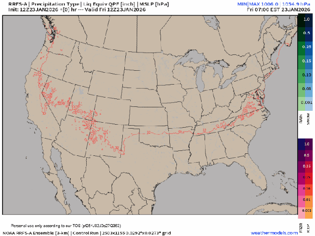
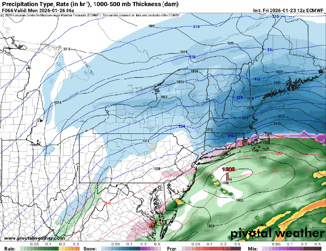
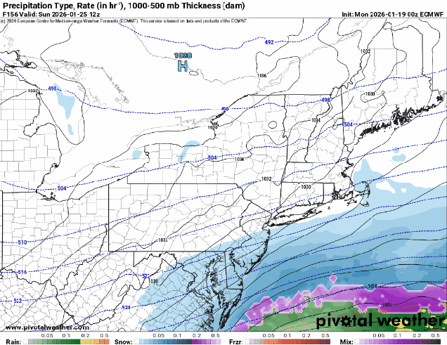
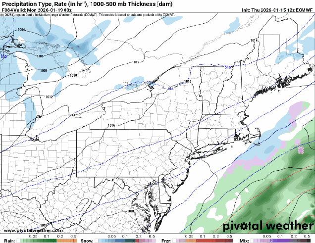
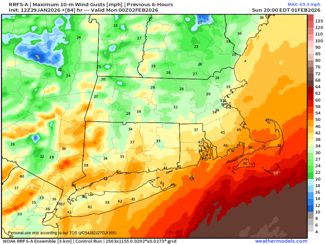
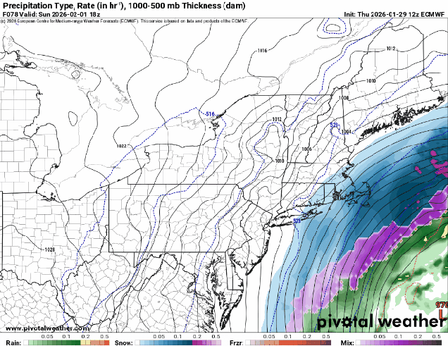
Despite the hype all week, we are not expecting another major snowstorm for much of the region at this point. Oh, it could still happen, but the odds continue to decrease for most (but not all) of the region. As the low heads northward on Sunday, it will rapidly strengthen – you’ve probably heard the term “bombogenesis” used. This term has been around for a long time, and the definition is a storm whose lowest pressure falls by 24mb or more over a 24 hour period. If you look at your home barometer, it’s probably reading around 29.9″ of mercury right now, which is about 1013mb. The low pressure system that will spawn our ocean storm is currently over northern Texas with a minimum pressure of 1015mb. By the time it reaches the Carolina coast, it should be down to around 1008mb. When it passes well south and east of New England Sunday night, it should be down to about 965-970mb. When a storm strengthens like that, the gradient between it and high pressure to the north will result in very strong winds, especially near the coast. This will be the case around here for Sunday and into Monday. We’re also near the astronomical high tides, so for northeast and north-facing coastal locations, some coastal flooding is possible with the high tides Sunday morning and again Monday morning.
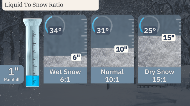
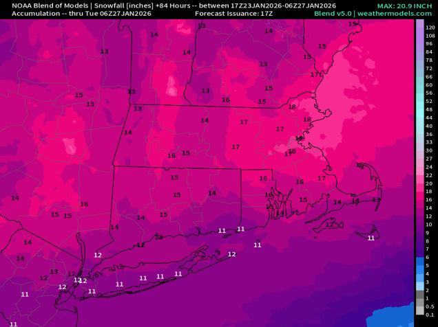
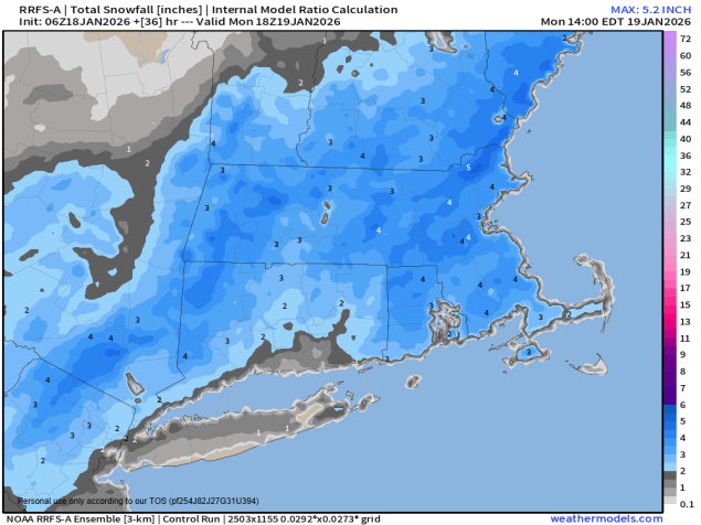
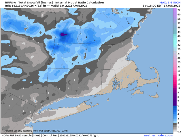
OK, it’s going to be cold, it’s going to be windy, there could be flooding issues along the coast, but what about snow? Well, the models aren’t in complete agreement yet, but they’re getting there, in terms of the potential for snow. For now, the system looks to be far enough offshore to prevent much of the region from a significant snowstorm. In fact, there’s a very good chance that areas north and west of Interstate 95 could see little to no snow at all. South and east of I-95, some snow is possible, becoming more likely the farther south and east you go. If anyone were to get significant snow from this, it would be Cape Cod (especially the Outer Cape), and Nantucket. Now, could the models start showing a trend closer to the coast, thus bringing more snow in farther north and west? Of course they could – the storm is still 3 days away, but at this point, it’s not looking likely. Obviously, we’ll keep a close eye on it. As the storm pulls away on Monday we’ll clear out, but winds may remain gusty.
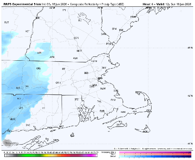
Thursday night: Evening clouds, maybe a lingering snow shower across the Outer Cape, then becoming clear and very cold. Low -4 to +3, a little milder on Cape Cod.
Friday: Sunshine and a few clouds, breezy, and cold. High 11-18.
Friday night: Mostly clear, winds diminish in the evening. Low 0 to -7, a little milder on Cape Cod.
Saturday: Sunshine dimmed by increasing afternoon high clouds. High 17-24.
Saturday night: Becoming mostly cloudy, winds start to increase late at night. Low 1-8, a little milder along the coast.
Sunday: Cloudy and windy with a chance of snow, mainly across southeastern Massachusetts and Cape Cod. High 21-28, a little milder across Cape Cod.
Sunday night: Any snow ending in the evening, some gradual clearing after midnight, winds slowly diminish. Low 12-19.
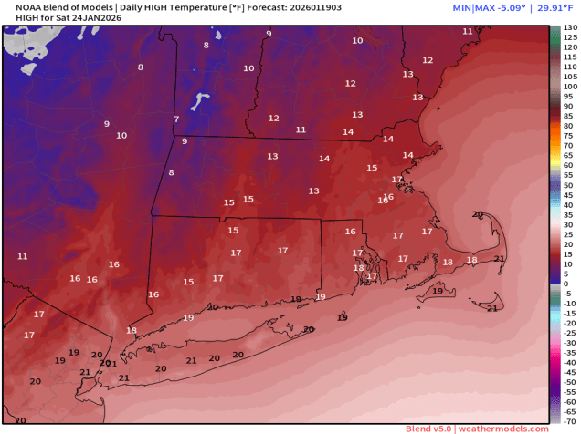
Monday: Becoming partly to mostly sunny, breezy in the morning. High 27-34.