The winter of little snow rolls on this week, with just a little bit of snow and more cold weather. Don’t worry, it won’t last too long, and it could be a LOT worse.
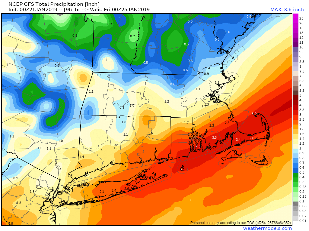
The week starts off with high pressure building in, giving us sunshine and seasonably cold conditions. Clouds will start to move in during the evening as low pressure heads towards the Midwest. As this system moves across the Great Lakes on Tuesday, snow will develop across the region Tuesday afternoon. A secondary area of low pressure will develop across the Mid-Atlantic states during the afternoon. This will help bring milder air into the region, changing to snow to rain during the afternoon and evening hours. Whether or not this changeover makes it into southern and central NH is still a question mark. Either way, this doesn’t look like a big snow producer, with a few inches across central and southern NH, and an inch or less elsewhere.

Once that secondary low pressure area moves past the area, colder air will quickly move back in, changing any rain back to snow before it ends towards daybreak. That’s not the end of the story though. We could see some sunshine develop in the afternoon, but an arctic front will move through late in the day. This front may produce some snow showers or squalls, which could impact the Wednesday evening commute, but they may hold off until a little later. These squalls may briefly lower visibility, and could drop a quick half inch or so, but the bigger story is what comes in behind the front.

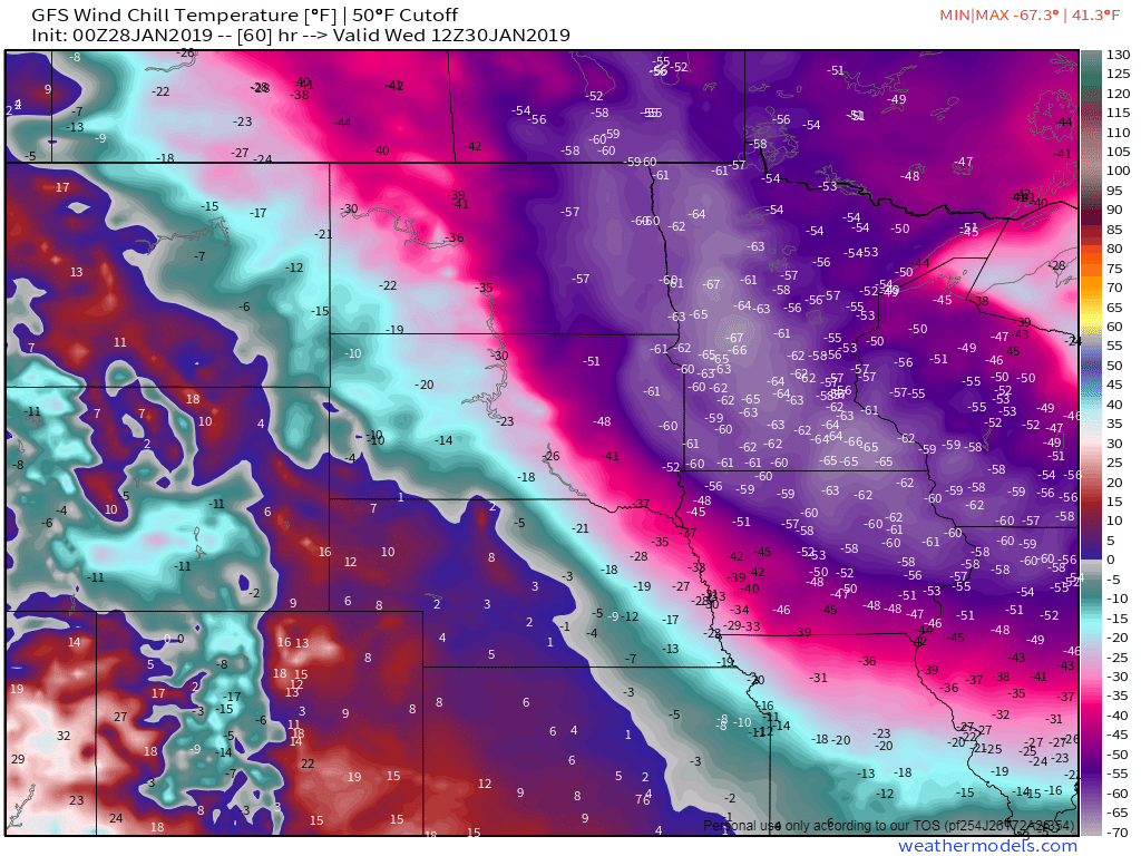
Skies clear out Wednesday night as high pressure builds in, ushering in much colder air. While it won’t be quite as cold as last Monday when most of the area had high temperatures around 5 degrees, we’ll have more wind this time, so wind chills will be well below zero on Thursday. So, how could it be worse? When this airmass moves into the Northern Plains and Upper Midwest later Tuesday into Wednesday, temperatures will be a LOT colder. Across parts of the Dakotas and Minnesota, low temperatures will drop near or below -40 Thursday morning, with afternoon highs not reaching -30 in some areas. This is actual air temperature, not wind chill. So what will the wind chills be? How does -60 to -65 sound? We’re not quite sure why people voluntarily live in this area, but they do.
Getting back to our weather, Thursday night will be chilly, but we’ll start to moderate on Friday as high pressure shifts to the east. Oh, it’ll still be cold, just not as cold as Thursday. The gradual warmup will continue on Saturday as high pressure moves offshore and then a warm front moves through on Sunday with milder weather moving in.
Monday: Mostly sunny and chilly. High 24-31.
Monday night: Increasing clouds. Low 15-22.
Tuesday: Cloudy with light snow developing in the afternoon, quickly changing to rain south of Boston. High 30-37.
Tuesday night: Light snow likely across central and southern NH, changing to rain from the MA/NH border southward during the evening. Rain changes back to snow everywhere after midnight, ending towards daybreak. Temperatures may rise a bit through midnight, then drop back to 22-29 by daybreak.
Wednesday: Breezy with any snow showers ending early, then skies become partly to mostly sunny. Snow showers or squalls are possible in the evening. High 26-33, but temperatures will quickly plunge at night.
Thursday: Partly to mostly sunny, breezy, and much colder. High 7-14.
Friday: Sunshine and afternoon clouds, still cold. High 17-24.
Saturday: A mix of sun and clouds, still chilly. High 22-29.
Sunday: Partly sunny and milder. High 34-41.