Weekly Outlook: October 19-25, 2026

While the forecast for the upcoming week looks complex, it’s actually rather simple.
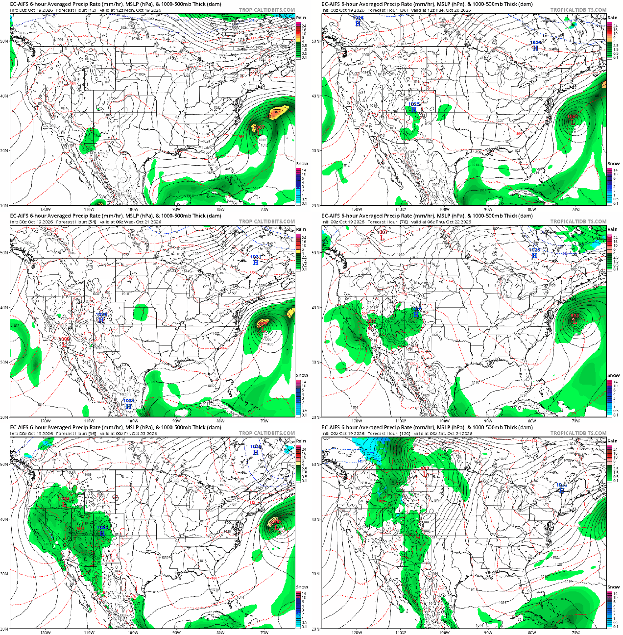
Low pressure will mill around south of New England for much of the week. Loop provided by Tropical Tidbits.

A large area of high pressure will provide us with more sunshine and slightly milder temperatures today, but we’re going to be watching a developing low pressure area off the Mid-Atlantic coastline. The system will meander around for a few days, blocked by the large high pressure to the north. The gradient between the high to the north and low to the south will result in breezy to occasionally windy conditions, especially along the coast from Tuesday into at least Thursday if not Friday. We’ll see some clouds start to move in ahead of the low pressure system later today, but the big question is whether any rain gets this far north. While many models keep the entire region dry, several bring a period of some showers at least to parts of Cape Cod and the South Coast towards Wednesday, some bring it even farther inland. The system starts to pull away on Friday, then high pressure builds back in for the weekend.
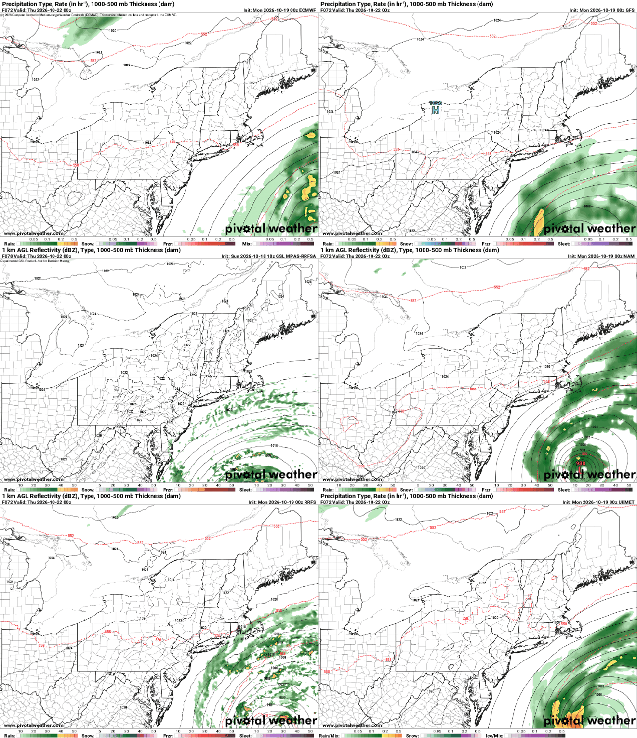
Will the system spread some rain in late Wednesday across Cape Cod? Images provided by Pivotal Weather.

Monday: Morning sunshine fades behind afternoon high clouds. High 55-62.

Monday night: Partly to mostly cloudy, slight chance for a shower over the Outer Cape and Nantucket. Low 37-44, a little milder along the coast and in urban areas.

Tuesday: Intervals of clouds and sun, breezy. High 57-64.

Tuesday night: Partly to mostly cloudy, breezy. Low 36-43, a little milder along the coast and in urban areas.

Wednesday: More clouds than sun, breezy. High 52-59.

Wednesday night: Partly to mostly cloudy, breezy, chance for a few showers, mainly near the South Coast and Cape Cod. Low 34-41, a little milder along the coast and in urban areas.

Thursday: A mix of sun and clouds. High 56-63.

Thursday night: Clear to partly cloudy. Low 36-43, a little milder along the coast and in urban areas.

Friday: Mostly sunny, breezy. High 51-58.

Saturday: Sunshine and a few clouds. High 51-58.

Sunday: Mostly sunny. High 57-64.
Weekend Outlook: October 16-19, 2026

If you haven’t pulled out the sweatshirts and heavier clothes yet, then you probably should today, because you’ll need them this weekend.

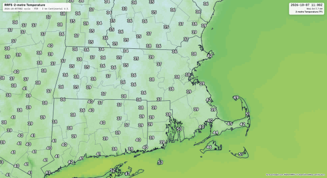
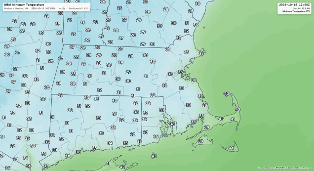
Sunday morning will be quite chilly, especially across the interior. Image provided by Forecast Eagle.

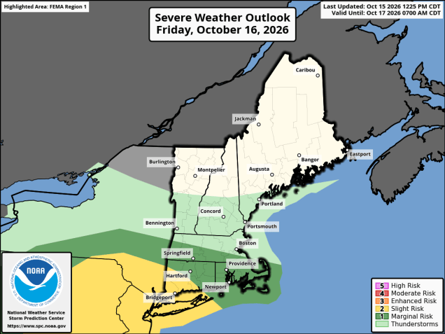
Low pressure will move into the Great Lakes tonight, sending a warm front our way. Temperatures will drop this evening with clear skies and light winds, but as locs move in tonight and winds shift into the south behind the warm front, we’ll see temperatures start to rise after midnight. A period of showers is expected towards daybreak and into the morning, but much of Friday afternoon will just feature clouds, a few sunny breaks, maybe a shower or two and breezy and mild conditions. As the system drags a strong cold front our way late in the day, another round of showers is expected, possibly even a few thunderstorms, during the evening hours. The front pushes offshore overnight with showers ending, though possibly not until daybreak across parts of Cape Cod. Skies will start to clear out on Saturday, but as the low pressure system intensifies over Atlantic Canada, northwest winds will really pick up across the region, ushering a much colder airmass in. Despite sunshine, temperatures may fail to reach 50 in many areas, with northwest winds of 20-30 mph, gusting to 40 mph making it possible that we’ll be using the phrase “wind chill” for the first time this season. Winds diminish Saturday evening, and combined with clear skies will result in a very chilly night. Areas away from the shoreline and urban areas will likely drop below freezing, with upper 20s in some spots. High pressure slowly slides eastward for Sunday giving us plenty of sunshine and lighter winds. While it will not be as chilly as Saturday, temperatures will remain below normal, with most places only in the 50s for highs. Temperatures will continue to moderate on Monday with skies remaining mostly sunny, but we’ll be keeping an eye on a potential ocean storm off the Mid-Atlantic coastline. If it has any impacts here, it won’t be until at least Tuesday, if at all, but we could see some clouds ahead of it move in to at least the South Coast late Monday.

A few strong thunderstorms are possible ahead of a cold front Friday evening. Image provided by the Storm Prediction Center.

Thursday night: Clear this evening, then increasing clouds, showers possible towards daybreak. Low 40-47 during the evening, temperatures start rising after midnight.

Friday: Morning showers, then mostly cloudy with a few sunny breaks, becoming breezy. More showers and possibly a thunderstorm late in the day. High 63-70.

Friday night: Plenty of clouds, showers and a few thunderstorms, mostly before midnight, ending towards daybreak near the South Coast and Cape Cod, breezy. Low 40-47.

Saturday: Morning clouds, then becoming partly to mostly sunny and windy. High 47-54.

Saturday night: Clear skies, diminishing winds. Low 28-35, a little milder in urban areas and neat the coast.

Sunday: Plenty of sunshine. High 51-58.

Sunday night: Clear skies. Low 32-39, a little milder in urban areas and near the coast.

Monday: Sunshine and some afternoon clouds. High 57-64.

Weekly Outlook: October 12-18, 2026

This week will feature a little bit of everything around here.

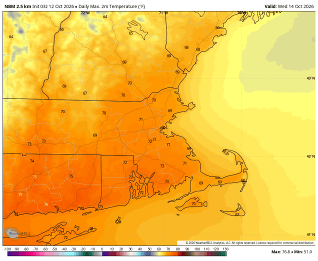
We could top 70 ahead of a cold front on Wednesday. Image provided by WeatherBell.

We start off with rain ending this morning as what’s left of Isaias pulls away from the region with sunshine developing in the afternoon. A frontal system trying to drop down from the north will stall out on Tuesday, with a wave of low pressure riding along it, bringing clouds back in, with some showers likely, mainly north of the Mass Pike through the morning with the stalled out front nearby, spreading southward late in the day and at night. A cold front moves through on Wednesday, accompanied by some additional showers, but we’ll remain fairly mild during the daytime ahead of the front. High pressure settles in with cooler and drier weather for Thursday.

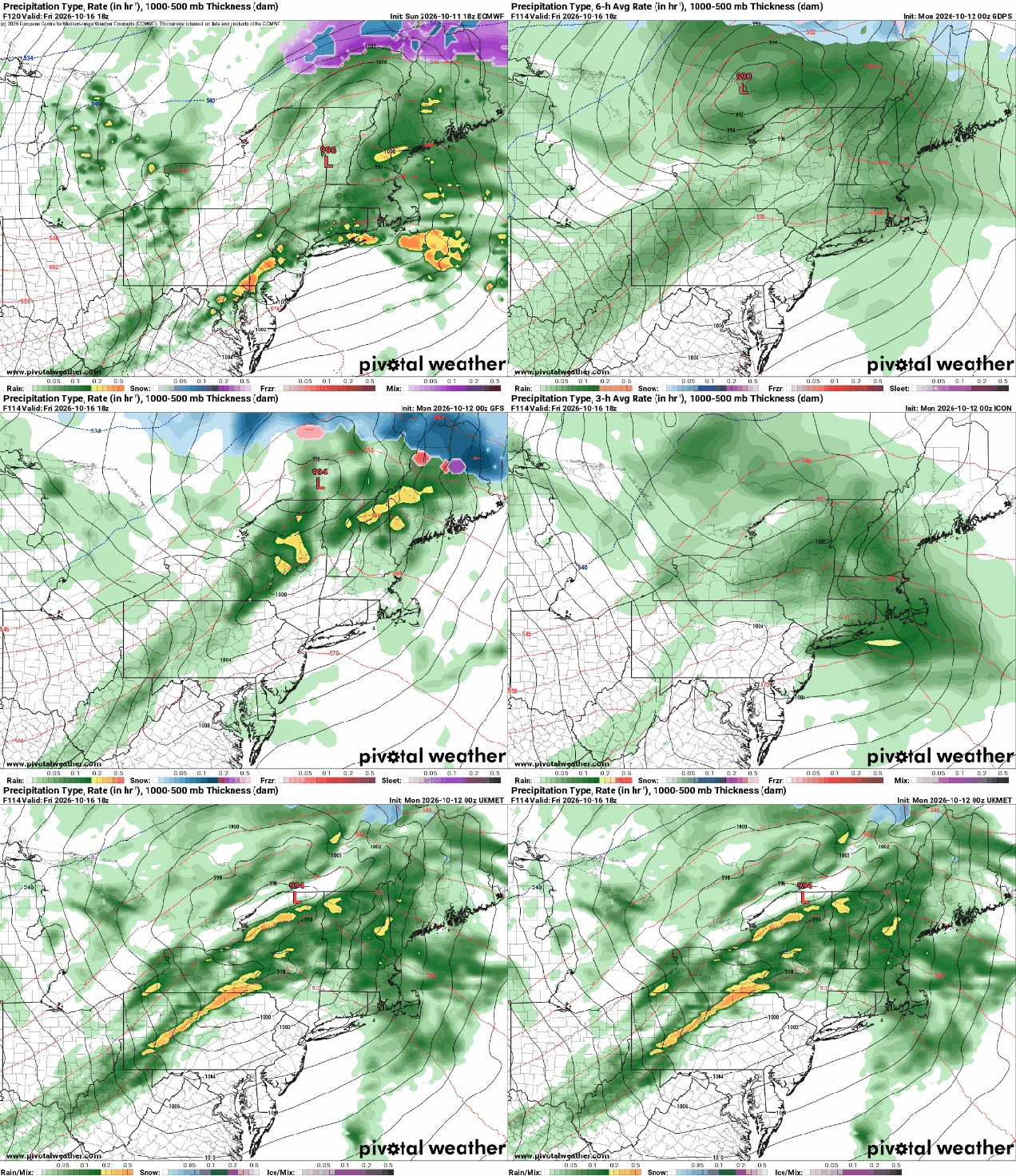
Will low pressure pass north, south, or right over the region on Friday. Too early to tell. Images provided by Pivotal Weather.

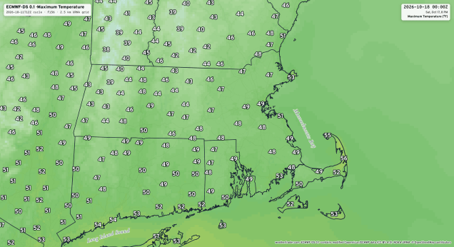
Things get a little more interesting for the end of the week. Another low pressure system will head our way with another round of rain for Friday. Most of the models send the system north of us, allowing warmer weather to settle in despite the rainfall, but a few models have the system move right across the region or even pass a little south of New England, which would result in a much cooler day. We’re going to lean towards the cooler scenario for now. The system pulls away Friday night and intensifies rapidly over Atlantic Canada. Behind it, very windy and much cooler conditions are expected for Saturday, with most places likely staying in the 50s, and some places not even reaching 50 during the daytime. With an upper-level low moving through we’ll see lots of clouds and likely some pop-up showers. With much colder air aloft, and it being chilly at the surface, don’t be surprised if some of those showers contain some graupel or even, brace yourselves, some wet snowflakes (yes, really). High pressure builds in for Saturday night and Sunday with diminishing winds, clearing skies, and chilly conditions.

Temperatures not might reach 50 in many places on Saturday. Image provided by Weather Trader.

Monday: Any lingering showers end early, skies become partly to mostly sunny in the afternoon. High 65-72.

Monday night: Becoming mostly cloudy from north to south during the evening, some showers possible after midnight, mainly north of Route 2. Low 47-54.

Tuesday: Showers likely, mostly north of the Mass Pike, gradually shifting southward late in the day. High 59-66.

Tuesday night: Showers likely during the evening, skies become partly cloudy late at night. Low 52-59 during the evening, temperatures hold steady or rise a little overnight.

Wednesday: Partly sunny, chance for a few showers, breezy. High 68-75.

Wednesday night: Partly cloudy to clear. Low 46-53.

Thursday: Mostly sunny. High 58-65.

Thursday night: Increasing clouds, showers possible towards daybreak. Low 39-46, a little milder in urban areas and near the coast.

Friday: Rain likely, ending before midnight, becoming breezy. High 58-65.

Saturday: Intervals of clouds and sun, windy a few pop-up showers likely, possibly mixed with some graupel or wet snow. High 47-54.

Sunday: Partly to mostly sunny, breezy in the morning. High 50-57.

Weekend/Tropical Outlook: October 9-12, 2026

We have our first hurricane of the season, and it will indirectly impact part of the upcoming weekend around here.

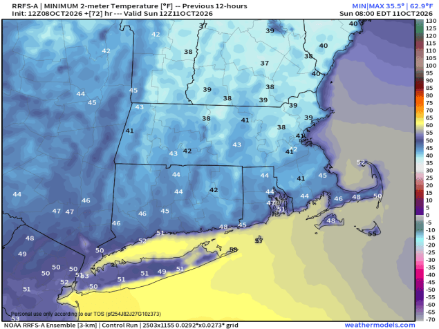
Sunday morning could be another chilly one. Image provided by weathermodels.com

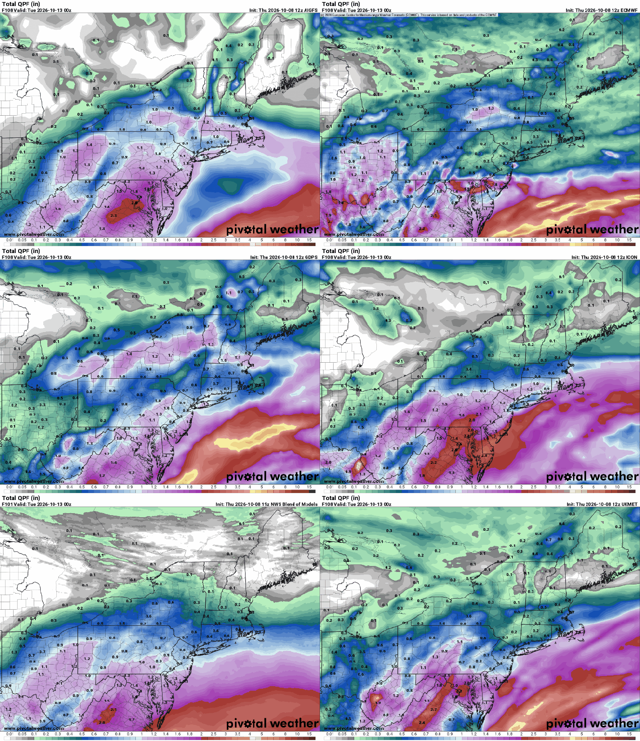
A cold front continues to push offshore and high pressure builds in this evening, remaining in control into Saturday. With an upper-level low nearby, we’ll see some clouds and possibly a shower or two on Friday, but most of them should stay well to our north. As the high moves overhead Saturday night we’ll have clear skies and diminishing winds, setting up another radiational cooling night, though some high clouds may interrupt to keep things a bit milder. If we stay clear, many places could again dip into the 30s by Sunday morning, with frost possible once again. As the high slides eastward on Sunday, clouds will start to stream in from the south and west ahead of what’s left of Hurricane Isaias (more on that in a moment). What’s left of the system will pass south of the region Sunday night and early Monday, spreading rain in by late Sunday afternoon or evening. Some of the rain could be heavy near the South Coast, but for most of us just a steady light rain is expected. Everything winds down Monday morning as the system pulls away, with dry weather for the afternoon, possibly even a few sunny breaks.

Sunday night’s rain should not be exceptionally heavy. Images provided by Pivotal Weather.

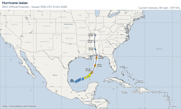
Before this year, we’d never gone past September 11 without a hurricane during the satellite era (since 1960). This year, it took until October 7, but we finally have our first hurricane of the season – Isaias. As of 2pm Thursday, it was centered about 350 miles south of the mouth of the Mississippi River, moving toward the east-northeast at 10 mph. Maximum sustained winds have increased to 85 mph, and additional strengthening is expected. Tropical Storm, Hurricane, and Storm Surge Warnings are in effect for parts of the Gulf Coast from Louisiana to the Florida Panhandle. Isaias is over some very warm water, but wind shear is starting to increase a little. It could continue to strengthen for the next 12-24 hours, possibly reaching category 3 strength, However, as it nears the coastline, wind shear will rapidly increase, with significant weakening likely before landfall. The storm may still be a hurricane at landfall, likely near Pensacola, Florida Friday night, but it should rapidly weaken once inland. The main threats will be flooding from heavy rain inland and storm surge along the coast, and some wind damage, likely confined to coastal areas.

Forecast track for Hurricane Isaias. Image provided by Polar Wx.

Thursday night: Mostly clear. Low 45-52.

Friday: Sunshine and some afternoon clouds, very slight chance for a sprinkle, breezy. High 62-69.

Friday night: Clear skies. Low 39-46.

Saturday: Sunny through the morning, high clouds start to filter in during the afternoon. High 59-66.

Saturday night: Partly cloudy. Low 41-48, a little milder in urban areas and near the coast.

Sunday: Becoming mostly cloudy, showers possible by late in the day. High 62-69.

Sunday night: Showers likely, some periods of steadier rain, especially south of the Mass Pike. Low 50-57.

Monday: Showers ending by early afternoon, some late-day sunny breaks possible. High 62-69.

Weekly Outlook: October 5-11, 2026

We started last week with a lot of rain, but this week, rain will be hard to come by.

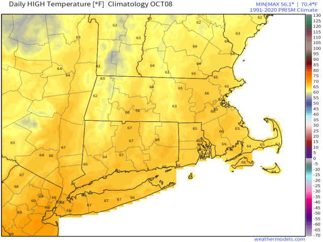
High temperatures should be in the middle 60s in early October. Image provided by weathermodels.com

We start the week off with a relatively mild day, but a cold front will cross the region this morning, accompanied by a just a few clouds. Behind it, northwest winds will bring some much cooler air in. High pressure brings lots of sunshine on Tuesday, but it will remain breezy and cool, with many locations struggling to get to 60. Clear skies and diminishing winds will result in a rather chilly night Tuesday night, with some frost possible by Wednesday morning in some spots. As the high slides eastward, we will see temperatures moderate a bit on Wednesday as winds start to pick up out of the southwest. Another cold front moves through on Thursday, accompanied by some clouds and possibly a shower or two, then high pressure returns with cooler weather for Friday and Saturday. Clouds start to move back in on Sunday as the next system begins to approach the region.

Wednesday morning looks quite chilly with some frost possible. Image provided by Forecast Eagle.

Monday: Morning clouds, then becoming partly to mostly sunny, breezy. High 62-69.

Monday night: Clear skies. Low 39-46 a little milder in urban areas and near the coast.

Tuesday: Sunshine and a few clouds, breezy. High 54-61.

Tuesday night: Clear and chilly. Low 36-43 a little milder in urban areas and near the coast.

Wednesday: Plenty of sunshine, breezy. High 60-67.

Wednesday night: Clear to partly cloudy. Low 49-56.

Thursday: A mix of sun and clouds, slight chance for a shower, breezy. High 67-74.

Thursday night: Becoming clear. Low 45-52.

Friday: Mostly sunny, breezy. High 61-68.

Saturday: Partly to mostly sunny. High 59-66.

Sunday: Sunshine gives way to increasing clouds. High 60-67.

Weekend Outlook: October 2-5, 2026

October has arrived, which means that 2026 is now 3/4 over. October can be an interesting month. We’ve had snow before, but we’ve also hit 90. Over average high temperatures start the month in the upper 60s, and end the month in the upper 50s. Most locations in our area will see their first frost during October in most years (possibly even next week). Of course, October is also one of the best months of the year if you’re a sports fan.

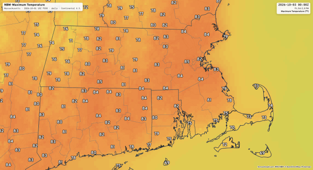
Will Friday be the last 80-degree day of the year for much of the region? Image provided by Forecast Eagle.

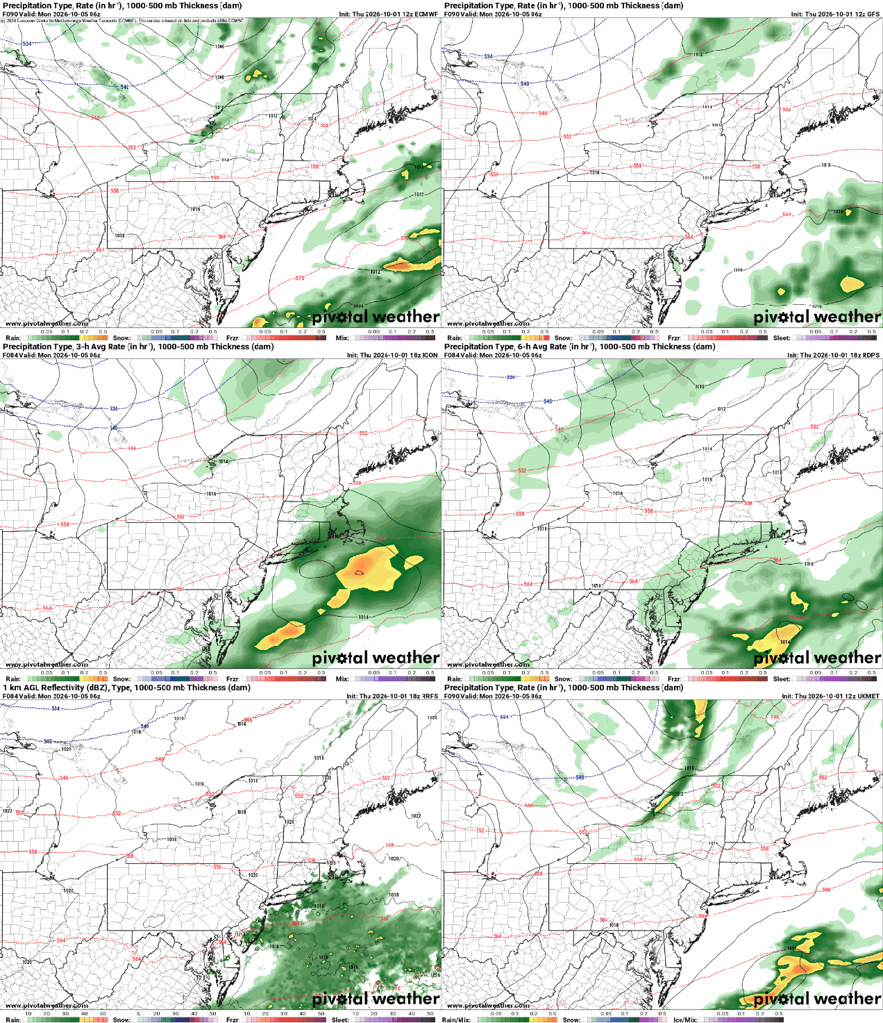
A cold front will head towards the region on Friday. Ahead of, we will see some sunshine in the morning, but it will be a breezy and mild day, with many places getting close to or over 80 degrees, likely for the last time in 2026. The front moves through in the evening, accompanied by a few showers, then high pressure builds in with sunshine and cooler air for Saturday. With clear skies and light winds, Saturday night will likely be on the chilly side. Sunday is a bit of a question mark at this point. That cold front will be stalled out well south of us, and a wave of low pressure will ride along it. Most of the models keep the rainfall associated with the system too far south to impact us, but not all of them. Could there be a period of showers near the South Coast late Sunday and Sunday night? It’s possible, but we’re not sure it’s likely at this point. Another cold front moves through on Monday. Ahead of it, it’ll be another mild day, with some places possibly reaching 70. Behind it, some rather chilly air will settle in. We’ll delve deeper into that in our Weekly Outlook early Monday, but don’t be surprised if much of the region sees its first frost of the fall Tuesday night.

There is a chance for a little rain near the South Coast Sunday night. Images provided by Pivotal Weather.

Thursday night: Becoming partly cloudy. Low 61-68.

Friday: Morning sun, then clouds increase and thicken up in the afternoon with some showers likely, breezy. High 77-84, cooler near the South Coast and Cape Cod.

Friday night: Any showers end in the evening, skies clear out after midnight. Low 51-58.

Saturday: Plenty of sunshine with a few afternoon clouds. High 62-69.

Saturday night: Clear skies. Low 42-49, a little milder in urban areas and near the coast.

Sunday: Sunny in the morning, clouds return in the afternoon, chance for a few showers near the South Coast late in the day. High 59-66.

Sunday night: Mostly cloudy, chance for a few showers, mainly near the South Coast. Low 46-53.

Monday: Becoming partly to mostly sunny and breezy. High 62-69.