Weekly Outlook: April 29-May 5, 2019

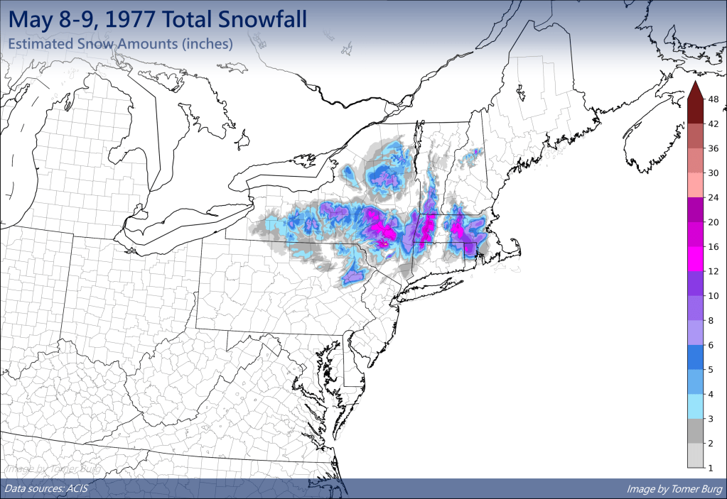
Can you believe that we’re at the end of April already? That means it’s almost to the time of year where it’s safe to push your snowbrush away! We’ve had accumulating snow into early/mid-May before, so it’s not quite that time yet, but we’re getting close.

We’ve had heavy snow into early May, so don’t put those snowbrushes away just yet. Image provided by Tomer Burg.

We’ll start the week on a chilly note as high pressure builds in from the north, so you may need a heavier jacket as you venture out Monday morning. You may even need to scrape your windshield if you’re out earlier enough, as there will likely be some patchy frost out there as well. Clouds will start to stream in during the afternoon as the high moves out and our next system approaches from the west.

Temperatures may drop into the 30s across much of the area before daybreak today. Image provided by WeatherBell.

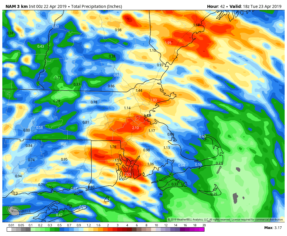
Rain will develop late Monday night as a weak system moves toward the area. The rain won’t be heavy and should be done by early afternoon, with some clearing possible late in the day. A cold front trailing the system will stall out just south of New England, and then remain there for much of the week.

The latter half of the week looks to be cool and damp. Waves of low pressure will ride along that front, bringing in rainfall at times. We won’t be raining the entire time, but it will be mainly cloudy with some sunny breaks. With the front to our south, we’ll stay on the cool side around here, with daytime temperatures generally in the 50s to lower 60s., which is a little below normal for early May. Saturday may turn out to be a decent day with some sunshine and and milder temperature. However, a stronger storm will moves toward the area on Sunday, with some steadier and heavier rain more likely.

So close, yet so far away. Thursday afternoon could see temperatures get into the 80s in New York City, while we could be stuck in the 40s and lower 50s in the afternoon. Image provided by Weathermodels.com

Monday: Sunny and cool in the morning, clouds stream in during the afternoon. High 54-61.

Monday night: Cloudy with showers developing. Low 37-44.

Tuesday: Mostly cloudy with showers ending by midday. High 49-56.

Tuesday night: Partly to mostly cloudy. Low 34-41.

Wednesday: Plenty of clouds with a few sunny breaks. Showers are possible late in the day and at night. High 50-57.

Thursday: More clouds than sunshine with showers possible in the morning and some patchy drizzle in the afternoon. High 48-55, warmer as you head farther south and west

Friday: Cloudy with a chance for more showers. High 50-57, possibly warmer south of the Mass Pike.

Saturday: Partly sunny. High 66-73.

Sunday: Cloudy with a chance of rain, possibly heavy. High 53-60.

Weekly Outlook: April 22-28, 2019

Did you enjoy the sunshine and warm temperatures at the end of the past week? Good, because you probably won’t get much of that this week. This week looks rather wet at times. The whole week won’t be wet, but there will be a few days that are quite damp.

We start the week off with some fog this morning, especially along the south coast, since we have plenty of moisture in the air. A weak system will pass offshore today, and it will bring in a period of rain and showers, mainly across eastern New England. Some of this rain will be locally heavy, and thanks to northeast winds off the still-cool Atlantic, temperatures will be cooler than the past few days. The rain may linger into Tuesday morning before the system pulls away. Some sunny breaks may develop in the afternoon, but they won’t last long. Another cold front quickly approaches for Tuesday night into Wednesday morning with more showers.

Some of the rain today into early Tuesday could be heavy across eastern New England. Keep that umbrella handy. Image provided by WeatherBell.

High pressure builds in for later Wednesday into Thursday with sunshine and seasonable temperatures, but this too will only be temporary. The next system approaches on Friday, with, you guessed it, more rain, but it’ll be generally light. High pressure returns for Saturday with some sunshine, but again, not for long. Yet another system will move in for Sunday with another round of rain, and there’s a chance that this could be heavy too. We’ll keep an eye on that as the week goes along, but don;t go cancelling any plans for next weekend just yet.

Rainfall has actually well below normal over the last couple of months across much of the Northeast, so we really need this week’s rain. Image provided by the Northeast Regional Climate Center

Monday: Fog burns off early, then a few sunny breaks are possible before clouds return, with rain likely during the afternoon. Becoming breezy during the afternoon, especially along the coast. High 57-64, but turning cooler in the afternoon along the coast.

Monday night: Periods of rain and showers, possible heavy at times. Low 45-52.

Tuesday: A few lingering showers in the morning, otherwise cloudy with some sunny breaks in the afternoon. High 51-58, except 59-66 north and west of I-495.

Tuesday night: Cloudy with scattered showers. Low 41-48.

Wednesday: Showers ending early, then skies become partly to mostly sunny and breezy in the afternoon. High 60-67.

Thursday: Mostly sunny for much of the day, clouds start to filter back in during the afternoon. High 59-66.

Friday: Mostly cloudy with showers likely. High 54-61.

Saturday: Sunshine to start, clouds come back in the afternoon, breezy. High 54-61.

Sunday: Mostly cloudy with a chance of rain. High 55-62.

Weekly Outlook: April 15-21, 2019

We’ve reached Patriots Day, which is the “unofficial” end of winter in many years. We’ve got the Marathon, the Red Sox 11:05am game, and usually, but not always, some decent weather.

The morning may be quite wet, but things should improve for the Marathon and the Red Sox game. Loop provided by WeatherModels.com

The week starts off on a damp but mild note as warm front lifts northward during the morning. Showers and maybe even some thunderstorms are likely. This system has been producing severe weather across much of the eastern half of the nation for the past few days, but we’re not expecting any severe weather here. Some downpours, gusty winds, and a little lightning are expected, but nothing severe. The rain should end around 9-10am, which is perfect timing for both the Marathon and the Red Sox game. Some sunny breaks could develop in the afternoon, which may allow temperatures to get up to 70 once again. The mild weather comes to an end late this afternoon as a cold front moves through, likely with a few more showers.

Temperatures could get close to or over 70 this afternoon if we can get some sunshine. Image provided by WeatherBell.

Windy and cooler weather moves in behind the front for Monday night into Tuesday as high pressure builds in. Wednesday looks dry as well, and slightly milder, but still cooler than what we enjoyed this past weekend. Thursday will see some clouds move in ahead of a warm front, along with some showers, but we’ll stay on the cool side until the front actually moves through, which will likely be sometime on Friday.

This brings us to the end of the week and the weekend. Another strong storm will be moving through the Plains states and into the Midwest. More severe weather is likely, but with this storm only making slow progress eastward, we’ll also be dealing with it for a couple of days. We’ll have some showers around on Friday as the milder air moves in, but a period of heavy rain is possible later Friday into Saturday. Don’t go cancelling any outdoor plans yet, but we’ve got the potential for quite a bit of rain. The rain may linger into Sunday before a cold front finally moves across the region.

Heavy rain is possible across the region on Saturday. Image provided by Pivotal Weather.

Monday: Rain, maybe a thunderstorm this morning, then some sunny breaks in the afternoon before another round of showers moves through late afternoon. High 64-71.

Monday night: Clearing, windy, and cooler. Low 34-41.

Tuesday: Sunshine and a few clouds, breezy. High 53-60.

Tuesday night: Clear skies. Low 33-40.

Wednesday: Mostly sunny, though some high clouds may start to stream in late in the day. High 54-61.

Thursday: Partly to mostly cloudy. High 48-55.

Friday: Mostly cloudy and breezy with a few showers possible, becoming a steadier rain at night. High 61-68.

Saturday: Cloudy and breezy with rain likely, possibly heavy. High 61-68.

Sunday: More clouds than sunshine, a few lingering showers possible. High 64-71.

Weekly Outlook: April 8-14, 2019

The Red Sox finally return to Fenway this week. Unfortunately, the weather for the next few days is going to be about as good as the Sox season has been thus far.

The week starts off with a backdoor front dropping south of the region as low pressure moves this way from the Midwest. That will result in some rain today, along with chilly northeast winds, and some drizzle on fog. as you head north, up into portions of Maine and central New Hampshire, we might be talking about some snow, as well as rain. In other words, it’ll be typical weather for April in New England.

The High-Resolution NAM model clearly shows the impact that the backdoor front has on temperatures across the region today and tonight. Loop provided by Weathermodels.com

That front will stall out south of New England tonight, and another wave of low pressure will ride along it on Tuesday. This will bring another round of showers in for the late afternoon and evening hours. Most of Opening Day for the Sox should be dry (except for some drizzle at times), but the longer the game goes, the better the chance for some rain moving in and causing problems.

Opening Day at Fenway looks cloudy, chilly, drizzly, and just plain miserable. Hopefully the on-field product won’t be as bad. Image provided by WCVB.

We’ll start to improve on Wednesday as high pressure starts to build in, but an upper-level low will move across the region, so we’ll still have some clouds and maybe a few showers to deal with. Sunshine finally returns on Thursday, but temperatures will still be on the cool side. Another system brings in some showers on Friday, then high pressure returns next weekend with dry and milder weather, but we could see some showers moving in by late Sunday.

This brings us to next Monday. A week from today is Patriots Day, also known as Marathon Monday. This is the unofficial start of Spring in New England. Last year, Patriots Day featured heavy rain and cool conditions. This resulted in the Red Sox traditional 11:05am game being postponed for the first time since 1984. So, things will be much better this year, right? Right now, it’s not looking that way. There’s still plenty of time for things to change, but right now, the models are showing the potential for heavy rain again, maybe even some snow in parts of the region. We’ll keep our eyes on this through the week.

One model is showing midday temperatures on Marathon Monday in the upper 30s to near 40. That’s rather chilly for Mid-April. Image provided by WeatherBell.

Monday: Cloudy and cool with periods of rain and showers, along with some fog and drizzle. High 43-50 north of the Mass Pike, 51-58 south of the Pike.

Monday night: cloudy with patchy fog and drizzle. Low 34-41.

Tuesday: More fog and drizzle, with showers likely late in the day. High 41-48.

Tuesday night: Mostly cloudy with showers ending. Low 31-38.

Wednesday: Intervals of clouds and sunshine, chance for a shower or two. High 43-50.

Thursday: Partly to mostly sunny. Clouds return late in the day. High 50-57.

Friday: Cloudy with a chance for some showers. High 53-60.

Saturday: Sunshine and a few clouds. High 60-67.

Sunday: Some early sun, then becoming cloudy with a chance of showers late in the day. High 52-59.

Finally, as you probably know by now, we’re big hockey fans here at Storm HQ. This is a big week in the hockey world. The NCAA Frozen Four takes place Thursday and Saturday, and the NHL playoffs start Wednesday. In the Frozen Four, we’re rooting for Providence to beat the defending champions from Minnesota-Duluth and for Denver to beat UMass by double digits. In the NHL playoffs, the picture above says it all for the 1st round at least. Go Bruins!

Weekly Outlook: April 1-7, 2019

Today is April Fool’s Day, but there’s no jokes in our forecast. Sure, there’s sarcasm, because that’s how we roll, but we’d never try and fool you. Having said that, we can tell you that there’s a little bit of everything in this week’s forecast, because, well, that’s called Spring in New England.

The week starts off on a sunny but chilly note as high pressure builds into the region. Even with sunshine, wind chills will be in the 30s this afternoon. The chill won’t last too long as temperatures will start to moderate on Tuesday as high pressure moves offshore. Clouds will start to move in late in the day on Tuesday as a storm system starts to move up the East Coast.

Heading out at lunchtime? Wind chills will only be in the upper 20s and 30s around midday. Image provided by Weathermodels.com

Low pressure will pass offshore to the south and east of the region, but should be close enough to bring in some rain for Wednesday morning. Some wet snowflakes could even be mixed in before daybreak, mainly from the hills of Worcester County into southern New Hampshire. The rain will light for much of us, but some heavier rain is possible across parts of southeastern Massachusetts and Cape Cod, where gusty winds are also expected. The system will be a fast mover, with clearing expected to start Wednesday afternoon.

At least one model shows the potential for a decent amount of rain on Wednesday, especially from Boston southward. Image provided by WeatherBell.

High pressure returns for Thursday with dry conditions. However, the dry weather won’t last (does it ever really?) as the next system moves in for Friday. Again, we’re looking at rain, but don’t be surprised if you see some snowflakes at the start across parts of southern New Hampshire and maybe even the Merrimack Valley. High pressure builds back in for next weekend.

Monday: Sunshine, and lots of it, but also breezy. High 39-46.

Monday night: Clear to partly cloudy. Low 23-30.

Tuesday: A sunny start, clouds thicken up in the afternoon. High 44-51.

Tuesday night: Cloudy with showers developing towards daybreak. Low 32-39.

Wednesday: Rain during the morning, especially south of Boston, then skies clear out in the afternoon, breezy. High 52-59.

Thursday: A mix of sun and clouds, breezy. High 46-53.

Friday: Cloudy with showers likely. High 42-49.

Saturday: Showers ending early, then skies gradually clear out in the afternoon. High 54-61.

Sunday: Mostly sunny. High 55-62.