We’ve got an early taste of summer before we get to Memorial Day Weekend.
Before we get to the forecast, we wanted to point out that this is blog post #1000 since we started on this long, strange journey, and it is posted just two days shy of the 10th anniversary of the first blog post. Before that StormHQ was just a Facebook page and a Twitter account, but now it’s been 10 years or sarcasm, information, commentary and of course weather forecasts, and for those of you still reading, we thank you very much. Now, onto the forecast.
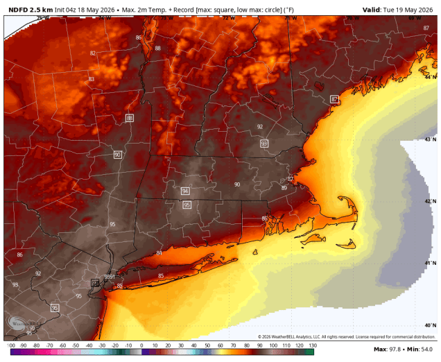
A backdoor cold front has settled south of the region, so temperatures are will be on the cooler side today despite plenty of sunshine. Of course, cool is relative, as temperatures will be close to where the should be in mid-to-late May, but most places will be 10-20 degrees cooler than they were on Sunday. That front will lift back northward tonight, allowing the warm to hot and increasingly humid weather to return on Tuesday, with temperatures away from the South Coast getting well into the 80s, with some spots topping 90 degrees. We could see a few showers and thunderstorms during the afternoon, but the bulk of the region should remain dry. Wednesday starts off with sunshine, but clouds will quickly move in as a cold front heads our way. It will be another very warm and humid day with temperatures well into the 80s away from the South Coast, with a few places possibly reaching 90 again. The front will trigger showers and thunderstorms during the afternoon and evening, some of which could be strong to severe. Some of the stronger storms may produce heavy downpours, gusty winds, and hail. High pressure builds in behind the front with cooler and drier conditions for Thursday and Friday.
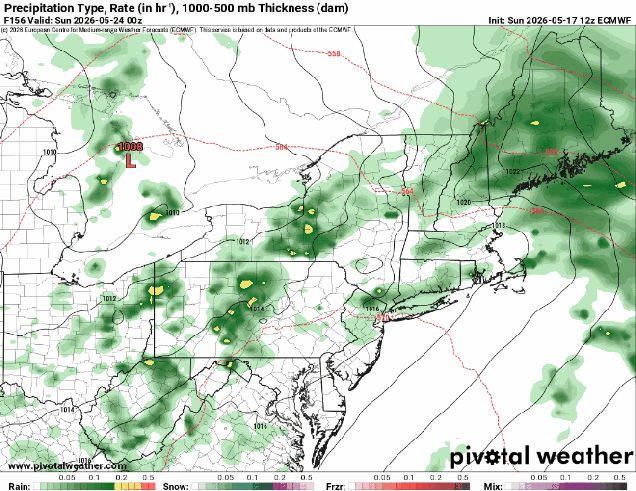
As for Memorial Day Weekend, there is a considerable amount of uncertainty at this point. We’ll have high pressure to the north, keeping temperatures on the cooler side, which a series of waves ride along a frontal system south of the region. That’s about all the models agree on at this point. Whether there is one wave or two, when do they move through, how far north does the rain get, how cool will it stay with cloudcover and/or rainfall. None of these are questions we can answer with any certainty at this point. Right now, it looks like Saturday and possibly Sunday will be the cooler and wetter days, but this is far from certain, and doesn’t mean that Monday will be a great day either for the holiday. We should have a better idea by the time we get to our Weekend Outlook on Thursday, and will take a deeper dive into it at that point.
Monday: Partly to mostly sunny. High 75-82 south and west of Boston, 67-74 north of Boston, possibly a little cooler across the North Shore and Hew Hampshire Seacoast.
Monday night: Clear to partly cloudy. Low 58-65, except 50-57 across the North Shore, Hew Hampshire Seacoast, and Cape Cod.
Tuesday: Sunshine and some afternoon clouds, breezy, chance for an afternoon shower or thunderstorm. High 87-94, except 79-86 across the South Coast and 71-78 across Cape Cod.
Tuesday night: Partly cloudy. Low 64-71, cooler across Cape Cod.
Wednesday: Morning sun then increasing clouds with late-day showers and thunderstorms, some could be strong, breezy. High 84-91, except 76-83 across the South Coast and 68-75 across Cape Cod.
Wednesday night: Showers and storms end in the evening, becoming partly cloudy. Low 48-55.
Thursday: Partly sunny, much cooler. High 63-70.
Thursday night: Partly cloudy. Low 42-49.
Friday: Partly sunny. High 61-68.
Saturday: Mostly cloudy with a chance of showers. High 59-66.
Sunday: Mostly cloudy with a chance of showers. High 61-68.
Memorial Day: Intervals of clouds and sun. High 64-71.
