Weekly Outlook: October 29 – November 4, 2018

We’ll tell you right now – the best day of the week is going to be Wednesday, and not because it’s Halloween. It’s going to be an absolutely glorious day. Why? That’s when the parade is.

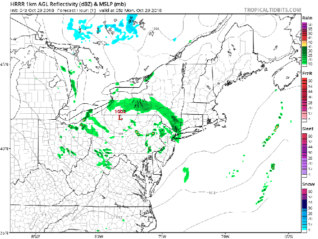
As for the weather itself, well, a good chunk of the week should be nice, and believe it or not…..mild! The week starts off on a damp note though, as a little system comes rolling in from the west, giving us some rain showers this morning, ending by early afternoon. We’re not looking at a lot of rain, certainly nothing compared to what we had on Saturday, but it will fall during the morning commute, so, be prepared for that.

hrrr_ref_frzn_neus_fh1-18
It’ll be wet out this morning, so bring an umbrella to work or school. Things will improve this afternoon. Loop provided by Tropical Tidbits.

After that, high pressure builds in with dry and warmer conditions for Tuesday and Wednesday. If you’re heading to the parade on Wednesday, expect plenty of sunshine with temperatures in the 50s. For trick-or-treaters that evening, expect it to be dry abd possibly a little breezy with temperatures generally in the middle to upper 50s. By Thursday, we’ll really start to warm up with temperatures getting into the 60s, but it will come with clouds as a storm system starts to approach the area. That storm passes to our north and west Thursday night into Friday, with some rain likely along with the mild temperatures. A cold front brings an end to the rain and the mild weather late Friday.

GFS 50-STATES USA Mass & CT & RI 2-m Maximum Temperature 96
Despite the cloudcover, Thursday is looking like a very mild day. Image provided by Weathermodels.com

We’ll have a brief break on Friday night, but another system will start to head up the coast early Saturday, with a chilly rain expected for much of Saturday and Saturday night. This system may produce a little bit of snow in the mountains, but we shouldn’t have much to worry about around here. High pressure builds in on Sunday with dry and cooler conditions.

Also, don’t forget, Daylight Saving Time ends Sunday morning at 2am. If you have any clocks that don’t automatically update, then you’ll need to change them back an hour Saturday night. The good news is that you’ll get an extra hour of sleep. It’ll help make up for all the sleep you lost staying up for the Red Sox games.

Victory-Cigar-Congress-Passes-DST
Turn your clocks back an hour Saturday night before bed. We don’t want to know what you’re doing with your hoe for that extra hour. Image provided by Wikipedia.

Monday: Showers ending by early afternoon, some clearing develops late in the day. High 50-57.

Monday night: Clear to partly cloudy. Low 34-41.

Tuesday: A mix of sun and clouds. High 44-51.

Tuesday night: Clear skies. Low 30-37.

Wednesday: Sunshine and a few clouds, becoming breezy. High 55-62.

Thursday: Becoming partly to mostly cloudy and breezy. High 62-69.

Friday: Cloudy and breezy with showers likely. High 59-66.

Saturday: Mostly cloudy with more rain likely. High 50-57.

Sunday: Partly to mostly sunny. High 49-56.

Weekly Outlook: October 22-28, 2018

The forecast for this week is fairly straightforward for most of the work week. Next weekend? Well, there could be some issues.

NWS NDFD 2.5-km Mass & CT & RI 2-m Daily Low T 1
We’re starting the week off on a very chilly note. Image provided by Weathermodels.com

The week starts off on a chilly, but dry note with high pressure in control. If you’re up early enough, you may need to find the scraper for your windshield before you head out. Either that, or turn the defroster on and let in run for a but before you get in the car.Yup, it’s that time of year again. Clouds will start to stream in late in the day as a fast-moving storm system approaches from the Great Lakes. That system will bring us some rain showers on Tuesday. If the rain moves in early enough, we could see some snowflakes mixing in, mainly across the higher terrain from central Massachusetts into southwestern New Hampshire.

hires_snow_neng_61
The storm on Tuesday and Wednesday could drop a decent amount of snow from parts of Northern New England into New Brunswick. Image provided by WeatherBell.

As that system departs, it will start to strengthen as it moves into the Gulf of Maine and Atlantic Canada. It may drop a decent a mount of snow from the mountains of northern New England into parts of northern Maine and New Brunswick, but around here, we can expect breezy and cooler conditions for Wednesday and Thursday. High pressure builds in on Thursday, allowing the winds to die down, with dry and cool conditions continuing into Saturday.

Later Saturday and into Sunday is where things start to get complicated. Hurricane Willa will make landfall in southwestern Mexico on Tuesday, then move into Texas, and then the Gulf of Mexico (but not as a tropical system any more). From there, it will start to head up the East Coast, while becoming a strong storm system once again. High pressure to the north should block in from getting in here on Saturday, though the clouds ahead of the system will move in. It’s Sunday that could be a problem. As the high continues to retreat to the north and east, we’ll still have plenty of cold air in place Saturday night into Sunday. As the storm starts to move up the coast, it will spread some moisture into the region. If you have cold air trapped at the surface while moisture and milder air move in aloft, you have the potential for problems. While coastal areas will just see a gusty winds and a cold rain, across interior areas, we have the potential for some sleet or freezing rain on Sunday. Milder air should eventually win out, with a change to all rain even across the interior. There are other models that have the storm pass to our west, which would just mean a wind-swept mild rain. Obviously, there’s a lot of uncertainty with future of this system. For now, we’re leaning towards the colder scenario, but it’s low confidence. As we get later in the week, if this scenario becomes more likely, we’ll keep you updated.

gfs_mslp_pcpn_frzn_neus_fh120-168
The GFS model is showing the potential for some sleet or freezing rain across the interior next Sunday. Other models have a wind-swept warmer rain. It’s too early to tell which scenario is more likely. Loop provided by Tropical Tidbits.

Monday: Sunny and chilly to start, clouds start to move in during the afternoon. High 45-52.

Monday night: Becoming mostly cloudy, showers developing towards daybreak, possibly mixed with some wet snowflakes across the interior. Low 35-42.

Tuesday: Cloudy with scattered showers. High 45-52 north and west of I-495, 53-60 elsewhere.

Tuesday night: Showers ending in the evening, then some clearing late at night. Low 34-41.

Wednesday: Becoming partly to mostly sunny and breezy. High 46-53.

Thursday: Sunshine and a few clouds, still breezy. High 40-47.

Friday: Partly to mostly sunny. High 41-48.

Saturday: Some early sun, otherwise thickening clouds throughout the day. Breezy again. High 44-51.

Sunday: Cloudy and breezy with rain likely , possibly starting as a period of freezing rain and/or sleet across the interior. High 39-46 north and west of I-495, 47-54 elsewhere.

Weekly Outlook: October 15-21, 2018

Fall has finally arrived, and you’ll know it for sure this week. If you’re playing the game of trying to avoid turning on the heat before November 1, there’s a good chance you’ll lose before this week is out.

snow_2d_mw
The storm moving into our area today brought snowfall to the Rockies and Plains over the weekend. We’re not going to see any snow around here from it. Image provided by Weathermodels.com

We start the week off with low pressure passing well north of our area. This low used to be Hurricane Sergio in the Pacific Ocean. As it moved across the nation’s mid-section, it produced severe weather in the Mississippi Valley and heavy snow from the Rockies into parts of the Plains. Nothing like that is expected here, but it will bring in some milder air today, along with some showers, mainly during the afternoon an evening. A cold front trailing the system pushes through in the evening which produce some heavier showers, maybe even a thunderstorm, and some gusty winds.

nam3km_mslp_pcpn_frzn_neus_fh6-36
Showers are likely during the afternoon today, but some thunderstorms may accompany the actual cold front this evening, as the high-resolution NAM model shows. Loop provided by Tropical Tidbits.

High pressure builds in on Tuesday with sunshine and breezy conditions, but it’ll turn cooler. The high slides offshore on Wednesday, allowing slightly milder air to move back in, but it’ll be short-lived. Another cold front approaches. This one won’t contain a lot of moisture, so only a few showers are expected. Behind it, windy and much cooler conditions are expected on Thursday. In fact, Thursday will likely be the coolest day we’ve had since the end of April, with high temperatures likely staying below 50 across much of the region.

GFS 50-STATES USA Mass & CT & RI 2-m Maximum Temperature 96
Those are the high temperatures Thursday afternoon, not the lows Thursday morning. Image provided by Weathermodels.com

The cool shot doesn’t last long though, as high pressure moves offshore, allowing temperatures to moderate again. However, another cold front moves through on Saturday, bringing some more showers to the region. Once again, the front moves through, and windy and cooler conditions return on Sunday.

Monday: Mostly cloudy and breezy with showers likely, especially during the afternoon. High 59-66.

Monday night: Showers end in the evening, possibly with some thunder, then skies clear out by daybreak. Low 40-47.

Tuesday: Sunshine and a few clouds, breezy. High 50-57.

Tuesday night: Clear to partly cloudy. Low 39-46.

Wednesday: A mix of sun and clouds, breezy, slight chance for a late-day shower. High 53-60.

Thursday: Partly to mostly sunny, breezy, and cooler. High 41-48.

Friday: Sunshine dimmed by afternoon high clouds. High 53-60.

Saturday: Cloudy with some showers possible. High 54-61.

Sunday: A mix of sun and clouds, breezy. High 44-51.

Hurricanes, Severe Weather, and Snow, All at the Same Time (not the Same Place)

For the third year in a row, the “M” storm in the Atlantic is prepared to wreak havoc on a populated area, but Michael isn’t the only headline maker in the weather at the moment.

Hurricane Michael isn’t the only storm in the news, but it is the biggest threat at the moment. As of early Tuesday afternoon, Michael was centered about 335 miles south of Panama City, Florida, moving toward the north at 12 mph. Maximum sustained winds are near 110 mph, making Michael a Category 2 Hurricane. Additional strengthening is expected over the next 12-18 hours as the storm moves over the warm waters of the eastern Gulf of Mexico. Hurricane and Storm Surge Warnings are in effect for the Florida Panhandle and the Big Bend area of Florida, with Tropical Storm Warnings and Watches surrounding the Hurricane Warnings. Tropical Storm Watches are also in effect for the Atlantic coast from northeastern Florida into South Carolina.

152906_3day_cone_no_line_and_wind
Michael is going to pack quite a wallop when it slams into the Florida Panhandle Wednesday afternoon. Image provided by the National Hurricane Center.

Michael is expected to make landfall in the Florida Panhandle Wednesday afternoon, likely as a Category 3 storm. Strong winds, torrential rainfall, storm surge, and some tornadoes are all possible with this storm. Unlike Florence, which hung around the Carolinas for days and dumped incredible amounts of rainfall on the region, Michael is expected to keep moving at a steady pace, emerging off the Mid-Atlantic coast by Friday morning. Rainfall totals of 5-10 inches are still expected in parts of the region, which will produce flooding in some areas, especially in Carolinas, where many areas are still recovering from Florence. Right along the coast, a storm surge of 6-12 feet is possible, especially in the Big Bend area of Florida. Fortunately, this area is not heavily populated, but for the residents that do live in this area, storm surge flooding is a significant threat.

Once it moves back into the Atlantic early Friday, it should pass well south of our area. The northern edge of the rainfall from the system could reach the South Coast, but the bulk of the heavy rain should remain well to the south.

This is the 3rd year in a row that the “M” storm is expected to result in significant damage to a populated area. In 2014, Category 5 Hurricane Matthew left a path of death and destruction across parts of Haiti, Cuba, the Bahamas, and eventually parts of the southeastern United States. Last year, Category 5 Hurricane Maria devastated the northeastern Caribbean, including Puerto Rico and the US Virgin Islands. While Michael is not expected to become a Category 5 storm, it is still expected to result in significant damage to parts of Florida and the Southeast.

download
Tropical Storm Leslie has been around for near 2 weeks and still looks rather healthy. Loop provided by NOAA.

Meanwhile, in the eastern Atlantic, Tropical Storm Leslie refuses to go away. As of midday Tuesday, Leslie was centered a little more than 1000 miles west-southwest of the Azores, moving toward the south-southeast at 13 mph. Maximum sustained winds are near 65 mph. The forecast for Leslie calls for a turn more toward the east over the next few days while it strengthens back into a hurricane. Leslie is expected to remain over open waters for the next few days, and could become an extratropical storm this weekend while continuing on a general easterly track.

15L_tracks_latest
Nadine is a fish storm. Nothing to worry about here. Image provided by Tropical Tidbits.

To the south, Tropical Storm Nadine as formed nearly 500 miles southwest of the Cabo Verde Islands. Nadine has maximum sustained winds near 40 mph, and is moving toward the west-northwest at 9 mph. Nadine is expected to remain fairly weak over open waters for the next several days while turning more toward the northwest. As it moves over colder water late this week and this weekend, it should weaken and eventually dissipate.

rtma_t2m_ne
What month is it again? 70s and 80s early in the afternoon on October 9th? Image provided by WeatherBell.

Back in the United States, unseasonably warm conditions remain in place across much of the eastern half of the nation. Temperatures are in the 70s and 80s across much of the region, which is 15 to 25 degrees above normal. A strong frontal system is located in the Plains states this afternoon, separating the warm air in the East, from much cooler weather behind it in the Plains and the Rockies. Right along this front, which hasn’t moved much for the past 24 hours, severe weather and heavy rainfall are common this afternoon.

RAD_MOS_NAT_8KM_L2WINTER_ANI
That’s snow in Colorado, and heavy rain along with severe weather from Texas into the Central Plains this afternoon. Loop provided by WeatherTAP.

Several tornadoes have been reported already today, including a few in the Oklahoma City area, and more are expected later today and tonight. Heavy rainfall is also expected from Texas into the Central Plains and parts of the Upper Midwest. Rainfall totals of 1-3 inches and locally heavier may produce flash flooding in some areas. Flash flood watches are in effect for much of the region.

sn10_acc.us_nc (1)
Several inches of snow is expected form the Plains into the Upper Midwest over the next few days. Image provided by Pivotal Weather.

On the other side of the front, where much cooler weather is in place, rain is expected to change over to snow as low pressure rides along the front and into the Midwest. Winter weather advisories have already been posted for parts of the region. Snow is already falling in parts of Colorado this afternoon, and several inches may fall over the next 36-48 hours from western portions of Kansas and Nebraska into the Dakotas and northern Minnesota.

gfs_tprecip_boston_15
Some heavy rain is possible across our area on Thursday as a strong cold front approaches the region. Image provided by WeatherBell.

As the system moves eastward, it will spread some heavy rain and thunderstorms into our area on Thursday. We’re not expecting any severe weather, but some heavy downpours are possible, especially from western Massachusetts into southern New Hampshire. Some localized flooding may result. Once this front pushes offshore, much cooler weather will settle in for the Friday and the weekend.

Weekly Outlook: October 8-14, 2018

Much of the week will not feel like October once again, but changes are coming. Enjoy the warm weather we’ll have this week, it might not be back for a while.

NAM-WRF 3-km Mass & CT & RI 2-m Temperature (1)
We’re going to be riding that temperature roller coast again between today and tomorrow. Loop provided by Weathermodels.com

The week starts out on a cool note. A backdoor front crossed the region on Sunday, and high pressure has built in behind it. With the high in control, temperatures will be cool, but with the front stalled out nearby, we’ll still have plenty of clouds along with some showers. The front lifts northward again early Tuesday as a warm front. Tuesday and Wednesday won’t exactly be hazy, hot, and humid, but partly sunny and unseasonably warm will have to suffice. After that, things get interesting.

14L_tracks_latest
The track of Michael will likely take it inland in the Florida panhandle, then back out into the Atlantic, passing south of New England. How much will it impact us? Image provided by Tropical Tidbits

Tropical Storm Michael formed on Sunday and is now moving into the southeastern Gulf of Mexico. Most of the forecast models show the potential for the storm to rapidly intensify before slamming into the Gulf Coast, likely near the Florida Panhandle, on Wednesday. A lot of these models seem a bit too aggressive in their development of Michael, but they are in fairly good agreement on its track. Once inland, it should head northeastward, bringing more heavy rain to the Carolinas (just what they need!), before moving off the Mid-Atlantic coastline and passing south of New England on Friday. At the same time, low pressure moving into southern Canada will drag a strong cold front through the region. These two will combine to bring an end to the warm weather, but also to produce gusty winds and some heavy rain Thursday into Friday. The front brings in some rain on Thursday, then Michael brings in another round on Friday. How heavy the rain on Friday will be is still up in the air, as it depends on the exact track the Michael, or whatever is left of it by then, actually takes. The best chance for heavy rain will be south of the Mass Pike.

9-km ECMWF USA Cities Mass & CT & RI Total Precipitation 156
The potential exists for some heavy rainfall later this week. Image provided by Weathermodels.com

On Thursday, we may have another wrinkle to throw in – another backdoor front. Some of the models are showing the potential for a backdoor front moving down from Maine Wednesday night, bringing some cooler air into Maine, New Hampshire, and at least northeastern Massachusetts before the front stalls out, and then lifts northward again in the afternoon, before the strong cold front arrives from the west. Other models show Thursday remaining quite mild until the front arrives in the afternoon. We’re going to lean towards the cooler side for now, but keep in mind that it could end up being several degrees warmer than our forecast shows.

Behind the cold front and what’s left of Michael, much cooler weather will move into the region next weekend. How cool? Many of the models show the potential for some wet snow across parts of northern New England, especially in the mountains. One model shows the cold air moving in well before the moisture arrives, with some heavy snow in parts of Maine, extending into the mountains of New Hampshire, but we’re not buying that solution as of yet. As for this area, no snow, but it’ll definitely by cooler with partial sunshine as high pressure tries to build in.

gfs_t2min_boston_27
Harvest what’s left in the garden and put another blanket on the bed – it’s going to be chilly next weekend. Image provided by WeatherBell.


Meanwhile, what about the weather in the Bronx this evening for the pivotal Game 3 between the Sox and Yankees? Well, it’ll likely be cloudy, with a light east wind, which is blowing in from center. A shower is possible, but it shouldn’t interrupt the game. Temperatures will likely be in the middle 60s. For Game 4 on Tuesday, we’re expecting partly to mostly cloudy skies, a light southwest wind (blowing out to left), and temperatures starting in the middle 70s, dropping into the upper 60s by the end of the game. If a Game 5 is needed, it’s scheduled for 7:40pm on Thursday at Fenway. Right now, that forecast looks like rain, southwest winds 5-10 mph (blowing out to center), and temperatures around 70. A delay until Friday would likely be needed, and even that wouldn’t be a sure thing.

5bb89d294fdbc.image
The greatest rivalry in baseball continues tonight and tomorrow in New York. Image provided by Western Mass News.

RedSoxLogoBruinsLogoMonday: Plenty of clouds, chance for a shower or two. High 57-64.

Monday night: Mostly cloudy. Low 51-58 in the evening, then temperatures hold steady or slowly rise a bit overnight.

RedSoxLogoTuesday: Becoming partly sunny, breezy, and warmer. High 71-78.

Tuesday night: Partly to mostly cloudy with some patchy fog developing. Low 60-67.

Wednesday: A mix of sun and clouds, breezy. High 76-83.

RedSoxLogoBruinsLogoThursday: Cloudy and breezy with showers developing, becoming a steady rain at night. High 68-75.

Friday: Mostly cloudy and cooler, with a chance for more rain, possibly heavy, especially south of the Mass Pike and mainly during the morning. High 59-66.

BruinsLogoSaturday: More clouds than sunshine, windy. High 49-56.

PatriotsLogoSunday: A mix of sun and clouds. High 53-60.

Weekly Outlook: October 1-7, 2018


e91c7370cd07f5f55c992fa09ddd2525--boston-bruins-hockey-swag
Yes, hockey fans, October has arrived.

October has arrived, which means that 2018 is now 3/4 over. October can be an interesting month. We’ve had snow before, but we’ve also hit 90. Over average high temperatures start the month in the upper 60s, and end the month in the upper 50s. Most locations in our area will see their first frost during October in most years. Of course, October is also one of the best months of the year if you’re a sports fan. The Patriots season is in full swing, the Red Sox start the playoffs this week, the Bruins open their season this week, the Celtics start their season in a couple of weeks, and the Revolution…..ummm….sorry Revs fans, another disappointing season is almost over. What about the weather for this week? Well, we’re going to have another week with a little bit of everything (except snow).

NAM-WRF 3-km Mass & CT & RI 2-m Temperature
A backdoor cold front brings in cooler weather today. The milder air may try to move back in Tuesday night and early Wednesday, but areas north of the Mass Pike may remain quite cool. Loop provided by Weathermodels.com

The week starts off with a backdoor cold front dropping down from the north. We’ll have a mild day ahead of it south of the Mass Pike, but a few showers are possible late in the day and tonight as the front moves through. The front will stall out near or just south of the region, and a wave of low pressure will ride along it on Tuesday. This will bring in a period of steadier rain. While some of the rain could be heavy, we’re not looking at a repeat of some recent systems that have dropped several inches of rain on the area.

MonthPDataNRCC
Much of Central and Southern New England received 6-10″ of rain (or more) during September Image provided by the Northeast Regional Climate Center.

High pressure builds in on Wednesday with drier conditions, but as the high slides offshore, another warmup is expected for Thursday. This warmup will be short-lived however, as another cold front brings in more showers Thursday night. Another high pressure area builds in for Friday and Saturday with dry and cooler conditions once again. It doesn’t look like there will be any weather problems aside from cool temperatures for Game 1 of the American League Division Series at Fenway on Friday, or Game 2 on Saturday (times still unknown), but we’ll keep an eye on things, as the pattern can change fairly quickly. By Sunday, high pressure moves offshore again, with another warmup expected across the area.

gfs_t2max_boston_28
One model is forecasting some summer-like warmth next Sunday. We’re not convinced yet that it will be this warm, but for now, next Sunday does like quite mild. Image provided by WeatherBell.

Monday: Some sunshine to start, especially south of the Mass Pike, then clouding up with showers developing during the afternoon. High 58-65 north of the Mass Pike, 65-72 south of the Pike.

Monday night: Mostly cloudy with a chance of showers along with some drizzle and fog. Low 51-58.

Tuesday: Cloudy with showers likely, possibly a period of some steady rain late in the day. High 59-66, possibly warmer south of the Mass Pike.

Tuesday night: Rain tapers off and ends, with some gradual clearing developing towards daybreak. Low 54-61 in the evening, with temperatures holding steady overnight, possibly rising a bit, especially south of the Mass Pike.

BruinsLogoWednesday: Intervals of clouds and sunshine. High 67-74.

PatriotsLogoBruinsLogoThursday: Becoming mostly cloudy and breezy with a chance for a few showers during the evening. High 70-77.

RedSoxLogoFriday: Some early clouds, then becoming partly sunny, breezy., and cooler. High 59-66.

RedSoxLogoSaturday: Sunshine and a few clouds. High 60-67.

Sunday: Mostly sunny. High 70-77.