Changes are coming, right about when we flip the calendar until November. Before that? Let’s just say that this will be a good week to get stuff done around the house in you’re not working.
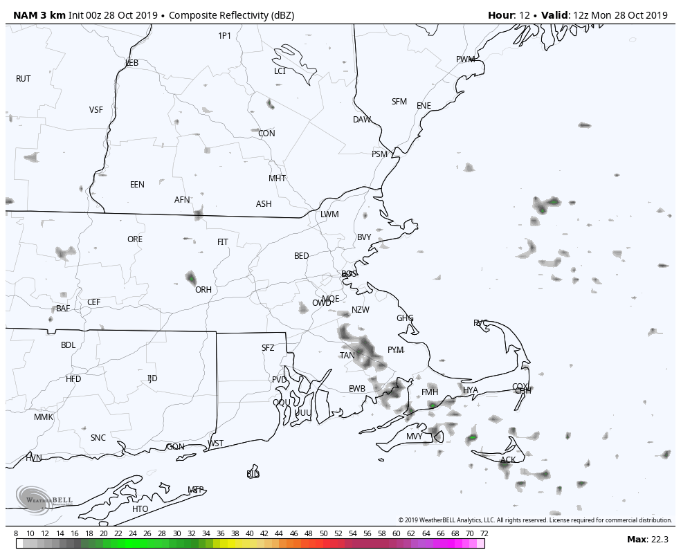
The low pressure that brought us all the rain and wind yesterday? Yeah, it hasn’t gone too far away yet. It’ll keep some clouds around today, especially close to the coastline, with some patchy drizzle, fog, and maybe even a few showers. It may also help produce a little coastal flooding, as tides remain astronomically high, and persistent northeast to east winds will help push the water into the coastline.
The low starts to pull away Monday night and high pressure starts to build into the Canadian Maritimes, so things get better for Tuesday and Wednesday, right? Sorta. We’ll still have some residual moisture around thanks to easterly winds, that’ll keep clouds and maybe some drizzle or a few showers around. A weak trough of low pressure may bring in some additional showers Tuesday night into Wednesday.
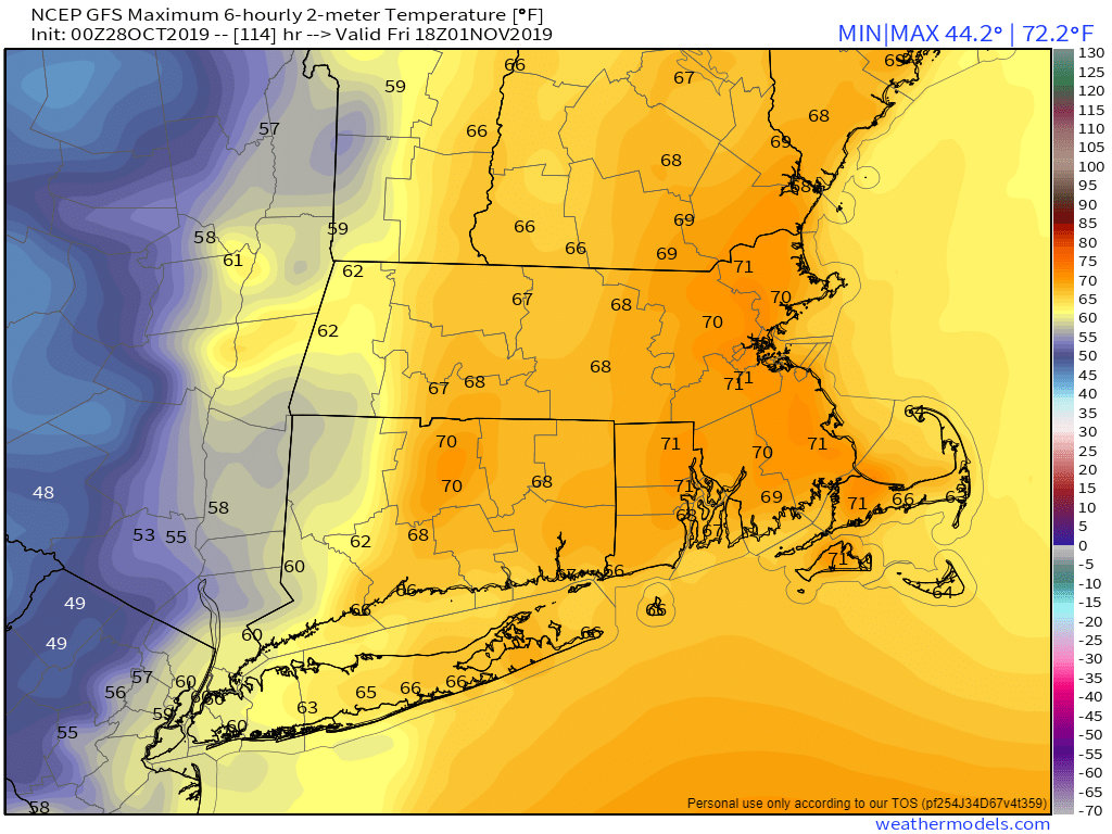
OK, so once the trough moves through, things finally improve, right? Wrong, they go downhill even more. Low pressure moving across the Ohio Valley will move into the eastern Great Lakes Thursday into Friday. Ahead of it, we should get pretty mild around here, thanks to some gusty south to southwest winds. However, we’ll also have plenty of clouds and some rain, possibly a decent amount of rain. (For trick-or-treaters: Find an umbrella) A strong cold front brings an end to the rain sometime Friday morning or early afternoon.
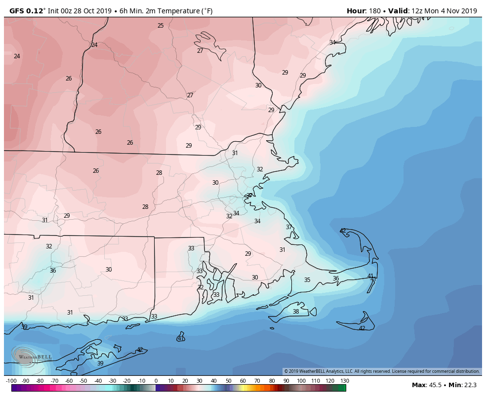
Alright, so things will finally get better for next weekend, right? Yes and no. High pressure will build in, so we’ll have sunshine returning. That’s good. However, much cooler air will also move in (it will be November after all), and for some of you, that’s not a good thing. Also, don’t forget that Daylight Saving Time ends next Sunday morning at 2am. That means you get an extra hour of sleep!
Monday: Low clouds, fog, drizzle, maybe a few sunny breaks well inland in the morning. High 51-58.
Monday night: Mostly cloudy with some drizzle and fog around. Low 44-51.
Tuesday: Plenty of clouds with a chance for some drizzle or a shower, a few sunny breaks are also possible. High 53-60.
Tuesday night: Partly to mostly cloudy with some showers likely. Low 48-55.
Wednesday: Mostly cloudy and milder with a few showers around. High 60-67.
Thursday (Halloween): Cloudy, breezy, and mild with scattered showers. High 59-66.
Friday: Windy with rain ending in the morning, then becoming partly to mostly sunny in the afternoon. High 61-68 in the morning, then temperatures drop during the afternoon.
Saturday: Sunshine and a few clouds, much cooler. High 49-56.
Sunday: Mostly sunny. High 46-53.
Finally, we’ve seen plenty of people releasing their “Winter Outlook” over the past week or two, and more will be coming in the next few weeks. Lots of these will fail spectacularly, others may end up close to the truth. But we’re going to give you ours right now. Not only that, we’re going to guarantee that it’s 100% accurate! You read that right. So, without further delay, here’s our outlook: The months of December through March will be colder than temperatures are now, and there will be some snow. If you want any more details than that, we’ll keep providing them through the winter, 7 days at a time, more often when there are storms.