Weekly Outlook: June 29 – July 5, 2020

This is going one of those weeks where the weather app on your phone just won’t cut it. Most of those apps will give you a little icon for the day, and for this week, we wouldn’t be surprised if there was a little thunderstorm icon in there for every day. Yes, there will be a chance of thunderstorms for almost every day this week. However, the vast majority of the time will be dry, and none of the days should be a washout.

Satellite loop showing the explosive development of Sunday’s storms from midday through sunset. Loop provided by the College of DuPage.

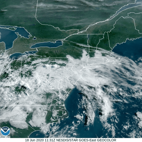
After widespread strong to severe thunderstorms on Sunday, things should be a bit more quiet today. We’ve got an upper-level low pressure settling into the northeast, so we’ll see clouds popping up, and some showers and thunderstorms will likely develop this afternoon. This will be nothing like yesterday however. Sure, a few of the storms may produce a quick downpour or even some small hail due to some cold air aloft, but they’ll be hit and miss storms, with more areas getting nothing than areas that get storms. Most of the activity should diminish with the setting sun.

Much of the region received beneficial rain on Sunday. From northern Rhode Island into Metro Boston, rainfall totals of 1-4″ and heavier were common. Image provided by NOAA.

That upper-level low will remain nearby for Tuesday and Wednesday, so we’ll have similar conditions both days with showers and thunderstorms popping up each afternoon, produce a few downpours and maybe a little hail, but nothing widespread is expected. Temperatures will be on the cooler side, possibly even a little below normal for the end of June/beginning of July, with highs only in the 70s for most of us, with some coastal locations possible staying in the 60s thanks to a wind off the water.

Despite the chances for rain every day, we’re not actually expecting a lot of rain this week. Image provided by Weathermodels.com

The upper-level low finally starts to move out on Thursday, but it still may produce a few showers and thunderstorms. After it moves out, a ridge of high pressure starts to build in…..to the Midwest. That means another upper-level trough of low pressure starts to build in for Friday and the weekend. So, we’ll be a bit warmer, but, you guessed it, we’ll have a daily chance for some pop-up showers and thunderstorms. Wash. Rinse. Repeat. Things may start to dry out a bit more on Sunday.

Average high temperatures for the start of July are in the upper 70s to lower 80s. Image provided by Weathermodels.com

Monday: Some patchy fog to start the day, otherwise more clouds than sunshine, chance for some showers and thunderstorms. High 73-80, a little cooler along the coast.

Monday night: Showers taper off in the evening, then partly to mostly cloudy with some fog redeveloping. Low 59-66.

Tuesday: Intervals of clouds and sunshine, chance for a few showers and thunderstorms. High 69-76, a little cooler along the coast.

Tuesday night: Partly to mostly cloudy, again some patchy fog is possible. Low 60-67.

Wednesday: A mix of sun and clouds with some afternoon showers and thunderstorms possible. High 72-79.

Thursday: A sunny start, then clouds pop up, just a slight chance for a shower or thunderstorm. High 80-87, a little cooler along the coast.

Friday: Morning sunshine then afternoon clouds, a shower or thunderstorm may pop up. High 77-84.

Independence Day: Partly sunny with an afternoon shower or thunderstorm possible. High 75-82.

Sunday: Sunshine and a few clouds. High 78-85.

Weekend Outlook: June 26-29, 2020

The forecast for this weekend is rather simple, yet complicated at the same time.

While fair-weather cumulus are popping across interior areas, high clouds are streaming across southeastern New England this afternoon. Loop provided by the College of DuPage.

We’ve got a nice afternoon in progress with sunshine, warm temperatures, and lower humidity, but as is usually the case, that won’t last too long. A weak disturbance moves through tonight, with a few showers, possibly a thunderstorm, focused mainly south of the Mass Pike. High pressure then slides offshore on Friday, with southwest winds, bringing more humidity back to the region. It won’t be as humid as Wednesday was, but it’ll be more noticeable than today.

Dewpoints will get back into the 60s across parts of the region on Friday. Image provided by WeatherBell.

By late Friday, a low pressure area will move across Ontario and into southern Quebec. A warm front ahead of the low will move across the area Saturday morning, resulting in another warm and humid day, but with a bit more in the way of cloudcover. As the low continues to move eastward, it will drag a cold front across the region late Saturday night and into Sunday. This front will produce some showers and thunderstorms late Saturday afternoon and into Saturday night. This is where things get complicated.

Conditions will be favorable for some strong to possibly severe thunderstorms if everything falls together properly. If we get enough sunshine, conditions could become unstable enough for strong to severe storms to form. Some of the storms could produce strong winds and heavy downpours. However, if there’s more in the way of cloudcover, and temperatures are a bit cooler, then we’d just be looking at showers and a few thunderstorms late Saturday and Saturday night.

Some strong to severe thunderstorms are possible late Saturday, but the highest risk for severe weather is to our west and southwest. Image provided by Pivotal Weather.

Showers may linger into Sunday as the front moves offshore. As has been the case for a while now, there will be a few spots that pick up some heavy rain in downpours, but most of us will see just a little or even no rainfall. This will provide little to no relief from the drought conditions that are developing across the region. High pressure starts to build in later on Sunday with clearing likely at night, and then Monday should feature seasonably warm temperatures and low humidity, but with an upper-level low pressure area moving through, a few pop-up showers are possible.

The drought is starting to get a little worse across the region. Image provided by the National Drought Mitigation Center.

Thursday night: Partly to mostly cloudy with a few showers or thunderstorms possible across Rhode Island and southeastern Massachusetts, clear to partly cloudy elsewhere. Low 60-67.

Friday: Sunshine and some afternoon clouds. High 80-87.

Friday night: Clear to partly cloudy. Low 59-66.

Saturday: Intervals of clouds and sunshine, some showers and thunderstorms are expected during the afternoon and evening. High 78-85.

Saturday night: Partly to mostly cloudy, showers and storms gradually taper off. Low 62-69.

Sunday: More clouds than sun, some additional showers are possible. High 83-90.

Sunday night: Clear to partly cloudy. Low 61-68.

Monday: A mix of sun and clouds, slight chance for a shower or thunderstorm. High 80-87.

A New “Tropical” System in the Atlantic

The National Hurricane Center is tracking another system in the Atlantic, but the only threat it presents is to the Hurricane Center’s credibility.

Official forecast track for “Subtropical Depression Four”. Image provided by the National Hurricane Center.

Late Monday afternoon, the National Hurricane Center started issuing advisories on “Subtropical Depression Four”, which was centered a little more than 300 miles southeast of Nantucket. Their forecast calls for it to strengthen into a Tropical Storm tonight, at which time it would be given the name “Dolly.” The system should head eastward then northeastward, staying over open waters before it weakens and then, according to the forecast, becomes “extratropical”. Here’s the problem. It’s extratropical now, and has been the entire time.

Satellite loop from Monday afternoon showing “Subtropical Depression Four” south of Nova Scotia. Loop provided by NOAA.

To be considered a tropical or even subtropical system, it needs to be “warm core.” What that means, is that temperatures are warmest at the center of the storm, and cooler as you head away from the center. In some stronger hurricanes, like Dorian from last year, temperatures can be as much as 20 degrees warmer in the eye compared to just outside the eye.

Analyzed data from satellite photos shows that “Subtropical Depression Four” is a cold-core system. Image provided by Florida State University.

Tropical systems also need warm water to feed them and help them strengthen. The threshold is generally accepted as 27C (80F) as the minimum needed for a tropical system to maintain itself and/or strengthen. This system is over the northern edge of the Gulf Stream, which is fairly mild, but water temperatures in the region are 25-26C, and quickly drop to 22-24C just to the east of the system’s current location. That’s not warm enough to sustain a “tropical” system.

Current Sea Surface Temperature analysis of the North Atlantic Ocean. Image provided by Tropical Tidbits.

Lastly, and this partially refers back to the first point we made about the system being cold-core, the storm itself is centered under an upper-level low pressure system. Tropical systems usually need an upper-level high pressure system over them, to help vent the rising air near the center. The stronger the high aloft, the more a tropical system will strengthen. A storm sitting under an upper-level low is the same as most of the storms that we see impacting us all through the year – extratropical. As you can see in the analysis below, there is a trough of low pressure extending southward from the system. It’s not quite a cold front, but close enough. Extratropical systems have fronts and/or troughs extending from them, tropical systems don’t.

Surface analysis of the Western Atlantic Ocean from Monday afternoon. Image provided by the Ocean Prediction Center.

Assuming this gets named Dolly, it will be our fourth named “tropical” system this year. However, only one, Cristobal, was ever truly tropical. Cristobal was a tropical storm when it moved into southern Mexico. When it moved back over the Gulf and headed towards Louisiana, it was already extratropical, even though the Hurricane Center didn’t declare it extratropical until it got into Iowa.

It’s been a running joke among meteorologists for years that if a system is over water and has a thunderstorm nearby, it’ll get a name from the “National Thunderstorm Center.” This storm is just further proof of that. With many forecasts for an active hurricane season, every system is going to get named to pad the stats and help verify that forecast. We’ve had colleagues joke that by the time this season is over, we’ll have gone through the entire name list and the Greek Alphabet. We not only agree with that sentiment, we even made a prediction elsewhere that “Tropical Storm Lambda” will produce 70 mph winds on Nantucket in late December while bringing 6-12 inches of snow to southern New England. As long as there’s a thunderstorm in the warm sector, it’ll get a name.

Plumes of Saharan Dust will continue to cross the Atlantic over the next several days. Loop provided by Weathermodels.com

As far as actual tropical systems, none are forthcoming in the Atlantic for at least a week or two, thanks to several plumes of Saharan dust moving off the coast of Africa and across the Atlantic over the next several days. The dust is accompanied by very dry air, which suppresses thunderstorm activity.

Weekly Outlook: June 22-28, 2020

No matter how you define summer, it is now officially here in the Northern Hemisphere, and we’ll feel it all week long.

The past few days have all featured the same general pattern. A muggy start to the day with low clouds and fog across southern Rhode Island and southeastern Massachusetts, then sunshine, some fair-weather cumulus clouds, warm to hot temperatures, moderate to somewhat high humidity, a few pop-up showers and thunderstorms during the afternoon, diminishing by evening, then low clouds and fog return to the South Coast. Wash. Rinse. Repeat. Well, that general pattern will continue today and Tuesday with one added wrinkle – a seabreeze along the coast. That actually started on Sunday, which helped to produce the heavy thunderstorms across eastern Massachusetts. It will likely be the case today, and probably Tuesday as well.

Locally heavy showers and thunderstorms developed on Sunday. Loop provided by the College of DuPage.

By Wednesday, we start to get some changes. A cold front will be approaching from the west as low pressure passes north of the region. We’ll still have morning low clouds and fog, and it’ll still be warm to hot and fairly humid, but the cold front will help produce a little more in the way of thunderstorm activity Wednesday afternoon and evening. The timing of the front will have a hand in determining how strong the thunderstorms get, but right now, it does not look like a widespread severe event.

Some of Wednesday’s storms could be locally heavy, but a widespread heavy rain event is not likely. Image provided by WeatherBell.

The front moves through at some point Wednesday night early Thursday, then high pressure builds in with some drier weather for Thursday into Friday. Temperatures will still be quite warm, but with lower humidity, it will feel a bit more comfortable. The weekend is a bit of a question mark at this point. Another system will likely pass north of the region, with some showers and thunderstorms possible, but there is plenty of disagreement among the models in regards to the timing of the system. Either way, it doesn’t look like much to worry about, with neither day being a washout.

Dewpoints will drop into the 50s across much of the region Thursday afternoon. Image provided by Weathermodels.com

Monday: Low clouds and fog to start the day across the South Coast, and also from the North Shore to the New Hampshire Seacoast, then skies become partly to mostly sunny, a few showers and thunderstorms are possible during the afternoon, mainly well inland. High 85-92 inland, 77-84 along the coast.

Monday night: Clear to partly cloudy, low clouds and fog return to the South Coast. Low 61-68.

Tuesday: A mix of sun and clouds, chance for a few showers and thunderstorms during the afternoon. High 85-92, cooler right along the coast.

Tuesday night: Clear to partly cloudy, low clouds and fog return to the South Coast once again. Low 63-70.

Wednesday: Intervals of clouds and sunshine with scattered showers and thunderstorms likely during the afternoon and evening, tapering off before midnight. High 83-90, cooler along the South Coast.

Thursday: Partly to mostly sunny and less humid. High 82-89.

Friday: Sunshine and a few clouds. High 81-88.

Saturday: Intervals of clouds and sun with a chance for showers and thunderstorms. High 78-85.

Sunday: Partly sunny, chance for some showers and thunderstorms. High 80-87.

Weekend Outlook: June 19-22, 2020

Astronomical Summer officially begins at 5:43pm on Saturday, but summer weather will be here all weekend.

This morning’s satellite loop shows low clouds and fog burning off before high clouds move into the South Coast. Northern New England remains clear. Loop provided by NOAA.

We’ll be brief today, because it’s really a very simple forecast. High pressure slides offshore, providing us with warm to hot and humid conditions for the next several days. Friday and Saturday look to be the hottest days, with temperatures topping 90 in some areas, especially from the Merrimack Valley into southern New Hampshire. Sunday and Monday will be a couple of degrees cooler, as we’ll have a bit more cloudcover, thanks to an upper-level low pressure area moving through. It may produce a few showers and thunderstorms, especially on Monday, but neither day should be a washout.

Dewpoints will be well into the 60s across the region for the next few days. Image provided by WeatherBell.

If you’re thinking of heading to the beach, bring the sunscreen. The UV Index will be in the very high range for the next few days, which means you’ll start to burn in just 15-20 minutes. High tides will be around midday for beaches on the east coast, while south coast beaches will have high tides in the morning, with a low tide around midday. Water temperatures are generally in the 60s right now. For those of you thinking about heading out on a boat, you’ll have southwest to south winds at 5-15 knots for the next few days, seas generally 1-3 feet, and aside from some patchy fog in the mornings, good visibility each day.

Thursday night: Clear to partly cloudy. Some low clouds and fog are possible along the south coast. Low 61-68.

Friday: Sunshine and a few clouds. High 86-93, cooler along the South Coast.

Friday night: Clear to partly cloudy. Low 61-68.

Saturday: Mostly sunny with a few afternoon fair-weather clouds, just a slight chance for an afternoon shower or thunderstorm, mainly across southern New Hampshire. High 87-94, cooler along the South Coast.

Saturday night: Clear to partly cloudy. Low 62-69.

Sunday: A mix of sun and clouds, a shower or thunderstorm is possible, but most of the shower activity should stay north and west of the area. High 84-91, cooler along the South Coast.

Sunday night: Partly cloudy. Low 61-68.

Monday: Partly sunny, some showers and thunderstorms are possible in the afternoon. High 83-90, cooler along the South Coast.

Weekly Outlook: June 15-21, 2020

High ‘N’ Dry – that pretty much sums up this week’s forecast. High pressure provides dry weather for most of the week.

High pressure will settle into the Northeast for the next few days. This means we’ll have dry and cool conditions for the first part of the week, with temperatures and humidity levels starting to creep up as we get to the latter half of the week. As is usually the case, temperatures will be coolest along the coast thanks to onshore flow, and well see some fair-weather cumulus clouds pop up each afternoon across the interior.

Water temperatures are in the upper 50s to lower 60s off the east coast, and lower to middle 60s off the south coast. Image provided by NOAA.

By late in the week, we’ll be warm to potentially hot, and humid, with the chance for some showers and thunderstorms to pop up on Friday afternoon. The weekend is a bit of a question mark at this point. The models have 2 separate but equally plausible solutions right now. One model has the heat come to an abrupt end Saturday afternoon with a backdoor cold front, leading to much cooler conditions for Saturday night and Sunday, along with plenty of clouds and possibly some showers. Some other models keep us warm and humid with some showers and thunderstorms possible, and a slow-moving cold front still well to our west. For now, we’re going to lean towards the latter solution, but obviously things could change. With next Sunday being Fathers Day, many people will be making plans, especially outdoor plans. We should have a clearer picture when we publish our Weekend Outlook Thursday afternoon. If the latter solution is indeed correct, some locations across the interior could be near or above 90 starting on Thursday and continuing at least into Sunday.

Little to no rainfall is expected across the region between now and Sunday morning. Image provided by WeatherBell.

Monday: Some low clouds and fog this morning, then becoming partly to mostly sunny. High 67-74, a little cooler along the coast.

Monday night: Mostly clear. Low 48-55.

Tuesday: Sunshine and lots of it. High 73-80, a little cooler along the coast.

Tuesday night: Clear to partly cloudy. Low 48-55.

Wednesday: Sunshine and a few afternoon clouds. High 79-86, again cooler along the coast.

Thursday: Mostly sunny, a few clouds during the afternoon. High 84-91, cooler along the South Coast.

Friday: Partly to mostly sunny, just a slight chance for an afternoon shower or thunderstorm. High 86-93, cooler along the South Coast.

Saturday: A mix of sun and clouds, an afternoon shower or thunderstorm is possible. High 85-92, cooler along the South Coast.

Sunday: Partly sunny, chance for some afternoon showers and thunderstorms. High 84-91, cooler along the South Coast.

Weekend Outlook: June 12-15, 2020

Changes are coming to our weather pattern, some good, some bad.

Showers and some thunderstorms are likely this afternoon and evening ahead of a cold front. Loop provided by Weathermodels.com

A cold front will move across the region later today, with some showers and thunderstorms likely ahead of it. The front moves through this evening, bringing an end to the shower activity, with some drier air moving in behind it. The front will likely stall out and dissipate off the South Coast on Friday, but with some sunshine developing, we’ll actually be warmer than we are today, with less humidity. Another weak front will move through late in the day, but it will have little moisture associated with it, so you’ll barely notice it aside from some clouds accompanying it.

Dewpoints will drop into the 40s and lower 50s for Saturday afternoon. Image provided by WeatherBell.

High pressure builds in for Saturday, with more sunshine, but some cooler weather. With the high to the north we’ll have an easterly flow, so the warmest weather will be found well inland. Along the coast, temperatures may stay in the 60s all day, even with the sunshine.

As we get to Sunday and Monday, things become more uncertain. High pressure will be moving into Atlantic Canada, while an upper-level low pressure area moves into the Appalachians, spinning up a low pressure area at the surface in the Mid-Atlantic states. We’ll be caught in between these, and at this point, there’s no consensus as to which feature will win out. So, we’re going to play the middle ground for now, with generally cloudy conditions and below normal temperatures, especially along the coast. There will be a risk of some showers, but we don’t expect either day to be a washout. In fact, both days will probably be relatively dry, as the bulk of the shower activity should remain to the south, but some of it could move up this way.

There’s plenty of disagreement among the models as to whether we’ll have any precipitation on Monday. Images provided by Pivotal Weather.

Thursday night: Mostly cloudy with showers and thunderstorms ending from northwest to southeast. Low 59-66.

Friday: Becoming mostly sunny. High 79-86.

Friday night: Clear to partly cloudy. Low 53-60.

Saturday: Mostly sunny. High 71-78, cooler along the coast.

Saturday night: Clear skies. Low 49-56.

Sunday: A mix of sun and clouds, chance for a few showers. High 68-75, a little cooler along the coast.

Sunday night: Mostly cloudy. Low 51-58.

Monday: More clouds than sun, chance for a few showers. High 69-76, a little cooler along the coast.

Weekly Outlook: June 8-14, 2020

Heat and humidity will gradually be increasing over the next few days, which means it actually will feel like June.

The first half of the week is a fairly straightforward forecast. High pressure will slide offshore, with generally dry weather through Wednesday. Temperatures and humidity levels will gradually increase thanks to southwesterly flow around the high pressure area.

The week starts off with very low dewpoints, but they’ll gradually rise, especially by Wednesday and Thursday. Loop provided by Pivotal Weather.

By late Wednesday, things start to get a little more complicated. A strong low pressure sure, fueled by whatever is left of “Cristobal”, will be moving across the Great Lakes and into Ontario. It will send a warm front across the region, leading to an increase in humidity levels. The low will move up towards Hudson Bay on Thursday, dragging a cold front into the Northeast. Ahead of that front, it’ll likely be fairly breezy, but also warm and humid, with the front triggering some showers and thunderstorms. There is some disagreement among the models as to when the cold front moves through the region, but right now, we’re leaning towards Thursday night.

Thursday could be a very breezy day, with wind gusts in excess of 40 mph across the region. Image provided by WeatherBell.

High pressure builds in behind the front on Friday with drier conditions. Next weekend is highly uncertain at this point. An upper-level low pressure system may drift across the Northeast, which would result in some additional clouds and cooler conditions, as well as the chance for a few showers. Some models are more pessimistic than others, but given the fact that it’s been dry lately, we’re going to lean away from the models that are showing more widespread rainfall. There’s an old adage we learned a while ago that holds true with forecasting rainfall – “When in drought, leave it out.” We’re going to go with that.

Rainfall has been near to below normal across the region over the past 60 days. Image provided by Weathermodels.com

Monday: Sunshine and a few high clouds. High 72-79.

Monday night: Partly cloudy. Low 53-60.

Tuesday: Mostly sunny in the morning, some clouds pop up during the afternoon. High 77-84.

Tuesday night: Clear to partly cloudy. Low 55-62.

Wednesday: Partly to mostly sunny and breezy, slight chance for an afternoon shower. High 70-80 along the coast, 81-88 inland.

Thursday: Partly sunny, windy, and humid with showers and thunderstorms possible late in the day and at night. High 79-86, cooler along the south coast.

Friday: Clouds and a few lingering showers across southeastern Massachusetts, otherwise becoming partly sunny and less humid. High 79-86.

Saturday: A mix of sun and clouds. High 74-81, cooler along the coast.

Sunday: Intervals of clouds and sun, chance for a few showers. High 71-78, cooler along the coast.

Severe Weather Possible Today

A warm and humid airmass has been in place for a couple of days, but a cold front is approaching the region. That front may produce some strong to severe thunderstorms later this afternoon.

A severe thunderstorm watch is in effect for most of the region until 8pm. Image provided by NOAA.

After some showers and thunderstorms moved across southeastern Massachusetts and Rhode Island early this morning, some sunshine has developed, allowing temperatures to quickly warm into the 80s away from the south coast by midday. Dewpoints are in the upper 60s to lower 70s, making for a rather muggy afternoon.

Temperatures are already well into the 80s away from the South Coast at midday. Image provided by NOAA.

A cold front extends from Lake Champlain into central New York at midday. Ahead of it, showers and thunderstorms are developing rapidly. Some strong to severe storms have been moving across portions of Vermont, New Hampshire, and Maine already, and these will become more numerous as the afternoon wears on. With an unstable airmass already in place, many of the thunderstorms will become strong to severe, producing strong winds, hail, and heavy downpours.

Forecast through early Sunday morning from the HRRR model. Loop provided by WeatherBell.

The most likely time for severe weather across our area looks to be in the 2-6pm time frame. This is when we’ll have the best chance for severe weather. The front itself may not move through until 7-9pm, and there may be some additional showers and thunderstorms accompanying the front. Some of these storms may produce downpours and gusty winds, but the threat of severe weather should be significantly diminished by then. Cooler and drier air will settle in behind the front tonight, but Sunday will probably still feature plenty of clouds thanks to an east to northeast wind off the ocean. Some drizzle and a few showers are also possible, but the day won’t be a washout. Temperatures will be much cooler though, staying in the 60s for much of the region. We should start to warm up again on Monday with sunshine returning.

Cristobal Threatens the Gulf Coast

After dumping feet of rain on portions of southern Mexico and Central America, Cristobal is now starting to take aim on the Gulf Coast.

Cristobal is become a little better organized this afternoon. Loop provided by NOAA.

Early Friday afternoon, Cristobal had strengthened back into a Tropical Storm and was located about 35 miles south-southeast of Merida, Mexico, moving toward the north at 12 mph. Maximum sustained winds have increased to near 40 mph. Cristobal should continue moving toward the north, with the center of circulation moving back over the Gulf of Mexico later today or tonight. Once that happens, the system should strengthen a bit more.

Cristobal is a bit of a lopsided system right now, with most of the rainfall along with the strongest winds all located east of the center of the storm. While some of the rainfall will eventually rotate around to the western side of the storm, the overall structure of the system likely won’t change much over the weekend. This has important implications that we’ll get to in a little bit.

As Cristobal moves away from Mexico tonight and Saturday, some additional strengthening is expected. The waters of the Gulf are very warm, which will help the storm intensify, but the presence of dry air aloft and some wind shear will act to inhibit significant strengthening. Cristobal should strengthen a bit more on Saturday, but at this time, it does not look like it will become a hurricane before approaching the central Gulf Coast Sunday night.

Model forecasts for the track of Cristobal. Image provided by WeatherBell.

The current forecast calls for Cristobal to make landfall as a tropical storm along the coastline of Louisiana Sunday evening. A Tropical Storm Warning is already in effect for the coast of Mexico from Punta Herrero to Rio Lagartos, where tropical storm conditions are expected into Saturday. A Tropical Storm Watch has been issued from Intracoastal City, Louisiana to the Alabama/Florida border, including Lakes Ponchatrain and Maurepas. A Storm Surge Watch has also been issued from Grand Isle, Louisiana to Ocean Springs, Mississippi, including Lake Borgne, and also along the coast of Florida from Indian Pass to Arepika.

As we mentioned earlier, Cristobal is a bit lopsided, and this should still be the case as the storm moves inland Sunday night. That’s not to say that areas west of the center will escape without issues, but they shouldn’t be as problematic. There will still be some heavy rain, and wind gusts to 30-40 mph, but this isn’t anything the region hasn’t experienced plenty of times before. Near and east of the center are where the problems will become more numerous.

Storm surge of 2-4 feet is expected along parts of the Gulf Coast as Cristobal moves inland. Image provided by the National Hurricane Center.

Cristobal should have sustained winds of 50-60 mph near the center at landfall, but these winds will only be experienced over a small area along the coast. The remainder of the area will likely have sustained winds of 30-40 mph, with some gusts to 50-60 mph. Along the coast, a storm surge of 2-4 feet will result in flooding of some areas, especially the low-lying locations near the Mississippi River entrance. By far, the biggest threat is heavy rain.

GFS forecast for rainfall from Saturday through Tuesday morning across the Gulf Coast, Image provided by WeatherBell.

Rainfall totals of 4-8 inches are expected across a wide area, with isolated totals to 12 inches possible. This will lead to flooding across much of the region. Flood watches have already been issued. Parts of the Gulf Coast have actually been in a drought recently, but too much rain in a short period isn’t a good thing. Once inland, Cristobal should weaken and head northward, bringing heavy rain to parts of the Mississippi Valley and the Great Lakes early next week.

Tropical Depression Three formed in the Bay of Campeche Monday afternoon and strengthened into Tropical Storm Cristobal Tuesday afternoon. It made landfall along the coast of Mexico Wednesday morning, and has been drifting around southeastern Mexico and Guatemala for the past 48 hours. Cristobal has produced torrential rainfall, with 15-25 inches of rain reported across much of the region, resulting in widespread flooding. Another 3-6 inches of rain, possibly more, is expected across this region before the system pulls away over the weekend.