Here Comes the Snow

We really haven’t had a decent-sized snowstorm around here since mid-December. That will change in a hurry on Monday. As a result, the Extreme Hype Watch we issued on Thursday has been upgraded to an Extreme Hype Warning.

Low pressure moving across the Ohio Valley this afternoon is just one ingredient in the mix for the upcoming storm. Image provided by the Weather Prediction Center.

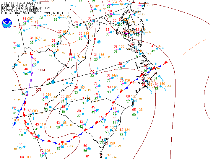
High pressure remains in place across Quebec, keeping plenty of cold air in place across the Northeast this afternoon. Meanwhile, low pressure is moving across the Ohio Valley, producing a swath of snow from the Great Lakes into the Mid-Atlantic states. As that low moves eastward, it will weaken tonight, but a new area of low pressure will develop off the Mid-Atlantic coastline. At the same time, and upper-level low pressure area will also move toward the East Coast. As the new surface low gets caught underneath the upper-air low pressure area later Monday and Monday night, it will stall out or meander around south of Long Island. Eventually, it will resume an east to northeast motion on Tuesday, passing south and east of Nantucket before moving into the Gulf of Maine.

Snow is falling from Chicago to New York City late this afternoon. Loop provided by Weathertap.

As we mentioned, an Extreme Hype Warning has been issued, which means you’ll see blanket coverage from the network stations around here, hourly updates even when they go to regular programming, and of course, obligatory live shots from (take your pick):

  • The side of an Interstate
  • Logan Airport
  • A local DPW salt pile
  • A beach showing the rough surf and coastal flooding
  • A Dunkin Donuts where they are talking to a plow operator
  • All of the above

You’ll also get network reports about how the snow is creating chaos in New York City, how it put Washington at a standstill, and possibly how it dumped heavy snow on the Midwest. The latter is debatable, because anything west of the Appalachians is considered “flyover country” to the media around here.

OK, we’ve explained what’s going on in the big picture, now let’s focus on some of the details for our area (Southern New Hampshire, Eastern Massachusetts, Rhode Island):

Winter Storm Warnings are in effect from Maine to Virginia.

As you can see on the radar above, snow is already moving into the Tri-State area, and will continue to make slow progress northward tonight. By morning, east to northeast winds will start to increase around here, and we’ll see some ocean-effect snow showers develop in parts of southern New Hampshire and eastern Massachusetts. These aren’t directly related to the storm, but may drop 1/4-1/2″ of snow. This is also a common occurrence before some storms around here. The snowfall from the storm will move in during the late-morning and early afternoon hours and should become moderate to heavy by late afternoon or early evening. Snow may fall at the rate of an inch or two per hour at times. This will continue overnight with precipitation starting to taper off before daybreak. For much of the region, that precipitation will fall as all snow, but a change to rain is likely along the coast and across parts of southeastern Massachusetts and southern Rhode Island. How far inland that rain-snow line penetrates will obviously have a large impact on accumulations. Right now, we don’t expect it to get past Interstate-95, and it might not even get that far.

By Tuesday morning, the steady precipitation will taper off, but the storm will still be south of Long Island. So, what we’re looking at is occasional snow showers and periods of light snow throughout the day, with rain or mixed precipitation in southeastern Massachusetts and southern Rhode Island, This likely won’t add too much accumulation, but in some places, we could see another inch or two. As the low finally gets moving, colder air will work its way back in, changing everywhere back to all snow before it ends late Tuesday night or Wednesday morning.

There are several factors that could cause problems around here. First and foremost is the wind. Northeast winds will increase to 15-25 mph inland, and 20-30 mph along the coast, with gusts of 30-50 mph. This will create near-blizzard conditions at times Monday night, with reduced visibility and blowing and drifting snow. If you don’t have to go out Monday night, stay home. Driving will be extremely hazardous. Across Cape Cod and the Islands, a High Wind Warning is in effect. Sustained winds of 25-35 mph with gusts to 60 mph are possible here. Winds will only slowly diminish across the region on Tuesday.

Peak wind gusts of 40-50 mph are expected across the region. Image provided by WeatherBell.

Along with the wind, we have coastal flooding to worry about. A Coastal Flood Watch is in effect for eastern Massachusetts, mainly for the high tide cycles Monday night and Tuesday morning. Those strong northeast winds, combined with tides that are still astronomically high, will likely produce some coastal flooding, especially in some of the normally prone areas (like Morrissey Boulevard in Boston). By Tuesday afternoon, winds will become more northerly, reducing the coastal flood threat.

Finally, we get to the part you’re all interested in – how much snow? The good news is that they heaviest snow from this storm will likely be south and west of us, from southeastern New York and northern New Jersey into parts of Pennsylvania. Many locations in this area could see 20 or more inches of snow before everything winds down. Even New York City could see a foot to perhaps a foot and a half of snow. Around here, there will likely be many reports in excess of a foot, especially north and west of Boston. As for specifics, here’s what we’re thinking:

Cape Cod: 1-3″, heaviest near the Canal
South Coast/Immediate East Coast: 3-6″
Interior Southeastern Massachusetts/I95 Corridor from RI into Eastern MA: 6-10″
Areas North and West of Interstate-95 (including southern/Central NH): 10-15″ with some heavier amounts possible.

Our thinking is closest to what the NWS Blend of Models is showing. Image provided by Weathermodels.com

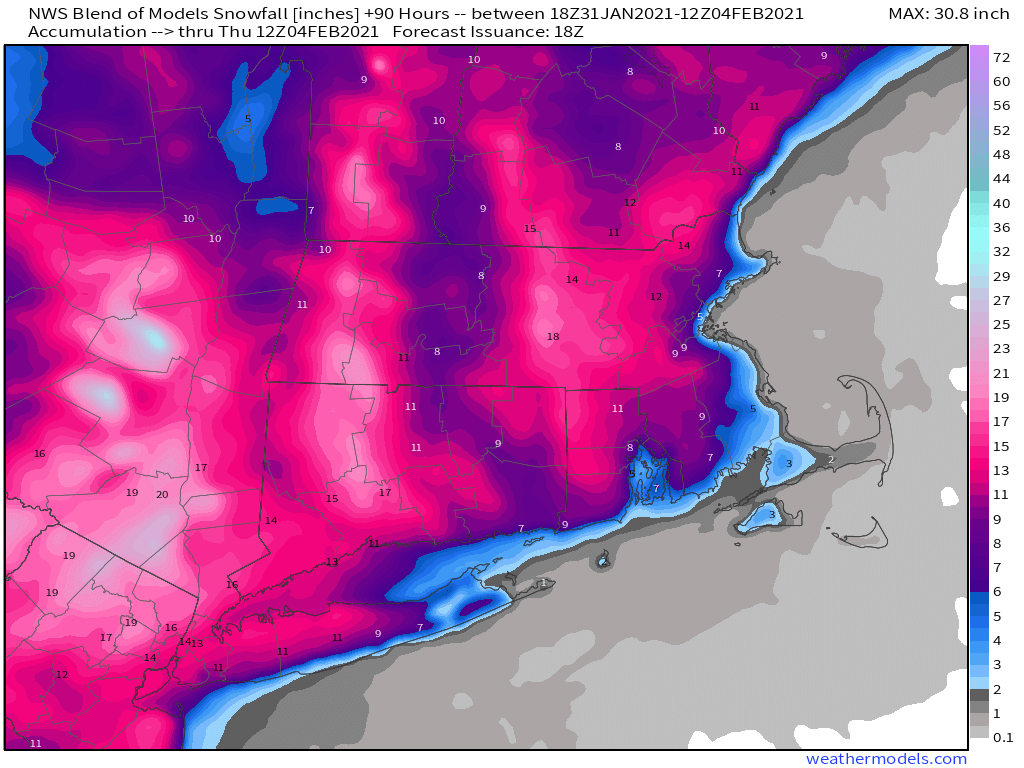
Obviously, some of these amounts are dependent on when/if rain starts to mix on or a complete change to rain occurs. Most of the accumulating snow will occur between late Monday afternoon and daybreak Tuesday, but there will still be some snow falling during the day on Tuesday.

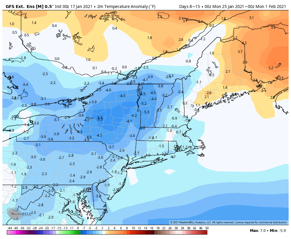
Another storm will move in late this week, but this one looks to be milder, with rain for a bigger chunk of the region, though snow is a possibility across the interior. We’ll have more on that in our Weekly Outlook tomorrow morning.

Weekend Outlook: January 29-February 1, 2021

Bond villian Elliot Carver said it in “Tomorrow Never Dies”, but it’s appropriate for the forecast for the next several days – “Let the mayhem begin”

We start off with a developing low pressure system well offshore tonight. The system will continue to strengthen, but also continue to pull away, so it won’t directly impact us. However, it will produce northerly winds around here that will serve two purposes. First, they’ll continue to produce some ocean-effect snow across parts of eastern Massachusetts and the New Hampshire Seacoast, and second, they’ll usher in some of the coldest air thus far this winter.

Low pressure well south of New England shows up nicely on satellite imagery this afternoon. Loop provided by NOAA.

First, we’ll look at the ocean-effect snow. It’s been ongoing since early this morning, and will continue off and on into this evening. While it won’t amount to much for a good chunk of the region, right along the coast, especially Cape Ann, coastal Plymouth County, and Cape Cod, could see an inch or two in spots. On Friday, a disturbance rotating around the ocean storm will bring some more ocean-effect snowfall back into Cape Cod. This could result in additional accumulations, especially across the Outer Cape, where a few inches is possible.

A few inches of snow may accumulate across the Outer Cape over the next day or two. Image provided by Weathermodels.com

Back to the cold air. This past week has been rather chilly compared to the rest of January, but temperatures have only been near to a little below normal. That’s going to change tonight and this weekend. Skies will start to clear out tonight (except for Cape Cod), and it’s going to get cold. Temperatures will likely drop into the single numbers for much of the region tonight, but it will remain quite breezy, so we’re looking at wind chills of 10 to 20 below zero Friday morning. Wind Chill Advisories have been posted from Worcester County westward, but even without the advisory, you should know enough to dress warmly if you have to go outside.

Bundle up before you head outside Friday morning because it’s going to be chilly. Image provided by WeatherBell.

Friday looks rather chilly as well. Some clouds may move in from the ocean, but even in places where the sun is out, it’ll still be breezy and cold, with daytime highs only in the teens to lower 20s. Skies clear out again Friday night and winds will start to diminish, so we’re looking at another cold night, with some places possibly dropping below zero. Saturday should feature a lot of sunshine, but it will still be cold, with highs only in the upper teens to lower 20s. After another bitterly cold night Saturday night, temperatures should start to moderate a bit on Sunday, but we’ll also see clouds starting to move back in ahead of another storm system heading this way. This brings us to Monday.

For several days now, most of the forecast models have been showing the potential for a storm system to impact the Northeast early next week. They’ve bounced around with the details on strength, timing, and track, but in general, there’s been a fairly strong signal that something is going to happen around here after we flip the calendar to February. Well, that signal hasn’t gone away, and the Universal Hub website has upgraded to a Level 2 on the French Toast Alert System. In other words, don’t worry just yet. However, knowing how the media can be around here, and knowing what the models are showing, we’re issuing our own Extreme Hype Watch. An Extreme Hype Watch is issued when conditions are favorable for media hype of an event to reach extreme levels within the next 48-72 hours. If conditions warrant, a Hype Advisory or Extreme Hype Warning will be issued as the event draws nearer.

As for the system itself, there are still plenty of questions that need to be answered. We’ll have a large high pressure area in eastern Canada keeping some cold air in place. It’s not quite in the ideal position for a big storm here, but it is there. We’ll have a low pressure system moving through the Midwest that will redevelop over the Mid-Atlantic states, then head northeastward, likely passing south and east of New England, close to the “benchmark”. The benchmark is at 40 degrees North latitude and 70 degrees West longitude, about 90 miles south of Nantucket. Storms that pass over that spot are usually (but not always) in a prime position to deliver heavy snow to much of the region. Storms that pass north and west of there usually end up with a rain/snow line farther inland, and storms that pass south and east of there don’t always deliver snow far inland. This is more of a general rule than an absolute, but it’s something we look for. The other issue we have is that an upper-level low pressure area will be moving in, and the storm may get stuck underneath it, which could stall it out or have it meander around south of us for a day or so, which would result in an extended period of precipitation.

In addition to the models, another tool we use is analogs. You will most often hear about these in relation to a seasonal pattern or a hurricane season, but we can also use them for individual storms. Basically, we compare the pattern to previous setups, and see how it compares, and see what those previous setups produced to give us an idea of what is possible. Now, these analogs are run compared to the forecast of one model, so if that model isn’t the one your using, then the analogs might not be of much help. Based on the midday run of that model, the best analog for the pattern early next week is the storm of January 26-28, 2015. You may recall that storm received an extreme amount of media hype, and did produce very heavy snow around here, but was considered a “bust” in New York City, where the actual amounts fell well short of the forecast. It also was the storm that essentially kick-started our 6-week snow blitz (and also was responsible for the formation of the original StormHQ Facebook page). Using the Top 15 analogs for the forecast pattern, here’s the average of snowfall from those 15 systems:

Analog snowfall forecast for Monday-Tuesday. Image provided by the Cooperative Institute for Precipitation Systems (CIPS).

As you can see, there is a signal for a significant snowstorm, which is why we’re going to be monitoring this closely for the next several days. We’re not going to post any model snow forecasts yet because there’s still too much uncertainty. We’ll let the media and Facebook Forecasters take care of that. If conditions warrant, we’ll issue another blog post either Saturday or Sunday as the details become more clear.

Thursday night: Mostly cloudy along the coast with a few snow showers across the Cape, clearing inland, breezy. Low 1-8.

Friday: Intervals of clouds and sun, more snow showers across Cape Cod, windy. High 13-20.

Friday night: Lingering clouds across Cape Cod, clear elsewhere, still breezy during the evening. Low 2-9.

Saturday: Plenty of sunshine, except for some clouds across the Outer Cape. High 16-23.

Saturday night: Clear skies. Low 0-7.

Sunday: High clouds stream in. High 22-29.

Sunday night: Thickening clouds. Low 12-19.

Monday: Cloudy and breezy with a chance of snow (or possibly rain south of Boston) High 30-37.

Weekly Outlook: January 25-31, 2021

This is shaping up to be one of those weeks that ages a meteorologist rapidly, since there are not only multiple systems to track, but the bust potential is much higher than normal.

The week starts off rather quietly, with high pressure moving offshore. We’ll still be on the chilly side, but close to normal for late January, and not as cold as the past few days were. Clouds will start streaming in as well, ahead of a storm system moving into the Midwest. This is the first headache of the week.

On average, high temperatures should be in the lower to middle 30s around here in late January. Image provided by Weathermodels.com

As that low pressure area moves into the Midwest, a secondary area of low pressure will develop near the Mid-Atlantic states, and will pass offshore to our south later Tuesday. However, some energy from the original system will still move towards us late Tuesday into Wednesday. The bulk of the precipitation from the secondary storm will stay to the south, with some snow showers or flurries possible along the South Coast, possibly as far north as the Mass Pike. What complicates things is the energy from the original storm. Some of the models have that move across the region with another area of snow, and possibly a decent amount. This has been a recent development in the models over the last 24 hours, which makes us skeptical, but many of the models show something similar, so we can’t completely ignore it. Right now, we’re thinking that a period of light snow is likely Tuesday night into early Wednesday, with some accumulations expected. There are some models that show significant accumulations in parts of the region. While that is possible, we don’t think it’s likely at the moment. If that were to change, we’d update the blog later Monday or Tuesday.

There is plenty of disagreement among the models about how much snow to expected between now and Wednesday afternoon. Images provided by Pivotal Weather.

That system pulls away on Wednesday and high pressure builds in. However, with the high building in north of us, we’ll stay chilly, but we’ll also have northeast winds. This may result in some ocean-effect snow in eastern parts of the area, especially Cape Cod, coastal Plymouth County, and Cape Ann. Some persistent snow showers could result in accumulations, possibly several inches, but this far in advance it’s too tough to predict if or where those bands may setup.

Ocean-effect snow is essentially the same as lake-effect snow. Image provided by NOAA.

Another storm system will head towards the Mid-Atlantic by Thursday, and again, this storm should also pass far enough south to have little direct impact on us. However, unlike the system on Tuesday that will be weakening as it moves this way, this storm will strengthen. In fact, once it moves offshore, it should become a powerful storm over the North Atlantic. It may produce some gusty winds along the coast, especially Cape Cod, and possibly some additional ocean-effect snowfall, but the precipitation shield associated with the storm itself should remain offshore.

Behind that storm, much colder air will settle in for Friday and Saturday. We should finally start to clear out as high pressure builds in, though a few more ocean-effect snow showers are possible, especially across Cape Cod. The more noticeable impact is that it will be very chilly, likely colder than we just experienced this weekend. Daytime highs in the 20s (even some upper teens), and overnight lows in the teens and single-digits seem reasonable right now, with sub-zero wind chills, especially Friday into early Saturday.

Wind chills may be well below zero around here Saturday morning. Image provided by WeatherBell.

This brings us to Sunday, and our next headache. Yet another storm system will be heading for the Mid-Atlantic states, sending clouds our way. With high pressure over southern Quebec, we’ll still be on the cold side. The exact track this storm takes is still a big question mark, but this one doesn’t look like it’ll pass offshore to our south. In fact, several models bring the storm right across southern New England on Monday. We’re not going to get into too many details because it’s a week away, and technically outside the usual range of this forecast, but we’ll just let you know that there is the potential for a decent amount of snow early next week for parts of the region. It’s just potential for now and far from a lock, but the models have been showing this potential for several days now. We’ll get into more details on this one in our Weekend Outlook on Thursday.

Monday: Sunny in the morning, clouds start to move in during the afternoon. High 30-37.

Monday night: Becoming partly to mostly cloudy. Low 17-24.

Tuesday: Cloudy, light snow may develop late in the day. High 29-36.

Tuesday night: Cloudy with light snow likely, possibly mixed with some rain along the south coast. Low 22-29.

Wednesday: Cloudy with light snow likely, mainly north and west of Boston, with snow or rain showers likely from Boston southward. High 32-39.

Thursday: Cloudy and breezy with a chance of snow showers, especially near the east coast. High 31-38.

Friday: Becoming partly to mostly sunny, breezy, and cold, though clouds may linger along the east coast with a few more snow showers possible. High 18-25.

Saturday: Mostly sunny and cold. High 19-26.

Sunday: Becoming mostly cloudy with a chance for snow at night. High 28-35.

Weekend Outlook: January 22-25, 2021

We’re more than halfway through meteorological winter, but for the first time in about a month, it’s actually going to feel like winter outside.

The disturbance that gave us snow showers and flurries today will push offshore tonight with some clearing, but it will be short-lived. Another system heading into the Great Lakes will send a warm front our way on Friday with clouds and somewhat milder conditions. As that system passes to our north Friday night, it will drag a strong cold front across the region. There may be a few snow showers along the front, but for the most part it will remain dry. What you will notice is gusty north to northwest winds behind the front bringing much colder air into the region for the weekend. Despite sunshine, temperatures may not reach freezing on Saturday. When you add in the gusty winds, wind chills will be in the single digits. Winds will remain gusty into the nighttime hours, when wind chills may drop below zero. The winds start to decrease on Sunday, but it will be another chilly day despite sunshine once again.

Wind chills will be near or below zero Sunday morning. Image provided by WeatherBell.

This brings us to Monday. We’re keeping an eye on a storm system that will be moving out of the Midwest and toward the East Coast. We’ll also have high pressure building in to the north so it will remain chilly. The question is, where does the low actually track? Right now, it looks like it should stay too far south to have much impact here, but that is far from definite at this point. If there are going to be any impacts, it would be mainly across southern parts of the area, and likely late Monday night into Tuesday, but again, there is still a lot that needs to be worked out. While most of the models are in pretty good agreement at this point that the storm stays south, we’ve seen plenty of times before (even earlier this winter), where the models agree on a storm missing out to the south 4-5 days in advance, and then they all shift northward a few days later. So, we’re not going to just write this off yet. Obviously, we’ll have a better idea when we get to our Weekly Outlook Monday morning.

Low pressure should stay to the south Monday night, but how far south? Images provided by Pivotal Weather.

Thursday night: Becoming clear to partly cloudy. Low 21-28.

Friday: Some morning sun, then clouds return. High 36-43.

Friday night: Partly to mostly cloudy through the evening with a slight chance for a snow shower, clearing and becoming breezy after midnight. Low 18-25.

Saturday: Sunshine and a few clouds, windy. High 23-30.

Saturday night: Clear and cold, still breezy. Low 10-17.

Sunday: Partly to mostly sunny and breezy. High 25-32.

Sunday night: Partly cloudy. Low 12-19.

Monday: Morning sunshine, clouds move in during the afternoon. High 30-37.

Weekly Outlook: January 18-24, 2021

We’ve had an extended stretch of relatively mild weather for January, but that’s about to change.

Temperatures have been well above normal across the Northeast for most of January thus far. Image provided by the Northeast Regional Climate Center.

Temperatures will remain mild compared to normal today, but we’ll have plenty of clouds once again as a weak upper-level disturbance moves across the region. It may produce a sprinkle or flurry in spots, but for the most part, we’ll remain dry. We’ll clear out tonight, then Tuesday will feature some sunshine and cooler temperatures as high pressure builds in. Some clouds will likely develop, because that’s just the way things have been this winter – we can’t seem to get a completely clear day, even when it looks like we should.

Even with high pressure building in, we’ll still have some clouds around Tuesday afternoon. Image provided by Weathermodels.com

Another weak disturbances moves through Tuesday night and early Wednesday with more clouds and possibly a few snow showers, but even colder air will start to filter in behind this system. Some clearing is possible Wednesday afternoon as the system moves away, but another quickly system follows for Thursday into Friday. This may produce some snow showers, but right now, we’re only expecting light accumulations, if that. That system will strengthen as it moves into Atlantic Canada, producing gusty northwest winds around here over the weekend as high pressure builds in, which will result in much cooler weather moving in. It does look like the colder weather will hang around through much of next week, so it will start to feel like winter once again.

Temperatures are expected to below normal across a large portion of the Northeast next week. Image provided by WeatherBell.

Monday: Some morning sun, then becoming mostly cloudy, chance for a sprinkle or a flurry, breezy. High 39-46.

Monday night: Clearing. Low 20-27.

Tuesday: A mix of sun and clouds. High 33-40.

Tuesday night: Partly to mostly cloudy with a few flurries possible. Low 22-29.

Wednesday: Plenty of clouds, maybe a few flurries in the morning and a few afternoon sunny breaks, breezy. High 29-36.

Thursday: Partly to mostly cloudy with scattered snow showers. High 28-35.

Friday: More clouds than sun. High 35-42.

Saturday: Partly to mostly sunny, windy, and colder. High 29-36.

Sunday: Sunshine and a few clouds, breezy. High 27-34.

Weekend Outlook: January 15-18, 2021

Our extended stretch of dry weather is nearing an end, with some rain on the way.

Most of the region has received less than 1 inch of liquid precipitation so far this month. Image provided by the Northeast Regional Climate Center.

The system that brought in some rain and snow showers earlier today is pulling away and we’ll have some clearing tonight. However, it won’t last too long, as clouds will stream back in on Friday ahead of low pressure moving into the Great Lakes. This is the same system that produced heavy rain and strong winds in the Pacific Northwest a few days ago, and strong winds across the Plains and Rockies last night and today. Around here, the biggest threat will be rainfall.

The system will move into the Midwest on Friday, sending a front well ahead of it towards the East Coast. A secondary area of low pressure will develop along the front in the Mid-Atlantic states and head northward along the front. This will bring rain into the region Friday night into Saturday, some of which could be heavy. We could see a little snow to start, especially across the higher elevations from central Massachusetts into southwestern New Hampshire, but temperatures should be mild, especially on Saturday as a warm front moves through. How far north the warm front gets is still a bit of a question, but it looks like most of our area should get into the mild air, with temperatures well into the 40s Saturday morning and early afternoon, possibly topping 50 in spots. While it will still be breezy, especially along the South Coast behind the warm front, the strongest winds will likely be on Sunday, behind a cold front.

Saturday’s system could produce a decent amount of rain around here. Image provided by weathermodels.com

The rain ends Saturday afternoon with the passage of that cold front, but skies probably won’t completely clear. High pressure will try to build in at the surface, but an upper-level low pressure system will make its way eastward, crossing our area later Sunday into Monday. This will keep plenty of clouds around, but with drier air moving in, only a few rain or snow showers are possible, mainly on Monday.

Thursday night: Becoming partly cloudy. Low 24-31.

Friday: Some morning sun, then clouds return. High 37-44.

Friday night: Cloudy and becoming breezy with showers developing, possibly some wet snow from the hills of Worcester County into the Monadnocks of southwestern New Hampshire. Low 30-37 during the evening, then temperatures rise after midnight.

Saturday: Cloudy and windy in the morning with rain likely, possibly heavy at times, ending in the afternoon, possibly followed by some late-day clearing. High 44-51.

Saturday night: Becoming partly cloudy and breezy. Low 27-34.

Sunday: Partly sunny and breezy. High 37-44.

Sunday night: Partly cloudy. Low 23-30.

Monday: Intervals of sun and clouds, still breezy, slight chance for a sprinkle or a flurry. High 34-41.

Weekly Outlook: January 11-17, 2021

Another fairly quiet week is coming up across the region, but don’t expect the dry spell to last too much longer.

We start the week on a chilly note with high pressure sliding offshore. A weak disturbance will spread some clouds in, but little precipitation will accompany it. The middle of the week will feature high pressure at the surface, but with some additional upper-level disturbances swinging through, we’ll have periods of clouds at times, but little to no precipitation, and temperatures that are near to above normal for the middle of January.

Average high temperatures for mid-January are in the middle to upper 30s. Image provided by Weathermodels.com

By Friday, we’ll start to see some changes as a fairly strong low pressure system moves into the Great Lakes. That will keep us on the mild side of it, with some rain possible during Friday and Saturday before a cold front finally pushes through. It won’t be raining the entire time, but it does appear as though our extended stretch of dry weather will finally end. How much rain we’ll get is still up for debate, as the models aren’t all on the same page at the moment. Cooler air settles in behind that front on Sunday.

Some models bring a decent amount of rain in for Friday and Saturday, some have very little. We’ll see which way they trend over the next few days. Images provided by Pivotal Weather.

Monday: Partly to mostly cloudy. High 34-41.

Monday night: Clearing. Low 20-27.

Tuesday: A mix of sun and clouds. High 35-42.

Tuesday night: Variably cloudy. Low 20-27.

Wednesday: Partly sunny. High 36-43.

Thursday: Intervals of clouds and sunshine. High 40-47.

Friday: Mostly cloudy with some showers possible late in the day and at night. High 43-50.

Saturday: More clouds than sun, chance for a few showers, mainly in the morning. High 40-47.

Sunday: Becoming partly to mostly sunny, breezy, and cooler. High 33-40.

Weekend Outlook: January 8-11, 2021

We’ve got a very quiet weather pattern across the region for the next several days.

High pressure is providing us plenty of sunshine afternoon. Loop provided by the College of DuPage.

A chilly night is expected tonight with high pressure in control. Clear skies and light winds will allow for some radiational cooling, with some places dropping into the teens. Friday features sunshine, but a weak cold front will move through. It will have little moisture associated with it, so aside from a few snow showers in northern New England, you won’t really notice it. For Saturday, a storm system will pass well to the south, sending some clouds our way, but little else, as it will be too far south to have any other impacts. High pressure then returns for Sunday and Monday with dry and seasonably cool conditions.

Tranquil weather is expected through the weekend. Loop provided by WeatherBell.

Thursday night: Clear skies. Low 17-24.

Friday: Plenty of sunshine. High 33-40.

Friday night: Clear to partly cloudy. Low 18-25.

Saturday: A mix of sun and clouds. High 30-37.

Saturday night: Partly cloudy. Low 19-26.

Sunday: Partly sunny. High 31-38.

Sunday night: Partly cloudy. Low 16-23.

Monday: Sunshine and some afternoon clouds. High 33-40.

Weekly Outlook: January 4-10, 2021

We’ve got a fairly quiet week coming up, but that doesn’t mean sunshine and mild weather the entire time.

The storm system that brought us some rain and snow yesterday and last night will slowly pull away from the region today, but we’ll still have plenty of clouds, and maybe a few more showers, mainly across southeastern Massachusetts and Cape Cod. By Tuesday, the storm will stall out near Atlantic Canada, but the flow around it may help produce a few ocean-effect rain or snow showers, especially across eastern parts of the region. By Wednesday, the system pulls away and high pressure builds in with dry and seasonably cool conditions into Friday.

Normal high temperatures for early January are in the middle to upper 30s around here. Image provided by Weathermodels.com

By Friday night, low pressure will be moving off the North Carolina coastline and headed off toward the northeast. Right now, it looks like this system will pass too far to the south and east to have any impact on us, except possibly Cape Cod and southeastern Massachusetts, but it’s still 5 days away and things can change, so we’ll keep an eye on it. Once that system pulls away on Saturday, high pressure builds back in for next weekend.

For now, the models are in agreement that a storm stays well to our south Friday night. Images provided by Pivotal Weather.

Monday: Plenty of clouds, some showers are possible across southeastern Massachusetts and Cape Cod, mainly in the morning, a few sunny breaks are possible well inland during the afternoon. High 35-42.

Monday night: Partly to mostly cloudy, a few rain or snow showers are possible in eastern areas. Low 24-31.

Tuesday: Mostly cloudy, chance for a few more rain or snow showers in eastern areas. High 32-39.

Tuesday night: Partly to mostly cloudy. Low 25-32.

Wednesday: Becoming partly to mostly sunny. High 33-40.

Thursday: Lots of sunshine. High 36-43.

Friday: Sunshine dimmed by increasing afternoon high clouds. High 33-40.

Saturday: Clouds early, skies start to clear out in the afternoon. High 31-38.

Sunday: Mostly sunny. High 32-39.