Weekly Outlook: March 30-April 5, 2020

It’s probably a good thing that most of us don’t have anywhere to go this week, since the weather is going to be on the dreary side.

Rainfall has been well below normal across the Northeast this year, so we need all the rain that we can get right now. Image provided by the Northeast Regional Climate Center.

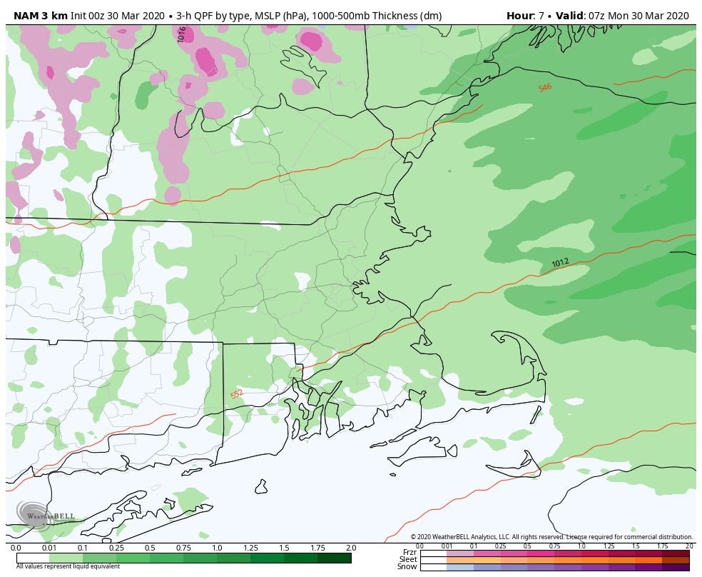
The low pressure system that produced last night’s thunderstorms is moving away, but another system will pass to the north today, dragging a cold front across the region. At the same time, an upper-level low pressure system will move across the region. Add those up and we’ll have plenty of clouds and some showers. Showers and drizzle will linger into the evening, and as cooler air settles in, we could even see some wet snow mix in, especially across southern New Hampshire and northern Massachusetts.

Rain may change to wet snow before ending across the region late tonight and early Tuesday. Little to no accumulation is expected. Loop provided by WeatherBell.

That upper-level low moves offshore on Tuesday, but we’ll be stuck with northeast winds, resulting in plenty of clouds, some drizzle, maybe a few showers, and cool conditions. That upper-level low will start to drift back westward Tuesday night into Wednesday, keeping us trapped in the drizzle, fog, and cool weather. In one sense, this is a good thing, as a storm system will be moving off the Carolina coastline. With the upper-level low up here, it will steer that system well offshore, but that doesn’t mean it won’t have any impact. It just won’t be a nor’easter. Instead, as it passes well south and east, a trough of low pressure will extend northwestward from it, back into New England. This will bring in more clouds and a better chance of showers for Thursday into Friday, especially along the coast, where winds may also be quite gusty at times.

Wind gusts of 30-40 mph are possible Friday morning, especially along the coast. Image provided by WeatherBell.

The low finally pulls away from the region later on Friday, resulting in some drier weather finally moving in for Saturday, along with milder conditions as high pressure builds into the Northeast. Sunday looks to be milder as well, but a cold front will start to move in by late in the day, with some more showers possible.

Monday: Plenty of clouds, maybe a few glimpses of sunshine along with some spotty drizzle. Showers may develop in the afternoon. High 41-48.

Monday night: Mostly cloudy and breezy with showers possibly mixing with some wet snow before ending. Low 29-36.

Tuesday: Clouds and some sunny breaks. High 39-46.

Tuesday night: Partly to mostly cloudy with some low clouds and drizzle, especially along the coast. Low 27-34.

Wednesday: More clouds than sunshine. High 42-49, coolest along the coast.

Thursday: Cloudy with showers becoming likely. High 44-51, coolest along the coast.

Friday: Mostly cloudy and breezy, especially along the coast, showers gradually ending. High 45-52, coolest along the coast

Saturday: Low clouds and fog early, especially near the coast, then that big bright thing in the sky returns. High 45-52, coolest along the coast.

Sunday: Morning sunshine, then clouds come back in the afternoon. Showers are possible late in the day. High 48-55.

Weekly Outlook: March 23-29, 2020

We’ve finally made it to Spring, so naturally, we’re expecting some snow. Look on the bright side – for many of you, it won’t have any impact on your commute!

Winter Weather Advisories and Winter Storm Watches/Warnings are in effect for parts of the area today. Image provided by Pivotal Weather

Clouds will stream into the region this morning as low pressure starts to take shape off the Mid-Atlantic coastline. This system will strengthen as it heads northeastward, passing south and east of Nantucket early Tuesday. Ahead of it, we could see some flurries or snow showers develop late this morning thanks to an onshore flow, but the steadier precipitation associated with the storm arrives during the mid-to-late afternoon hours. There will be some dry air in place, so as the atmosphere moistens up, it will allow temperatures to drop, so we’ll see the precipitation start off as snow for most, with rain across southeastern Massachusetts and Rhode Island. Temperatures will likely be near or above freezing, so a quick change to rain is expected across much of eastern Massachusetts. The changeover should take place during the evening across the Merrimack Valley and New Hampshire Seacoast, and by midnight across the rest of southern New Hampshire. This will be a fast-moving storm, so everything should wind down before midnight. Even this close to the storm, we’ve got some significant discrepancies among the models as the how much snow to expect. There are still some models forecasting significant accumulations for parts of the area, and then there’s others like the GFS, playing the part of Alfred E. Neuman.

This pretty much sums up the GFS forecast for today’s storm.

As for how much we’re expecting, we’ll get to that in a second. There are some facts both good and bad that go into that forecast, that we’d like to explain.
1. Temperatures will be right around freezing in many places, so what does fall as snow will be wet snow.
2. Elevation will play a role in amounts, as higher elevations should receive more snow, as they’ll be a bit colder.
3. Ground temperatures, especially pavement temperatures, are getting fairly mild now, so accumulations will be more likely on grassy surfaces.
4. The initial burst of snow will fall during the daytime. With the higher sun angle, that’ll make it a little tougher to accumulate as well. However, once it gets dark out, that isn’t a factor.
5. The closer you are to the ocean, the quicker precipitation will change to rain.

So, having said all that, here’s our forecast:
Southeastern Massachusetts/Southern Rhode Island – Zip, Zero, Nada
I-95 Belt (Boston-Providence) – A few flakes
Metro West/North Shore/Northern Rhode Island – An inch or so
Merrimack Valley/New Hampshire Seacoast – 1-2 inches
Southern New Hampshire (Nashua/Manchester/Concord) – 1-3 inches, maybe 4″ in a few spots

The jackpot will be from the Worcester Hills into the Monadnocks, where some places could see as much as 4-8 inches.

While not identical to our forecast, the National Weather Service model blend forecast is similar to ours. Image provided by Weathermodels.com

So, the storm pulls away and skies clear out on Tuesday. With sunshine, temperatures should get well into the 40s, maybe even some low 50s. So, you probably won’t even need to shovel, not that you really can go anywhere. The nice weather doesn’t last long as another system quickly follows for later Wednesday into early Thursday. This system will likely take a similar track to today’s storm, but the atmosphere will be a bit warmer, so this should be mainly rain, with some wet snow at the start across southern New Hampshire and possibly the Merrimack Valley.

High pressure builds back for Thursday into early Friday with drier conditions. We may be looking at yet another storm bringing in some rain on Saturday before drier weather returns on Sunday

We didn’t have a St. Patrick’s Day parade, so how about a parade of low pressure systems this week? Loop provided by Pivotal Weather.

Monday: Cloudy with snow developing in the afternoon, except rain across southeastern Massachusetts and southern Rhode Island. High 3542.

Monday night: Cloudy and breezy with snow changing to rain from southeast to northwest before ending. Low 31-38.

Tuesday: Becoming partly to mostly sunny. High 47-54.

Tuesday night: Clear during the evening, clouds move back in overnight. Low 30-37.

Wednesday: Cloudy and breezy with rain likely late in the day and at night, possibly mixed with some wet snow, mainly across southern New Hampshire and the Merrimack Valley. High 40-47.

Thursday: Mostly cloudy with showers ending early, some sun may develop in the afternoon. High 43-50.

Friday: A sunny start, then clouds return, breezy. High 49-56.

Saturday: Mostly cloudy with a chance of showers. High 47-54.

Sunday: A mix of sun and clouds, breezy. High 51-58.

Weekly Outlook: March 16-22, 2020

While everything around comes to a grinding halt, the weather does not, which means that here at StormHQ, The Show Must Go On. This week, that will be a variety show.

We start the week off with high pressure in control, so we’ll have a sunny but rather chilly Monday. The dry weather won’t last much longer though, as the high moves offshore and a disturbance moves into the Great Lakes. This will bring some precipitation in for Tuesday. While most of us will just see some rain, there could be some wet snow mixed in at that start Tuesday morning across southern New Hampshire. We’re not expecting any accumulation, and despite what this winter has been like, this is a fairly normal occurrence in mid-March. The rain ends late in the day and high pressure builds back in with sunshine and seasonable conditions returning for Wednesday.

While today is on the chilly side, the first 2 weeks of March are among the Top 5 warmest on record for the region. Image provided by the Southeast Regional Climate Center.

The latter half of the week isn’t looking that great right now. We’re not expecting any big storms, but a series of smaller ones. The first one moves in for Wednesday night and Thursday. With some cold air in place, this one may start as snow for much of the area (except southern areas), but should change over to rain during the morning. If there’s any accumulation (and it is a possibility this time), it will be most likely across grassy areas and at elevation. Would we be surprised if we end up with some coatings from southern New Hampshire into the northern and western suburbs of Boston? Of course not. In fact, one model shows the potential for a lot more than just coatings. if the trend continues that way, we’ll do a special update later in the week.

There’s still a wide variety of model solutions for Thursday morning, some some snow is possible. Images provided by Pivotal Weather.

The rain ends during the Thursday evening, but another storm quickly follows. This one will move across the Great Lakes, with significantly milder air expected on Friday. Of course, it will be accompanied by rain, but it’s not like you can do much to head out an enjoy it anyway, right? The rain ends Friday night as a cold front moves through, then high pressure builds in next weekend with sunshine and colder weather once again.

Friday could be a very mild day despite cloudcover and some showers. Image provided by WeatherBell.

Monday: Sunshine fades behind increasing and thickening afternoon clouds. High 34-41.

Monday night: Mostly cloudy. Low 26-33, but temperatures may hold steady or drift up a few degrees after midnight.

Tuesday: Cloudy with showers likely, possibly starting as some wet snow across southern New Hampshire. High 44-51.

Tuesday night: Becoming clear. Low 27-34.

Wednesday: Sunshine gives way to afternoon clouds again, snow develops late at night, except rain along the South Coast. High 43-50.

Thursday: Cloudy with snow changing to rain, ending by evening. Some accumulation is possible, mainly well north and west of Boston. High 43-50.

Friday: Cloudy, breezy, and quite mild with showers redeveloping. High 62-69.

Saturday: A cloudy start, then skies become mostly sunny, breezy. High 43-50.

Sunday: Partly to mostly sunny. High 36-43.

Weekly Outlook: March 9-15, 2020

March Madness is upon us, and we’re not just talking about the NCAA basketball tournament. We’ve got some interesting weather coming up this week.

High pressure slides offshore today, and with southwest winds flowing around that high, we’ve got some very mild weather on tap. Temperatures should get into the 60s in many locations today, with some spots possibly topping 70. Not everywhere will be that warm though. Along the South Coast, those southwest winds will be blowing over water that is still in the 40s, so it”ll be much cooler across the Cape, Islands, Southeastern Massachusetts and southern Rhode Island. A backdoor cold front may move into the New Hampshire Seacoast and possibly northeastern Massachusetts tonight, with much cooler conditions, but it will likely head back northward on Tuesday ahead of an approaching cold front. Most of the region should be quite mild once again despite some cloudcover. That front brings in some showers late Tuesday and Tuesday night.

Temperatures could top 70 degrees in spots this afternoon. Image provided by WeatherBell.

High pressure returns on Wednesday with some sunshine and cooler conditions. The dry weather doesn’t last too long as another weak system moves in Wednesday night. This one will produce some rain showers, but a few wet snowflakes are possible, especially across southern New Hampshire and the Merrimack Valley.

It’s been a very dry start to 2020, so we can use any rain that we can get. Image provided by the Northeast Regional Climate Center.

Dry weather returns on Thursday, but again, it looks like it will be a brief respite. Another system moves in for Friday with more rain. While it doesn’t look that heavy right now, it will be a bit more substantial that the system Wednesday night. High pressure builds in behind that system with dry and seasonably cool conditions next weekend.

Monday: Sunshine filtered through some high clouds at times. High 62-69, cooler across the South Coast and Cape Cod.

Monday night: Becoming partly to mostly cloudy. Low 41-48, except 34-41 from Essex County up into the New Hampshire Seacoast and Southern Maine.

Tuesday: Plenty of clouds, breezy, some showers may develop late in the day. High 57-64, cooler across the South Coast and Cape Cod.

Tuesday night: Mostly cloudy and breezy with showers likely during the evening, some clearing is possible late at night. Low 36-43.

Wednesday: Becoming mostly sunny in the morning, clouds return in the afternoon, chance for a few showers at night, maybe a few wet snowflakes mixed in as well. High 48-55.

Thursday: More clouds than sunshine. High 45-52.

Friday: Partly to mostly cloudy, breezy, and mild again with some rain likely. High 50-57.

Saturday: Mostly sunny and breezy. High 44-51.

Sunday: Partly sunny. High 39-46.

Weekly Outlook: March 2-8, 2020

We’re into March which means that Spring has arrived (meteorological spring). It’ll even feel like Spring for a good portion of the week too.

On average, high temperatures should be in the upper 30s to lower 40s during the first week of March. Image provided by Weathermodels.com

We start the week off with a fantastic day, probably the pick of the week. High pressure slides offshore and a warm front moves through, so we’ll have sunshine after some morning clouds and temperatures possibly getting into the 50s in many areas. A cold front spreads clouds back in late in the day, with some showers possible at night.

Tuesday looks to be another mild day with temperatures well into the 50s, maybe even 60 in spots. A weak system will approach the region during the day, so we’ll have plenty of clouds and some sunny breaks, but some rain is expected to move in during the evening and at night. The rain shouldn’t be that heavy, and it should end by daybreak. Behind the system, breezy and somewhat cooler conditions settle in for Wednesday as high pressure starts to build in, but temperatures should remain above normal. Thursday remains dry and mild with high pressure in control.

Temperatures could get close to 60 again on Tuesday in many locations. Image provided by WeatherBell.

Friday is where things start to get interesting. Low pressure will be moving across the Great Lakes while a second low pressure area moves off the Southeast coastline. One or both of these systems could impact us, but that’s where the uncertainty lies. You may hear some of the TV meteorologists talking about the systems “phasing”. What that means is when you get the two branches of the jet stream (northern and southern) to join together or “phase”. When this happens, you usually get the disturbances moving through each jet stream to join together and create a big storm system. When that occurs with cold air in place, we get big snowstorms. When they don’t phase, we just get your average run-of-the-mill storm system moving through. That’s what we’re looking for with the potential on Friday/Saturday. Some of the models have been hinting at this possibility, but some don’t show the phasing until well offshore, which is great for snow-lovers in Nova Scotia, but not most of New England. Given how this winter has gone, we’re leaning away from the idea of a snowstorm, but it’s obviously possible. At the very least, we’ll likely have some snow or rain from the northern system as it moves through. We’ll keep an eye on this for the next few days, and if necessary, have a special blog later in the week.

The GFS model shows the disturbance over the Great Lakes and the disturbance across the Southeast “phasing” once they get offshore, east of New England. Loop provided by Tropical Tidbits.

High pressure builds in behind the system with colder and drier conditions, but they’ll likely be short-lived, with another warmup to start next week.

Monday: Morning clouds, then becoming partly to mostly sunny and breezy. High 45-52.

Monday night: Clouds return along with a few showers. Low 36-43.

Tuesday: Intervals of clouds and sunshine, showers develop late in the day. High 52-59.

Tuesday night: Cloudy and breezy with some light rain likely. Low 36-43.

Wednesday: Becoming partly sunny and breezy. High 46-53.

Thursday: Sunshine and lots of it. High 44-51.

Friday: Cloudy with rain or snow possible late in the day and at night. High 41-48.

Saturday: Rain or snow ending in the morning, some late-day sunshine is possible, breezy. High 32-39.

Sunday: Partly to mostly sunny. High 41-48.