Weekend Outlook: October 1-4, 2021

Most of the upcoming weekend should be pretty good weatherwise, but probably not all of it.

An upper-level low pressure area will pull away tonight, but a few showers are still possible through the first part of the night, mainly near the coastline. High pressure builds in for Friday into Saturday with drier conditions. While Friday should feature a decent amount of sunshine, Saturday will likely have more clouds as a weak system passes by to the north. Could it produce a few showers? Maybe, but mainly in southern New Hampshire.

Friday morning will be on the chilly side. Image provided by WeatherBell.

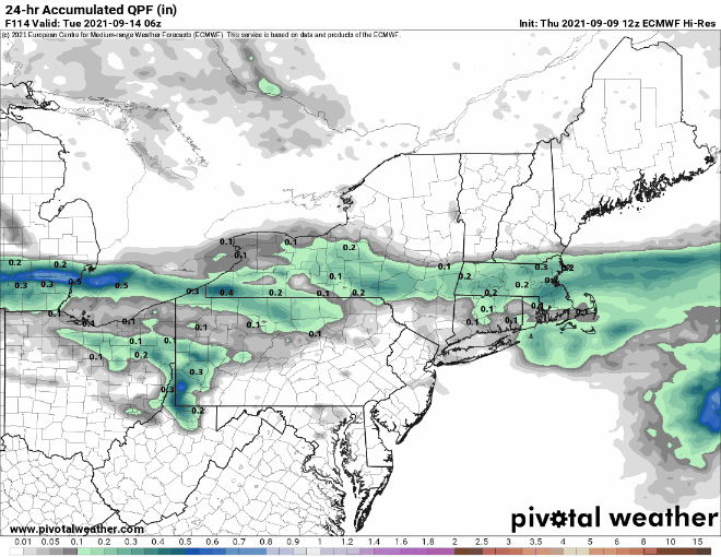
Sunday is when things get really tricky. A low pressure area will be slowly moving in from the west, sending a warm front toward the region. The question is, how far north does the warm front get before stalling out? This will have a large impact on temperatures. Our best estimate at this point is that it will at least get up to the Mass Pike, but beyond that, we’re not sure. South of the warm front, it will be warm and humid, with temperatures likely getting into the 70s. North of the front it may stay in the upper 50s and lower 60s. The next question is – when does the rain move in? Right now, it looks like we may have some showers late Sunday afternoon and evening ahead of the warm front, but that isn’t set in stone at this point. Late Sunday night into Monday do look wetter, but again, this is far from a lock.

Sunday’s temperatures will be determined by how far north the warm front gets. Images provided by Pivotal Weather.

Thursday night: Mostly cloudy with a few showers possible this evening, then skies clear out overnight. Low 40-47.

Friday: Sunshine and some afternoon clouds. High 60-67.

Friday night: Partly to mostly cloudy. Low 43-50.

Saturday: More clouds than sun, slight chance for a sprinkle across southern New Hampshire. High 65-72.

Saturday night: Partly to mostly cloudy, slight chance for a shower, mainly across southern New Hampshire. Low 50-57.

Sunday: Mostly cloudy, chance for a few late-day showers. High 59-66 north of the Mass Pike, 67-74 south of the Pike.

Sunday night: Mostly cloudy with showers developing. Low 53-60.

Monday: Mostly cloudy with scattered showers. High 62-69.

Weekly Outlook: September 27 – October 3, 2021

Baseball’s regular season is in the home stretch, football is well underway, hockey is starting up, and pumpkin everything is showing up everywhere. It’s definitely fall now. Mother Nature is going to get in on the act this week too. Goodbye shorts, hello light jackets or sweatshirts.

It’s been a warm September, but changes are coming as we near the end of the month. Image provided by the Northeast Regional Climate Center.

The week starts off on a warm note with high pressure still in control, but changes are coming. A cold front dropping southward will produce some showers tonight and Tuesday, with a rumble of thunder possible as well. High pressure builds in behind the front on Wednesday with cooler and drier conditions. A wave of low pressure will ride along the front to our south Wednesday night and Thursday, with another period of showers likely. Friday looks like a typical fall day to start October. An upper-level low pressure are will be moving across the region, bringing with it some clouds and possibly a few showers. High pressure should return for the weekend with dry and cool conditions.

High temperatures may struggle to reach 60 on Thursday. Image provided by WeatherBell.

Monday: Partly sunny. High 70-77.

Monday night: Mostly cloudy with a chance for a shower. Low 57-64.

Tuesday: Plenty of clouds with showers likely, possibly a rumble of thunder. High 68-75.

Tuesday night: Partly to mostly cloudy, any lingering showers end in the evening. Low 46-53.

Wednesday: A mix of sun and clouds. High 61-68.

Thursday: Mostly cloudy with some showers possible. High 57-64.

Friday: Early sun, then clouds return, slight chance for an afternoon shower. High 60-67.

Saturday: Plenty of sunshine. High 61-68.

Sunday: A mix of sun and clouds. High 62-69.

Weekend Outlook: September 24-27, 2021

Some rain is on the way, but much of the weekend looks decent weatherwise.

A slow-moving cold front will make its way across the region tonight and Friday, bringing plenty of clouds in, with some rain likely, mainly on Friday. A few rumbles of thunder are also possible. We’re not expecting a widespread heavy rain like we had at times for most of the summer, but don’t expect to see much, if any, sunshine on Friday. The front pushes offshore Friday night, but showers may linger into Saturday morning across eastern Massachusetts. While there may be some sunshine developing, especially well west of Boston, during Saturday afternoon, clouds will linger in the east. Another wave of low pressure will ride up that front offshore, but will likely pass close enough to bring some rain back in for Saturday night and Sunday morning. This is a relatively new development in the models, but it shows up on several models, so we’re inclined to go with it. We should start to clear out again on Sunday, but an upper-level feature will be moving across the region, and it may kick off another shower or two during the afternoon. High pressure builds in for Sunday night and Monday with drier conditions.

Most of the heavy rain will be confined to western New England. Image provided by Weathermodels.com

In the tropics, Tropical Storm Sam has developed over 1700 miles east of the Lesser Antilles. It is sat least 5 days away from potentially threatening any land areas, but Sam will definitely be a storm to watch. Most of the models develop Sam into a powerful hurricane over the weekend and early next week. Sam should continue on a west-northwest track across the Atlantic through the weekend. Beyond that? It’s still way too early to speculate on where Sam may go.

Forecast track for Tropical Storm Sam. Image provided by the National Hurricane Center.

Thursday night: Partly to mostly cloudy with a few showers possible. Low 64-71.

Friday: Cloudy with scattered showers, possibly a thunderstorm. High 71-78.

Friday night: Mostly cloudy, showers ending from west to east. Low 55-62, a little milder across Southeastern Massachusetts and Cape Cod.

Saturday: Intervals of clouds and sun, chance for a few showers, mainly in eastern Massachusetts. High 68-75.

Saturday night: Mostly cloudy with more showers possible. Low 53-60.

Sunday: Any lingering showers end early, then becoming partly sunny with a chance for a late-day shower. High 68-75.

Sunday night: Clear to partly cloudy. Low 49-56.

Monday: A mix of sun and clouds. High 67-74.

Weekly Outlook: September 20-26, 2021

“Summer’s going fast, nights growing colder”

That line from the Rush song “Time Stand Still” is talking about the next couple of days. Summer officially ends with the autumnal equinox at 3:20pm on Wednesday.

We start the week off with high pressure in control, providing us with sunshine and seasonably mild temperatures. As the high moves offshore on Wednesday, southerly winds will bring warmer and more humid air into the region. There may be enough moisture around to trigger a shower or two across the interior, but for the most part, the day will remain dry.

Tuesday morning could be a little chilly across the interior. Image provided by WeatherBell.

The end of the week is where things get tricky. A slow-moving frontal system will head this way, but the models don’t agree on the timing of the system. One model has the system bring us a rainy day on Thursday, with the showers ending early Friday. A couple of others have just a few showers on Thursday, with the bulk of the rain moving in on Friday and lingering into part of Saturday as the front really slows down. Given the trends recently, we’re going to lean toward the slower timing for now. This will impact Sunday’s forecast as well, as another system will be following, and if the first system takes longer to move out, then then second system will take longer to move in. We should have some more clarity on this for our Weekend Outlook on Thursday.

The models don’t agree on the timing, but they all show a pretty decent amount of rainfall for the end of the week. Images provided by Pivotal Weather.

Monday: Sunshine and a few afternoon clouds. High 68-75.

Monday night: Clear to partly cloudy. Low 48-55.

Tuesday: A mix of sun and clouds. High 67-74.

Tuesday night: Partly to mostly cloudy. Low 55-62.

Wednesday: Partly sunny, chance for a few showers, mainly across the interior. High 71-78.

Thursday: Intervals of clouds and sun, a few showers are possible, mainly across the interior again. High 72-79.

Friday: Mostly cloudy and breezy with showers likely, possibly some steady rain at night. High 70-77.

Saturday: Showers end by early afternoon, some sunny breaks may develop in the afternoon, especially across the interior. High 68-75.

Sunday: Partly to mostly sunny. High 67-74.

Weekend Outlook: September 17-20, 2021

Improving weather is coming, but it will take a little while to get here this weekend.

A frontal system will wash out along the South Coast tonight and Friday while high pressure tries to build in. The result will be mainly dry conditions, but still plenty of cloud cover, especially along the South Coast. Temperatures will remain on the cool side compared to the last few days thanks to northeast to east winds, but we should still see most places get into the 70s.

Skies are clearing out not far to our north and west, Meanwhile, low pressure is trying t organize off the Carolina coast. Loop provided by NOAA.

Meanwhile, an area of low pressure off the Carolina coast is trying to organize this afternoon and it could become a tropical depression or even a weak tropical storm over the next day or so. It will move northward and then northeastward, passing well south and east of us Friday night and Saturday. However, it will bring some gusty northeast winds to coastal areas, and churn up the seas again, resulting in some rough surf and rip currents at the beaches.

Forecast tracks for the disturbance off the Carolina coast from the various members of the GFS Ensemble. Image provided by Weathernerds.org

A weak cold front will also be moving in on Saturday, with a few showers possibly accompanying it. For later Saturday into Sunday and Monday, we’ll have high pressure building in, which means sunshine and mild temperatures, which is about as good as it gets for the final weekend of astronomical summer. Fall begins with the autumnal equinox at 3:20pm next Wednesday.

Average high temperatures in mid-September are in the lower to middle 70s around here. Image provided by Weathermodels.com

Thursday night: Mostly cloudy, chance for a few showers across the South Coast and Cape Cod. Low 58-65.

Friday: Partly to mostly cloudy. High 70-77.

Friday night: Partly to mostly cloudy. Low 60-67.

Saturday: A mix of sun and clouds, slight chance for a shower, mainly well north and west of Boston. High 72-79.

Saturday night: Mostly clear. Low 57-64.

Sunday: Plenty of sunshine. High 69-76.

Sunday night: Clear skies. Low 50-57.

Monday: Unlimited sunshine (daylight hours only). High 71-78.

Nicholas Soaks Texas, More Systems Coming?

As we enter the climatological peak of Hurricane Season, the Atlantic is getting active again.

The Atlantic is getting active again. Image provided by the National Hurricane Center.

The main focus right now is Tropical Storm Nicholas, centered about 105 miles south of Port O’Connor, Texas, moving northward at 12 mph. Maximum sustained winds are near 60 mph. A Hurricane Watch, Tropical Storm Warning, and Storm Surge Warning are all in effect for much of the Texas coastline. The good news is that Nicholas doesn’t have too long to strengthen, as landfall is likely along the Texas coastline this evening. The bad news is that it will be a prolific rain-maker for Texas (and Louisiana). Rainfall totals of 8-16 inches and locally heavier will produce widespread flooding across the region, including the Houston metropolitan area.

Very heavy rain is likely in southeastern Texas and Louisiana this week, Image provided by Weathermodels.com

While heavy rain and resultant flooding are the main threat with Nicholas, they aren’t the only threat. Tropical Storm force winds are already impacting the Texas coast, and will continue into tonight. With Nicholas expected to be close to hurricane strength at landfall, wind gusts may exceed 70 mph along the coast. Storm surge is the other concern. A surge of up to 5 feet is possible near and just to the right of where the center makes landfall. This will result in coastal flooding, in addition to the freshwater flooding that the heavy rain will produce.

Nicholas is the only active system in the Atlantic right now, but it’s not the only system that we’re keeping an eye on. A tropical wave that just moved off the coast of Africa is disorganized right now, but should move into an area of favorable conditions as it continues westward this week. It could become a tropical depression toward the latter half of the week, but it is still at least a week away from impacting any land areas, if it ever does. We’ve got plenty of time to watch this one as it makes its way westward.

Forecast tracks from the various members of the GFS Ensemble for the system that just moved off of Africa. Image provided by Weathernerds.org

A little closer to home, we need to keep our eyes on the Bahamas. Many of the forecast models are showing the potential for a cluster of storms near the Bahamas to interact with a tropical wave, and organize into a low pressure area later this week. Most of these models keep the system fairly weak, but it could become a tropical depression or even a weak tropical storm as it makes its way northward over the warm waters of the Gulf Stream. At the very least, it should bring some rainfall to parts of the East Coast, but there’s a chance that the leftover moisture from Nicholas could be infused into the system, which would enhance the rainfall with the system. We’ll have to watch this system to see if it develops, and if so, how it develops, to get a better idea of what, if any, impact if will have on the East Coast.

Much of the East Coast is clear (aside from some smoke) today, but the cluster of storms near the Bahamas should be watched. Loop provided by NOAA.

Typhoon Chanthu continues to slowly weaken in the Western Pacific. After grazing Taiwan over the weekend it has moved northward, but has slowed down off the eastern coast of China, just east of Shanghai. It is expected to resume moving northeastward on Tuesday while continuing to weaken, passing near or just south of South Korea on Wednesday as a tropical storm. Gusty winds and heavy rain are expected, especially in southern portions of South Korea.

Forecast track for Typhoon Chanthu. Image provided by the Korean Meteorological Administration.

Finally, we’ll leave you with this. Former Hurricane Larry remains a powerful storm near Greenland at this time. Over the weekend, it dropped up to 4 feet of snow on the island, and more is falling today. It is already beginning to impact Iceland, where winds have gusted to 46 mph at Reykjavik today. We may be at the peak of hurricane season, but the fall and winter are not far away for those of us in the Northern Hemisphere.

Former Hurricane Larry is burying Greenland with heavy snow and will impact Iceland over the next day or two. Loop provided by NOAA.

Weekly Outlook: September 13-19, 2021

A return to a wet pattern appears to be heading our way for a chunk of the upcoming week.

The week is actually going to start off with a line of showers and thunderstorms crossing the region this morning. Depending on when you read this, they may already be offshore. As the line moves through, they’ll produce some gusty winds, lightning, and downpours, especially north of the Mass Pike. Once they finally move through, high pressure will build in, with a rather nice day expected today. Unfortunately, today is the best it will be for a while. Winds will shift into the east on Tuesday, bringing in some clouds, but also cooler temperatures. A warm front will move through at night, with some showers accompanying it.

The line of showers and thunderstorms should weaken as it moves through this morning. Loop provided by Weathermodels.com

The middle to latter portion of the week looks the most unsettled, but also has the most uncertainty associated with it. Wednesday looks like a warm and humid day, but we’ll have a cold front approaching, which will likely produce some showers and thunderstorms. Depending on the timing of the front, which is still a big question, some of those storms could become strong to severe. Behind the front, cooler weather will settle in on Thursday, but with the front stalled out nearby, and a southerly flow aloft, we’ll still have plenty of moisture around, so more showers are likely.

Wednesday is looking quite warm, especially for mid-September. Image provided by WeatherBell.

This brings us to Friday, which is the day with the most uncertainty at this point. We’ll continue to have tropical moisture flowing northward into the region, so more rainfall is likely. The question is, will it just be a steady stream of moisture, or will it organize into a system? Some of the models do try to develop it into an organized low pressure area, which could become a tropical depression or even a tropical storm. As of their early morning update, the National Hurricane Center gave the system a 50% chance of developing into a tropical depression over the next 5 days. (We’ll have a more detailed post on the tropics this afternoon, where we’ll take a look at this system, Tropical Storm Nicholas, which will bring heavy rain to Texas, and two other systems we’re watching in the Atlantic.) Further complicating things is the potential for the remains of Nicholas to get infused into the system, resulting in even more rainfall. Either way, it looks like Friday will be a cool, wet day, with the potential (for now) for heavy rainfall. Moisture may hang around on Saturday with plenty of clouds and possibly some more showers. Sunday may see some clearing, but that’s a low-confidence forecast right now.

As you’d expect in mid-September, the Atlantic is fairly active right now. Image provided by the National Hurricane Center.

Monday: Showers or thunderstorms early this morning, becoming partly to mostly sunny. High 73-80.

Monday night: Clear to partly cloudy. Low 54-61.

Tuesday: Some early sun, then clouds filter back in. High 68-75, coolest along the coast.

Tuesday night: Becoming mostly cloudy with showers developing. Low 60-67.

Wednesday: Mostly cloudy, chance for showers and thunderstorms, especially late in the day and at night. High 79-86.

Thursday: Cloudy with occasional showers. High 70-77.

Friday: Cloudy and cool with a chance of rain. High 69-76.

Saturday: More clouds than sun, chance for some more showers. High 73-80.

Sunday: A mix of sun and clouds. High 77-84.

Weekend Outlook: September 10-13, 2021

We have got an absolutely fantastic stretch of weather on tap for the upcoming weekend.

Sunday is looking like a rather warm day for mid-September. Image provided by WeatherBell.

Before we get to the nice weather, we’ve got some rain tonight as a cold front crosses the region. The rain will end from west to east tonight, and skies will start to clear out by daybreak. On Friday, we’ll have an upper-level disturbance moving through. So we’ll start off with sunshine, but clouds will develop, and a few pop-up showers are possible. We’ll clear out again Friday night as high pressure builds in. With clear skies and light winds, we’ll have radiational cooling, which could result in a rather cool night in some spots. Saturday will feature sunshine and mild temperatures. As the high slides offshore, we’ll warm up on Sunday, just in time for the Patriots season opener in Foxborough. Another cold front will move through on Monday with some clouds and a few showers. There is the chance that Monday may not be as nice as we’re currently forecasting it to be. Some of the newer model runs are going for a cloudy day with more rainfall and cooler temperatures. This is a shift from what they had been previously been showing, so we’re not going to jump on that bandwagon yet, but we’re keeping an eye on it.

Will it rain Monday? Some models say yes, some don’t. We’ll see what happens. Images provided by Pivotal Weather.

Thursday night: Showers ending followed by some clearing late at night. Low 57-64.

Friday: Sunshine and some afternoon clouds, maybe a shower or two. High 68-75. Offshore: Northwest wind 10-15 knots, gusts to 20 knots, seas 3-6 feet, up to 6-9 feet in the waters south and east of Cape Cod and the islands.

Friday night: Clear and cool. Low 49-56.

Saturday: Sun, sun, and more sun. High 69-76. Offshore: West winds 5-15 knots, seas 3-5 feet, up to 5-8 feet in the waters east of the Cape and Islands.

Saturday night: Clear skies. Low 57-64.

Sunday: Sunshine and a few clouds. High 76-83. Offshore: West to southwest winds 10-20 knots, seas 3-5 feet.

(Kickoff Forecast for Foxborough: Sunny, temperature near 80, southwest winds 10-15 mph.)

Sunday night: Partly to mostly cloudy. Low 60-67.

Monday: Intervals of clouds and sun, chance for a few showers. High 74-81. Offshore: West to southwest winds 10-20 knots, seas 3-6 feet.

Weekly Outlook: September 6-12, 2021

The first full week of September will turn out to be rather nice for the most part.

We’re starting things off this Labor Day morning with some clouds and lingering showers, but skies should clear out this afternoon as a cold front pushes offshore. As an upper-level disturbance rotates through, we could see a stray shower or thunderstorm pop up in the afternoon, mainly north and west of Boston. Clear skies, light winds, and low humidity will result in radiational cooling tonight, which means it could be rather cool in some spots when you wake up Tuesday morning. High pressure builds in for Tuesday, resulting in a rather fine and dandy day with seasonably mild temperatures.

Normal high temperatures for early September are generally in the middle 70s. Image provided by Weathermodels.com

Humidity returns on Wednesday as a warm front moves through, but right now, it looks like most of the shower activity will hold off until after dark. Showers are likely at night, with a rumble of thunder possible as well. The showers end on Thursday as a cold front moves through the region. The end of the week and the weekend look dry with high pressure building back in. Another front may start to approach late Sunday with more clouds, but again, it looks like any shower activity should hold off until nightfall.

Hurricane Larry should be passing well to our east late this week, but it will generate large swells that will impact the beaches and coastal waters late in the week and into the weekend. This will increase the threat of rip currents. Keep this in mind if you’re planning to head to the beach or out on a boat late this week.

Hurricane Larry will send large waves toward the shoreline late this week. Image provided by WeatherBell.

Monday: Any lingering showers end in the morning, then becoming partly to mostly sunny with a slight chance for an afternoon shower or thunderstorm. High 74-81.

Monday night: Clear skies. Low 53-60.

Tuesday: Sunshine and a few clouds. High 71-78.

Tuesday night: Clear skies. Low 55-62.

Wednesday: Sunshine fades behind increasing clouds, breezy, showers develop at night. High 77-84.

Thursday: Mostly cloudy with some showers likely, ending during the afternoon. High 72-79.

Friday: Partly to mostly sunny. High 70-77.

Saturday: Sunshine and a few clouds. High 71-78.

Sunday: A mix of sun and clouds. High 72-79.

Weekend Outlook: September 3-6, 2021

After yet another deluge, the unofficial end of summer will feature mostly dry weather.

Over the past 60 days, most of the region has received 2-3 times the normal amount of rainfall. Image provided by WeatherBell.

High pressure builds in tonight with dry and cool conditions. Friday will remain mostly dry with high pressure in control, but an upper-level low will slowly pull away and a disturbance riding around it will produce some clouds, and possibly a sprinkle or shower Friday afternoon. The high slides offshore on Saturday, keeping us dry, but temperatures will start to warm up once again. A weak frontal system moves through on Sunday with plenty of clouds, and a few showers Sunday afternoon and night. The system pulls away on Labor Day and high pressure builds back in, with dry and seasonably warm conditions returning.

Labor Day looks it will be seasonably warm once the skies start to clear out. Image provided by Weathermodels.com

Thursday night: Clear and cool. Low 49-56.

Friday: Sunshine and some afternoon clouds, chance for a sprinkle or shower during the afternoon. High 66-73. Offshore: Northwest winds 5-15 knots, seas 2-4 feet.

Friday night: Becoming mostly clear. Low 51-58.

Saturday: Plenty of sunshine. High 71-78. Offshore: Northwest to west winds 10-15 knots, seas 2-4 feet.

Saturday night: Increasing clouds. Low 53-60.

Sunday: Mostly cloudy, showers possible late in the day. High 70-77. Offshore: Southwest winds 10-15 knots, gusts to 20 knots, seas 2-4 feet.

Sunday night: Cloudy with occasional showers. Low 59-66.

Labor Day: Any showers end early, becoming partly sunny in the afternoon. High 74-81. Offshore: Southwest winds 5-15 knots, seas 3-5 feet.