Weekly Outlook: November 27 – December 3, 2017

Believe it or not, December starts later this week. Yup, 2017 is nearly over already. As we get to the end of November, another quite week lies ahead.

hrrr_snow_neng_17
Some snow showers will move across Northern new England today, mainly this morning. We could see a few stray flakes around here, but if there are any, it’ll be mainly before most of you read this. Image provided by WeatherBell.

The week starts off with high pressure in control. Sure, Monday will be windy and a little cool, but we’ll have sunshine, and besides, it’s late November, it’s supposed to be cool outside! Tuesday will be feature a little more sunshine, and a little less wind, with high pressure still in control. A cold front will approach the region on Wednesday, with some clouds, and maybe a shower in the morning. Sunshine will return in the afternoon, and it will actually turn milder, with highs getting into the 50s. we’ll cool off again for Thursday, but the dry and cool weather will be short-lived. Another cold front will approach on Friday, bringing with it a better chance for some rain. High pressure returns for the weekend, with improving conditions on Saturday, followed by partial sunshine and cool temperatures on Sunday.

ecmwf_t2max_massachusetts_72
Wednesday is looking like it will be a mild day. Image provided by Weather.us

Monday: Some morning clouds, then becoming partly to mostly sunny and breezy. High 40-47.

Monday night: Clear skies with diminishing winds. Low 19-26.

Tuesday: Sunshine and just a few clouds. High 39-46.

Tuesday night: Becoming partly to mostly cloudy and breezy. Low 36-43 in the evening, then temperatures hold steady or rise a bit overnight.

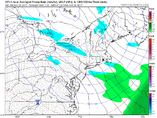
Wednesday: Intervals of clouds and sunshine, breezy, slight chance for a stray shower, mainly early. High 50-57.

Thursday: Plenty of sunshine to start, clouds start to filter back in during the afternoon. High 41-48.

Friday: Cloudy and breezy with rain likely. High 47-54.

Saturday: Perhaps a few lingering showers along the coast early, otherwise becoming partly to mostly sunny and breezy. High 43-50.

Sunday: A mix of sunshine and clouds. High 41-48.

Finally, here at Storm HQ, we focus on short-range forecasts, 7 days or less. However, some of you are wondering what the winter has in store for us. Our colleagues over at Woods Hill Weather issued their Winter Outlook Sunday afternoon. If you’re curious about their thought on the winter, we would advise you to give it a read. For short-range forecasts, we usually end up with very similar thinking, so we trust what they have to say, and you should too.

Weekly Outlook: November 20-26, 2017

Thanksgiving week has arrived, which means that we’re already getting to the tail end of 2017. Before you know it, we’ll be talking about snowstorms. No, we’re not talking about them yet, but soon, we will be. This is New England after all.

gfs_t2m_massachusetts_108
It’s going to be chilly for the Black Friday early morning sales. Make sure you’re wearing a winter coat and gloves if you’re going to fight the crowds. (Or you could just sleep in and wait for Cyber Monday.) Image provided by Weather.us

For the most part, we’re looking at a fairly benign pattern this week. We start off with high pressure in control for Monday and Tuesday, with sunshine and cool temperatures. On Wednesday, a cold front will approach from the west while a coastal storm passes offshore. The result will be some rain showers, especially along the coastline. High pressure builds back in on Thanksgiving with sunshine returning, making for some great weather for high school football and traveling to see family. High pressure remains in control on Friday, keeping the dry and cool weather in place, so dress properly if you’re heading out for the “Doorbuster” sales on Black Friday. By Saturday, a strong low pressure system will pass well to our north and west, across southeastern Canada. This will result in a bit of warmup, but also some rain showers. The system drags a strong cold front across the region Saturday night, with breezy and colder conditions expected on Sunday. A few rain or snow showers are possible with that frontal passage on Sunday.

gfs_mslp_pcpn_frzn_neus_fh12-168
The GFS model shows that the next 7 days will be fairly quiet, with only a little precipitation on Wednesday and again late Saturday, Loop provided by Tropical Tidbits..

Monday: A mix of sunshine and clouds, slight chance for a morning snow flurry, breezy. High 36-43.

Monday night: Clear to partly cloudy. Low 28-35.

Tuesday: Sunshine and some high clouds at times, still breezy. High 50-57.

Tuesday night: Becoming partly to mostly cloudy with winds diminishing overnight. Low 43-50 in the evening, then temperatures hold steady or rise a bit overnight.

Wednesday: Mostly cloudy with scattered showers, especially along the coast. High 48-55 early, then temperatures drop in the afternoon.

Thanksgiving: Partly to mostly sunny. High 37-44.

Friday: Sunshine dominates again. High 41-48.

Saturday: Becoming mostly cloudy and breezy with some showers possible. High 47-54.

Sunday: Chance for a rain or snow shower early, then becoming partly to mostly sunny and breezy. High 38-45.

Weekly Outlook: November 13-19, 2017

Well, now that it is actually feeling like November outside, we’ve got a more sobering thought for you. Christmas is six weeks from today. Six weeks. You know what that means, right? Yup, we’ll be talking about that dreaded “s-word” soon. It doesn’t look like we’ll worry about it for most of this week, but rest assured, it’s coming.

As for this week, the week will start off with, to quote a friend of the blog, “not exactly a chamber of commerce day.” A weak system passes offshore today, close enough to spread some showers in, mainly from Boston southward, during the afternoon. We suppose there could be a few wet flakes mixed in, but generally, just some light rain is expected. High pressure builds in after that with dry and cool conditions for Tuesday and Wednesday. Temperatures will start to moderate on Thursday ahead of a storm system. However, with the milder conditions will come some more rainfall. The rain ends during the afternoon as a cold front moves through. This sets up another dry and but cold day on Friday.

gfs_t2max_massachusetts_96
No more highs in the 70s, but temperatures on Thursday should be in the 50s, which is near to a little above normal for mid-November. Image provided by Weather.US

Next weekend is where things get interesting. Another storm system will move into the Great Lakes and eventually into southeastern Canada. This will give us some precipitation Saturday into early Sunday. The precipitation may not be entirely plain rain. Remember, we’re going to have a very cold airmass in place on Friday. Warmer air will certainly move in aloft, but as it typically the case in the fall/winter, it may struggle to move in at the surface, especially inland. So, what does that mean? For the coastal plain, we’re looking at just rain. For places farther inland, especially north and west of 495, it wouldn’t be a surprise to see the precipitation start as some wet snow, before a changeover to rain, possibly with a period of sleet or freezing rain in between. This is all assuming that the precipitation moves in during the morning. If it holds off until afternoon, then the chance for wintry precipitation diminishes considerably. All in all, this doesn’t look like a big deal, but since it could be the first potential wintry event of the season, we certainly need to keep our eyes on it. The other big question is the temperatures. How warm will we get on Saturday? Across inland areas, depending on which model you believe, we could stay in the upper 30s to middle 40s, or we could soar well into the 50s. Right now, based on what we’ve seen in the past, we’re going to lean towards the cooler scenario inland, but obviously that could change. No matter what happens, a cold front pushes through early Sunday, with clearing and colder conditions expected once again.

gfs_ptype_slp_boston_23
At least one model shows the potential for a wintry mix across inland areas Saturday morning. Image provided by WeatherBell.

Monday: Cloudy with scattered showers developing, mainly along the coast and south of Boston. High 38-45, except 46-53 across southeastern Mass and Cape Cod.

Monday night: Showers taper off, but some drizzle and/or a few flurries may persist. Low 32-39.

Tuesday: Intervals of clouds and sunshine. High 39-46.

Tuesday night: Becoming mostly clear. Low 27-34.

Wednesday: Sunshine, dimmed by some high clouds during the afternoon. High 43-50.

Thursday: Showers likely in the morning, clearing  and becoming breezy late in the day. High 49-56.

Friday: Mostly sunny. Clouds start to filter in during the afternoon. High 40-47.

Saturday: Rain likely, possibly starting as a wintry mix well inland. Becoming breezy, especially across Cape Cod.  High 41-48 north and west of I-495, 49-56 south and east.

Sunday: Becoming partly to mostly sunny. High 39-46.

Of course, next week is Thanksgiving, and everyone wants to know what the weather will be live for the drive to see family. At least one model (the GFS) has a storm come through on Wednesday, with some snow, especially north and west of Boston. Other models have drier conditions. We’ll go into that forecast in more detail in next week’s outlook.

gfs_6hr_snow_acc_boston_43
If you believe the GFS model, we could be in for some snow the day before Thanksgiving. Wouldn’t that make for a lovely travel day? Image provided by WeatherBell.


Weekly Outlook: November 6-12, 2017

You’ve got one more day to enjoy the unseasonably warm weather, then changes are certainly on the way. By the end of the week, some bigger changes are coming.

The week starts off on a mild note, as most of the ones this fall have, but we’ll have plenty of clouds in place as a cold front comes marching in from the west. This front produced severe weather across much of the Midwest yesterday, and while we’re not expecting severe weather here, we are expecting some locally heavy showers from late morning into the evening, and a rumble of thunder can’t be ruled out. The showers end in the evening as a strong cold front crosses the region. That front will stall out south of New England for mid-week, and a couple of waves of low pressure will ride along it. They should be too far to the south to spread much, if any precipitation into the region, but they should keep the clouds in place. At the same time, high pressure will build into Northern New England, with more seasonable temperatures expected. This will keep us dry and cool into the middle portion of the week.

nam_total_precip_boston_13
Some places could see half an inch of rain in a short time frame today. Image provided by WeatherBell.

By Thursday, we start to prepare for the next set of changes. A strong cold front will cross the region Thursday night, producing a few showers across the region. There’s even a chance that some of those showers could have some snowflakes mixed in. (Remember – it is early November) Behind that front, colder air will come pouring into the region on Friday on gusty northwest winds. A few more snow showers are possible as well. Winds start to die down on Saturday, but despite the sunshine, temperatures will be well below normal. In fact much of the region may not even reach 40 degrees for a high. The next system heads towards the area on Sunday, with clouds streaming in followed by showers late in the day. Temperatures will start to moderate, so we’ll be looking at mainly rain showers.

gfs_t2max_massachusetts_144
Saturday is looking like it might be quite the chilly day. Image provided by weather.us

Monday: Cloudy and mild with showers developing, possibly even a thunderstorm. High 62-69.

Monday night: Becoming clear to partly cloudy. Low 35-42.

Tuesday: More clouds than sunshine. High 46-53.

Tuesday night: Partly to mostly cloudy. Low 34-41.

Wednesday: Becoming partly to mostly sunny. High 45-52.

Thursday: A mix of sun and clouds, chance for a rain or snow shower at night. High 48-55.

Friday: Partly sunny and windy. High 41-48 early, temperatures may drop in the afternoon.

Saturday: Mostly sunny. Clouds start to stream back in late in the day and at night. High 37-44.

Sunday: Becoming clouds with showers developing late in the day. High 42-49.