Some typical summertime weather is expected for the first full week of the last month of meteorological summer.
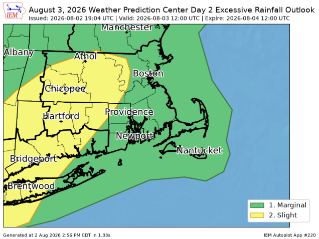
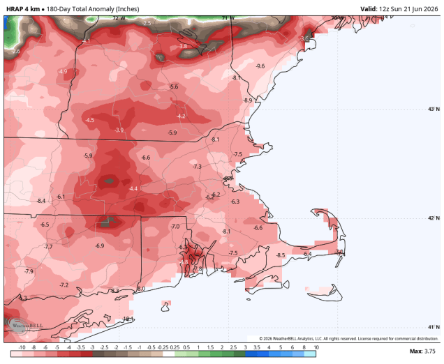
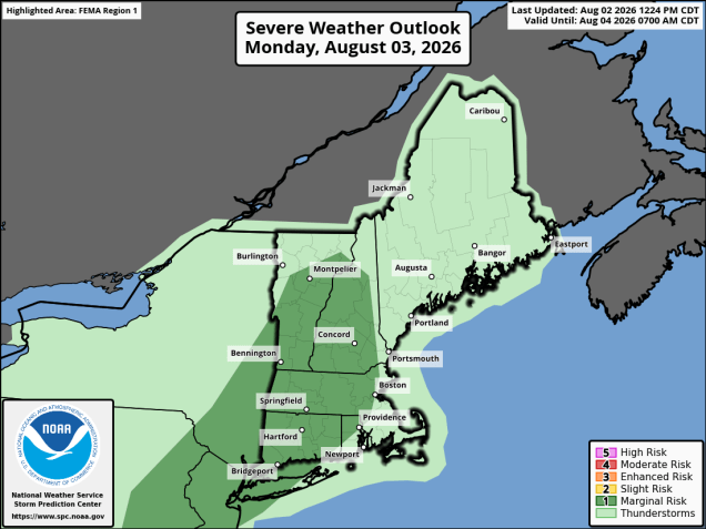
The week starts off on a wet note with a cold front approaching the region. A warm and humid airmass will be in place with gusty southwest winds at times, especially across eastern Massachusetts. Showers and a few thunderstorms are likely through the morning, some of which could be locally heavy. Some pockets of flash flooding are possible, as the ground remains fairly saturated from recent rainfall, which has pretty much taken care of the drought. We’re still in a long-term rainfall deficit, but the drought itself is essentially gone. The showers will taper off, then we may see some sunny breaks develop. As the cold front moves in during the afternoon, it will trigger a second round of showers and thunderstorms. Depending on how much sun we get, some of those storms could become severe.
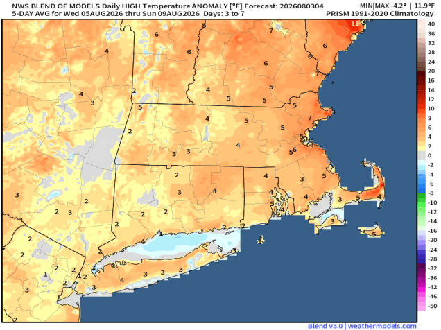
The front moves offshore tonight then high pressure builds in with drier weather for Tuesday. High pressure then sets up residence off the East Coast, resulting in very warm to hot and humid weather from Wednesday through the weekend. As is typical of a warm and humid airmass in the summer, we’ll see a daily chance for pop-up showers and thunderstorms, especially towards the end of the week and into the weekend. Widespread severe weather is not expected, but any of these storms could produce heavy downpours and gusty winds.
Monday: Morning showers and thunderstorms, some may produce heavy downpours, then some sunny breaks develop. Showers and thunderstorms redevelop in the afternoon, breezy, very humid. High 74-81.
Monday night: Showers and thunderstorms end in the evening, clearing overnight. Low 59-66.
Tuesday: Partly to mostly sunny, less humid. High 79-86.
Tuesday night: Partly cloudy. Low 59-66.
Wednesday: Partly sunny, chance for afternoon showers and thunderstorms. High 80-87.
Wednesday night: Partly cloudy. Low 64-71.
Thursday: A mix of sun and clouds, humid, chance for an afternoon shower or thunderstorm. High 83-90.
Thursday night: Clear to partly cloudy. Low 66-73.
Friday: Partly to mostly sunny, an afternoon shower or thunderstorm is possible. High 84-91.
Saturday: Partly sunny, chance for afternoon showers or thunderstorms. High 83-90.
Sunday: A mix of sun and clouds, chance for a shower or thunderstorm. High 84-91.