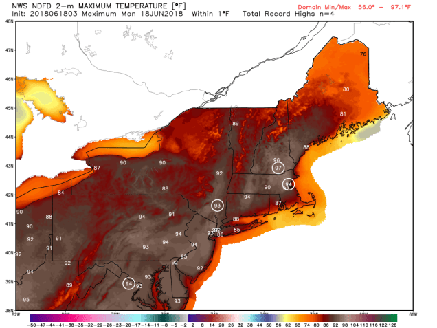
You’ve heard us say it in some shape or form before – the computer models are tools that help with forecasting, but they shouldn’t be used as the entire forecast. They all have limitations and biases, and none of them are perfect. There are plenty of amateurs out there across Facebook and Twitter (we won’t name names) that think that because they can read the models, that they can forecast the weather too. This is especially true in the winter with snowstorms. So, why are we bringing this up now? For the past several days, many of the models have been forecasting a heat wave to settle into New England around the start of July. Some of the models aren’t going for just any heat wave though, they are going for an extreme heat wave. How extreme? Here’s an example:

Yes, that is a real model forecast for high temperatures, not heat index, for next Monday, from a trusted model. Obviously, this is utterly ridiculous. A high of 112 in Taunton? 111 in Lawrence? 108 in Boston? To put some perspective on that. Boston’s all-time record high is 104, set on July 4, 1911. The Massachusetts state record is 107, set in August 2, 1975 in New Bedford and Chester. We’re supposed to believe that these records are going to get beaten by 4-5 degrees? Yes, we expect it to get hot next weekend, but not THIS hot. We’ll get to how hot a little later in this forecast.
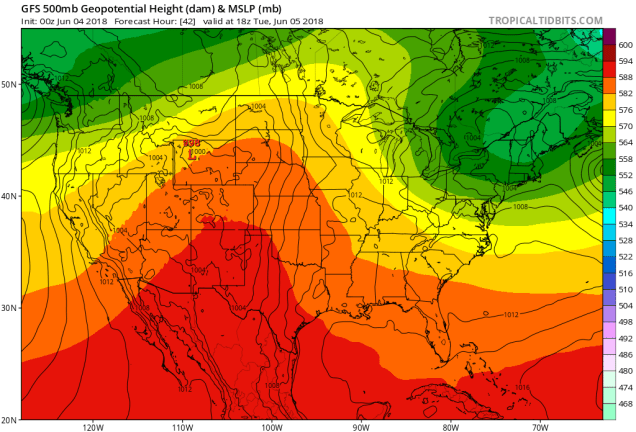
The week actually starts off with low pressure pulling away from the region and high pressure building in. However, an upper-level disturbance will be moving through, so we’ll still have plenty of clouds and maybe even a few showers today. We should clear out for Tuesday as high pressure settles in, with seasonable temperatures.
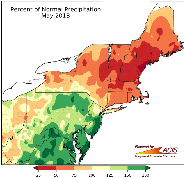
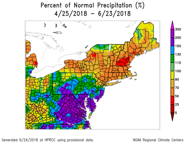
Another system starts to approach on Wednesday, with showers and some thunderstorms likely for late Wednesday into Thursday. This is a good thing, because we need the rainfall. We haven’t had a lot of rain since the beginning of May, and we’re starting to head towards a drought if that trend continues.
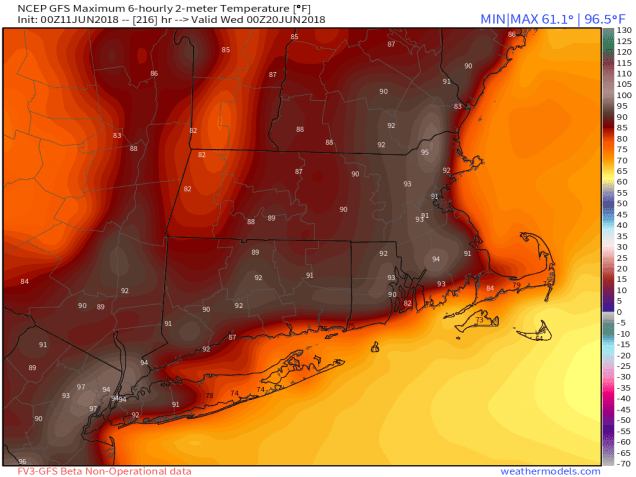
High pressure builds in behind that system on Friday, and the warmup begins. High pressure builds in both at the surface and aloft, which will allow temperatures to skyrocket as we flip the calendar from June to July. No, we don’t expect widespread readings of 100 degrees or more, but much of the region should get into the 90s, perhaps well into the 90s. Could a few locations reach 100? Sure, it’s possible.

It won’t be just blue skies and blazing heat though. With the ridge of high pressure centered just to our west, we’ll have northwest winds aloft. As complexes of thunderstorms form in the Plains and the Midwest, they’ll ride up and over that ridge, and head towards New England. Now, they may dry up before reaching here, but they may also send cloudcover our way, which could help to keep temperatures down a bit. This is exactly what happened last Monday, when most of the models and the TV talking heads were going for highs in the upper 90s, and most places stayed in the upper 80s to lower 90s (our forecast of 90-97 north and west of Boston worked out fairly well as most places made 90-92, but nobody got close to the 97). We also could have some showers and thunderstorms develop around here each afternoon as well, with a hot and humid airmass in place. Depending on how far west that ridge sets up, we may also have to contend with a backdoor cold front bringing an abrupt end to the heat across eastern areas, especially towards Tuesday or Wednesday. These are details that we’ll worry about later in the week, as things become a bit more clear. For now, just get ready to fire up the BBQ, clean the pool, and stock up on sunscreen, because you’re going to need it by the weekend.
Monday: Partly sunny, chance for a few showers, maybe even a rumble of thunder. High 70-77, perhaps a little cooler along the coast.
Monday night: Becoming mostly clear. Low 48-55.
Tuesday: Sunshine dimmed by afternoon high clouds. High 74-81.
Tuesday night: Becoming partly to mostly cloudy. Low 54-61.
Wednesday: Plenty of clouds with a few sunny breaks, showers and thunderstorms possible late in the day and especially at night. High 75-82.
Thursday: Cloudy and breezy with scattered showers and thunderstorms. High 73-80.
Friday: Becoming partly to mostly sunny, slight chance for a shower or thunderstorm. High 85-92.
Saturday: Plenty of sun with a few clouds around, slight chance for a shower or thunderstorm. High 88-95, cooler along the south coast.
Sunday: Sunshine and some high clouds. High 91-98, cooler along the south coast.