It won’t feel like the last day of November as we start the week on a windy, warm, and wet note.
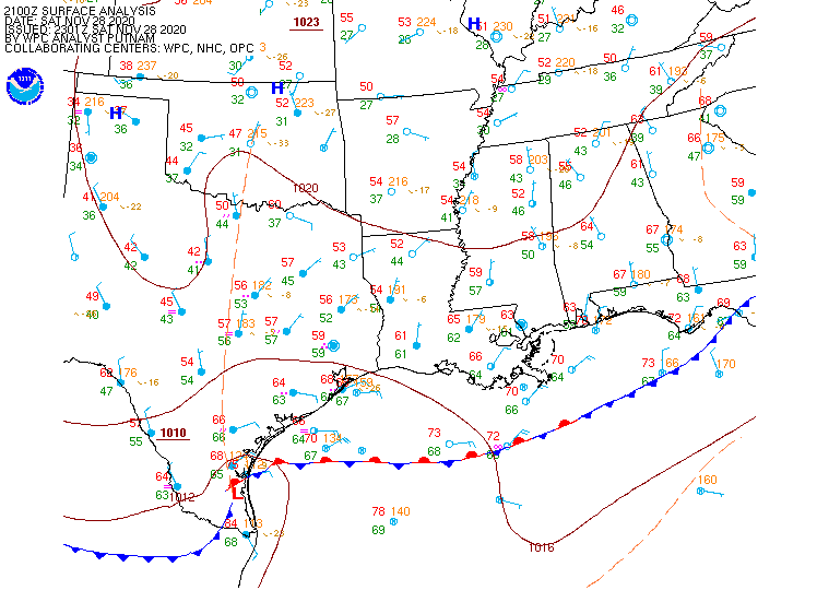
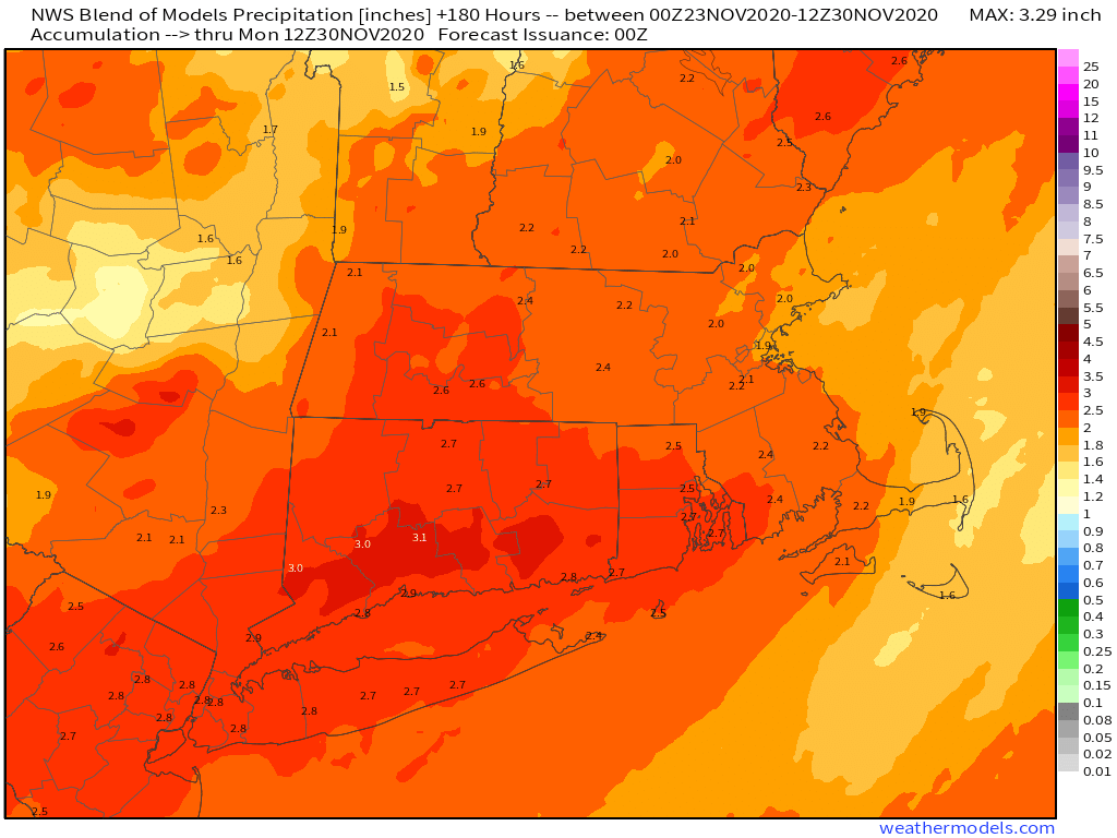
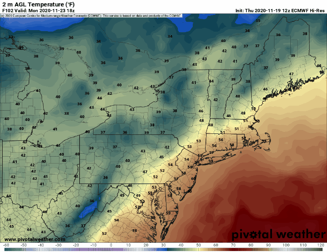
A strong storm system will move up the Appalachians today, passing west of the region. This will allow unseasonably mild air into the area on gusty south to southeast winds. Sustained winds of 25-35 mph are expected, with some gusts of 50-60 mph (or higher) possible, especially near the coast. Temperatures will get well into the 50s across the region today, with many areas, especially in eastern Massachusetts possibly topping 60 by late in the day. The warm weather will be accompanied by rain, some of which may be heavy at times this afternoon and evening. A few thunderstorms are possible as well. By the time everything winds down at night, much of the region will have received 1-2 inches of rain, with some heavier amounts possible.

As the system moves into southeastern Canada on Tuesday, it will drag a cold front across the region. The day will start off mild, with temperatures in the upper 50s and 60s during the morning, but they’ll drop during the afternoon behind the front. A few more showers are also possible, but nothing as heavy as what we’re expecting today.

By Wednesday, an upper-level low pressure system will move into the Northeast and southeastern Canada, bringing much cooler air in, though it will still be close to normal for early December. We’ll still have plenty of clouds around, and a pop-up shower or two can’t be ruled out, maybe even a snow flurry. High pressure then builds in for Thursday with sunshine. Clouds return Thursday night and Friday along with milder weather ahead of the next storm system.
Next weekend looks unsettled, but pinning down specifics at this point is an effort in futility. The models have performed relatively poorly beyond a few days lately, and there are significant differences in their solutions for next weekend as well. For now, we’ll just go with unsettled conditions, and the chance for some rain both Saturday and Sunday, but there is a possibility that the entire weekend won’t be unsettled. There’s also the possibility that all of the precipitation that falls wouldn’t be just rain. It will be early December, so this shouldn’t be a big surprise. We hope to have much more clarity on this when we write our Weekend Outlook on Thursday.

Monday: Cloudy and becoming windy with rain, possibly heavy at times, maybe a thunderstorm as well. High 55-62.
Monday night: Mostly cloudy with diminishing winds, showers taper off toward midnight. Temperatures hold steady overnight.
Tuesday: More clouds than sun, breezy, chance for a few more showers. High 56-63 early, then temperatures drop in the afternoon.
Tuesday night: Becoming clear to partly cloudy. Low 31-38.
Wednesday: Intervals of clouds and sunshine, breezy, slight chance for a sprinkle or flurry. High 39-46.
Thursday: Mostly sunny, some high clouds may start to stream in late in the day. High 41-48.
Friday: Mostly cloudy, showers possible late in the day. High 47-54.
Saturday: Mostly cloudy and breezy with a chance of rain. High 43-50.
Sunday: Mostly cloudy and breezy with a chance of rain. High 42-49.