We’ve reached the Fourth of July, and for the most part, we’ll have some great weather for the long weekend.
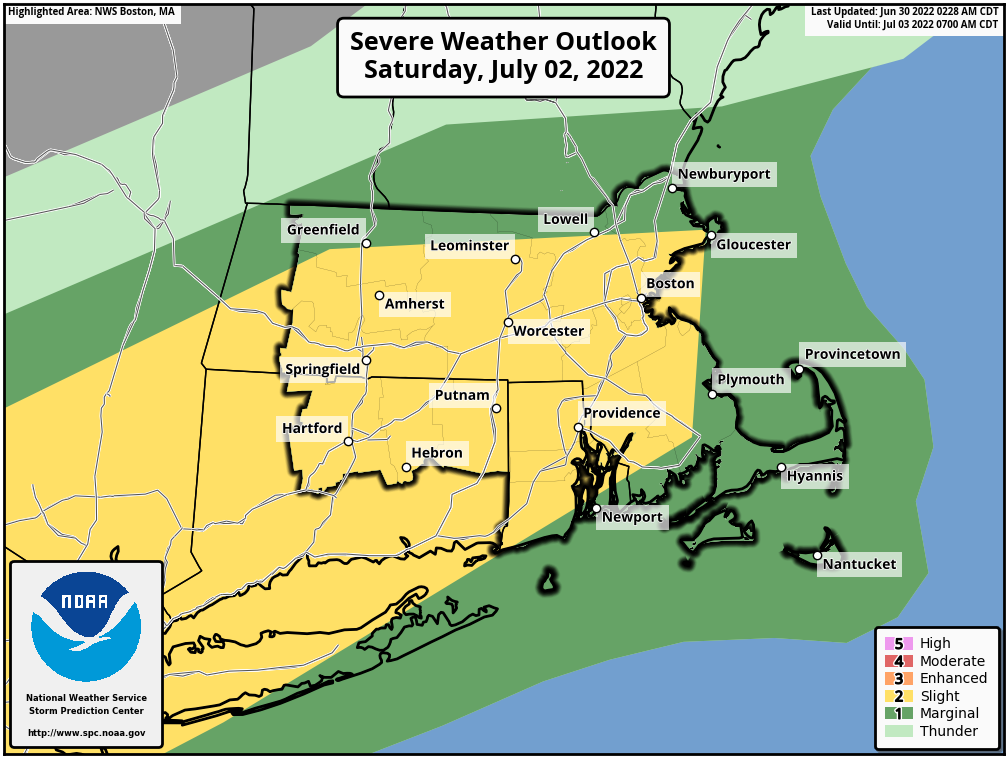
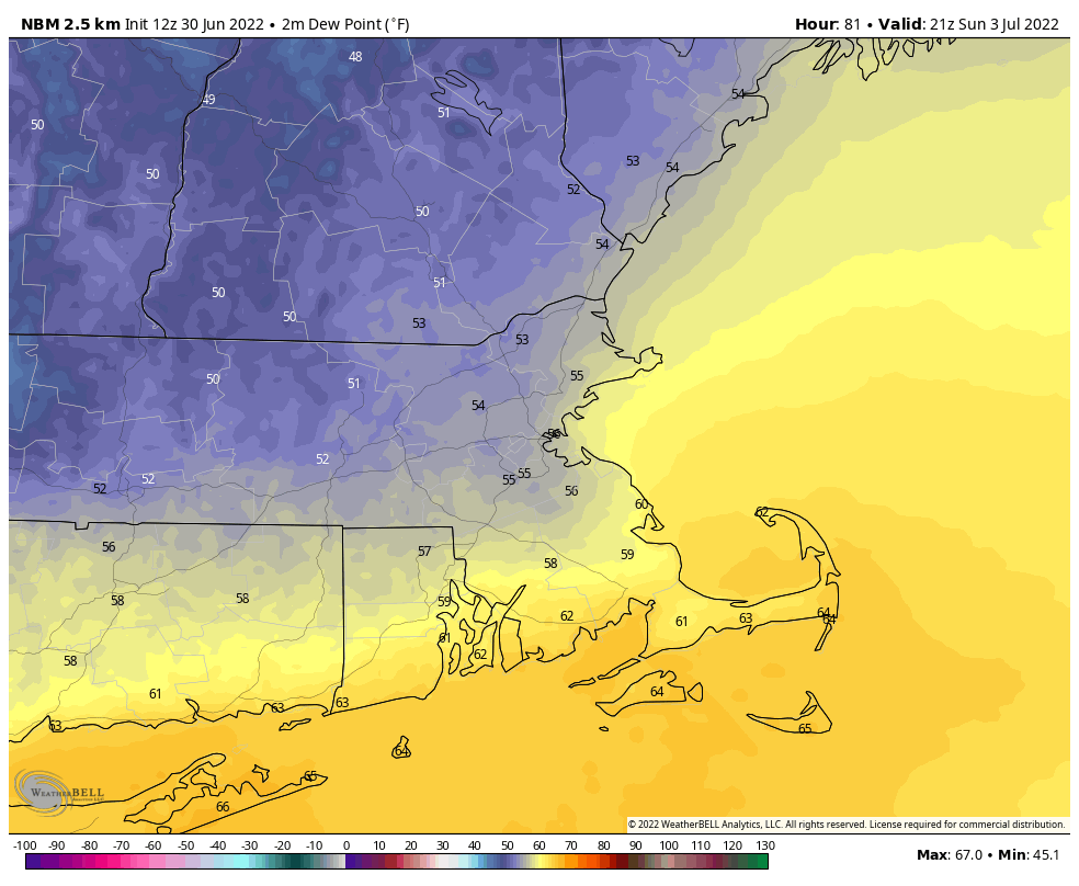
High pressure slides offshore tonight, resulting in hot and increasingly humid conditions on Friday. Temperatures will likely top 90 in much of the region. Humidity levels, while rising, won’t be in the unbearable range (yet), but you’ll definitely notice the increase in moisture. A warm front moves through at night, with a shower or thunderstorm possible, but all this front will really do is increase the humidity for Saturday. We’ll have more cloudcover on Saturday as a cold front approaches, but with a very warm and now very humid airmass in place, showers and thunderstorms are likely ahead of that cold front. Some of the storms that do form could be strong to severe, with strong winds, heavy downpours, and hail. If you’ve got outdoor plans Saturday afternoon/evening, keep an eye on the sky and the radar, and be prepared to move indoors.
Showers come to an end from northwest to southeast Saturday night, though they may linger across the South Coast and Cape Cod into early Sunday morning. Sunday should feature cooler and drier conditions as high pressure builds in, but with the front stalled out just south of New England, there will still be a slight chance for a shower on Sunday, mainly near the South Coast. For the 4th itself, we’re looking at sunshine, seasonably warm temperatures and comfortable humidity levels.
Thursday night: Clear to partly cloudy. Low 58-65.
Friday: Partly to mostly sunny. High 88-95, cooler along the South Coast. Offshore: Southwest 10-15 knots, gusts to 20 knots, seas 2-4 feet visibility 1-3 miles in patchy morning fog, improving in the afternoon.
Friday night: Becoming mostly cloudy with a slight chance for a shower or thunderstorm. Low 66-73.
Saturday: More clouds than sunshine with showers and thunderstorms likely, some of which may become strong to severe. High 79-86. Offshore: Southwest 15-20 knots, gusts to 25 knots, seas 3-5 feet, visibility under 1 mile in showers and thunderstorms.
Saturday night: Showers and thunderstorms ending, then skies become partly cloudy. Low 60-67.
Sunday: A mix of sun and clouds, slight chance for a shower, mainly near the South Coast. High 80-87. Offshore: West winds 5-10 knots, seas 2-4 feet, visibility 1-3 miles in showers near the South Coast, 10 miles or better elsewhere.
Sunday night: Clear to partly cloudy. Low 57-64.
Monday: Partly to mostly sunny. High 80-87. Offshore: West winds 5-10 knots, seas 2-4 feet, visibility 10 miles or better.