Hurricane Dorian Prepares to Assault the Bahamas

Earlier this week, the models were showing the potential for Hurricane Dorian to smash into Florida and the hype train left the station at full speed. Well, now that the models have shifted, the hype train is on a different track. Dorian is now expected to smash the Northwestern Bahamas on Sunday before heading towards the Southeastern United States.

Dorian is not going to be a welcome visitor to Freeport Harbour on Sunday.

As of 11pm Saturday, Dorian was centered about 125 miles east of Great Abaco Island in the Bahamas, moving toward the west at 8 mph. Maximum sustained winds are near 150 mph, making Dorian a Category 4 Hurricane on the Saffir-Simpson Scale. Hurricane Warnings been been issued for the Northwestern Bahamas except for Andros Island, which is under a Hurricane Watch. A Tropical Storm Watch has been issued for the east coast of Florida, from Deerfield Beach to Sebastian Inlet.

Satellite loop showing Hurricane Dorian east of the Bahamas. Loop provided by the College of DuPage.

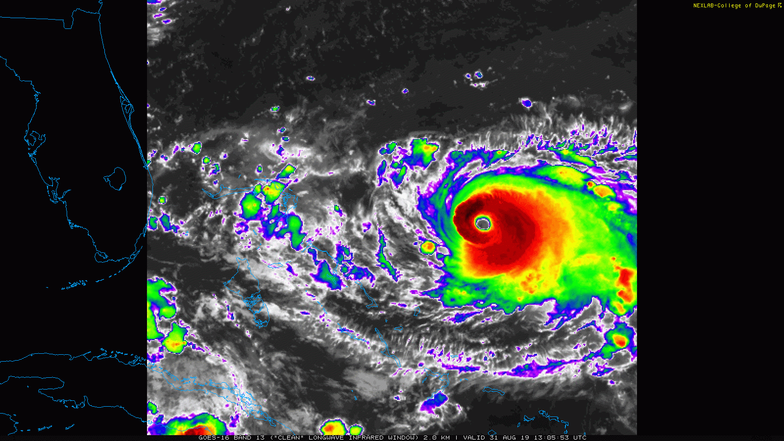
Dorian’s immediate future is fairly clear – it will continue westward overnight and into Sunday, passing very close to Freeport in the Bahamas as a powerful hurricane. Rainfall totals to 10-20 inches or more along with a storm surge of 10-15 feet will result in flooding along the coast and across the interior of the islands. While some additional strengthening is possible, some fluctuations are also possible as Dorian will likely start to undergo an eyewall replacement cycle at some point in the next 12-24 hours. The eyewall is where the strongest winds and most intense rainfall of a system are located. In an eyewall replacement cycle, the eyewall starts to collapse, and a new one forms a little farther away from the eye. This new eyewall eventually contracts closer to the eye, but in the meantime, it allows a storm to weaken. These are nearly impossible to predict, but they do occur in most hurricanes, mainly intense ones.

It’s pretty easy to see Dorian’s eye on radar this evening. Image provided by the Bahamas Meteorology Department.

After Dorian moves through the Bahamas, things get very tricky. Dorian is currently being steered westward by a ridge of high pressure located to its north. As a trough of low pressure moves into the Tennessee Valley, it will erode that western edge of that ridge, leaving Dorian in an area with little flow to steer it. It may stall out or move very little late Sunday and Sunday night, which is bad news for the Bahamas, as much of the circulation may remain over the northwestern Bahamas, resulting in catastrophic damage for parts of the region. If Dorian stays in the same place long enough, it may bring cooler water up to the surface in a process known as upwelling. Hurricanes need warm water to help fuel them, so sitting over cooler water could help Dorian to weaken a bit.

Computer model forecasts for the track of Hurricane Dorian. Image provided by Tropical Tidbits.

After that, as the ridge continues to erode and the trough advances eastward, a turn toward the north and eventually northeast is expected. Exactly when this turn occurs is still a rather large question mark. While the majority of the forecast models show this turn occurring offshore, not all of them do. This is mostly good news for Florida, as it would likely keep the worst effects offshore, though gusty winds, some rainfall, and rough surf are still likely along the coast. How far inland the rain and wind penetrate will be determined by the eventual track.

The HWRF model still shows landfall near Cape Canaveral. While a Florida landfall looks unlikely at this point, there is still a chance it can occur.

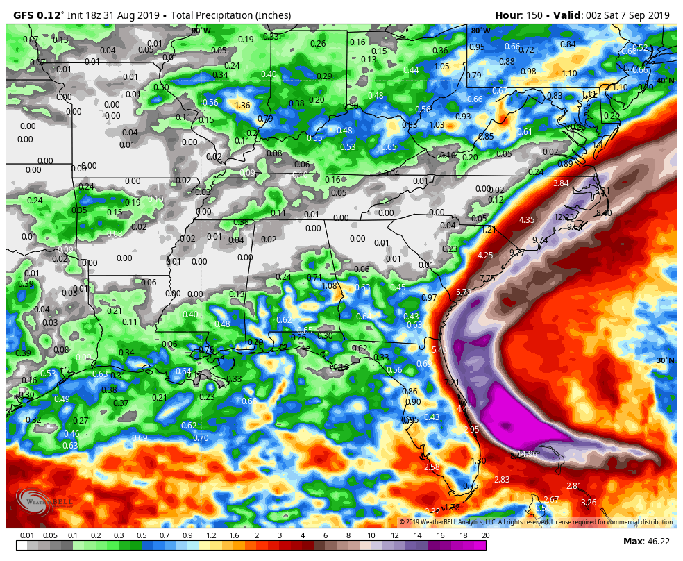
This is bad news for portions of the Southeast, especially coastal portions of the Carolinas. A track close to the coastline in these areas seems a bit more probable at this point, which means, strong winds, heavy rainfall, and rough surf are likely for a prolong period during the middle of the upcoming week. Although the forecasts are for the center of the storm to remain offshore, it would not take much of a deviation for the center to make landfall, which would increase the threat for damaging winds and storm surge.

GFS model forecast for rainfall through Friday. Image provided by WeatherBell

After forming last weekend, Dorian crosses Barbados and Saint Lucia as a tropical storm last Monday night. After reorganizing a little to the north, it then passes just east of St. Croix in the US Virgin Islands on Wednesday strengthening into a hurricane as it moved across St. Thomas, where it produced sustained winds as high as 82 mph with a gust to 111 mph.

The Tropics Are Starting to Get Active

It’s been a very quiet hurricane season so far, not just in the Atlantic, but in the Pacific as well, but that appears to be changing.

It’s been a quiet season compared to normal across the Atlantic and Pacific this far. Image provided by Colorado State University.

The most immediate concern is Tropical Storm Dorian. As of 2pm Monday, Dorian was centered about 95 miles east-southeast of Barbados, and was moving towards the west-northwest at 14 mph. Dorian has maximum sustained winds near 60 mph, and additional strengthen is expected. Tropical Storm Watches and Warnings are in effect for much of the Lesser Antilles, and a Hurricane Watch is in effect for St. Lucia.

Tropical Storm Dorian is approaching the Lesser Antilles. Loop provided by NOAA.

Dorian is expected to pass very close to Barbados this evening, and then close to St. Lucia or St. Vincent overnight tonight or early Tuesday. Because Dorian is not that large, the worst effects (damaging winds, torrential rainfall) will likely be limited to these islands.

Model forecasts for the track of Tropical Storm Dorian. Image provided by Tropical Tidbits.

Once Dorian moves past the Lesser Antilles, the questions become tougher to answer. The official forecast from the National Hurricane Center calls for Dorian to become a hurricane and turn northwestward, passing close to western Puerto Rico on Wednesday and then eastern portions of Dominican Republic Wednesday night and early Thursday, with some weakening as it interacts with land. In terms of the track itself, most of the forecast models are clustered in this area, give or take 100 miles. The intensity forecast is the biggest question mark for now. The Hurricane Center is calling for the storm to have maximum sustained winds of 80 mph when it reaches Puerto Rico and Hispaniola. However, looking at the various models, they are showing that it could be as strong as a Category 3 system, or as weak as a tropical depression. Intensity forecasts are still the toughest part of forecasting tropical systems, and for a small storm that has dry air all around it, this one is especially tough. Frankly, at this point, we wouldn’t be surprised with any outcome.

Model forecasts for the intensity of Tropical Storm Dorian. Image provided by Tropical Tidbits.

What about when it gets beyond Hispaniola and Puerto Rico? The official track and the various models all show the storm heading into the Bahamas and possibly towards Florida or the Southeast. It is still WAY too early to speculate on that (but that won’t stop the hype machine from Twitter and the Facebook Forecasters). First, we need to see if Dorian even survives that long. The mountains in central Hispaniola rise as high as 10,000 feet. Many storms that cross this area get torn apart by the terrain and dissipate. If (and that’s a big “if”) it survives, we’ll have to see what kind of shape it’s in when it emerges into the Bahamas before we can assess it’s future. This is all presuming the storm turns northwestward and heads towards Puerto Rico and Hispaniola. There’s nothing that says it won’t continue westward and heads towards Cuba or Jamaica. Just because none of the computer models are forecasting it does not mean it can’t happen.

Meanwhile, off the East Coast, a low pressure system is developing about 300 miles southeast of Cape Hatteras, NC this afternoon. This system could become a tropical or subtropical storm later today or tomorrow. As we mentioned in our Weekly Outlook, while the system is expected to stay well offshore and not impact the East Coast, this is far from definite. Some of the forecast models this afternoon show some moisture from the system interacting with an approaching cold front to bring some rain into parts of eastern New England Wednesday night and Thursday. Obviously, this will depend on exactly where the system tracks.

Model forecasts for the track of a developing system off the East Coast. Image provided by the University of Wisconsin.

Whether or not the system has any impact on New England, it will likely bring some gusty winds and heavy rain to portions of Atlantic Canada toward the end of this week. Rainfall totals of 2-4 inches and locally heavier are possible along with winds gusts to 50 mph along the coast, possibly higher, depending on how strong the storm gets. While this seems like an average Nor’easter, it will come on the heels of a non-tropical system that will bring heavy rain and strong winds to the same area tonight into Wednesday. Not exactly an ideal ending to summer for parts of the region.

Weekly Outlook: August 26 – September 2, 2019

First, our apologies for the brief post last week and the missing temperatures in the forecast. We at Storm HQ were taking a cruise to Bermuda for a much-needed vacation, and our internet connection on the ship was even worse than expected. It took far too long to even get what we wrote posted. We’re back in the Storm HQ World Headquarters Compound now, so we’re back to full updates.

It’s a chilly start to the week, with many locations dropping into the 40s north and west of Boston this morning. Image provided by Weathermodels.com

As for the coming week and the upcoming Labor Day Weekend, we’ll start off with high pressure in control, providing the region with dry and cool conditions today, but a warming trend is expected over the next few days. Some low clouds may remain in place this morning along the coast, thanks to the onshore flow around the high pressure area to our north and a deepening system south of Nova Scotia. The high pressure system will eventually win out, with sunshine developing along the coast by afternoon as well.

A cold front will start to approach the region on Wednesday, which means we should turn warmer and more humid, but there’s a possible fly in the ointment. There’s a system off the Carolinas right now that could become a tropical or subtropical storm later today (we’ll likely have a special blog post about this storm and Dorian either later today or on Tuesday). Right now, this system looks like it will head towards the northeast, and stay well offshore, but that is not set in stone yet. A track more towards the north-northeast could bring it close enough to at least bring in some clouds to southeastern New England. A return of onshore flow would mitigate any warm and humid weather along the coast, and depending on how close the system passes, we could even see a few showers reach the Outer Cape and the Islands. Obviously, we’ll keep an eye on this situation over the next few days. We think it’s a low-probability that it has an impact on us, but that probability is nowhere near zero right now.

How close will a potential tropical system come to New England? Probably not close enough to have much impact, but it’s possible. Image provided by Tropical Tidbits.

Back to that cold front, it likely produce some showers and a few thunderstorms Wednesday night into Thursday before it moves offshore. High pressure builds in behind the front on Friday with some drier weather, but another cold front moves will approach on Saturday. This one doesn’t look like it will have much moisture to work with, so we’re only expecting a few showers. High pressure builds in behind the front with cooler weather on Sunday. For Labor Day on Monday, the “traditional end of summer”, it looks like we’ll turn a littler warmer again as the high starts to move offshore.

You’re probably wondering if we’re done with the heat for the year. The answer is “not likely”. We’ve had plenty of 90-degree days well into September (and on very rare occasions into October. In fact, at least one model is showing some very warm weather the following weekend, with temperatures well into the 80s and close to 90 again. It’s nearly 2 weeks away, so it’s hardly set in stone, but don’t take the air conditioner out of the window and out away your summer clothes just yet.

Could we have some heat return next weekend? One model thinks so. We’ll see what happens over the next 10 days. Image provided by WeatherBell.

Monday: Low clouds linger across southeastern Massachusetts in the morning, bright sunshine everywhere in the afternoon. High 68-75, coolest along the coast.

Monday night: Clear skies. Low 47-54, warmest in the urban areas.

Tuesday: Sunshine and some afternoon clouds. High 71-78.

Tuesday night: Mostly clear. Low 53-60.

Wednesday: Partly to mostly sunny. Clouds move in at night with some showers possible towards daybreak. High 75-82, a little cooler along the coast.

Thursday: Intervals of clouds and sunshine with scattered showers, possibly a thunderstorm, mainly during the morning. High 77-84.

Friday: Plenty of sun. High 78-85.

Saturday: Partly to mostly sunny, some showers are possible at night. High 79-86.

Sunday: A mix of sun and clouds. High 71-78, coolest along the coast.

Labor Day: A sunny start, then clouds move in. High 73-80.

Weekly Outlook: August 19-25, 2019

Since this forecast is being written from the North Atlantic (somewhere around 39N/73W), and after a few mojitos, we’ll keep it simple this week. The graphics and sarcasm will return next week.

Basically, we’ve got hot and humid conditions through Thursday with high pressure sitting offshore. A few showers and thunderstorms may pop up each day, but especially Wednesday and Thursday as a cold front moves through. High pressure then builds in with drier and cooler conditions for Friday and the weekend.

Monday: A mix of sun and clouds, a few showers and thunderstorms are possible.

Monday night: Partly cloudy, and showers or storms end in the evening.

Tuesday: Partly sunny, chance for an afternoon shower or thunderstorm.

Tuesday night: Partly cloudy.

Wednesday: Intervals of sun and clouds, showers and thunderstorms likely in the afternoon.

Thursday: More clouds than sun with scattered showers and thunderstorms.

Friday: A mix of sun and clouds.

Saturday: Plenty of sunshine.

Sunday: Partly to mostly sunny.

Weekly Outlook: August 12-18, 2019

After a pretty- good weekend weatherwise, we’ve got another decent day today, though humidity levels will start to creep up. After that, there’s some rain in our future.

High pressure remains in control today, but it will be offshore, so we’ll see moisture start to move into the region. You’ll notice it both at the surface, where dewpoints will start to creep up, and later of aloft, as some clouds start to move into the region. A few showers are possible Monday night as a cold front starts to approach the region, but the bulk of the activity will wait until Tuesday when the front moves through. Some thunderstorms are also possible, especially towards the South Coast where there is the potential for some heavy downpours.

This may be a bit too much, but the NAM continues to insist on some very heavy rainfall along the South Coast from Tuesday’s system. Image provided by WeatherBell.

The front pushes offshore Tuesday night then stalls south of New England while high pressure tries to build in to the north. As a result, we may have clouds lingering near the south coast while sunshine dominates farther north.

High pressure building in behind the front could send temperatures into the 40s across much of Northern New England Wednesday morning. Image provided by Weathermodels.com

Another weak disturbance will move through on Thursday with some additional clouds and possibly a few more showers, then high pressure builds in for Friday and the weekend with conditions fairly similar to what we just had this past weekend. This also includes the chance for a few widely scattered pop-up showers. These won’t be an issue for 90-95% of the region, but if you’re one of the unlucky 5-10%, they won’t last too long and shouldn’t be that heavy. Certainly nothing to cancel any plans over.

While we’re talking about next weekend, we just wanted to let you know that next week’s outlook will likely be posted at some point next Sunday morning, and not early Monday morning as usual. We’ll return to the Monday morning posting the following week.

Monday: Morning sunshine starts to fade behind increasing high clouds in the afternoon, becoming humid. High 80-87.

Monday night: Becoming mostly cloudy with a few showers possible, especially across southern New Hampshire and northern Massachusetts. Low 64-71.

Tuesday: Mostly cloudy with scattered showers and thunderstorm. High 77-84.

Tuesday night: Mostly cloudy with scattered showers and thunderstorms lingering across the South Coast and Cape Cod through midnight. Skies may start to clear out after midnight north of the Mass Pike. Low 59-66.

Wednesday: Partly to mostly sunny from the Merrimack Valley northward, intervals of clouds and sunshine elsewhere. High 73-80, coolest along the coast.

Thursday: A mix of sun and clouds, chance for a shower or two. High 72-79.

Friday: Sunshine and some afternoon clouds, slight chance for a shower. High 74-81.

Saturday: Partly to mostly sunny, just a very slight chance for a pop-up shower. High 77-84.

Sunday: Sunshine and some afternoon clouds, but a stray shower is possible again. High 79-86.

Weekly Outlook: August 5-11, 2019

We’ve actually got some fairly typical summer-time weather coming up for most of the week. Nothing too extreme, just warm and humid weather for a few days with a daily chance for thunderstorms, followed by cooler and drier weather late in the week.

We start the week off with a cold front pushing farther offshore and high pressure building in today. This will result in seasonably warm temperatures and low humidity. This won’t last long, as a warm front will move through Monday night and early Tuesday. This will allow more humid air to settle back in on Tuesday. With the warm and humid air in place, a few showers and thunderstorms may develop Tuesday afternoon.

Dewpoints will be mainly in the 50s across the region this afternoon. Image provided by Weathermodels.com

As we get into Wednesday, a slow-moving cold front will start to approach from the west. The front likely won’t move through until Thursday night or Friday morning, but again, we’ll have warm and humid conditions in place, and the approaching front will help to trigger showers and thunderstorms both Wednesday afternoon and again Thursday afternoon. Some of these storms could become strong to severe, with gusty winds, hail and heavy downpours in some of the stronger storms. It’s not going to rain all day, but if you’ve got outdoor plans Wednesday and Thursday, keep an eye to the sky during the afternoon and evening both days.

Thunderstorms could drop some heavy rainfall on the region during the middle of the week. Image provided by WeatherBell.

The front finally pushes through early Friday, but an upper-level low pressure area will move across the Northeast. So, even though we’ll have some drier air moving in, a few pop-up showers and thunderstorms will be possible once again. High pressure then builds in for the weekend with cooler and drier conditions. In fact, temperatures could even end up a little below normal.

An upper-level low pressure area will help usher in some cooler weather for Friday and the weekend, Image provided by Pivotal Weather.

Monday: Sunshine and a few afternoon clouds. High 79-86.

Monday night: Clear to partly cloudy. Low 59-66.

Tuesday: Partly sunny and becoming humid, chance for a few showers and thunderstorms during the afternoon. High 80-87.

Tuesday night: Partly to mostly cloudy, some additional showers and storms are possible, mainly in the evening. Low 64-71.

Wednesday: Intervals of clouds and sunshine with scattered showers and thunderstorms developing. High 80-87.

Thursday: Partly sunny with another round of showers and thunderstorms possible. High 81-88.

Friday: Sunshine and some afternoon clouds, breezy, slight chance for a shower or thunderstorm. High 78-85.

Saturday: A mix of sun and clouds. High 75-82.

Sunday: Partly to mostly sunny. High 76-83.