We’re into the time of the year where the models are even more useless than normal beyond a few days out.
You’ll recall in our Weekend Outlook we talked about the potential for our first accumulating snow of the season for Sunday night into this morning. Well, before that could happen, another threat materialized for Friday night into Saturday morning that did coat the ground with snow across parts of the region, and this morning’s system was a complete dud. Having said that, much of this week looks quiet despite the pattern actually being fairly active, and we’re fairly confident in that (for now).
Low pressure pulls away from the region today with gradually clearing expected by tonight. High pressure will start to build in for tonight and Tuesday with dry and chilly conditions, but another weak disturbance will move towards the area. It will spread in some clouds on Tuesday, but little precipitation is expected, except possibly near the South Coast. High pressure builds back in on Wednesday with dry and slightly milder weather. Unfortunately more clouds are expected as another cold front approaches from the west. Some showers are likely ahead of that front on Thursday, but temperatures on Thursday should be quite mild (by early December standards), with some places topping 50. That front moves through during the afternoon, then high pressure builds back in with much cooler weather for Friday.

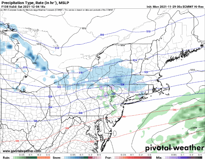
Next weekend is highly uncertain right now, and this is where the unreliability of the models beyond a few days comes into the play. Some of the models are showing the possibility for a system to come through on Saturday with some light snow, others aren’t. They are also showing the potential for another system Sunday night into Monday, which could be a messy storm. At this point, it’s fair to question both what the models are showing, and the timing of these systems. So, when you get down to the detailed forecast later on the page, you’re going to see things worded as a “chance”. Obviously, we should have a better idea of what to expect when we get to our Weekend Outlook on Thursday. Then again, when we did last weekend’s outlook on Wednesday, we didn’t see that potential for light snow late Friday and Friday night. In other words, don’t go cancelling any plans for next weekend yet.
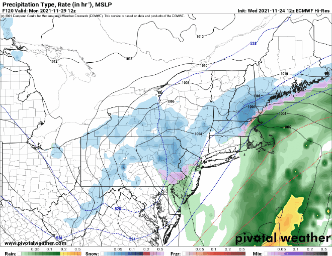
Monday: Mostly cloudy, chance for a few rain or snow showers during the morning across eastern Massachusetts. High 34-41.
Monday night: Clearing. Low 18-25.
Tuesday: Some early sun, then clouds stream back in, slight chance for a shower or two near the South Coast. High 35-42.
Tuesday night: Partly to mostly cloudy. Low 23-30.
Wednesday: A few sunny breaks early, otherwise mostly cloudy. High 40-47.
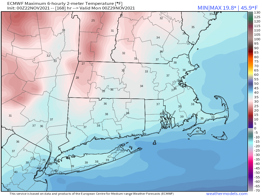
Thursday: Plenty of clouds with a few showers early, then showers are more likely at night. High 47-54.
Friday: Becoming mostly sunny, breezy, and cooler. High 38-45.
Saturday: Partly to mostly cloudy with a chance for snow showers. High 36-43.
Sunday: Intervals of clouds and sunshine. High 34-41.