Weekly Outlook: March 14-20, 2022

Astronomical spring begins on Sunday at 11:33am, but we’re already 2 weeks into meteorological spring, and this week it will feel like it.

High pressure slides offshore today, allowing for milder air to move back into the region. Tuesday looks to be mild as well, but a cold front will be dropping southward with a weak area of low pressure riding along it. This may bring in a few showers Tuesday night, possibly even mixed with a little wet snow across central and southern New Hampshire. That front will stall out nearby, so areas to the south may stay mild on Wednesday, but much of the region will be on the cooler side, though still a little above normal for mid-March. Thursday looks to be similar with some clouds and possibly even a few showers as another low pressure system passes by to the south. This brings us to Friday, which is most definitely the pick of the week.
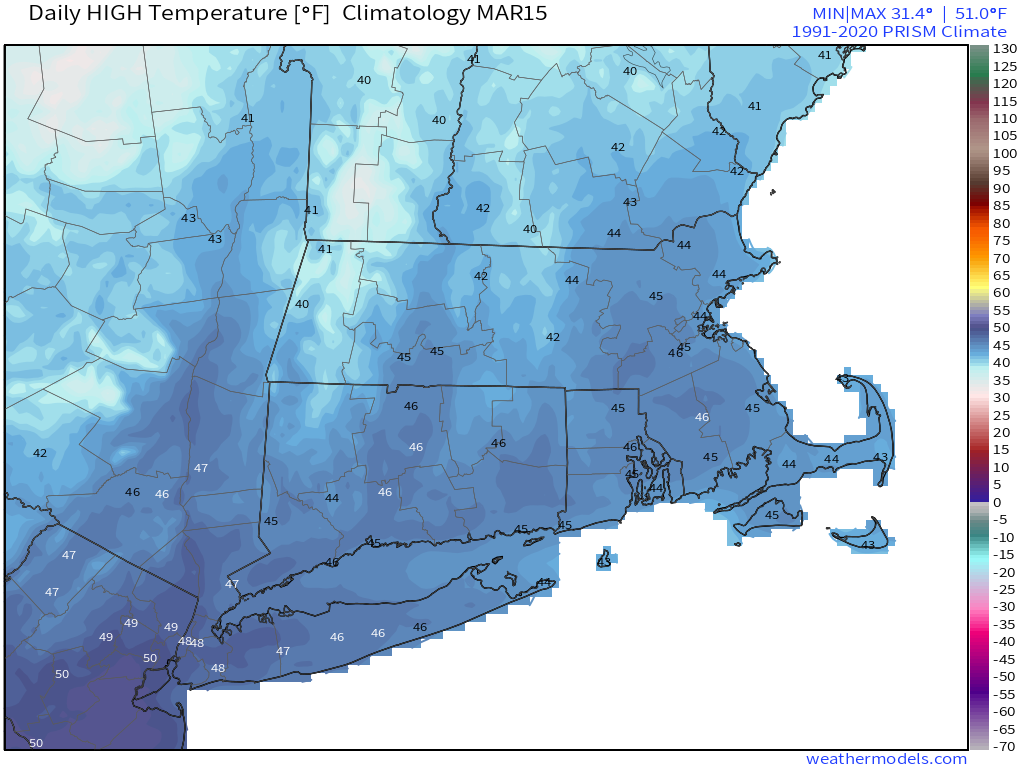
On average, high temperatures in mid-March are usually in the middle 40s. Image provided by Weathermodels.com

Low pressure will head into the Great Lakes, sending a warm front across the region. With some sunshine and southwesterly winds, temperatures should get well into the 60s away from the South Coast, with lower 70s possible. Saturday’s forecast is a bit trickier. That storm system will head into southeastern Canada, with 1 of 2 things possibly happening – We could have another very warm day with showers developing ahead of a cold front or a secondary area of low pressure develops off the Mid-Atlantic coast, resulting in more rain and significantly cooler temperatures. We’re going to lean towards the first scenario for now, but are cognizant of the fact that the second one is just as likely to happen. Either way, Sunday looks drier and seasonably cool.
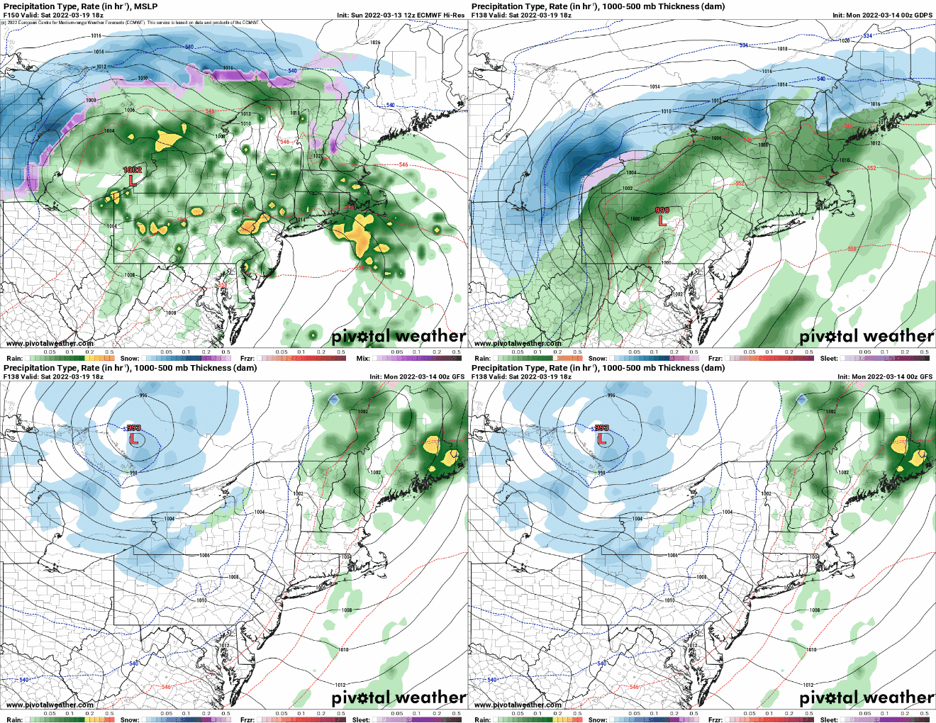
The models don’t agree on what will happen on Saturday. Images provided by Pivotal Weather.

Monday: Sunshine and some afternoon clouds. High 47-54.

Monday night: Mostly cloudy. Low 34-41.

Tuesday: Plenty of clouds with a few late-day showers possible, mainly north of the Mass Pike. High 55-62, a little cooler across southern New Hampshire.

Tuesday night: Mostly cloudy with showers during the evening north of the Mass Pike, possibly mixed with snow across southern New Hampshire. Low 32-39.

Wednesday: Becoming partly to mostly sunny. High 51-58, cooler along the coast.

Thursday: Intervals of clouds and sun, chance for a shower, especially near the South Coast. High 56-63.

Friday: A mix of sun and clouds. High 64-71, cooler along the South Coast.

Saturday: Cloudy and breezy with showers likely, ending in the afternoon. High 50-57.

Sunday: Partly sunny, breezy, and cool. High 51-58.
Weekend Outlook: March 11-14, 2022

While the clocks “spring ahead” with Daylight Saving Time beginning this weekend, we’ll still be dealing with winter at times.

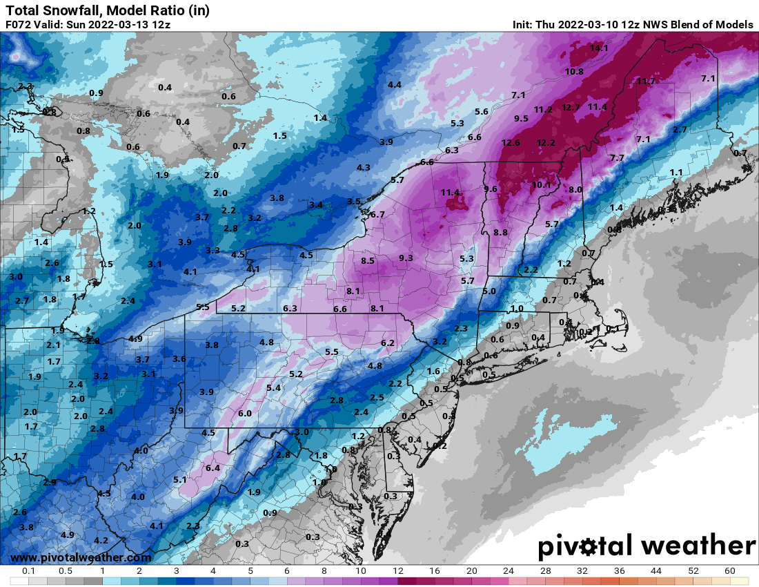
High pressure remains in control into Friday with generally dry weather. We’ll be on the chilly side tonight, but temperatures should rebound nicely on Friday, though we’ll see clouds streaming in and thickening up late in the day. This is in advance of a developing low pressure system that will impact us on Saturday. Earlier in the week, it looked like this system would pass west of us, with strong southerly winds bringing in very mild air and rainfall. Well, the latest indications are that the storm will pass right across southern New England, or possibly even south of it. This means that it won’t be as windy or warm as we were thinking earlier, but we’re not looking at a major snowstorm, it’ll still be too mild. We’ll have rain developing by daybreak Saturday, and it could be heavy at times during the day. It may still be quite breezy along the South Coast and across Cape Cod if the system does move across southern New England. Once it passes by during the afternoon it will continue to intensify, with strong northwest winds behind it ushering much colder air back in by late in the day. This will likely result in the rain changing to snow before it ends in the evening. How quickly it changes over and how quickly it moves out will determine whether the snow will accumulate. Right now, the best odds for any accumulation will be from central Massachusetts into southwestern and central New Hampshire. Farther north and west, this will be quite a storm for ski country, which is good news for them.

This storm will be good news for ski country. Image provided by Pivotal Weather.

Behind the storm, we’ll clear out for Saturday night and Sunday with high pressure building in. It will be breezy and quite chilly, but this won’t last long. Winds will subside Sunday afternoon, and as the high moves off to the east, temperatures will moderate nicely on Monday.

Thursday night: Clear to partly cloudy. Low 24-31.

Friday: Some morning sun, then increasing and thickening clouds. High 46-53.

Friday night: Mostly cloudy, rain develops before daybreak. Low 31-38.

Saturday: Rain, heavy at times, possibly changing to snow late in the day, becoming windy. High 45-52, possibly a little warmer across southeastern Massachusetts and Rhode Island. Temperatures will quickly drop during the afternoon

Saturday night: Windy with rain or snow showers ending in the evening, clearing late at night. Low 16-23.

Sunday: Sunshine and some afternoon clouds. High 30-37.

Sunday night: Clear to partly cloudy. Low 23-30.

Monday: Mostly sunny, some clouds may pop up in the afternoon. High 46-53.

Weekly Outlook: March 7-13, 2022

As you’d expect as we get into Spring, things will change quite a bit this week.

Low pressure will pass across New England today, bringing some rain in, mainly this afternoon and evening. With temperatures remaining mild, especially across Massachusetts, there’s even the potential for a rumble of thunder. The system pulls away tonight, setting up a sunny but breezy and cooler day on Tuesday. Another system passes by to the south on Wednesday, close enough for some clouds, but most of the precipitation with the system likely stays south of New England, though we could see a rain or snow shower reach the South Coast. By Thursday, we’ll start to turn milder once again as high pressure slides offshore, setting up the end of the week and the weekend.

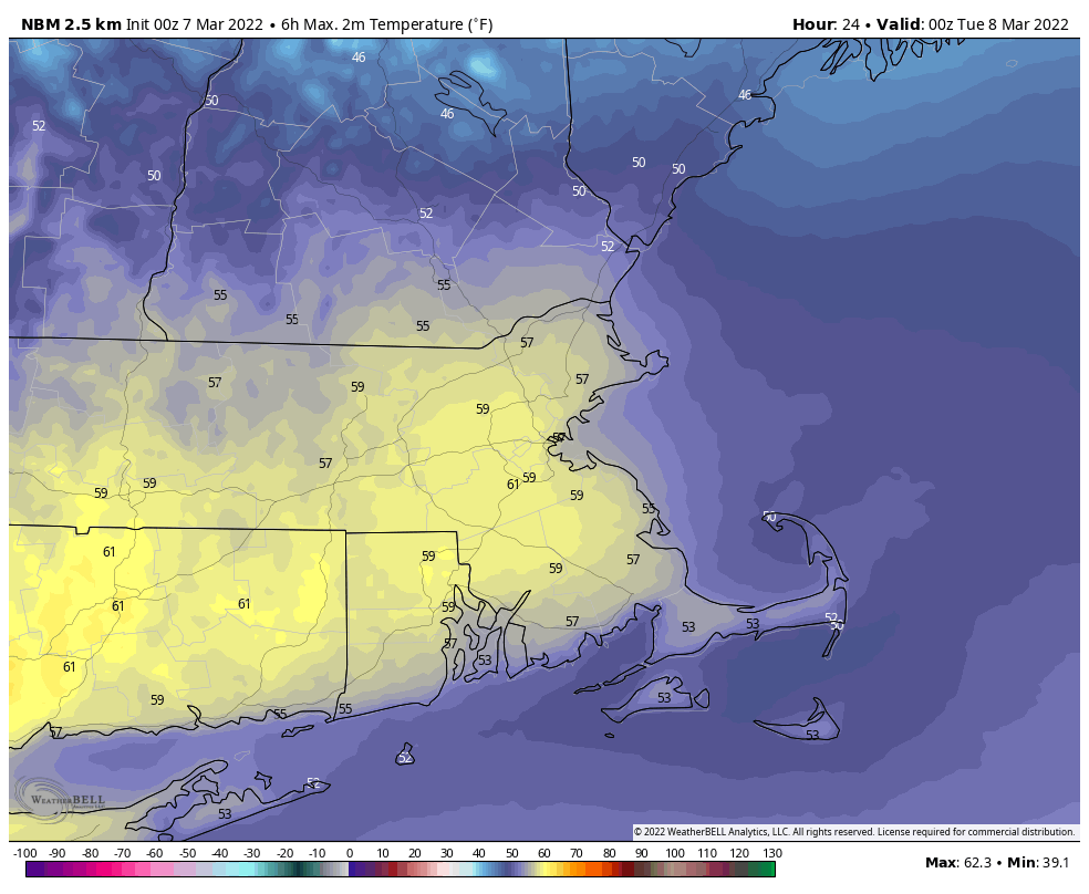
Another mild day is expected across the region. Image provided by WeatherBell.

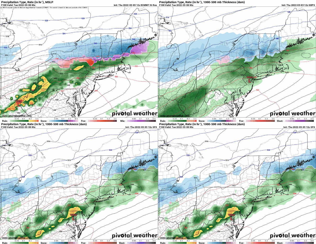
On Friday, low pressure will start to head up the Ohio Valley, crossing the Northeast on Saturday as it intensifies. We should be breezy and mild ahead of it, with rain likely Friday night into Saturday. Some of the models show the potential for very strong winds and potentially some heavy rain, but it’s still 5-6 days away, so for now it’s just potential. The system drags a cold front through later on Saturday, which may allow the rain to end as snow across the region, then windy and colder weather settles in for Sunday.

Most of the models show a rather potent storm system moving into the Northeast Saturday morning. Images provided by Pivotal Weather.

Monday: Cloudy and mild with periods of rain and showers during the afternoon. High 53-60, except 45-52 across southern New Hampshire.

Monday night: Rain during the evening, possibly a rumble of thunder, some clearing after midnight, breezy. Low 29-36.

Tuesday: Mostly sunny and breezy. High 39-46.

Tuesday night: Clear during the evening, clouds start to move in late at night. Low 20-27.

Wednesday: Plenty of clouds, just a slight chance for a rain or snow shower along the South Coast and Cape Cod. High 39-46.

Thursday: Partly sunny. High 46-53.

Friday: Morning sun, clouds move in during the afternoon, showers develop late at night. High 47-54.

Saturday: Cloudy and windy with rain likely, possibly mixing with wet snow before ending at night. High 53-60.

Sunday: A mix of sun and clouds., breezy, and colder. High 30-37.

Weekend Outlook: March 4-7, 2022

Winter or Spring? It depends on your definition, as March could be either. In terms of the forecast for the next few days, we’ll have both.

For most people, spring (a.k.a. astronomical spring), begins with the vernal equinox, which takes place this year on Sunday March 20 at 11:33AM. For others, meteorological or climatological spring began on March 1. No matter which definition you use, it will feel like winter into Friday. High pressure builds in tonight, with clearing and very cold conditions. Temperatures will likely drop into the single numbers in some of the cold spots Friday morning. Friday will also be rather chilly despite ample sunshine. The high slides off to the east on Saturday as low pressure heads toward the Great Lakes. It will send a warm front toward our area. The front will be accompanied by plenty of clouds, and although temperatures will turn milder with the high sliding offshore, the real mild air won’t be here yet.

Saturday night, that warm front moves through with a few showers possible, but temperatures will rise overnight. Could be there a little freezing rain or sleet over the interior right at the start? Sure it’s possible, but right now, it looks like temperatures might be a tad too warm by the time any precipitation arrives. This sets up a Sunday that will definitely feel like spring, as gusty southwest winds send temperatures to near or even over 60 degrees across the area, except for the South Coast, where the wind off the still-chilly water will act as a seabreeze. What’s the catch? We’ll still have plenty of clouds along with some showers as low pressure passes north and west of the region.

Saturday looks like a mild day across the region. Image provided by WeatherBell.

As the system moves by, it will try to drag a cold front across the area, but it doesn’t look like it will get all the way through. This has implications for Monday. Areas south of the front will stay quite mild Sunday night, while it will turn cooler north of the front. By Monday, another system quickly approaches from the southwest. This one looks a little more potent, but it will ride along that stalled out frontal boundary. Rain will redevelop in the afternoon, and it could be heavy in spots. North of the front, as colder air moves in, we could see a change to snow, especially Monday night into early Tuesday. We’ll look at this in much greater detail in our Weekly Outlook early Monday morning.

Things could start to get tricky late in the day Monday. Images provided by Pivotal Weather.

Thursday night: Clear and cold. Low 7-14.

Friday: Mostly sunny. High 28-35.

Friday night: Clear during the evening, some clouds start to filter in late at night. Low 13-20.

Saturday: Increasing and thickening clouds. High 36-43.

Saturday night: Mostly cloudy, chance for a few showers, possibly a little wintry mix well inland. Low 27-34 during the evening, temperatures rise overnight.

Sunday: Cloudy, windy, and mild with occasional showers. High 57-64, a little cooler along the South Coast.

Sunday night: Mostly cloudy. Low 40-47.

Monday: Cloudy with periods of rain or showers developing, possibly mixed with snow or sleet well inland by late in the day and at night. High 47-54, possibly cooler across southern New Hampshire and northern Massachusetts.

Weekly Outlook: February 28 – March 6, 2022

While there aren’t any big storms on our horizon, the upcoming week won’t exactly be quiet either.

We start off on a sunny but rather chilly note today with high pressure in control. As the high slides off to the east, temperatures will moderate a bit on Tuesday, but an Alberta Clipper will move through at night, with a few snow or rain showers likely. It pulls away early Wednesday, but another weak system quickly follows for Wednesday night into early Thursday with a few more rain or snow showers expected. High pressure then builds in for late Thursday into Friday with dry and cold weather once again.

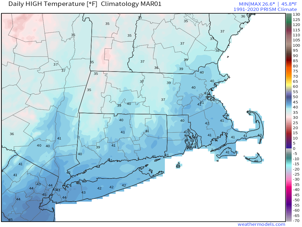
High temperatures should be in the upper 30s to lower 40s as March begins. Image provided by Weathermodels.com

By Saturday, the high will slide off to the east and a warm front will approach the region, with moderating temperatures. This is where things could get complicated. Low pressure will head into the Great Lakes, whie high pressure builds into Quebec. This may prevent that warm front from actually moving through the region, keeping us chilly for Saturday night and Sunday. Meanwhile, moisture will start to stream into the region ahead of that warm front. This could result in a messy mix of snow, sleet, freezing rain, and/or rain. It’s still far too early to try and pin down any details, but for now, Sunday looks like it could be messy.

The models are starting to show the potential for a messy weekend. Images provided by Pivotal Weather.

Monday: Sunshine and some late-day clouds. High 22-29.

Monday night: Partly to mostly cloudy. Low 4-11.

Tuesday: Plenty of clouds. High 35-42.

Tuesday night: Mostly cloudy with a chance for snow or rain showers. Low 27-34.

Wednesday: Developing sunshine in the morning, clouds return in the afternoon, snow or rain showers possible at night. High 39-46.

Thursday: More clouds than sun, breezy. High 31-38.

Friday: Sunny early, some clouds during the afternoon. High 29-36.

Saturday: Mostly cloudy with a chance for snow, sleet, freezing rain, or rain. High 32-39.

Sunday: Mostly cloudy with a chance for snow, sleet, freezing rain, or rain. High 33-40.

Weekend Outlook: February 25-28, 2022

As we head into the final days of February, yesterday’s record highs are just a memory and a snowstorm now gets all of our attention.

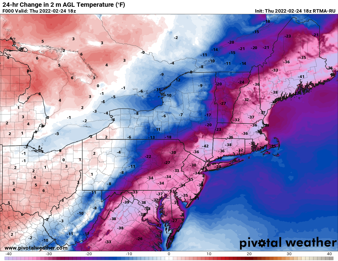
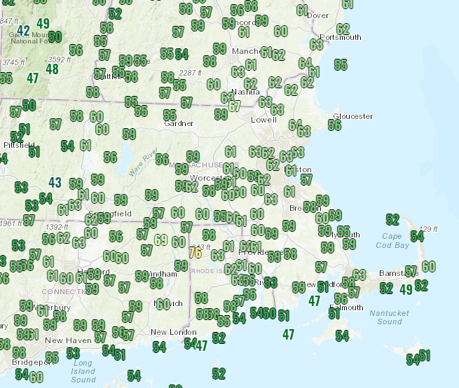
Temperatures at midday were 30-40 degrees colder than they were at this time yesterday. Image provided by Pivotal Weather.

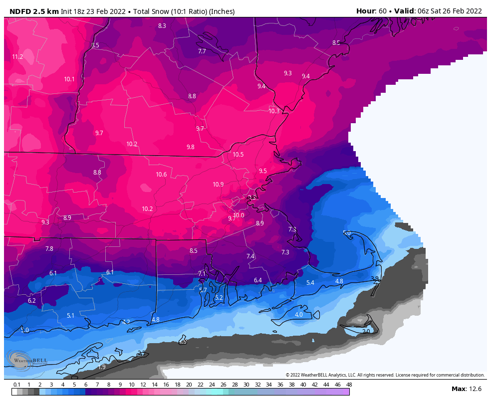
Low pressure will head toward the Ohio Valley tonight, then redevelop off the Mid-Atlantic coast, passing south of New England on Friday. We’ll see snow developing before daybreak on Friday, and it will quickly become heavy. Warmer air will start to move in Friday morning, first aloft, then at the surface. This will allow for a change to sleet, and along the South Coast and Cape Cod, eventually rain. The big question mark remains how far north does that sleet progress, since it will have a significant impact on snow accumulations? At this point, we’re thinking it gets to at least the Mass Pike, possibly Route 2. Is there a chance it makes it into southern New Hampshire? Yes, there is. By early afternoon, precipitation will lighten up, and as the storm starts to pull away, everything will go back to snow from northwest to southeast, with the snow ending during the evening.

How much snow do we expect? We really haven’t changed our thinking too much from yesterday:

Cape Cod: 2-5″
South Coast: 3-6″
Southeastern MA/RI: 5-9″
Metro Boston/MetroWest/Merrimack Valley/North Shore: 7-11″
Central and Southern New Hampshire/NH Seacoast: 6-10″

If the sleet doesn’t mix in, accumulations will be toward the higher end of the ranges, especially locations north of the Mass Pike. The longer that sleet occurs, the more likely accumulations will be toward the lower end of the ranges.

The ECMWF is probably closest to our thinking for snowfall. Image provided by WeatherBell.

Skies clear out late Friday night and Saturday as the storm pulls away and high pressure builds in. Another weak system moves through on Sunday with some clouds and possibly a snow shower or two. High pressure builds back in for Monday with some rather chilly weather for the final day of February.

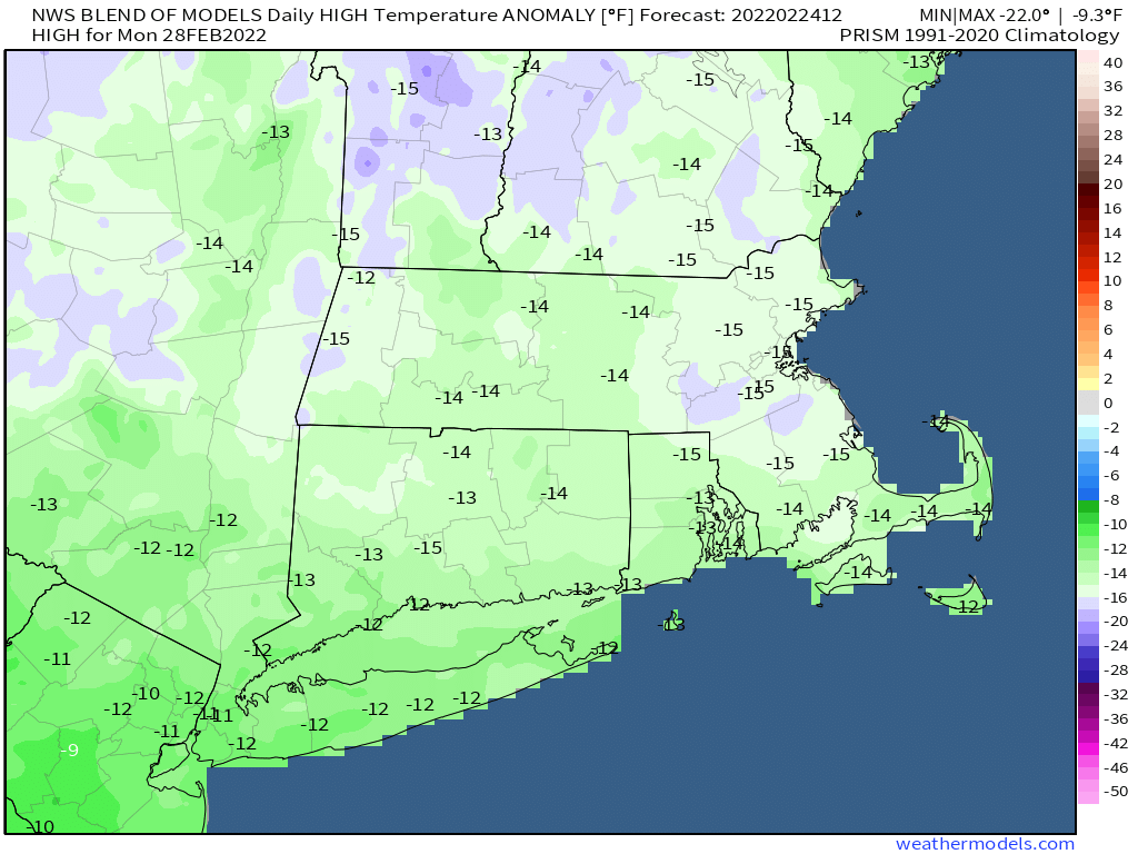
Monday’s temperatures will be about 15 degrees below normal. Image provided by Weathermodels.com

Thursday night: Mostly cloudy with snow developing 3-5am. Low 19-26.

Friday: Breezy with snow, heavy at times in the morning, mixing with or changing to sleet south of Route 2, and changing to rain across the South Coast. Precipitation lightens up during the afternoon before changing back to snow showers. High 27-34.

Friday night: Snow showers end in the evening, skies start to clear out after midnight. Low 7-14.

Saturday: Sunshine and a few clouds. High 27-34.

Saturday night: Clear to partly cloudy. Low 13-20.

Sunday: A mix of sun and clouds, chance for a snow shower. High 33-40.

Sunday night: Becoming clear. Low 6-13.

Monday: Sunny and colder. High 20-27.

From Record Highs to a Snowstorm in 36 Hours

While today is turning out to be a fantastic day across the region, significant changes are coming, and it won’t take long for them to happen.

A cold front is crossing the region this afternoon, which will bring an end to our record warmth. A few spots even managed to reach 70 today, but you can kiss the mild weather goodbye, as it won’t be back for a while. Temperatures quickly drop this evening and tonight as high pressure builds in, but clouds will start to stream back in on Thursday as low pressure heads toward the Ohio Valley. The system will then redevelop off the Mid-Atlantic coastline, and pass south of New England on Friday. As you’d expect with a system passing south of us in late February, this will produce snow for most of the area. The exact track of the system will determine how much snow we get (more on that in a bit).

Much of New England and eastern New York are under a Winter Storm Watch. Image provided by Pivotal Weather.

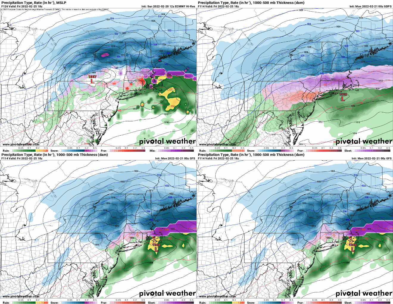
We’ll see snow develop before daybreak on Friday, and it may fall heavy at times during the morning and afternoon. At the same time, warmer air will be trying to move in aloft, which would allow the snow to change to sleet and/or freezing rain from south to north during the late morning and early afternoon. At this point, the only places that are likely to get above freezing and change to plain rain will be along the South Coast and across the Cape and the Islands. The question now is, how far north does that change to sleet occur, since it will have a significant impact on the accumulation totals? Most of the models only bring the change as far north as the Mass Pike. However, there is at least one model that brings the changeover all the way northward into southern New Hampshire. This concerns us a little, and we’re going to hedge our bets against this in the snowfall forecast, as you’ll see below.

There is some disagreement among the models as to how far north the changeover line progresses. Images provided by Pivotal Weather.

No matter how far north the changeover gets, as the system starts to pull away later on Friday, everything should change back to snow before winding down and ending in the evening. While this will likely impact the evening commute, the impact will be considerably less than what the morning commute experiences.

As for amounts, this is where things get tricky, since any mixing will cut down amounts significantly. There has been a trend in the models over the past 12 hours or so to shift the axis of heaviest snow into northern and central Massachusetts, with a bit less as you head into southern New Hampshire. Having said that, here’s our thinking as of now:

Cape Cod: 2-4″
South Coast: 3-6″
Southeastern MA/RI: 5-9″
Metro Boston/MetroWest/Merrimack Valley/North Shore: 6-12″
Central and Southern New Hampshire/NH Seacoast: 5-10″

Our forecast is not that dissimilar to the National Weather Service forecast. Image provided by WeatherBell.

The ranges are a bit wider than we normally like, but this reflects the uncertainty. The less sleet that mixes in, the more likely you are to be near the higher end of the range. Conversely, the more sleet that mixes in, the more likely you are to be toward the lower end of the range. We’ll update this forecast in our Weekend Outlook tomorrow afternoon.

Weekly Outlook: February 21-27, 2022

We’ve got a little bit of everything coming this week, unseasonably warm air (again), a snowstorm (again), some rain (again).

The week starts off with high pressure sliding offshore, allowing mild weather to return to the region today, with high temperatures likely topping 50 in many areas. Clouds start to stream in by late in the day though as low pressure heads toward the region. That low pressure system will pass north and west of the area later Tuesday, with gusty southwest winds bringing in very warm conditions in for Tuesday into Wednesday, with many places possibly topping 60 degrees on Wednesday. There are some indications that the warm air may struggle to move into southern and central New Hampshire on Tuesday, possibly holding off until Tuesday night, which may allow for a little freezing rain Tuesday evening. With the warm air comes some rain later Tuesday and Tuesday night, into early Wednesday morning. The rain ends when a strong cold front moves through, with skies clearing in the afternoon. High pressure builds in for Thursday with dry and cold conditions.

Wednesday could be a very mild day across the region. Image provided by WeatherBell

Another storm system moves into the Ohio Valley before redeveloping off the Mid-Atlantic coastline for Thursday night and Friday. There are still plenty of variables to be determined, but with colder air in place, we’ll likely see some snow to start. How much snow, and whether it changes over to sleet, freezing rain, and/or rain are questions that we cannot answer yet, but there is the chance for several inches of snow for at least part of the region. High pressure builds back in next weekend with dry and chilly conditions.

Thursday is looking wintry for at least part of the region for now. Images provided by Pivotal Weather.

Monday: Sunshine filtered through some high clouds at times. High 47-54.

Monday night: Increasing clouds. Low 26-33.

Tuesday: Some sunny breaks early, otherwise mostly cloudy and becoming breezy with showers developing in the afternoon. High 47-54, except possibly cooler across central and southern New Hampshire.

Tuesday night: Cloudy and windy with rain likely, possibly some freezing rain in parts of central or even southern New Hampshire for a while during the evening. Temperatures holding steady or rising overnight.

Wednesday: Lingering showers end early, clearing in the afternoon, breezy, and warm. High 58-65.

Thursday: Mostly cloudy and much colder, snow develops at night. High 31-38.

Friday: Breezy with snow likely, possibly mixing with or changing to sleet, freezing rain and plain rain, ending in the evening. High 30-37.

Saturday: Partly sunny and cold. High 25-32.

Sunday: Sunshine gives way to afternoon clouds. High 31-38.

Weekend Outlook: February 18-21, 2022

We’ve got a little bit of everything coming up over the next several days.

Temperatures are in the upper 50s and lower 60s across most of the region this afternoon. Image provided by NOAA.

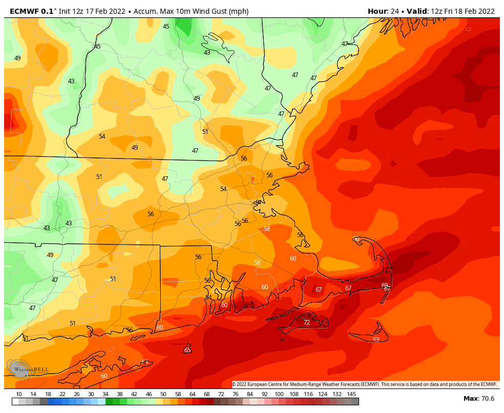
We’re starting off with unseasonably mild temperatures in place. Some records were set during the afternoon, and it will remain quite mild tonight as low pressure passes north and west of the region. As that system passes by, it will drag a strong cold front toward the region. A period of rain is likely tonight, and some of it could be heavy. Could there be a rumble of thunder? It’s certainly possible. The combination of rain and mild temperatures should just about take care of any remaining snow on the ground for the most part. We’ll also have some strong winds tonight ahead of that front. Sustained winds of 15-25 mph are likely across the region, with gusts of 40-60 mph expected, possibly even stronger across the Cape and Islands as well as southeastern Massachusetts.

Strong wind gusts are expected across the region tonight. Image provided by WeatherBell.

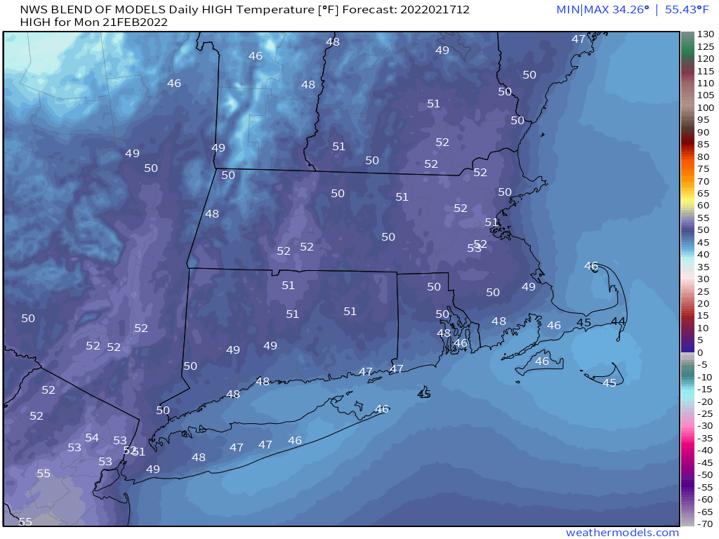
The front moves through Friday morning, bringing an end to the rain, and also our mild weather. In fact, temperatures will likely drop during the day as gusty northwest winds usher colder air in, though the winds should diminish during the afternoon. High pressure briefly builds in for Friday night with clear skies and chilly temperatures. Another system will quickly follow for Saturday though. Clouds will stream back in, with some snow showers or squalls possible during the day, possibly mixed with rain across the South Coast and Cape Cod. We’re not expecting much, if any, accumulation for the most part, but a few of these snow showers or squalls could drop a quick 1/2 inch and coat the ground, so keep that in mind if you’ll be out driving. High pressure builds back in for Saturday night and Sunday with clear and chilly conditions once again. However, as that high slides off to the east, temperatures will moderate again for Monday.

Monday is looking like another mild day. Image provided by Weathermodels.com

Thursday night: Cloudy and windy with rain likely, possibly heavy. Temperatures hold steady overnight.

Friday: Showers end early, skies start to clear out in the afternoon. Breezy early, but winds diminish during the afternoon. High 53-60 in the morning, temperatures drop during the day.

Friday night: Clear skies, but some clouds may start to move back in late at night. Low 13-20.

Saturday: More clouds than sunshine and becoming breezy with some snow showers or squalls possible, mixed with a little rain near the South Coast. High 33-40.

Saturday night: Becoming mostly clear. Low 12-19.

Sunday: Sunshine and a few clouds. High 31-38.

Sunday night: Clear to partly cloudy. Low 23-30.

Monday: A mix of sun and clouds, milder. High 46-53.

Weekly Outlook: February 14-20, 2022

We’ve got quite the week coming up with everything from some snow and bitterly cold temperatures to heavy rain and possibly more record highs by the end of the week.

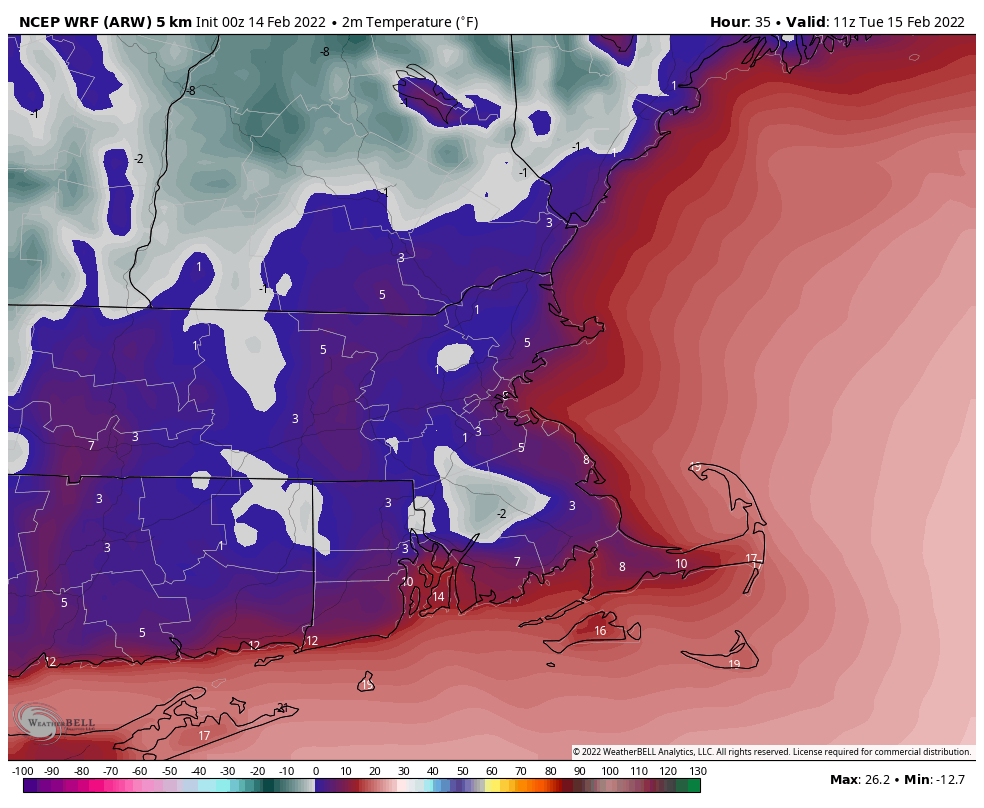
Snow showers will come to an end this morning, then skies will start to clear out this afternoon as high pressure starts to build in. Despite the developing sunshine, temperatures will only be in the 20s, which is 10-15 degrees below normal for mid-February. As skies become clear tonight and winds diminish, combined with the fresh snowcover, we’ll have some radiational cooling. Temperatures will likely drop into the single numbers, with some sub-zero readings possible. Tuesday remains chilly, but not quite as cold as today as the high pressure area continues to build in. By Wednesday, that high shifts offshore, and a significant temperature moderation develops. The milder air will be accompanied by clouds though as a storm system begins to move toward the region.

Tuesday morning looks quite chilly across the region. Image provided by WeatherBell.

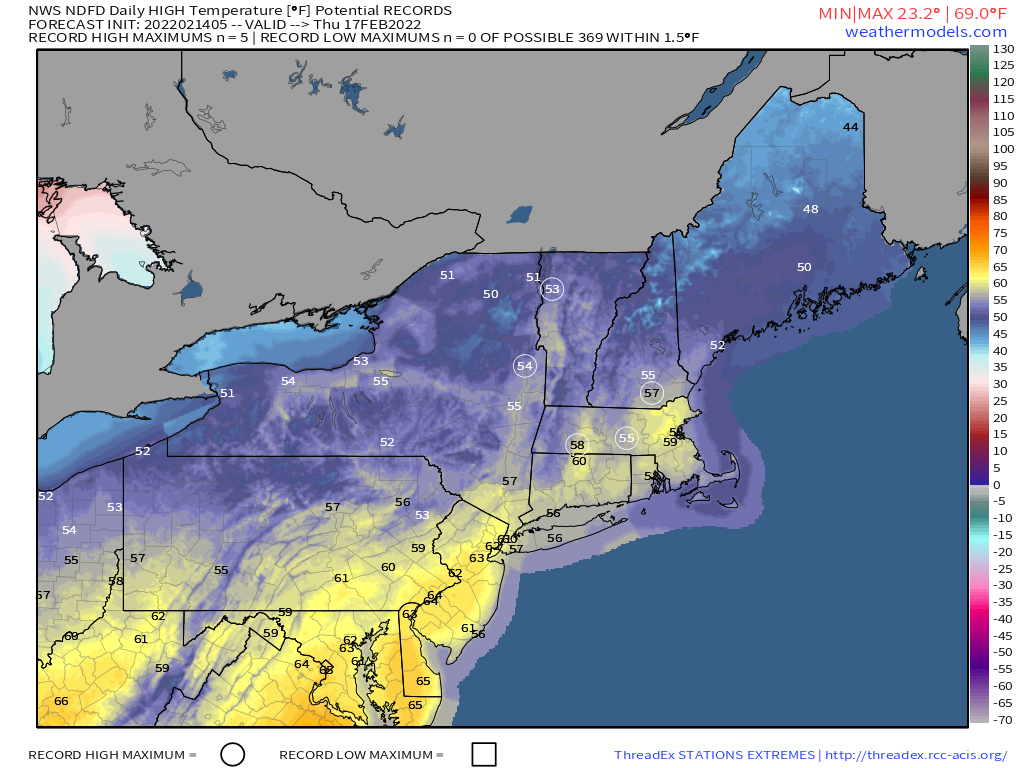
By Thursday, that system draws nearer, with gusty southwest winds sending temperatures well into the 50s and possibly 60s, with more record highs possible. While temperatures will be mild during the day, it looks like the warmest temperatures will be at night. We could be near or above 60 degrees at midnight Thursday night across the region. We’ll also have some heavy rain as the system gets closer, which combined with the mild weather, will help melt much of the snow that remains on the ground. A widespread soaking rainfall is likely, with rainfall totals of more than an inch possible. We wouldn’t even be surprised if there’s a rumble of thunder. This storm will likely produce some severe weather across the South, and while that’s not likely here, a few thunderstorms are possible. Friday likely starts off warm and wet with temperatures still in the 50s at daybreak, but as a strong cold front comes through during the morning, the rain will end, and temperatures will drop during the day. High pressure builds back in for the weekend with dry and seasonably cool conditions for Saturday, but we may start to turn milder again on Sunday.

Some record highs are possible on Thursday across the Northeast. Image provided by Weathermodels.com

Monday: Snow showers ending in the morning, skies start to clear out by late in the day, breezy. High 18-25.

Monday night: Becoming mostly clear. Low -2 to +5.

Tuesday: Sunshine and some afternoon clouds. High 23-30.

Tuesday night: Clear to partly cloudy. Low 6-13.

Wednesday: Sunny in the morning, clouds start to stream in during the afternoon, becoming breezy and milder. High 38-45.

Thursday: Plenty of clouds with some sunny breaks, especially in the morning, showers developing in the afternoon, becoming windy. Wind-swept rain likely at night, possibly some thunder as well. High 56-63. The warmest temperatures are likely at night.

Friday: Windy with rain ending in the morning, clearing during the afternoon. High 47-54 at daybreak, temperatures drop during the day.

Saturday: Mostly sunny. High 34-41.

Sunday: Sunshine and a few clouds. High 35-42.