Astronomical spring begins on Sunday at 11:33am, but we’re already 2 weeks into meteorological spring, and this week it will feel like it.
High pressure slides offshore today, allowing for milder air to move back into the region. Tuesday looks to be mild as well, but a cold front will be dropping southward with a weak area of low pressure riding along it. This may bring in a few showers Tuesday night, possibly even mixed with a little wet snow across central and southern New Hampshire. That front will stall out nearby, so areas to the south may stay mild on Wednesday, but much of the region will be on the cooler side, though still a little above normal for mid-March. Thursday looks to be similar with some clouds and possibly even a few showers as another low pressure system passes by to the south. This brings us to Friday, which is most definitely the pick of the week.
Low pressure will head into the Great Lakes, sending a warm front across the region. With some sunshine and southwesterly winds, temperatures should get well into the 60s away from the South Coast, with lower 70s possible. Saturday’s forecast is a bit trickier. That storm system will head into southeastern Canada, with 1 of 2 things possibly happening – We could have another very warm day with showers developing ahead of a cold front or a secondary area of low pressure develops off the Mid-Atlantic coast, resulting in more rain and significantly cooler temperatures. We’re going to lean towards the first scenario for now, but are cognizant of the fact that the second one is just as likely to happen. Either way, Sunday looks drier and seasonably cool.
Monday: Sunshine and some afternoon clouds. High 47-54.
Monday night: Mostly cloudy. Low 34-41.
Tuesday: Plenty of clouds with a few late-day showers possible, mainly north of the Mass Pike. High 55-62, a little cooler across southern New Hampshire.
Tuesday night: Mostly cloudy with showers during the evening north of the Mass Pike, possibly mixed with snow across southern New Hampshire. Low 32-39.
Wednesday: Becoming partly to mostly sunny. High 51-58, cooler along the coast.
Thursday: Intervals of clouds and sun, chance for a shower, especially near the South Coast. High 56-63.
Friday: A mix of sun and clouds. High 64-71, cooler along the South Coast.
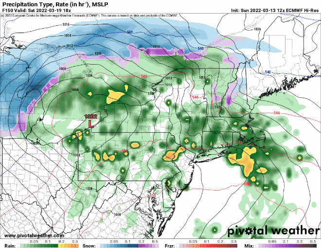
Saturday: Cloudy and breezy with showers likely, ending in the afternoon. High 50-57.
Sunday: Partly sunny, breezy, and cool. High 51-58.
