We’ve got a little bit of everything coming up over the next several days.
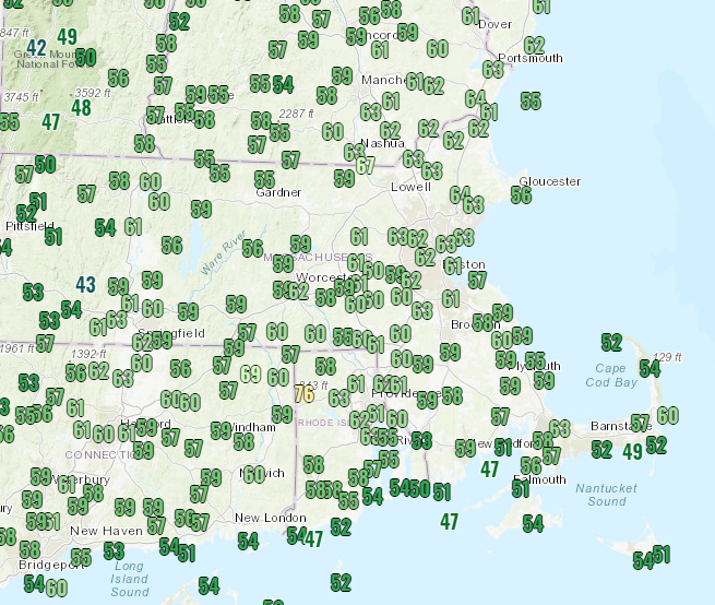
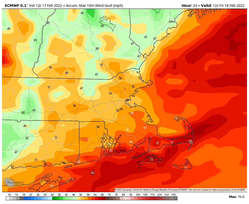
We’re starting off with unseasonably mild temperatures in place. Some records were set during the afternoon, and it will remain quite mild tonight as low pressure passes north and west of the region. As that system passes by, it will drag a strong cold front toward the region. A period of rain is likely tonight, and some of it could be heavy. Could there be a rumble of thunder? It’s certainly possible. The combination of rain and mild temperatures should just about take care of any remaining snow on the ground for the most part. We’ll also have some strong winds tonight ahead of that front. Sustained winds of 15-25 mph are likely across the region, with gusts of 40-60 mph expected, possibly even stronger across the Cape and Islands as well as southeastern Massachusetts.
The front moves through Friday morning, bringing an end to the rain, and also our mild weather. In fact, temperatures will likely drop during the day as gusty northwest winds usher colder air in, though the winds should diminish during the afternoon. High pressure briefly builds in for Friday night with clear skies and chilly temperatures. Another system will quickly follow for Saturday though. Clouds will stream back in, with some snow showers or squalls possible during the day, possibly mixed with rain across the South Coast and Cape Cod. We’re not expecting much, if any, accumulation for the most part, but a few of these snow showers or squalls could drop a quick 1/2 inch and coat the ground, so keep that in mind if you’ll be out driving. High pressure builds back in for Saturday night and Sunday with clear and chilly conditions once again. However, as that high slides off to the east, temperatures will moderate again for Monday.
Thursday night: Cloudy and windy with rain likely, possibly heavy. Temperatures hold steady overnight.
Friday: Showers end early, skies start to clear out in the afternoon. Breezy early, but winds diminish during the afternoon. High 53-60 in the morning, temperatures drop during the day.
Friday night: Clear skies, but some clouds may start to move back in late at night. Low 13-20.
Saturday: More clouds than sunshine and becoming breezy with some snow showers or squalls possible, mixed with a little rain near the South Coast. High 33-40.
Saturday night: Becoming mostly clear. Low 12-19.
Sunday: Sunshine and a few clouds. High 31-38.
Sunday night: Clear to partly cloudy. Low 23-30.
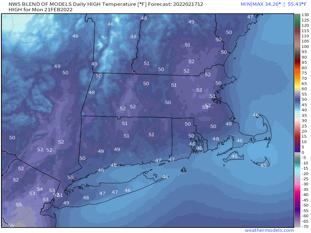
Monday: A mix of sun and clouds, milder. High 46-53.
