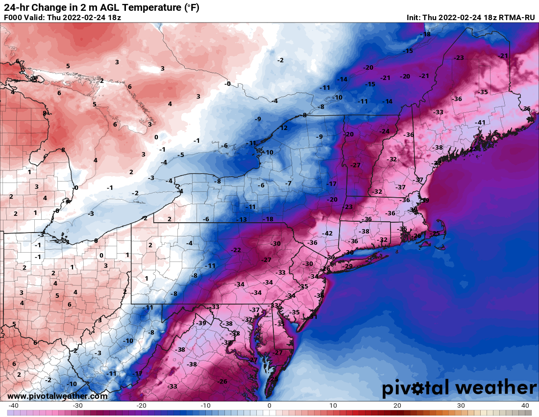
As we head into the final days of February, yesterday’s record highs are just a memory and a snowstorm now gets all of our attention.
Low pressure will head toward the Ohio Valley tonight, then redevelop off the Mid-Atlantic coast, passing south of New England on Friday. We’ll see snow developing before daybreak on Friday, and it will quickly become heavy. Warmer air will start to move in Friday morning, first aloft, then at the surface. This will allow for a change to sleet, and along the South Coast and Cape Cod, eventually rain. The big question mark remains how far north does that sleet progress, since it will have a significant impact on snow accumulations? At this point, we’re thinking it gets to at least the Mass Pike, possibly Route 2. Is there a chance it makes it into southern New Hampshire? Yes, there is. By early afternoon, precipitation will lighten up, and as the storm starts to pull away, everything will go back to snow from northwest to southeast, with the snow ending during the evening.
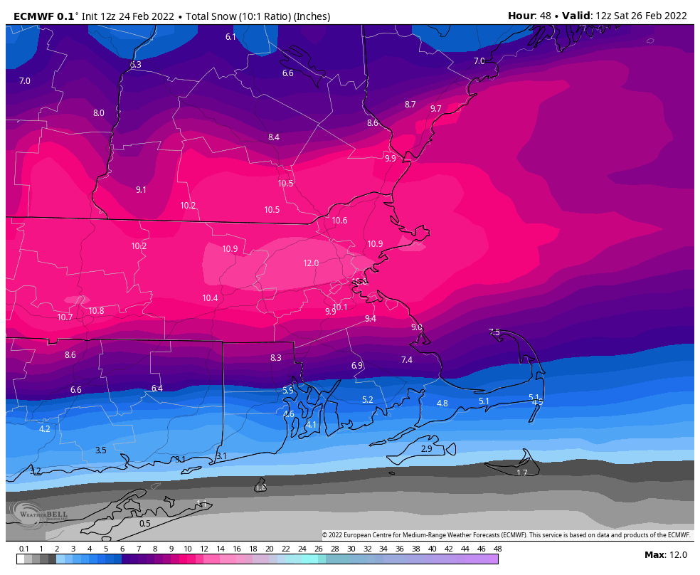
How much snow do we expect? We really haven’t changed our thinking too much from yesterday:
Cape Cod: 2-5″
South Coast: 3-6″
Southeastern MA/RI: 5-9″
Metro Boston/MetroWest/Merrimack Valley/North Shore: 7-11″
Central and Southern New Hampshire/NH Seacoast: 6-10″
If the sleet doesn’t mix in, accumulations will be toward the higher end of the ranges, especially locations north of the Mass Pike. The longer that sleet occurs, the more likely accumulations will be toward the lower end of the ranges.
Skies clear out late Friday night and Saturday as the storm pulls away and high pressure builds in. Another weak system moves through on Sunday with some clouds and possibly a snow shower or two. High pressure builds back in for Monday with some rather chilly weather for the final day of February.
Thursday night: Mostly cloudy with snow developing 3-5am. Low 19-26.
Friday: Breezy with snow, heavy at times in the morning, mixing with or changing to sleet south of Route 2, and changing to rain across the South Coast. Precipitation lightens up during the afternoon before changing back to snow showers. High 27-34.
Friday night: Snow showers end in the evening, skies start to clear out after midnight. Low 7-14.
Saturday: Sunshine and a few clouds. High 27-34.
Saturday night: Clear to partly cloudy. Low 13-20.
Sunday: A mix of sun and clouds, chance for a snow shower. High 33-40.
Sunday night: Becoming clear. Low 6-13.
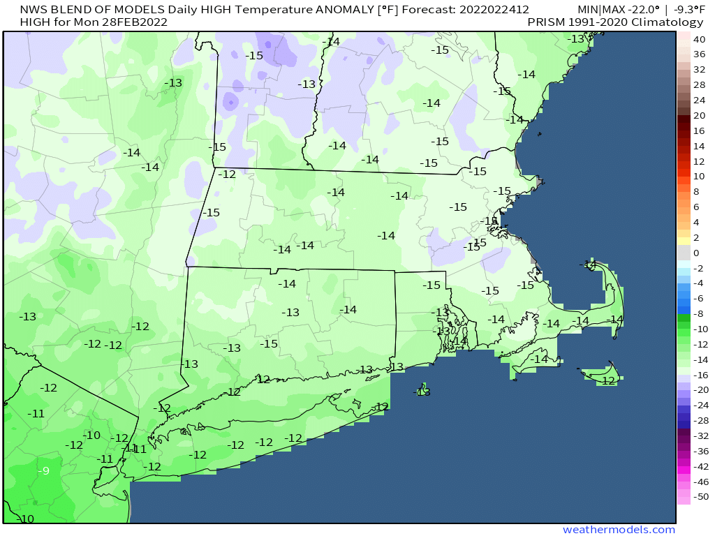
Monday: Sunny and colder. High 20-27.
