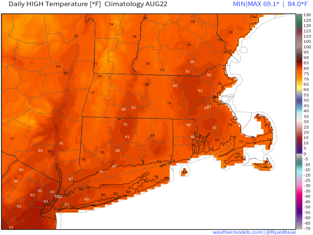
October has arrived, which means that 2018 is now 3/4 over. October can be an interesting month. We’ve had snow before, but we’ve also hit 90. Over average high temperatures start the month in the upper 60s, and end the month in the upper 50s. Most locations in our area will see their first frost during October in most years. Of course, October is also one of the best months of the year if you’re a sports fan. The Patriots season is in full swing, the Red Sox start the playoffs this week, the Bruins open their season this week, the Celtics start their season in a couple of weeks, and the Revolution…..ummm….sorry Revs fans, another disappointing season is almost over. What about the weather for this week? Well, we’re going to have another week with a little bit of everything (except snow).
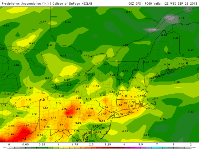
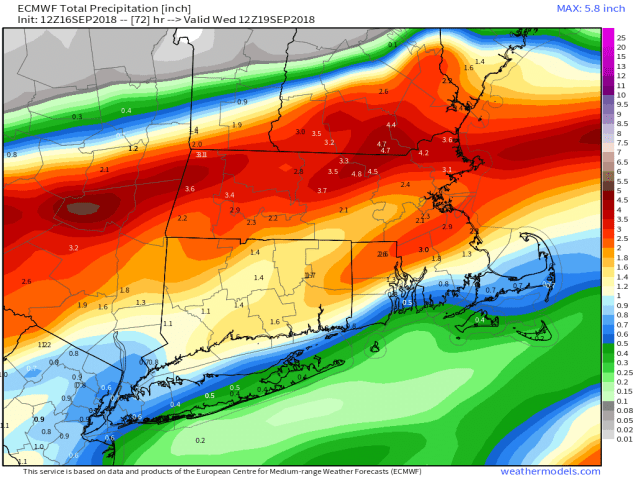
The week starts off with a backdoor cold front dropping down from the north. We’ll have a mild day ahead of it south of the Mass Pike, but a few showers are possible late in the day and tonight as the front moves through. The front will stall out near or just south of the region, and a wave of low pressure will ride along it on Tuesday. This will bring in a period of steadier rain. While some of the rain could be heavy, we’re not looking at a repeat of some recent systems that have dropped several inches of rain on the area.

High pressure builds in on Wednesday with drier conditions, but as the high slides offshore, another warmup is expected for Thursday. This warmup will be short-lived however, as another cold front brings in more showers Thursday night. Another high pressure area builds in for Friday and Saturday with dry and cooler conditions once again. It doesn’t look like there will be any weather problems aside from cool temperatures for Game 1 of the American League Division Series at Fenway on Friday, or Game 2 on Saturday (times still unknown), but we’ll keep an eye on things, as the pattern can change fairly quickly. By Sunday, high pressure moves offshore again, with another warmup expected across the area.
Monday: Some sunshine to start, especially south of the Mass Pike, then clouding up with showers developing during the afternoon. High 58-65 north of the Mass Pike, 65-72 south of the Pike.
Monday night: Mostly cloudy with a chance of showers along with some drizzle and fog. Low 51-58.
Tuesday: Cloudy with showers likely, possibly a period of some steady rain late in the day. High 59-66, possibly warmer south of the Mass Pike.
Tuesday night: Rain tapers off and ends, with some gradual clearing developing towards daybreak. Low 54-61 in the evening, with temperatures holding steady overnight, possibly rising a bit, especially south of the Mass Pike.
![]() Wednesday: Intervals of clouds and sunshine. High 67-74.
Wednesday: Intervals of clouds and sunshine. High 67-74.
![]()
![]() Thursday: Becoming mostly cloudy and breezy with a chance for a few showers during the evening. High 70-77.
Thursday: Becoming mostly cloudy and breezy with a chance for a few showers during the evening. High 70-77.
![]() Friday: Some early clouds, then becoming partly sunny, breezy., and cooler. High 59-66.
Friday: Some early clouds, then becoming partly sunny, breezy., and cooler. High 59-66.
![]() Saturday: Sunshine and a few clouds. High 60-67.
Saturday: Sunshine and a few clouds. High 60-67.
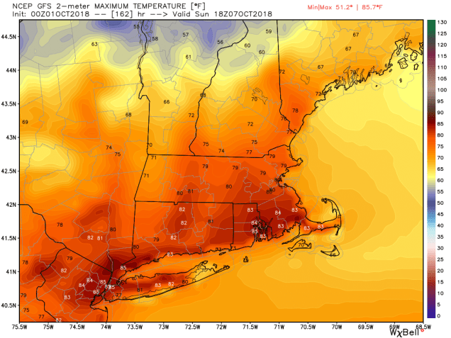
Sunday: Mostly sunny. High 70-77.