The weekend will start with heat and humidity, but that won’t last the entire weekend.
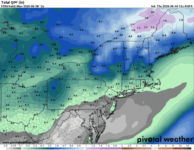
High pressure building in south of the region will result in increasing heat and humidity for Friday and Saturday. While we’ll have a few clouds around during the day on Friday, they’ll become more widespread on Saturday as a cold front begins dropping southward from Canada. A shower or thunderstorm is possible Saturday afternoon, but most of the activity should stay well north and west of our area. Showers and thunderstorms should become more widespread Saturday evening and night. A wave of low pressure will ride along the front on Sunday, bringing in more showers with much cooler temperatures, especially near the coast. We’re not expecting a soaking rain, but any rain we get will help with the ongoing drought. Unfortunately, the rain will fall on Sunday, so it will lead to a lot of complaints about another rainy weekend, despite the fact that most of Saturday will be dry. High pressure builds in for Monday with drier weather along with seasonably mild conditions.
Thursday night: Clear to partly cloudy. Low 55-62.
Friday: Sunshine with some afternoon clouds. High 83-90, cooler across Cape Cod.
Friday night: Partly cloudy. Low 59-66.
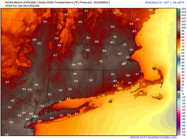
Saturday: Partly sunny, breezy, becoming humid, slight chance for a late-day shower or thunderstorm. High 85-92, cooler near the South Coast and Cape Cod.
Saturday night: Mostly cloudy with showers developing, possibly a thunderstorm. Low 60-67.
Sunday: Plenty of clouds with occasional showers. High 76-83, cooler across Cape Cod.
Sunday night: Showers end in the evening becoming partly cloudy overnight. Low 50-57.
Monday: Mostly sunny, breezy, not as humid. High 66-73.
