Another week gone by filled with heat and humidity, as well as some thunderstorms. Can we expect more of the same this week? Yes, at least for part of the week, though some subtle changes are coming.
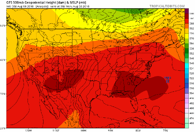
The reason for heat and humidity has been a persistent ridge of high pressure in the Eastern US for most of the past few weeks. As you can see in the loop above, that ridge is forecast to shift into the Western US later this week, while a trough of low pressure settles into the Northeast. What does that mean in terms of actual weather? We’ll explain.

With the ridge of high pressure in place aloft, we’ve also had high pressure at the surface, pumping warm and humid air into the region. That will continue today, and likely on Tuesday as well, though a frontal system approaching the region may produce a few showers and thunderstorms later Tuesday. That front will draw closer on Wednesday, likely moving through the region early Thursday. Ahead of it, more showers and thunderstorms are expected, some of which could be locally heavy. Depending on the timing of the front, severe weather is not out of the question. We’ll keep an eye on that as it gets closer.
We’ve had several fronts attempt to move through the region over the past few weeks, but as they run into that high pressure area at the surface and aloft, they end up stalling out and dissipating. With the ridge shifting westward and a trough of low pressure moving into the region, it will help provide enough impetus to help this front move offshore. Now, it’s not much of a “cold” front, as temperatures will still be warm to hot for the end of the week and into the weekend, but the most noticeable effect will be on the humidity. Humidity levels will drop on Thursday, with dewpoints in the upper 60s and 70s replace by dewpoints in the 50s to lower 60s for Thursday and Friday. Another frontal system may approach over the weekend, possibly bringing in some additional showers and thunderstorms, but also raising humidity levels a little.
Monday: Some patchy fog early, otherwise sunshine and some high clouds, humid. High 89-96.
Monday night: Mostly clear. Low 68-75.
Tuesday: Sunshine and some afternoon clouds, slight chance for a late-day shower or thunderstorm, humid. High 88-95.
Tuesday night: Partly cloudy, a few showers or thunderstorms are possible, mainly during the evening. Low 68-75.
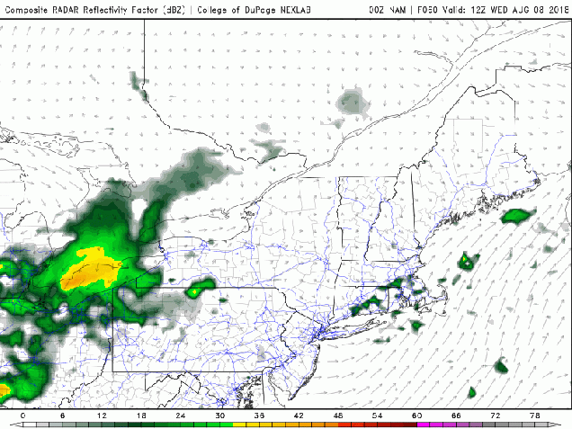
Wednesday: Partly sunny, with scattered showers and thunderstorms developing late in the day, with more possible overnight. High 84-91.
Thursday: Early showers and thunderstorms, then skies clear out in the afternoon. High 81-88.
Friday: A mix of sun and clouds, slight chance for a shower or thunderstorm. High 82-89.
Saturday: Partly sunny with some showers and thunderstorms possible. High 79-86.
Sunday: A mix of sun and clouds. High 79-86.
