The heat and humidity have finally departed. Don’t worry, the humidity will be coming back again this week, but only briefly. Then, once it leaves again, the heat might come back. Yup, we’ve got an interesting week coming up.

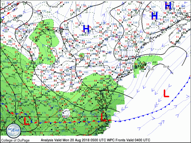
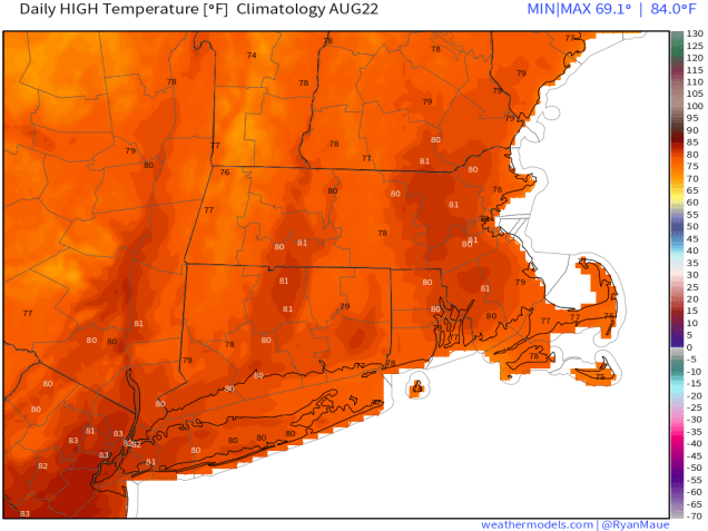
The week starts off with a frontal system stalled out south of New England and high pressure over New Brunswick. When you combine those two, you get a northeasterly flow, bringing in relatively cool and drier conditions. In the Spring, when water temperatures are only in the 40s or 50s this would result in temperatures in the 40s or 50s along the coast, while areas well inland might get into the 70s (or warmer). However, since it’s mid-August, water temperatures are in the lower to middle 70s, so a northeast wind means temperatures will be in the lower to middle 70s along the coast, and upper 70s to lower 80s inland.

Another cold front will start to move towards the area on Tuesday. We’ll have another relatively cool day, but clouds will start to move in. Tuesday night into Wednesday is when we notice bigger changes. A warm front moves through, bringing heat and humidity back into the area. With the warm and humid conditions will also be some thunderstorms. Much like many days over the past month or so, we’re not expecting any widespread severe weather, but a few places could get hit with a nasty storm that contains gusty winds and heavy downpours.
By Thursday, high pressure builds into the region, with seasonably warm conditions for the end of the week and into the weekend. Humidity levels will be fairly low to start, but should rise a bit for the weekend. While most of the region should remain dry as well, a few showers and thunderstorms are possible, mainly on Thursday as an upper-level low pressure area moves across the Northeast.

Monday: A few showers or some drizzle are possible in the morning, mainly south of Boston. Otherwise, intervals of clouds and sunshine, a little breezy, especially along the coast. High 71-78, coolest along the coast.
Monday night: Partly cloudy. Low 56-63.
Tuesday: Partly sunny. High 70-77.
Tuesday night: Mostly cloudy, showers and thunderstorms developing, mainly after midnight. Low 63-70.
Wednesday: Breezy with occasional showers and thunderstorms, some of which could be heavy at times. High 77-84.
Thursday: Partly to mostly sunny, slight chance for a pop-up shower or thunderstorm. High 73-80.
Friday: Sunshine and a few clouds. High 77-84.
Saturday: A mix of sun and clouds. High 78-85.
Sunday: Partly to mostly sunny. High 79-86.

Meanwhile, in the tropics, the Atlantic remains fairly quiet, but in the Pacific, we could have some trouble in paradise. As of early this morning, Hurricane Lane was centered a little more than 700 miles east-southeast of Hilo, Hawaii, moving towards the west at about 14 mph. Lane had maximum sustained winds around 120 mph. It is expected to gradually weaken over the next several days, while heading westward, before turning more toward the northwest. Where it makes that northwest turn is very important, as it will determine what, if any, impact Lane may have on Hawaii. At the very least, we’re looking some rough surf and some gusty winds, especially across the Big Island. However, a closer pass brings stronger winds and heavy rain in, possibly to more than just the Big Island. Hawaii doesn’t get direct hits very often. In fact, since their tropical cyclone records began in 1950, only 3 hurricanes have made direct hits on Hawaii – Hurricane Dot in 1959, Hurricane Iwa in 1982, and Hurricane Iniki in 1992 – all of which hit the island of Kauai . Dot and Iwa were both Category 1 storms when they hit, while Iniki was a Category 4 storm. There have been a lot more tropical storms that have hit the islands, and hurricanes that passed close enough to impact part of the island chain, but only those 3 have had direct impacts.
One thought on “Weekly Outlook: August 20-26, 2018”