Did you enjoy the past few weeks with the heat and humidity, or were you more happy with the lower humidity that we enjoyed on Sunday? No matter which you prefer, we’ve got both in the forecast for this week, but a lot more of one than the other (Hint: you’re gonna sweat a lot).
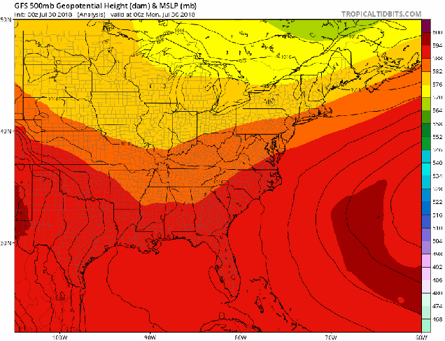
Once again, as is typical of summer, the general forecast is fairly simple. A “Bermuda High” will be anchored off the East Coast for most of the upcoming week. As a result, we get southwest winds pumping warm and humid air into the region. The high will actually start the week centered right over New England, which is why humidity levels will remain fairly low today. As the high slides offshore on Tuesday, a warm front will lift northward. That front may produce a few showers and thunderstorms late in the day, but once it moves through, it allows the humidity to come back in on Wednesday, and remain in place for the rest of the week.

With that warm and humid air in place, we can expect some showers and thunderstorms to pop up each afternoon. Some of these storms may produce heavy downpours and gusty winds in a few spots, but for the most part, we’re not looking at any widespread severe weather outbreaks. A few of the storms each day could become severe, but for the most part, we’re just looking at your typical garden-variety thunderstorms each afternoon. There are a couple of days where they could be a little stronger and a little more numerous. The first day is Wednesday. Low pressure will move across the Great Lakes, and try to bring a cold front into the region. The front will likely dissipate before it is able to move through, but it will create enough instability to help trigger more thunderstorms. The other day is Friday, when we have a similar setup. A frontal system will likely dissipate before it can get across the region, but will help to trigger more widespread showers and thunderstorms.
By next weekend, it looks like the heat will make a comeback as well. There are some indications that next week could end up being quite hot across the area for much of the week, but it’s still a little early to make that call, plus, not all of the models are showing this possibility.
Monday: Sunshine and some high clouds. High 79-86.
Monday night: Thickening clouds. Low 61-68.
Tuesday: Partly to mostly cloudy, more humid, chance for a few showers. High 79-86.
Tuesday night: Mostly cloudy, chance of a shower. Low 64-71.
Wednesday: Intervals of clouds and sunshine with scattered showers and thunderstorms possible. High 81-88.
Thursday: Partly sunny, chance for afternoon showers and thunderstorms. High 83-90.
Friday: More clouds than sun with scattered showers and thunderstorms. High 81-88.
Saturday: Partly to mostly sunny, chance for some showers and thunderstorms, especially early in the day. High 81-88.
Sunday: Sunshine and a few clouds. High 86-93.
