The forecast for the upcoming week is both simple, and not-so-simple at the same time. If it feels like you’ve heard this before, it’s because you have. The pattern has remained fairly persistent for a while now, but the subtle details make all the difference.
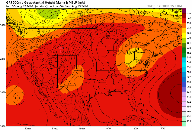
That stubborn Bermuda High remains in place off the East Coast for much of the week, which means the warm and humid pattern that we’ve been in for a while will continue. However, there are some differences in the pattern that will have other impacts. A frontal system remains stalled out near the East Coast. With an upper-level low pressure system across the Northeast, we’ll have little impulses of energy move through, bringing in some rounds of showers and thunderstorms over the next few days. None of these days will be a washout, and some of the rain will be very localized, but anything that does form could produce some heavy rainfall. This was the case over the weekend, when localized totals of 4 to as much as 8 inches produce flash flooding in a few spots.

The upper-level low moves out by mid-week, resulting in less showers and thunderstorm activity, and an increase in temperatures once again. Don’t worry, humidity levels will remain moderate to high right through the week. We could be looking at some places topping 90 again during the latter half of the week. By the weekend, another cold front (an another upper-level trough of low pressure) will approach the region. That means that we could be looking at more showers and thunderstorms. Again, we’re not expecting either day to be a washout right now, so don’t go cancelling any plans just yet. However, we’d have a backup plan ready, just to be safe. With the airmass remaining quite humid, we’d expect any showers and storms next weekend to again produce some locally heavy rainfall.
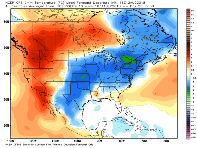
So, how much longer will this pattern last? We usually don’t delve into forecasts beyond 7 days, as the models don’t show a lot of skill beyond that, but for now, it looks like we’re locked in for at least a couple more weeks. Beyond that? There are some signs that we could shift into a cooler pattern as we get into early September. Obviously, this is not written in stone, and the cool weather may not even last too long. However, it can’t stay warm and humid forever. The days are getting shorter, meteorological autumn starts in less than 3 weeks, astronomical autumn starts in less than 6 weeks, and most importantly, the Patriots open the regular season 4 weeks from yesterday. Before you know it, we’ll be talking about that 4-letter word that begins with “s” that so many of you hate.
Monday: Intervals of clouds and sunshine, chance for some showers, maybe a rumble of thunder. High 73-80.
Monday night: Partly to mostly cloudy, maybe a lingering shower or two. Low 65-72.
Tuesday: Partly sunny, some showers and thunderstorms are possible, mainly in the afternoon. High 78-85.
Tuesday night: Partly cloudy, a few lingering showers are possible. Low 64-71.
Wednesday: A mix of sun and clouds, slight chance for a shower. High 81-88.
Thursday: Partly to mostly sunny, a pop-up shower or thunderstorm may develop in the afternoon. High 83-90.
Friday: Sunshine and some afternoon clouds, a few showers or thunderstorms can’t be ruled out. High 83-90.
Saturday: Partly sunny, chance for some showers and thunderstorms. High 79-86.
Sunday: More clouds than sunshine, more showers and thunderstorms are possible. High 74-81.
