Weekly Outlook: July 6-12, 2026

You’ve heard us use the phrase “When in drought, leave it out” in relation to rainfall plenty of times. There is a corollary to that phrase – “Droughts end in floods”, which we’re going to use for the next few days.

Excessive rainfall is likely today into early Tuesday. Images provided by the Iowa Environmental Mesonet at Iowa State University.

The front that brought an end to the heat Saturday night has stalled out south of New England, and a wave of low pressure will ride along it over the next day or so. This will result in periods of rain, some of it heavy at times later today into a good chunk of Tuesday, mainly south of the Mass Pike. Many of the forecast models are showing the potential for 2-4 inches of rain, with amounts in excess of 6 inches possible. Pinpointing where these tropical downpours will be the heaviest is a fool’s errand, but that much rain in a short period of time, even with the ongoing drought, will result in areas of flooding. That’s why Flood Watches have been issues for much of Rhode Island and southeastern Massachusetts, as this is where the heaviest rain is expected. The question is, how much rain falls north of the Mass Pike? While there are some models that bring the heavy rain all the way into southern New Hampshire, many of them have the amounts taper off quickly north of the Pike, with little rainfall once you get into southern New Hampshire. With the cloudcover and rainfall, temperatures will be quite cool, with many places staying in the 60s, especially on Tuesday, The showers wind down Tuesday night, then high pressure builds in with gradually improving conditions on Wednesday, though temperatures will remain below normal. Very warm weather returns for Thursday as high pressure moves offshore, with some places getting back to 90. This heat will be short-lived, as another cold front moves through on Friday with some showers and thunderstorms. High pressure brings cooler and drier weather in for Saturday, with temperatures turning a bit warmer again on Sunday.
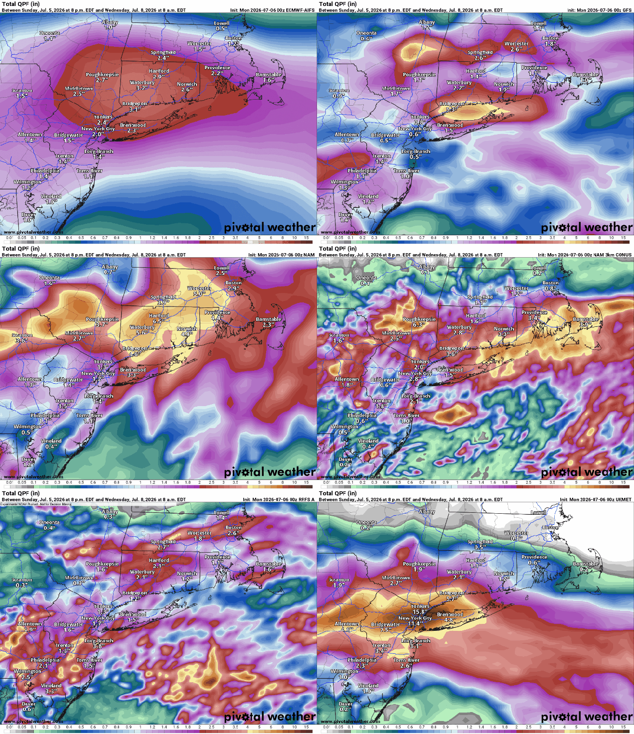
Many of the models are forecasting some very heavy rainfall, especially south of the Mass Pike. Images provided by Pivotal Weather.

Monday: Cloudy with periods of rain and showers, mostly south of the Mass Pike. High 69-76.

Monday night: Rain likely, heavy at times south of the Mass Pike. Low 57-64.

Tuesday: Rain during the morning, tapering off to showers in the afternoon. High 64-71.

Tuesday night: Showers ending during the evening, some clearing may start late at night, mainly north and west of Boston. Low 55-62.

Wednesday: Becoming partly to mostly sunny. High 75-82, a little cooler near the coast.

Wednesday night: Clear to partly cloudy. Low 61-68.

Thursday: Sunshine and some afternoon clouds. High 85-92, cooler near the South Coast and Cape Cod.

Thursday night: Partly cloudy. Low 65-72.

Friday: Partly sunny with some showers and thunderstorms likely in the afternoon. High 83-90.

Saturday: Mostly sunny. High 79-86.

Sunday: Partly to mostly sunny. High 78-85.
Weekend Outlook: March 13-16, 2026

After an early taste of Spring this week, Mother Nature is going to remind us that it’s still March, and astronomical Spring doesn’t start for another week.

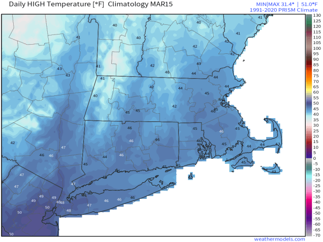
Average high temperatures for mid-March are in the middle 40s. Image provided by weathermodels.com

A wave of low pressure will ride along the cold front that crossed the region earlier today, bringing in some additional precipitation this evening. We’ll see rain changing over to sleet and then snow during the late afternoon and evening, ending before midnight. Some places could see a coating to perhaps an inch of accumulation, mainly on grassy surfaces, before everything winds down. We’ll see some clearing overnight, but clouds quickly move back in on Friday. A fast-moving system will bring in some snow or rain showers Friday evening. There probably won’t be much accumulation, and what little there is, will be mainly on grassy surfaces, and mainly north of Route 2. Gusty winds behind the system will bring colder air back in for Saturday, with wind chills in the 20s and 30s during the daytime as air temperatures only get into the lower to middle 40s. Sunday looks to be a dry and seasonably cool day, but more changes are coming.

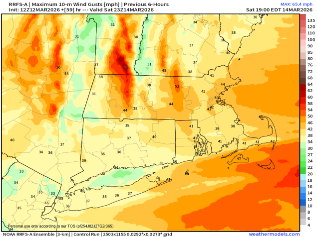
Wind gusts of 35-45 mph or higher are expected Saturday afternoon. Image provided by Weathermodels.com

A storm system that may produce blizzard conditions across the Great Lakes will begin heading towards southeastern Canada later Sunday. We’ll see some rain moving in Sunday night ahead of a warm front. Once the front moves through, rain will taper off Sunday morning, with gusty southerly winds bring much warmer air back in, with many places likely reaching 60 again on Monday. As a cold front trailing the system heads our way, we’ll see rain moving back in late in the day, and it could be heavy, with a rumble of thunder possible as well. While we do need the rain to help put a dent in the ongoing drought, the ground remains frozen in much of the region, so a lot of the rain won’t seep in. Many rivers are also running high due to some recent rain and melting snow, so another round of heavy rain could lead to some flooding.

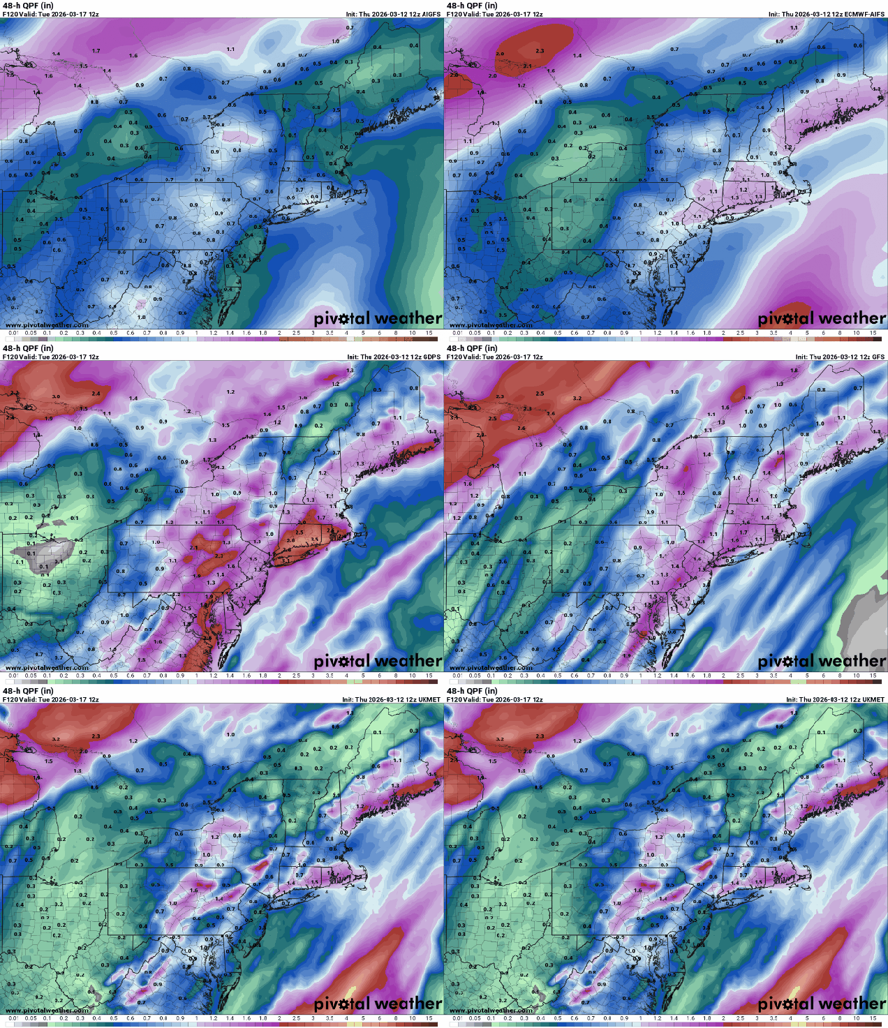
Much of the region could see an inch or more of rainfall on Monday. Images provided by Pivotal Weather.

Thursday night: Snow, sleet, and rain ending during the evening, less than 1 inch accumulation, mainly on grassy surfaces, skies clear out overnight. Low 24-31.

Friday: Sunny in the morning, clouds return in the afternoon, snow or rain showers possible by evening, becoming breezy. High 36-43.

Friday night: Partly to mostly cloudy and breezy with some snow or rain showers likely, mainly north of Route 2, and mostly before midnight. Low 30-37.

Saturday: Sunshine and a few clouds, windy. High 40-47.

Saturday night: Clear skies, clouds may start to move back in late at night. Low 23-30.

Sunday: Becoming partly to mostly cloudy. High 38-45.

Sunday night: Cloudy with rain developing. Low 31-38 during the evening, temperatures start rising after midnight.

Monday: Rain tapers off early, then mostly cloudy and windy with more rain by late in the day, possibly a rumble of thunder. High 54-61, coolest across the South Coast and Cape Cod.