Weekly Outlook: April 11-17, 2022

With both Opening Day at Fenway and Easter coming up this week, the forecast will be under a bit more scrutiny. As you might expect in mid-April, we’ve got a rather typical springtime pattern coming up this week, which means it’ll be warm, cool, dry, and wet. Let’s try to make some sense of that.

You know the summer is not far away when Opening Day at Fenway arrives.

We start off with high pressure building in today, giving us some sunshine and seasonably mild temperatures. Clouds start to stream in tonight ahead of low pressure heading toward southeastern Canada. That system will send a warm front toward the region early Tuesday, with some showers likely Monday night into Tuesday morning. We’ll clear out in the afternoon and turn milder before a cold front moves through during the afternoon with little fanfare. High pressure builds back in for Tuesday night into Wednesday before the next system starts to head toward the region.

The next system will be making headlines across the nation for a few days before it arrives. It’ll produce heavy rain and mountain snow in the Northwest and Northern California, a blizzard in the Northern Plains, and widespread severe weather from the Central and Southern Plains into the Mississippi Valley. None of that is expected here, but we will have some rain, which could be heavy at times on Thursday. Temperatures will be highly dependent on how far north the warm front ahead of the systems gets. South of the front, temperatures could soar into the 70s, while north of the front, it could stay in the 40s and 50s. As the system drags a cold front through late Thursday, the rain will end, and so will any of the warm weather that moves in. High pressure builds in for Friday with drier and a return to seasonable temperatures. For the Red Sox home opener on Friday at Fenway, for now it looks to be partly sunny with temperatures somewhere around 60.

Thursday could potentially be a very warm day for at least part of the area. Image provided by WeatherBell.

Next weekend presents some question marks. The models all handle the following system differently, not only from model to model, but from run to run. So, we’re looking at another period of rain and cooler temperatures at some point between Saturday and Monday, but we’re not quite sure when. Some models have even hinted at the potential for a little snow in the hills or even southern New Hampshire. So, what you see below represents our best thinking for now, but realize that it will almost certainly change by the time we get to our Weekend Outlook on Thursday. With Sunday being Easter, and next Monday being Patriots Day, a.k.a. Marathon Monday, the forecast is fairly important, so we hope to have a fairly good idea of what to expect by Thursday.
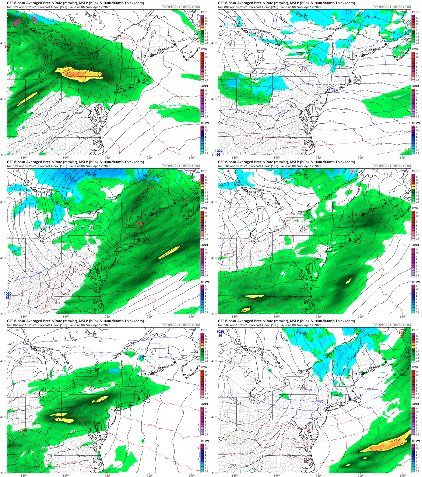
The GFS can’t decide from one run to the next if Easter will be wet or dry. Images provided by Tropical Tidbits.

Monday: Mostly sunny, clouds start to move in late in the day. High 55-62.

Monday night: Becoming cloudy with showers developing. Low 39-46.

Tuesday: Showers end early, becoming partly to mostly sunny in the afternoon. High 62-69.

Tuesday night: Clear to partly cloudy. Low 39-46.

Wednesday: Morning sun, increasing afternoon clouds, showers develop at night. High 60-67.

Thursday: Mostly cloudy with occasional rain and showers. High 62-69, potentially even warmer south of the Mass Pike, but potentially much cooler from the North Shore to the New Hampshire Seacoast.

Friday: Partly sunny. High 60-67.

Saturday: A mix of sun and clouds, breezy, chance for showers. High 60-67.

Sunday: Intervals of clouds and sun, breezy, showers possible. High 52-59.

Weekend Outlook: April 8-11, 2022

Some wet weather is on the way, but none of the upcoming days looks like a washout.

Low pressure will move across New England tonight, with another period of rain likely, some of which could be heavy overnight. The rain should end Friday morning as low pressure starts to pull away, with some sunshine developing in the afternoon. Some additional clouds will pop up, and there’s a very slight chance for a shower, but for the most part, Friday afternoon may end up fairly decent. Another weak disturbance moves in late Friday night into Saturday morning with more showers, then we’ll start to see some sunny breaks in the afternoon once again. An upper-level low moves across the Northeast on Sunday, so we’ll see more clouds pop up, with a few showers possible in the afternoon. High pressure then builds in for Monday with sunshine and drier weather.

The heaviest rain should stay well to our west, but a decent amount of rain is expected over the next few days locally. Image provided by WeatherBell.

For Opening Day in the Bronx on Friday, for the first pitch at 1:05pm, it should be partly to mostly sunny, southwest winds around 10 mph, and a temperature near 60. Play Ball!

It’s a little late, but Opening Day as finally arrived. Image provided by MLB.

Thursday night: Cloudy and breezy with rain likely, possibly heavy, maybe even a thunderstorm, especially south of Boston. Low 39-46.

Friday: Showers end early, then some clearing, but we could see another spot shower in the afternoon, breezy. High 60-67, cooler along the South Coast.

Friday night: Partly to mostly cloudy, showers possible late at night. Low 37-44.

Saturday: Morning showers, then becoming partly sunny and breezy again. High 54-61.

Saturday night: Partly cloudy. Low 35-42.

Sunday: Intervals of clouds and sun, chance for a few showers. High 50-57.

Sunday night: Partly cloudy. Low 34-41.

Monday: Partly to mostly sunny. High 55-62.

Weekly Outlook: April 4-10, 2022

Better enjoy today, because much of the upcoming week isn’t looking that nice.

High pressure builds in today with some sunshine and seasonably mild temperatures, but that will be enough to make this the best day of the week. Tuesday might not be that bad either, with some sunshine in the morning, but clouds will start to move in during the afternoon ahead of a low pressure system heading toward the Mid-Atlantic states. That system will pass south of the region Tuesday night into Wednesday with rain likely. Wednesday just looks like a cool, damp day, not that unusual for early April. Temperatures may be marginally cold enough for some wet snow across central and possibly southern New Hampshire, but any accumulation would likely be confined to grassy surfaces, and mainly before daybreak Wednesday. Again, this is not that unusual for early April.

Daytime temperatures on Wednesday will be 5-10 degrees below normal across the region. Image provided by Weathermodels.com

That system will pull away later on Wednesday, but another one quickly follows for Thursday into Friday. This one will bring another round of rain in, and it could be heavy once again. In fact, Thursday looks like a washout at this point. The Red Sox are scheduled to open the season at Yankee Stadium at 1pm Thursday, and the odds of that game happening look pretty slim at this point. Expect it to be bumped to Friday afternoon.

It’s a little late, and possibly a day later than we’re hoping, but Opening Day has finally arrived. Image provided by MLB.

That system will pull away late Friday, but an upper-level low moves into the Northeast for the weekend, keeping plenty of clouds around, with a few showers possible each afternoon. We also have to keep an eye on a storm system offshore, but right now, it looks to be too far offshore to have any impact, expected possibly bringing some showers to the Outer Cape.

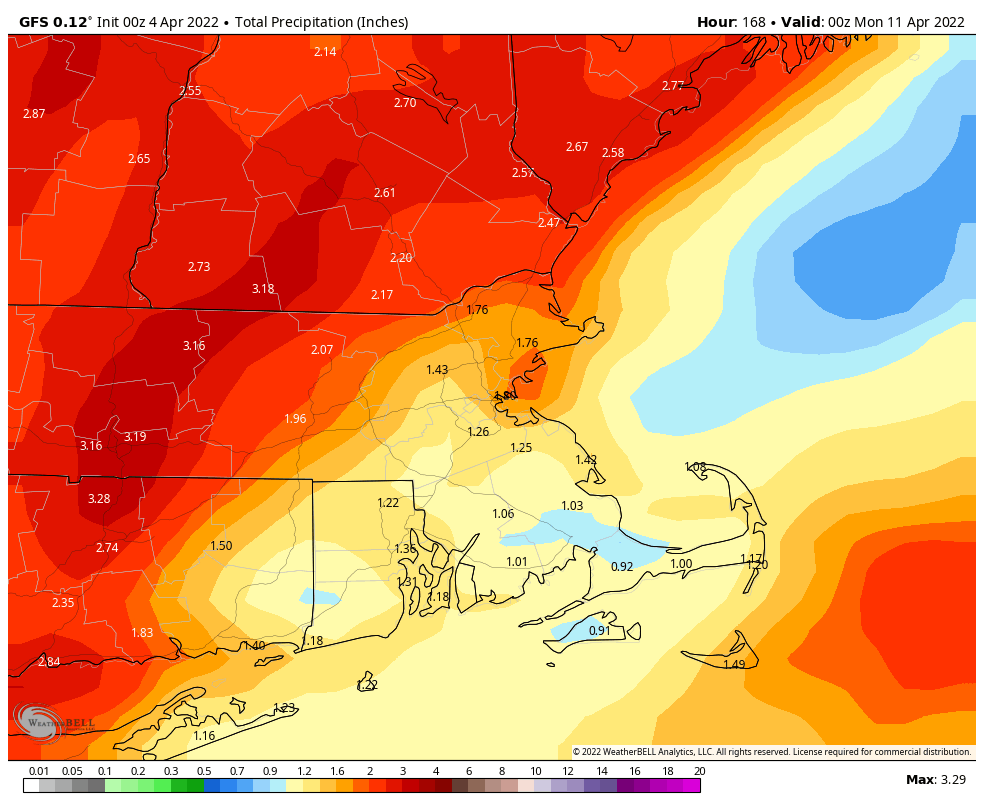
Parts of the region could pick up a decent amount of rain between now and next weekend. Image provided by WeatherBell.

Monday: A mix of sun and clouds. High 49-56.

Monday night: Partly cloudy. Low 30-37.

Tuesday: Morning sunshine, increasing afternoon clouds. Showers may develop near the South Coast late in the day. High 54-61.

Tuesday night: Cloudy with showers likely, possibly mixed with wet snow across central New Hampshire. Low 36-43.

Wednesday: Periods of rain and showers, tapering off by evening. High 44-51.

Thursday: Rain likely. High 47-54.

Friday: Plenty of clouds with more showers, possibly some afternoon sunny breaks. High 59-66.

Saturday: A mix of sun and clouds, chance for a shower. High 56-63.

Sunday: More clouds than sun, a shower or two possible. High 51-58.

Finally, we’ll mention that the models are showing the potential for a significant warmup next week. While we wouldn’t be surprised if there’s at least one very warm day in there, we’re skeptical that an extended warmup is on the way. For one, the water is still very cold, leaving us susceptible to seabreezes or even back-door cold fronts that will bring in much cooler air off the Atlantic. Also, if the upper-level ridge sets up a bit too far to the west, we stay on the cooler side of things. As we said, some of the models show a significant warmup, but beyond a day or two in the middle of next week, they haven’t been consistent is showing it lasting into the end of the week or beyond. We’ll obviously delve more into this next weekend.

Weekend Outlook: April 1-4, 2022

We’ve got a fairly typical pattern for Spring as we pass the quarter pole for 2022 and begin April.

A cold front will approach the region tonight with some rain and showers likely, possibly even a thunderstorm. The rain ends Friday morning as the cold front moves through, but the air behind it isn’t that cold, so we’ll remain mild during the day. However, another cold front quickly follows during the evening, with another shower possible ahead of it. High pressure builds in for Saturday with sunshine and seasonably cool temperatures. Clouds return Saturday night as another weak system approaches the region. It may produce a few showers on Sunday, but a washout is not expected. High pressure then builds back in for Monday with dry and cool conditions.

Average high temperatures for the first few days of April should be in the lower to middle 50s. Image provided by Weathermodels.com

Thursday night: Cloudy and breezy with rain and showers likely, possibly a thunderstorm. Low 47-54.

Friday: Showers end early, otherwise clouds with some afternoon sunny breaks, chance for another shower late in the day, breezy. High 55-62 in the morning, temperatures may start to drop a little in the afternoon.

Friday night: Chance for a shower during the evening, then clearing overnight, still breezy. Low 28-35.

Saturday: Plenty of sunshine. High 48-55.

Saturday night: Increasing clouds. Low 29-36.

Sunday: Mostly cloudy with showers possible during the afternoon. High 47-54 in the morning, temperatures may drop in the afternoon.

Sunday night: Showers end in in the evening, followed by late-night clearing. Low 31-38.

Monday: Partly sunny. High 49-56.

Weekly Outlook: March 28-April 3, 2022

No, Mother Nature is not playing an early April Fool’s joke on us, today really will be quite chilly.

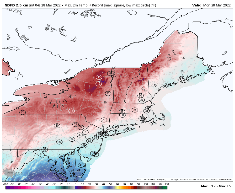
The week starts out on a very chilly note as an upper-level low pressure system slowly moves across the Northeast. We’ll have some sunny breaks today but there will be plenty of clouds and possibly a few snow showers or flurries during the afternoon and evening. Temperatures will be well below normal for late March, with highs only in the 30s, possibly upper 20s in some spots. This will likely break records for the lowest high temperature for the date across much of the Northeast. Add in gusty winds, and wind chills will only be in the teens (or colder), so bundle up if you’re heading outside today. Skies will clear out tonight as high pressure builds in, resulting in a rather cold night, possibly setting low temperature records in spots, as lows drop into the teens in many locations.

Record low high temperatures are likely across much of the Northeast today. Image provided by WeatherBell.

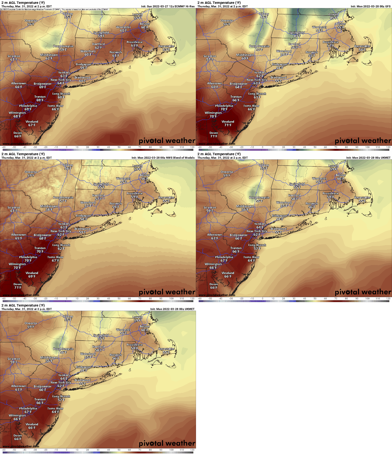
High pressure starts to slide off to the east on Tuesday, allowing temperatures to begin to moderate, but it will remain on the chilly side. Wednesday should be milder, but clouds will start to stream into the region as a complex low pressure system heads into the Great Lakes. That system will send a warm front toward the region on Thursday. Ahead of the warm front, we could see a little snow or sleet Wednesday night, especially across the interior. Milder air should eventually move in for Thursday as the warm front finally pushes through, but rain showers are likely Thursday night into early Friday before the storm sends a cold front across the region. How quickly that warm front moves through on Thursday will determine our temperatures. Some of the guidance is showing the potential for temperatures well into the 60s, but some of the models don’t bring the warmer air into the Merrimack Valley or southern New Hampshire until late afternoon or evening, resulting in a much cooler day. Steady rain ends early Friday, but some showers could linger during the day. Next weekend looks dry and cooler as high pressure builds back in.

Depending on how quickly the warm front moves through, Thursday could be quite mild. Images provided by Pivotal Weather.

Monday: Intervals of clouds and sunshine, blustery, chance for a few snow showers or flurries. High 27-34.

Monday night: Becoming clear to partly cloudy, breezy, and cold. Low 14-21.

Tuesday: Morning sun, afternoon clouds, still breezy. High 34-41.

Tuesday night: Mostly clear. Low 19-26.

Wednesday: Early sun, then clouds increase and thicken. A few showers possible at night, maybe mixed with sleet or snow across the interior. High 42-49.

Thursday: Cloudy and breezy with showers likely. High 55-62, possibly a little cooler across southern New Hampshire.

Friday: More clouds than sunshine, breezy, chance for a few more showers. High 56-63.

Saturday: Partly sunny, breezy, and cooler. High 46-53.

Sunday: A mix of sun and clouds. High 50-57.

Weekend Outlook: March 25-28, 2022

The weather won’t exactly be that great for the next few days, but it could be a lot worse.

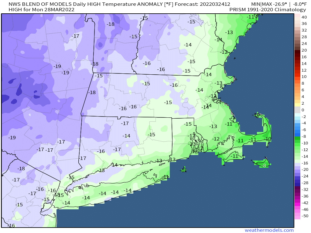
Rain will become steadier and heavier this evening and tonight as low pressure passes south and east of Cape Cod. The rain should taper off and end toward daybreak, then we’ll see some clearing, and temperatures will actually turn a bit milder for Friday afternoon. However, an upper-level low pressure system will slowly make its way into the Northeast, and will take all weekend to do so. What that means for actual weather is we’ll have sunshine in the morning, then clouds will develop, with a few pop-up showers both Saturday and Sunday. Temperatures will also be a bit cooler. In fact, with cold air aloft, some of those showers could contain some graupel, which is small, soft hail. Even colder air moves in for Monday, which will feel more like winter than spring, with temperatures likely in the 30s for highs. Don’t be surprised if there’s a snow flurry or two as that upper-level low will be slow to depart.

Temperatures will be 10-15 degrees below normal on Monday. Image provided by Weathermodels.com

Thursday night: Rain likely, tapering off toward daybreak. Low 37-44.

Friday: Any lingering showers end early, some clearing during the afternoon. High 55-62.

Friday night: Clear to partly cloudy. Low 34-41.

Saturday: Sunshine and afternoon clouds, chance for a shower or two. High 50-57.

Saturday night: Partly cloudy. Low 32-39.

Sunday: Partly sunny, breezy, chance for a shower or two. High 45-52.

Sunday night: Partly cloudy. Low 20-27.

Monday: A mix of sun and clouds, breezy, slight chance for a rain or snow shower. High 31-38.

Weekly Outlook: March 21-27, 2022

Now that Spring has officially arrived, cooler weather will return.

The week starts off with high pressure building into eastern Canada, providing us with sunshine and seasonably cool conditions for today and Tuesday. By Wednesday, that high will start to slide eastward as low pressure heads toward the Great Lakes, sending some clouds our way. Precipitation looks to spread in Wednesday night, and there may be enough cold air in place that allows it to start as some snow or a wintry mix, at least across the interior. Everything should go over to plain rain on Thursday, and some of it could be heavy as a secondary area of low pressure develops nearby and moves right across the region. Rain ends early Friday as that low pulls away, but with another upper-level low pressure area slowly moving in, we’ll start have a decent amount of cloud cover along with the threat of some pop-up showers Friday afternoon. For the weekend, that upper-level low will cross the Northeast, and a new area of low pressure will develop at the surface near the Mid-Atlantic coast. While the surface low may be too far offshore to have much impact, it may interact with the upper-level low to produce some additional rain or snow showers next weekend.

Around an inch of much-needed rainfall us expected later this week. I age provided by WeatherBell.

Monday: Sunshine and a few afternoon clouds, breezy. High 47-54.

Monday night: Clear to partly cloudy. Low 29-36.

Tuesday: Partly to mostly sunny and breezy. High 43-50.

Tuesday night: Clear to partly cloudy. Low 25-32.

Wednesday: Some sun in the morning, then clouds move in during the afternoon with rain or snow showers developing in the evening. High 41-48.

Thursday: Cloudy with rain likely, possibly some wintry mix across the interior during the early morning. High 42-49.

Friday: Rain ends early, otherwise plenty of clouds and a few sunny breaks, slight chance for an afternoon shower. High 52-59.

Saturday: More clouds than sunshine with a rain or snow shower possible. High 47-54.

Sunday: Partly to mostly cloudy with a chance for a few rain or snow shower. High 45-52.

Weekend Outlook: March 18-21, 2022

If there’s one constant to expect this weekend, it’s change. We’ve got some big swings coming up over the next few days.

Showers end this evening as low pressure pulls away to the south and east of New England. High pressure builds into the region for Friday with a very mild airmass accompanying it on southwest to west winds. With sunshine during the day, we’ll see temperatures get well into the 60s for much of the area, with lower 70s likely at many locations away from the coast. Right along the coastline, especially the South Coast, a seabreeze is likely, and with water temperatures still in the 40s, we’ll see temperatures drop into the 40s right at the water’s edge, with 50s a short distance inland. Clouds will start to move in late in the day as low pressure begins to approach the Northeast. Rain will move in early Saturday morning along with much cooler conditions. In fact, Saturday does not look like a pleasant day, with occasional rain and temperatures only in the upper 40s to lower 50s. Sunday looks a little better, but with an upper-level low crossing the Northeast, we’ll still have some clouds and possibly a few showers, with temperatures again mainly in the 50s, which is actually above normal for mid-March. High pressure starts to build back in on Monday with partly to mostly sunny skies, but temperatures will be a few degrees cooler, right around where we should for the middle of March.

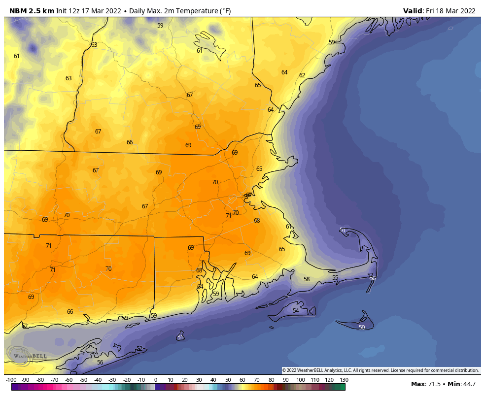
Friday should be a very mild day for most of the region. Image provided by WeatherBell.

Thursday night: Showers ending by midnight, some clearing late at night. Low 40-47.

Friday: Partly to mostly sunny and mild, clouds start to increase late in the day. High 65-72, cooler along the coast.

Friday night: Becoming cloudy with rain developing before daybreak. Low 39-46.

Saturday: Cloudy and cooler with occasional rain and showers. High 48-55.

Saturday night: Mostly cloudy with rain ending during the evening. Low 43-50.

Sunday: Intervals of clouds and sunshine with a few showers possible, breezy. High 55-62.

Sunday night: Partly cloudy. Low 34-41.

Monday: Partly to mostly sunny, breezy at times. High 49-56.

Weekly Outlook: March 14-20, 2022

Astronomical spring begins on Sunday at 11:33am, but we’re already 2 weeks into meteorological spring, and this week it will feel like it.

High pressure slides offshore today, allowing for milder air to move back into the region. Tuesday looks to be mild as well, but a cold front will be dropping southward with a weak area of low pressure riding along it. This may bring in a few showers Tuesday night, possibly even mixed with a little wet snow across central and southern New Hampshire. That front will stall out nearby, so areas to the south may stay mild on Wednesday, but much of the region will be on the cooler side, though still a little above normal for mid-March. Thursday looks to be similar with some clouds and possibly even a few showers as another low pressure system passes by to the south. This brings us to Friday, which is most definitely the pick of the week.

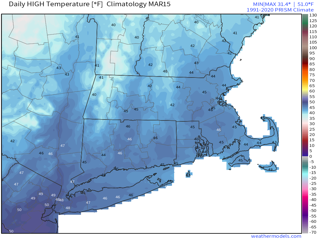
On average, high temperatures in mid-March are usually in the middle 40s. Image provided by Weathermodels.com

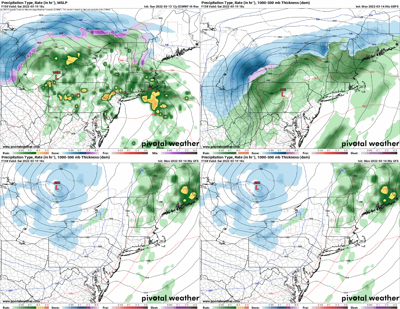
Low pressure will head into the Great Lakes, sending a warm front across the region. With some sunshine and southwesterly winds, temperatures should get well into the 60s away from the South Coast, with lower 70s possible. Saturday’s forecast is a bit trickier. That storm system will head into southeastern Canada, with 1 of 2 things possibly happening – We could have another very warm day with showers developing ahead of a cold front or a secondary area of low pressure develops off the Mid-Atlantic coast, resulting in more rain and significantly cooler temperatures. We’re going to lean towards the first scenario for now, but are cognizant of the fact that the second one is just as likely to happen. Either way, Sunday looks drier and seasonably cool.

The models don’t agree on what will happen on Saturday. Images provided by Pivotal Weather.

Monday: Sunshine and some afternoon clouds. High 47-54.

Monday night: Mostly cloudy. Low 34-41.

Tuesday: Plenty of clouds with a few late-day showers possible, mainly north of the Mass Pike. High 55-62, a little cooler across southern New Hampshire.

Tuesday night: Mostly cloudy with showers during the evening north of the Mass Pike, possibly mixed with snow across southern New Hampshire. Low 32-39.

Wednesday: Becoming partly to mostly sunny. High 51-58, cooler along the coast.

Thursday: Intervals of clouds and sun, chance for a shower, especially near the South Coast. High 56-63.

Friday: A mix of sun and clouds. High 64-71, cooler along the South Coast.

Saturday: Cloudy and breezy with showers likely, ending in the afternoon. High 50-57.

Sunday: Partly sunny, breezy, and cool. High 51-58.

Weekend Outlook: March 11-14, 2022

While the clocks “spring ahead” with Daylight Saving Time beginning this weekend, we’ll still be dealing with winter at times.

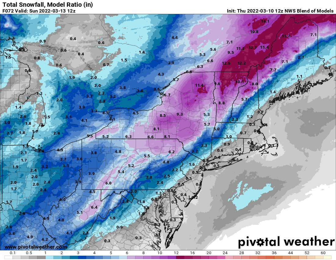
High pressure remains in control into Friday with generally dry weather. We’ll be on the chilly side tonight, but temperatures should rebound nicely on Friday, though we’ll see clouds streaming in and thickening up late in the day. This is in advance of a developing low pressure system that will impact us on Saturday. Earlier in the week, it looked like this system would pass west of us, with strong southerly winds bringing in very mild air and rainfall. Well, the latest indications are that the storm will pass right across southern New England, or possibly even south of it. This means that it won’t be as windy or warm as we were thinking earlier, but we’re not looking at a major snowstorm, it’ll still be too mild. We’ll have rain developing by daybreak Saturday, and it could be heavy at times during the day. It may still be quite breezy along the South Coast and across Cape Cod if the system does move across southern New England. Once it passes by during the afternoon it will continue to intensify, with strong northwest winds behind it ushering much colder air back in by late in the day. This will likely result in the rain changing to snow before it ends in the evening. How quickly it changes over and how quickly it moves out will determine whether the snow will accumulate. Right now, the best odds for any accumulation will be from central Massachusetts into southwestern and central New Hampshire. Farther north and west, this will be quite a storm for ski country, which is good news for them.

This storm will be good news for ski country. Image provided by Pivotal Weather.

Behind the storm, we’ll clear out for Saturday night and Sunday with high pressure building in. It will be breezy and quite chilly, but this won’t last long. Winds will subside Sunday afternoon, and as the high moves off to the east, temperatures will moderate nicely on Monday.

Thursday night: Clear to partly cloudy. Low 24-31.

Friday: Some morning sun, then increasing and thickening clouds. High 46-53.

Friday night: Mostly cloudy, rain develops before daybreak. Low 31-38.

Saturday: Rain, heavy at times, possibly changing to snow late in the day, becoming windy. High 45-52, possibly a little warmer across southeastern Massachusetts and Rhode Island. Temperatures will quickly drop during the afternoon

Saturday night: Windy with rain or snow showers ending in the evening, clearing late at night. Low 16-23.

Sunday: Sunshine and some afternoon clouds. High 30-37.

Sunday night: Clear to partly cloudy. Low 23-30.

Monday: Mostly sunny, some clouds may pop up in the afternoon. High 46-53.