Warm weather is finally here, and with it mostly dry weather, but that’s not a completely good thing.
High pressure will continue to build into the region over the next few days before sliding offshore. At the same time, the low pressure that has been sitting off the East Coast for the last several days while move into the Southeast and dissipate, but that doesn’t mean it won’t impact our weather.

With winds still coming off the ocean, we’ll have plenty of moisture around tonight, resulting in low clouds and fog, especially along the coastal plain. Once it burns off Friday morning we’ll have partly to mostly sunny skies, though the clouds may hang tough across parts of southeastern Massachusetts and Cape Cod. Areas that break out into the sunshine should see temperatures well into the 70s and 80s thanks to southerly winds, though that will keep areas with south-facing coastlines significantly cooler. We may see a little fog Friday night once again. By Saturday, winds will shift into the southwest, resulting in warm weather across most of the region, except for south-facing shorelines once again. We’ll probably have a bit more cloudcover across the region, but it will still be at least partly sunny. A couple of showers and thunderstorms may pop up during the afternoon across the interior. Sunday looks to be similar, but showers may be a bit more numerous as the moisture from that old low pressure system works its way up the coastline. The day won’t be a washout by any means, but if you’ve got outdoor plans in the afternoon, keep an eye on the sky (or the radar).
By Monday, we’ll have a cold front approaching from the west. It’ll still be quite warm, but we’ll have more clouds, and more widespread showers and thunderstorms, mainly late in the day. Given how dry it’s been lately, we actually need the rain, though it doesn’t look like this will produce a lot of rain. We’ve had some brush fires locally in recent weeks, and drought conditions are beginning to develop in parts of the region. We really could use some rain to help alleviate that.
Thursday night: Becoming mostly cloudy with patchy dense fog. Low 50-57.
Friday: Becoming partly to mostly sunny, though it may remain mostly cloudy near the South Coast and across Cape Cod. High 68-75 near the coast, 76-83 inland.
Friday night: Clouds return, fog may redevelop across southeastern Massachusetts. Low 55-62.
Saturday: Partly sunny, slight chance for an afternoon shower or thunderstorm across the interior. High 79-86, cooler along south-facing shorelines.
Saturday night: Partly to mostly cloudy, fog may redevelop across the South Coast and Cape Cod. Low 57-64.
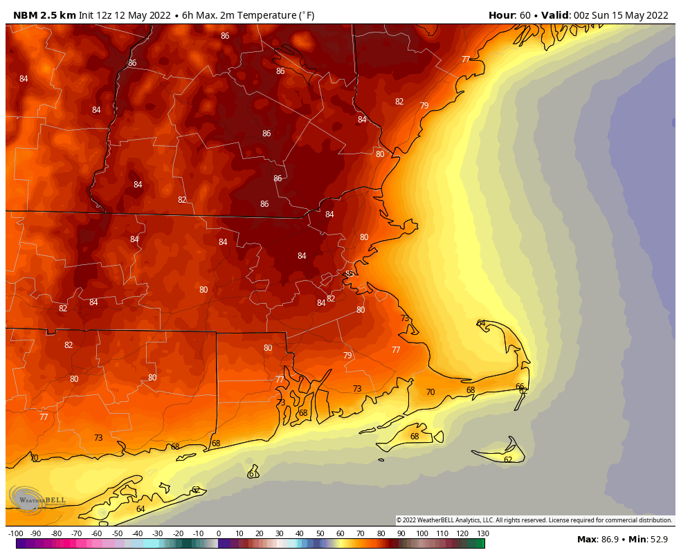
Sunday: Partly sunny, a late-day shower or thunderstorm is possible. High 78-85, cooler along south-facing shorelines.
Sunday night: Partly to mostly cloudy. Low 54-61.
Monday: Intervals of clouds and sun, showers and thunderstorms possible late in the day. High 74-81, cooler along south-facing shorelines.
