This week will feature a little bit of everything around here.
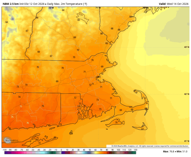
We start off with rain ending this morning as what’s left of Isaias pulls away from the region with sunshine developing in the afternoon. A frontal system trying to drop down from the north will stall out on Tuesday, with a wave of low pressure riding along it, bringing clouds back in, with some showers likely, mainly north of the Mass Pike through the morning with the stalled out front nearby, spreading southward late in the day and at night. A cold front moves through on Wednesday, accompanied by some additional showers, but we’ll remain fairly mild during the daytime ahead of the front. High pressure settles in with cooler and drier weather for Thursday.
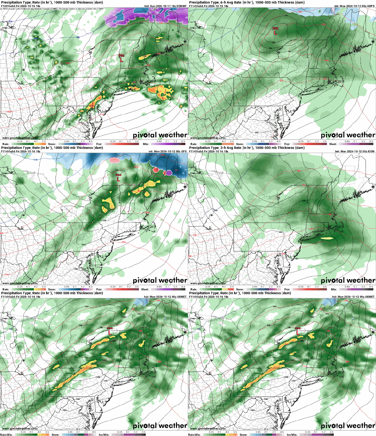
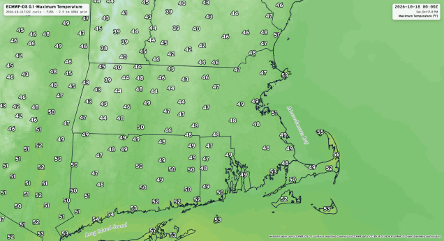
Things get a little more interesting for the end of the week. Another low pressure system will head our way with another round of rain for Friday. Most of the models send the system north of us, allowing warmer weather to settle in despite the rainfall, but a few models have the system move right across the region or even pass a little south of New England, which would result in a much cooler day. We’re going to lean towards the cooler scenario for now. The system pulls away Friday night and intensifies rapidly over Atlantic Canada. Behind it, very windy and much cooler conditions are expected for Saturday, with most places likely staying in the 50s, and some places not even reaching 50 during the daytime. With an upper-level low moving through we’ll see lots of clouds and likely some pop-up showers. With much colder air aloft, and it being chilly at the surface, don’t be surprised if some of those showers contain some graupel or even, brace yourselves, some wet snowflakes (yes, really). High pressure builds in for Saturday night and Sunday with diminishing winds, clearing skies, and chilly conditions.
Monday: Any lingering showers end early, skies become partly to mostly sunny in the afternoon. High 65-72.
Monday night: Becoming mostly cloudy from north to south during the evening, some showers possible after midnight, mainly north of Route 2. Low 47-54.
Tuesday: Showers likely, mostly north of the Mass Pike, gradually shifting southward late in the day. High 59-66.
Tuesday night: Showers likely during the evening, skies become partly cloudy late at night. Low 52-59 during the evening, temperatures hold steady or rise a little overnight.
Wednesday: Partly sunny, chance for a few showers, breezy. High 68-75.
Wednesday night: Partly cloudy to clear. Low 46-53.
Thursday: Mostly sunny. High 58-65.
Thursday night: Increasing clouds, showers possible towards daybreak. Low 39-46, a little milder in urban areas and near the coast.
Friday: Rain likely, ending before midnight, becoming breezy. High 58-65.
Saturday: Intervals of clouds and sun, windy a few pop-up showers likely, possibly mixed with some graupel or wet snow. High 47-54.
Sunday: Partly to mostly sunny, breezy in the morning. High 50-57.

