We’ve got a fairly decent weekend coming up with some typical springtime weather, which means keep the jackets handy.
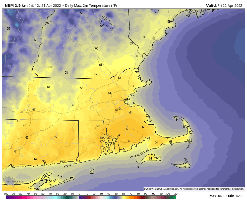
A few showers are likely this evening and tonight as a cold front crosses the region, then high pressure builds in for Friday with sunshine and milder temperatures. The cooler air starts to settle in Friday night. With high pressure building in to the north we’ll turn cooler for Saturday, with clouds moving in during the day as a backdoor cold front starts to slide down the coastline. That front may produce a few showers when it comes through Saturday evening, then Sunday will feature plenty of clouds and rather cool temperatures thanks to an east wind off the still chilly Atlantic. Temperatures will only be in the 40s at the coast and several miles inland, with 50s a little farther inland. You won’t have to go too far to find milder weather, as that front will likely stall out across southwestern New England, so temperatures could be in the 60s and 70s from southwestern Connecticut into the New York City area. That front may try to lift northward again as a warm front, and while it probably won’t get back here, temperatures will start to warm up a bit on Monday as winds will no longer be off the water. However, we’ll still have plenty of clouds as another storm system will start to approach from the west.
Thursday night: Cloudy with a few showers this evening, skies start to clear out late at night. Low 41-48.
Friday: Plenty of sunshine, breezy. High 60-67.
Friday night: Clear skies. Low 34-41.
Saturday: Sunny early, clouds move in and thicken up during the afternoon. High 56-63.
Saturday night: Mostly cloudy, chance for a few showers during the evening. Low 38-45.
Sunday: More clouds than sunshine. High 44-51 along the coast, 51-58 inland.
Sunday night: Partly to mostly cloudy. Low 37-44.
Monday: Intervals of clouds and sun. High 57-64.
