The week starts off unsettled, but a warmup is in the way.
Normal high temperatures for mid-October are in the lower 60s across the region. Image provided by Weathermodels.com
A strong cold front will approach the region today, with some showers developing ahead of it. Those showers will continue off -and-on into Tuesday morning before the front finally pushes offshore. It does not look like we’ll have the heavy rain that the models were advertising a few days ago, but any rain will help to continue to put a dent into the drought. Skies start to clear out late in the day as high pressure starts to build in. While temperatures will turn cooler for Tuesday and Wednesday, the core of the cold air will stay off to our west. In fact, some lake-effect snow is possible downwind of the Great Lakes over the next few days. We’ll have temperatures that are below normal, but highs should still be in the 50s. By the end of the week and the weekend, the high slides off to the east, allowing temperatures to moderate to above normal levels for Friday into Sunday.
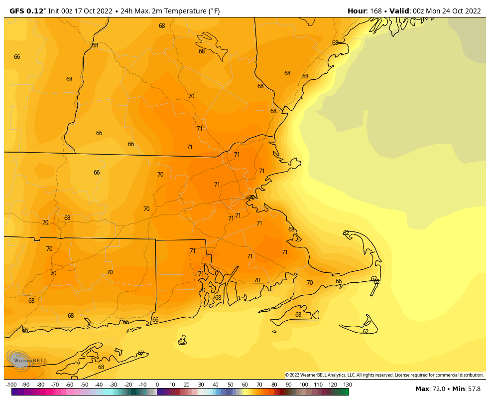
Temperatures could reach 70 degrees next weekend. Image provided by WeatherBell.
Monday: Mostly cloudy, showers develop in the afternoon. High 57-64.
Monday night: Cloudy with occasional showers. Low 46-53.
Tuesday: Showers ending by early afternoon, gradual clearing late in the day. High 56-63.
Tuesday night: Becoming clear. Low 34-41.
Wednesday: Sunshine and a few clouds. High 51-58.
Thursday: Plenty of sunshine, breezy. High 50-57.
Friday: Mostly sunny. High 56-63.
Saturday: Sunshine and some afternoon clouds. High 62-69.
High pressure will be in control for much of the upcoming week, but there is some unsettled weather on the way.
Normal high temperatures for mid-October are still in the middle 60s. Image provided by Weathermodels.com
Another cool day to start off the week with a weak frontal system moving through, but only producing some clouds. High pressure will be in in control with moderating temperatures for Tuesday through Thursday with dry weather. Clouds will start to move in later Wednesday and Thursday as a strong cold front starts to approach the region. That front will bring in a period of rain and showers for Thursday night and early Friday, along with some gusty winds at times. Behind the front, high pressure builds back in with cooler weather for next weekend.
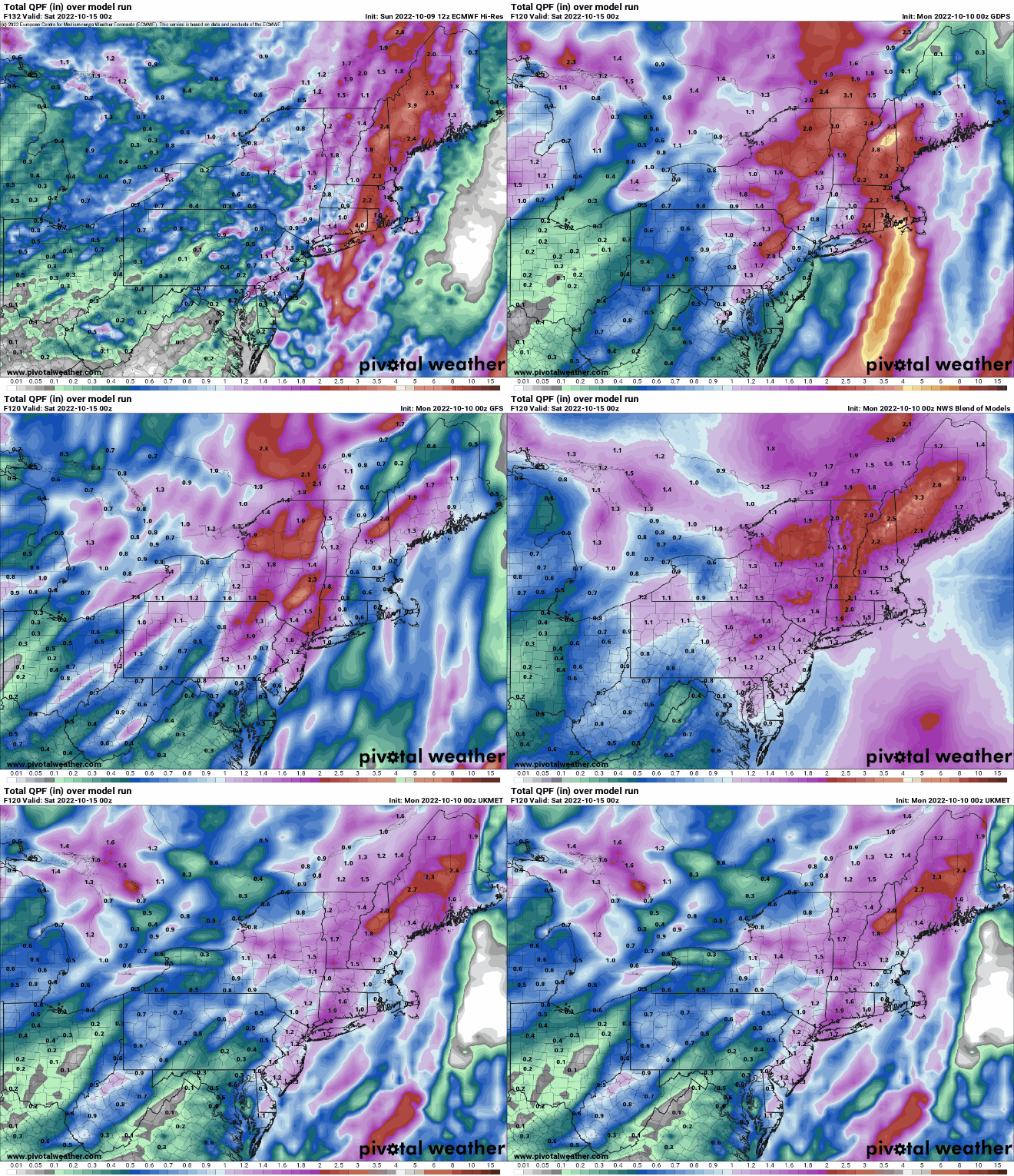
Some models are showing the potential for heavy rain Thursday into Friday. Images provided by Pivotal Weather.
Monday: Partly sunny, just a slight chance for an afternoon sprinkle, mainly north of Boston. High 59-66.
Monday night: Clear skies. Low 38-45.
Tuesday: Plenty of sunshine. High 60-67.
Tuesday night: Clear skies. Low 40-47.
Wednesday: A mix of sun and clouds. High 65-72.
Thursday: Becoming mostly cloudy and breezy with showers developing in the afternoon, possibly becoming a period of rain at night. High 65-72.
Friday: Showers end in the morning, then becoming partly sunny. High 64-71.
Saturday: Plenty of sunshine. High 59-66.
Sunday: Sunshine and some afternoon clouds. High 59-66.
The first full week of October will bring us a variety of weather between now and next weekend.
We’re starting the week off on a cool note. High pressure will be located to the north, while the remains of Ian will generate a new low pressure area to our south, off the Mid-Atlantic coastline. The gradient in between the two will produce some gusty northeast to east winds for the next few days. This will result in below normal temperatures. The high to the north will help keep the region dry for the most part, but the low to the south, which will take its time moving out to sea, will be closer enough to bring some clouds in, with a few showers possible, mainly near the South Coast, and mainly Tuesday into early Wednesday.
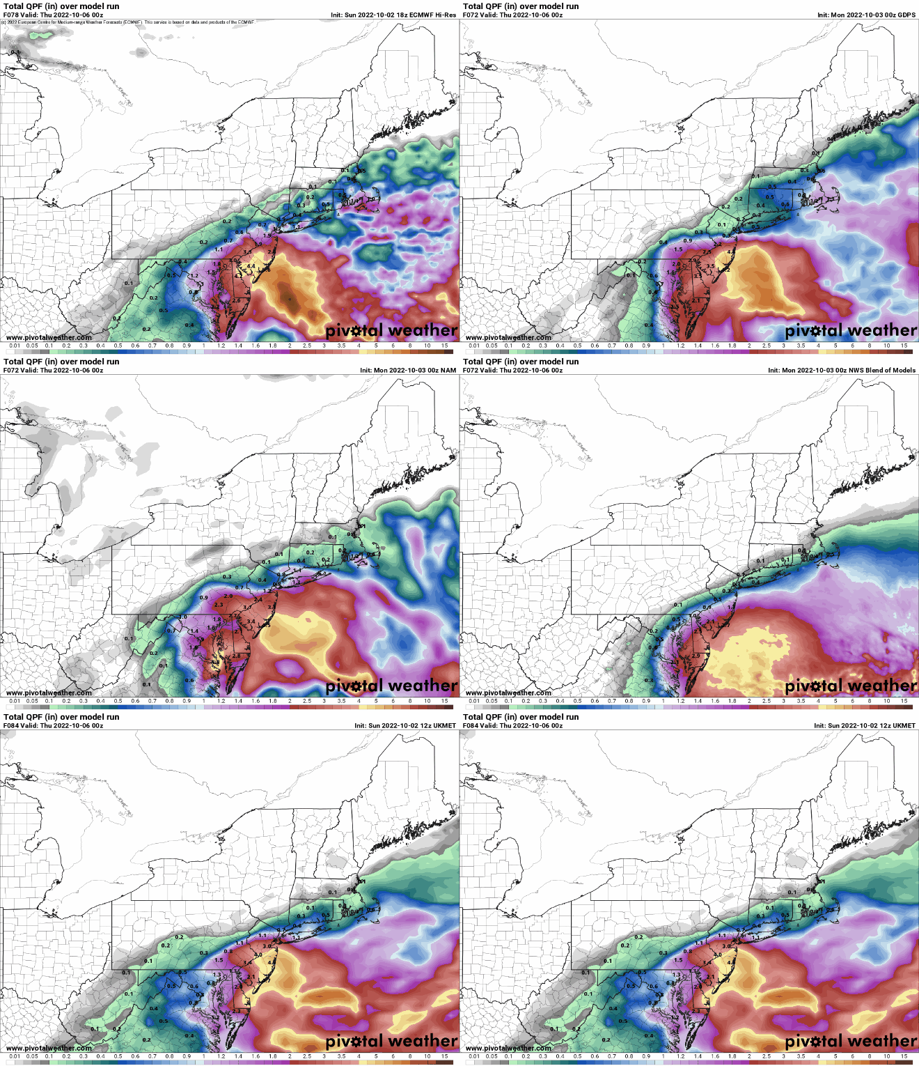
Once again, the models don’t agree on how far north the rain gets and how much will fall. We’re leaning towards lighter amounts, mainly near the South Coast. Images provided by Pivotal Weather.
By Thursday, the low finally pulls away, and the high slides eastward as well, resulting in sunshine and warmer temperatures. Friday looks to be similar, but a strong cold front will be advancing toward the region. While it will be starved for moisture, it will usher the coolest airmass so far this fall into the region. Saturday looks to be breezy and quite cool, with a widespread frost and/or freeze possible Saturday night as the winds die down. Sunday should remain dry, but temperatures will remain on the cool side.
Saturday night is looking rather chilly right now. Image provided by WeatherBell.
Monday: Intervals of clouds and sun, breezy. High 53-60.
Monday night: Partly to mostly cloudy. Low 35-42 north and west of I-95, 43-50 south and east of I-95.
Tuesday: Plenty of clouds, breezy, chance for a few showers late in the day near the South Coast. High 56-63.
Tuesday night: Cloudy with some showers possible, mainly across southeastern Massachusetts and southern Rhode Island. Low 45-52, a little cooler across southern New Hampshire.
Wednesday: Mostly cloudy, breezy again, chance for a few more showers across eastern Massachusetts and Rhode Island. High 58-65.
Thursday: Partly to mostly sunny and milder. High 66-73.
Friday: Sunshine and some afternoon clouds. High 68-75.
Saturday: Mostly sunny, breezy, and much cooler. High 54-61.
Much of the forecast for this week is fairly straightforward, but it gets very complicated next weekend.
An upper-level trough of low pressure will move across the Northeast today into Tuesday. This means we’ll have some clouds popping up with a few showers developing during the afternoon, mainly on Monday, but a couple are possible on Tuesday as well. Wednesday through Friday will feature high pressure, which means we’ll remain dry and on the cool side. Next weekend has a high amount of uncertainty, and it has to do with Tropical Storm Ian.
Normal high temperatures in late September are in the upper 60s to near 70 degrees. Image provided by Weathermodels.com
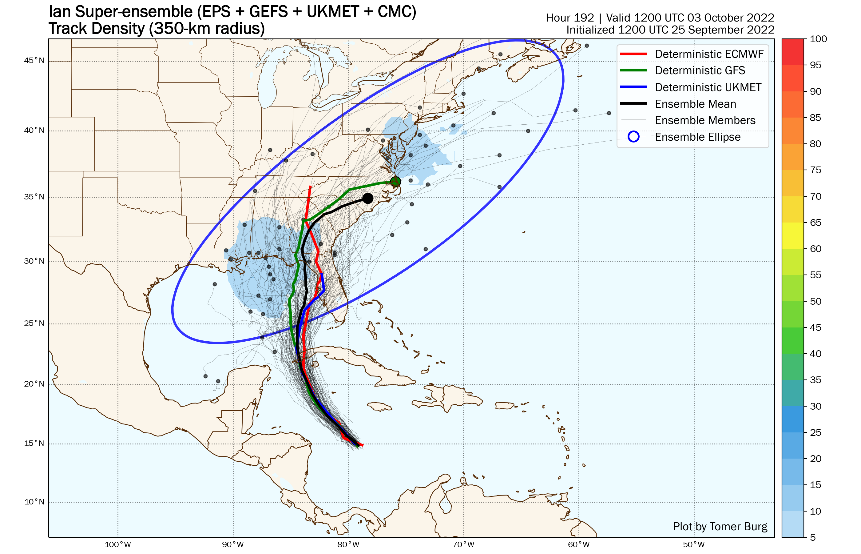
As of 12am Monday, Tropical Storm Ian was centered about 115 miles south-southwest of Grand Cayman, moving toward the northwest at 13 mph. Maximum sustained winds were near 70 mph. The forecast calls for Ian to pass close to the Cayman Islands on Monday as a hurricane, then near or across western Cuba Monday night and Tuesday before moving into the southeastern Gulf of Mexico. Ian could rapidly intensify into a major hurricane over the next few days. After that, its future gets a little murkier. A trough of low pressure across the eastern US should steer Ian northward and at some point northeastward, but when it makes that turn is not clear. This impacts where and when landfall will occur. At this point, landfall is possible anywhere from Fort Myers, Florida all the way to New Orleans. Complicating matters even more is the fact that as it gets farther northward, drier air and wind shear will act to weaken the storm. So, a sooner landfall (say in the Ft Myers to Tampa area) could result in a stronger storm making landfall, but if it heads toward the Florida Panhandle or central Gulf Coast, it could be considerably weaker at landfall. An earlier turn toward the northeast could also result in Ian moving back into the Atlantic, and thus could be a threat to the Carolinas.
The members of the various ensembles show a wide range of tracks for Ian as you get out to next weekend. Image provided by Tomer Burg.
So, how does that impact our forecast next weekend? Well, an earlier turn would likely keep the storm off to our south, with high pressure holding on over the Northeast, keeping us drier. A landfall farther north likely results in the storm rapidly weakening over land, but increases the possibility that the remains move up the Appalachians and bring some rain, possibly heavy, in here or across northern New England next weekend. At this point, it’s just too early to figure out which scenario may occur, so we’re going to be very vague in the forecast for now.
Most of the models keep the heavier rain both north and south of the region next weekend. Images provided by Pivotal Weather.
Monday: A mix of sun and clouds with a few showers possible in the afternoon, mainly north and west of Boston. High 68-75.
Monday night: Partly cloudy, chance for a few showers during the evening. Low 51-58.
Tuesday: Partly to mostly sunny, just a slight chance for an afternoon shower. High 67-74.
Tuesday night: Clear skies. Low 47-54.
Wednesday: A mix of sun and clouds. High 64-71.
Thursday: Partly to mostly sunny. High 60-67.
Friday: Partly sunny. High 59-66.
Saturday: Intervals of clouds and sun with a chance for showers. High 63-70.
Sunday: More clouds than sun with a chance for showers. High 63-70.
Changes are on the way as astronomical summer comes to an end and autumn begins later this week.
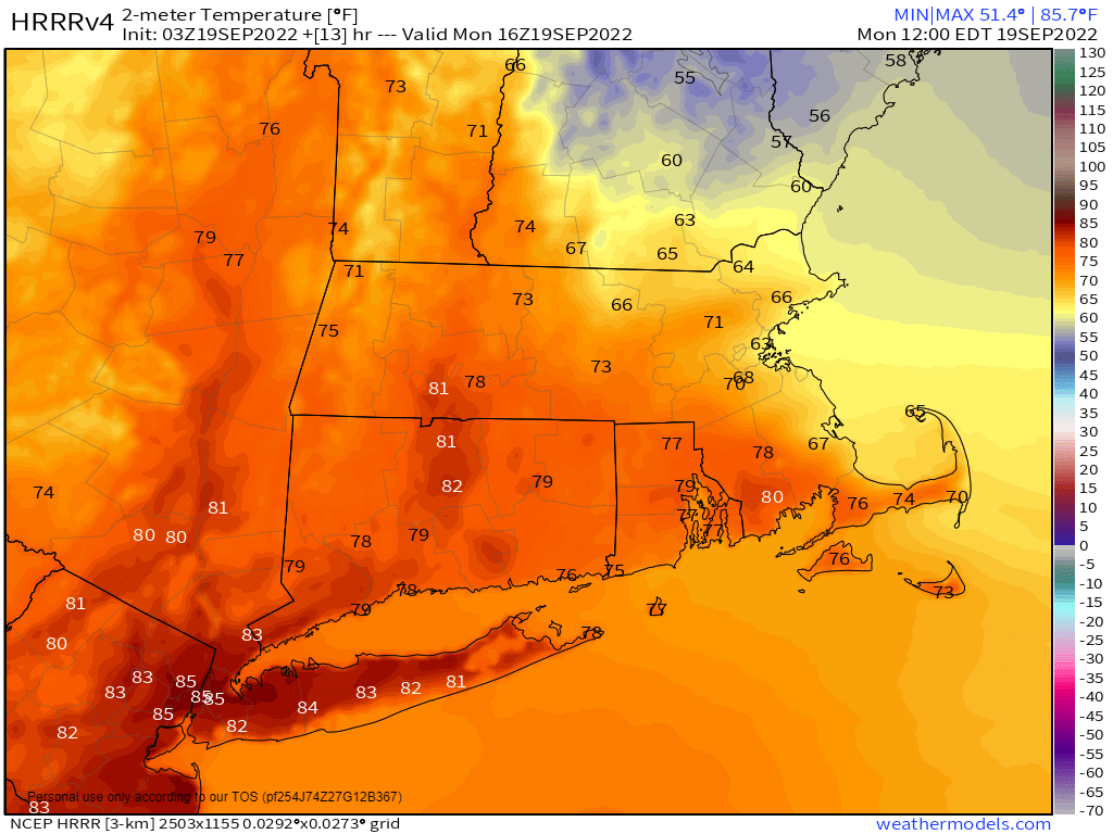
We start the week off with a backdoor cold front stalled out across the region, making for a rather tricky temperature forecast. North of the front, northeast to east winds will keep temperatures in the 60s (even upper 50s near the coast), while south of the front, temperatures will get well into the 70s once again. A wave of low pressure will pass north of the region later today, producing some showers and possibly thunderstorms during the afternoon and evening. Tuesday looks to remain rather cloudy and on the cool side with a few more showers possible as an upper-level disturbance moves across the region. Wednesday should be a rather nice day with some sunshine and milder temperatures, but don’t get used to it. Another cold front starts to approach late in the day, with another round of showers and perhaps thunderstorms expected Wednesday night into early Thursday. This brings us to the start of fall and the bigger changes.
Temperatures at midday may range from near 60 along the NH Seacoast to near 80 along the South Coast. Image provided by Weathermodels.com
The autumnal equinox occurs at 9:03pm Thursday, marking the end of astronomical summer and start of astronomical fall, and right on cue, some fall weather will settle in. The system moving through early Thursday will move offshore, allowing much cooler air to settle in. How cool? The rain may end as some wet snow across the mountains of northern New England. (Yes, really.) Around here, high pressure builds in, and despite sunshine, temperatures may struggle to reach 60 in some spots on Friday. Friday night looks rather chilly, with some frost possible in the normally cooler locations. Temperatures will moderate a bit over the weekend, but likely will remain below to near normal.
Friday is shaping up to be a rather cool day across the region. Image provided by WeatherBell.
Monday: A few sunny breaks across Cape Cod early, otherwise partly to mostly cloudy with a few showers or some drizzle early, showers becoming more widespread during the afternoon, except along the South Coast. High 57-64 across the Maine and NH Seacoast, 64-71 elsewhere north of the Mass Pike and east of Worcester, 72-79 south of the Mass Pike.
Monday night: Mostly cloudy with scattered showers, possibly a thunderstorm, mostly before midnight. Low 55-62.
Tuesday: More clouds than sun, chance for another shower or two. High 64-71.
Tuesday night: Partly to mostly cloudy. Low 50-57.
Wednesday: Partly sunny, showers move in by evening, continuing overnight. High 68-75.
Thursday: Showers gradually ending, skies start to clear out late in the day, breezy at times. High 68-75.
Friday: Sunshine and a few clouds, breezy, and cool. High 57-64.
We’ve got another week that starts out with some rain, but shouldn’t end that way.
Last week’s heavy rain helped, but we remain in in severe to extreme drought. Image provided by the National Drought Mitigation Center.
We start off with a few showers this morning as a warm front moves through, but once they end we’ll see some sunshine today with warm and humid conditions. Clouds return tonight as a cold front approaches, and that front will produce some showers and thunderstorms as it moves through on Tuesday. A few storms may produce some gusty winds and heavy downpours, but for the most part, this should be a light rainfall event for the region. Behind the front, high pressure starts to build in on Wednesday, but temperatures will remain on the mild side. A stronger push of colder air moves in Wednesday night, leading to below normal temperatures for Thursday through Saturday. Temperatures may fail to reach 70 for highs in parts of the region, especially Thursday and Friday. By Sunday, the high moves off the east, allowing temperatures to moderate across the region.
Tuesday’s rain will be beneficial, but we need a lot more. Image provided by WeatherBell.
Monday: Intervals of clouds and sun, a few showers likely, mainly in the morning. High 77-84.
Some much-needed rain is on the way, but unfortunately much of it will fall on a holiday.
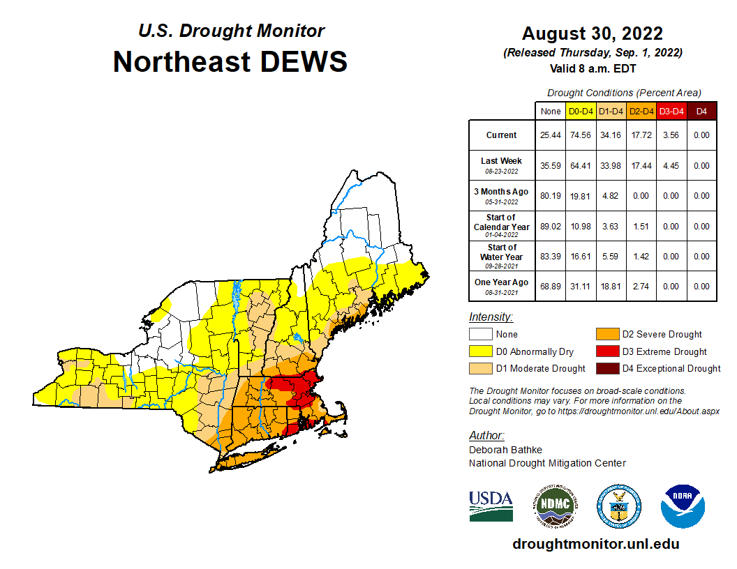
Despite last week’s rain, much of the region remains in severe or extreme drought. Image provided by the National Drought Mitigation Center.
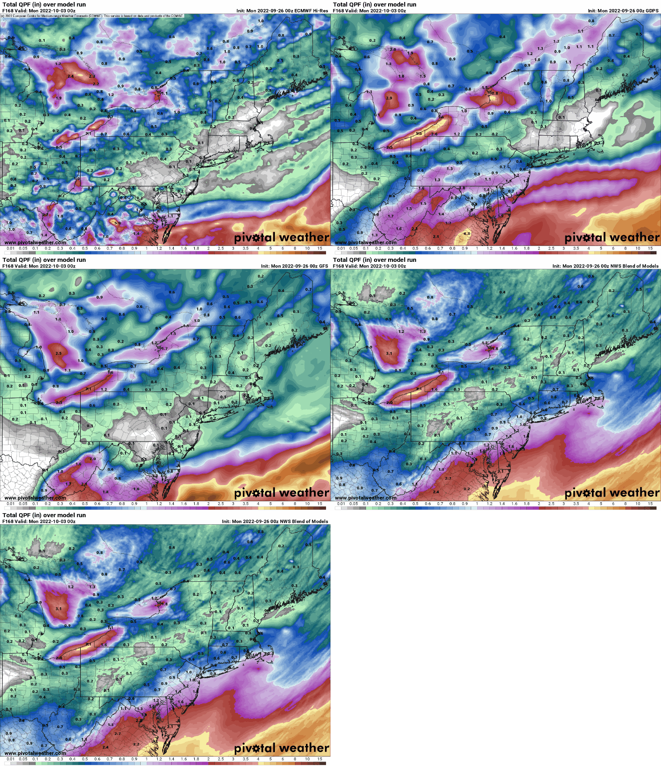
We start the week off with a cold front stalling out across the region. North of the front we’ll have some showers today with temperatures likely staying in the 60s. Closer to the South Coast, temperatures may be in the 70s with less rain at first, but still plenty of clouds. A wave of low pressure will ride along the front, bringing some additional showers or a period of steady rain in late today and tonight. By Tuesday, the front starts to push off to the south, and the shower activity winds down during the afternoon. How much rain we’ll see is still a bit of question, even as it has already started across parts of the area. Some models are still showing the potential for 3-6 inches of rain (or more) across the region, while others show less. Either way, we need all the rain we can get to help put a dent into the ongoing drought and to help refill the rivers, lakes, ponds, and reservoirs across the region. With most places likely to see at least a period of heavy rain, Flood Watches have been issued for much of the region through later Tuesday.
Some models show the potential for very heavy rain across the region today and tomorrow. Images provided by Pivotal Weather.
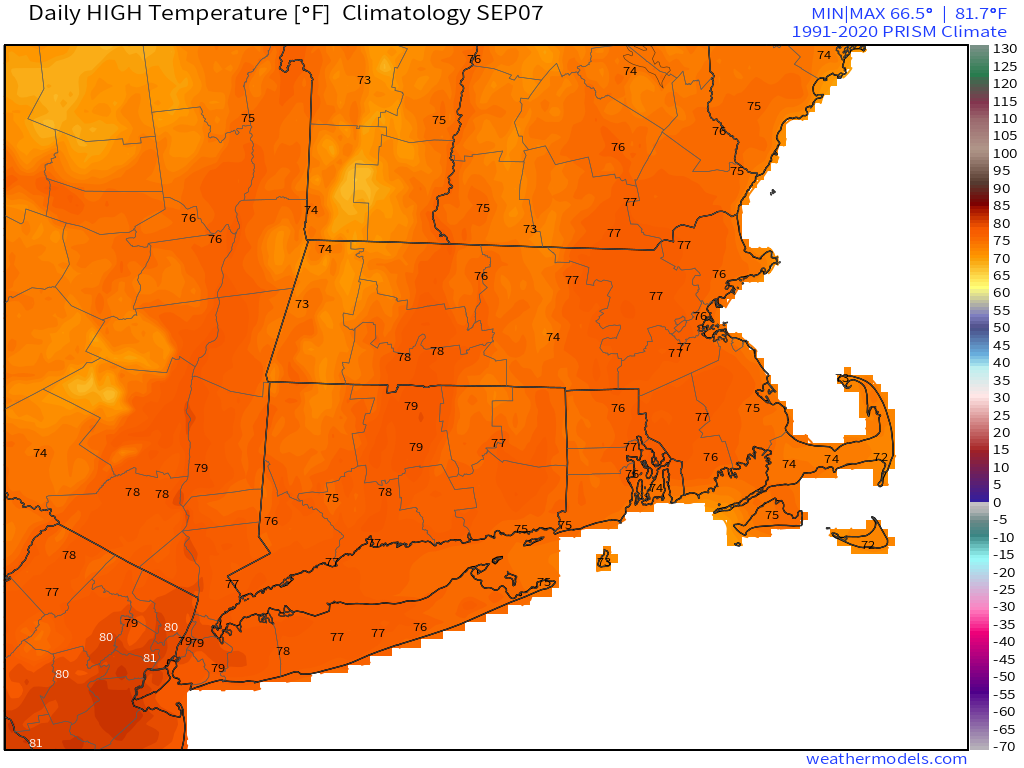
Skies start to clear out Tuesday night, then high pressure builds in for Wednesday right into the weekend, with a return to dry weather. After a couple of chilly day Monday and Tuesday, temperatures will return to near to above normal levels for the rest of the week and the weekend, with many days featuring highs getting back into the 80s across parts of the area once again.
Normal high temperatures for early September are in the middle to upper 70s across the region. Image provided by Weathermodels.com
Monday: Occasional showers. High 64-71 north of the Mass Pike, 71-78 south of the Pike.
Monday night: Periods of rain and showers, some of the rain could be heavy. Low 57-64.
Tuesday: Cloudy and cool with showers gradually ending during the afternoon. High 62-69.
Tuesday night: Overcast with a few lingering showers during the evening, then some late night clearing may develop. Low 53-60.
The last few days of August and beginning of September, including Labor Day weekend look to be similar to the rest of the summer, warm and dry for the most part.
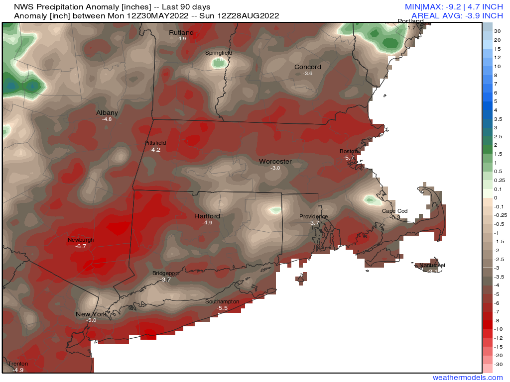
Despite last week’s heavy rain, rainfall is still 3-6 inches below normal over the past 90 days, and this week will provide little help. Image provided by Weathermodels.com
The week starts off with high pressure moving offshore, allowing for a sunny, warm, and humid day today. Tuesday looks similar, but we’ll see clouds start to move in as a cold front approaches the region. That front will produce some showers and possibly a thunderstorm Tuesday night into Wednesday morning before it pushes offshore. After that, high pressure builds back in with cooler and drier conditions for later Wednesday into Friday. As the high moves offshore, warmer weather returns for the holiday weekend. Some models show the potential for a cold front to bring in a few showers late Sunday, then cooler weather for Monday. We’re a little skeptical on the showers at this point, but Labor Day does look to be a bit cooler.
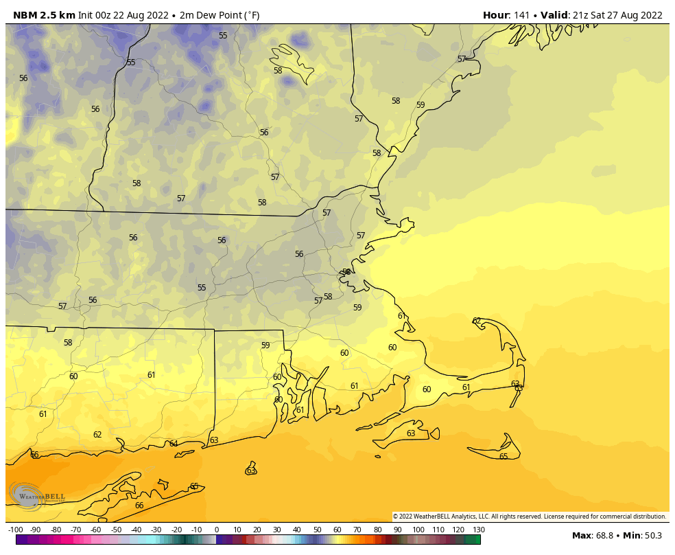
Dewpoints will be in the 60s and lower 70s through Wednesday morning, then drop into the 40s and lower 50s for Thursday and Friday. Loop provided by WeatherBell.
Monday: Partly to mostly sunny. High 84-91.
Monday night: Partly cloudy. Low 66-73.
Tuesday: A mix of sun and clouds, humid. High 86-93.
Tuesday night: Mostly cloudy with a few showers possible, maybe a rumble of thunder. Low 66-73.
Wednesday: Any showers end early, then becoming mostly sunny. High 82-89.
Thursday: Plenty of sunshine, drier. High 77-84.
Friday: Wall-to-wall sunshine. High 73-80.
Saturday: Sunshine and some afternoon clouds. High 79-86.
Sunday: A mix of sun and clouds, chance for a few showers late in the day. High 83-90.
The week will start off on a damp note, but dry weather will return for a good chunk of the remainder of the week.
Low pressure will pass well north and west of the region over the next 36-48 hours. It will send a warm front toward the region today, triggering showers and possibly a few thunderstorms, but temperatures will actually remain on the cool side. Some of the models are showing the potential for some heavy rainfall today, but we’ve seen that before, and we’re not falling for it again. Will it rain? Probably. Heavy rain? Don’t count on it. Of course, we could use the rain, so it some heavy rain does materialize, that’d probably be a good thing, but we just don’t see it happening. Showers taper off tonight, and we could see some sunshine early on Tuesday. However, a cold front will be approaching, and it may trigger another round of showers and thunderstorms Tuesday afternoon and evening, mainly north and west of Boston.
Several models show the potential for heavy rain across the region today and Tuesday. We’re not buying it. Images provided by Pivotal Weather.
After that, high pressure builds in for most of the remainder of the week with very warm to hot conditions. A few showers and thunderstorms are possible during some of the afternoons, but they probably won’t be that widespread. The best chance appears to be on Friday when a frontal system moves through, with some cooler and drier air settling in for the weekend.
Dewpoints may drop into the 50s next weekend. Image provided by WeatherBell.
Monday: Mostly cloudy with showers developing, possibly a rumble of thunder. High 72-79.
Monday night: Mostly cloudy with a few more showers, mainly during the evening. Low 62-69.
Tuesday: Intervals of clouds and sunshine, chance for a few showers or thunderstorms, mainly north and west of Boston. High 76-83.
Tuesday night: A few lingering showers during the evening, then becoming partly cloudy. Low 62-69.
Wednesday: Partly to mostly sunny. High 81-88.
Thursday: Sunshine and some afternoon clouds. High 84-91.
Friday: Partly sunny, chance for some late-day showers or thunderstorms. High 82-89.
There’s a chance for some beneficial rainfall this week to help put a dent in the drought. Unfortunately, that chance is a lot smaller than it looked a few days ago.
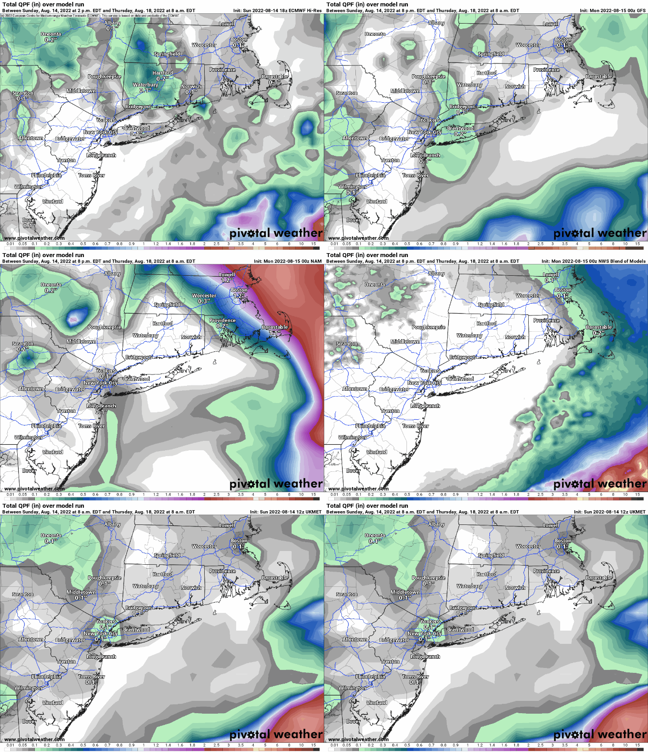
High pressure will slide offshore today, allowing for another in a string of rather nice days across the region with mild temperatures and low humidity. A low pressure system will be starting to take shape off the Mid-Atlantic coast while and upper-level low also sets up residence across the Northeast. The low off the Mid-Atlantic coast will slowly rotate around the upper-level low over the next few days, passing south and east of New England. How close it gets will determine how much, if any, rainfall we get. Over the past few days, the models have been all over the place, with solutions ranging from extreme amounts of rain that would likely lead to flooding, to virtually no rain at all across the region, to everything in between. There’s still plenty of uncertainty, but we’re leaning toward the drier side of things for now, especially given the ongoing drought. We do think there will be some showers at times between late Tuesday and early Thursday morning, favoring eastern portions of the region, but we don’t think they’ll be that heavy. At this point though, every little bit helps.
Most (but not all) of the models are forecasting the bulk of the rain to stay offshore with the mid-week system. Images provided by Pivotal Weather.
By the end of the week, the low pressure both at the surface and aloft move out, replaced with high pressure, so a return to very warm and humid conditions is expected, but just a few pop-up showers and thunderstorms each afternoon. The next system will begin to approach from the west on Sunday, though the timing of this system is uncertain as well. Some models bring it in with showers and thunderstorms Sunday afternoon and evening, others hold it off until Monday. We should have a little better idea of the timing by the time we get to our Weekend Outlook Thursday afternoon.
Temperatures could get near or above 90 again on Saturday. Image provided by WeatherBell.
Monday: A mix of sun and clouds. High 77-84.
Monday night: Partly cloudy, chance for a few showers across Cape Cod and the Islands. Low 56-63.
Tuesday: Partly sunny, breezy. High 75-82.
Tuesday night: Mostly cloudy, chance for a few showers across eastern Massachusetts and the New Hampshire Seacoast. Low 58-65.
Wednesday: Plenty of clouds with a few showers possible, especially across eastern Massachusetts and southern New Hampshire, breezy. High 71-78.
Thursday: Becoming partly to mostly sunny. High 77-84.
Friday: Sunshine and some afternoon clouds. High 82-89.
Saturday: A mix of sun and clouds. High 84-91.
Sunday: Partly sunny with a chance for showers. High 79-86.