Weekly Outlook: January 29 – February 4, 2018

Who’s ready for some snow? Don’t worry, we’re not looking at a lot. In fact, parts of the region might not see any at all. We could see some more later in the week and possibly over the weekend too. Yes, we understand some of you have some plans next Sunday – something having to do with owls.

15815707424_2597d35d65_o

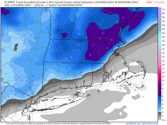
The cold front that moved through on Sunday stalled out offshore, and low pressure will ride up along it later today into early Tuesday. This will result in some light snow across the region, mainly south and east of I-495. With the storm passing far enough to the south and east, most of the accumulating snow will be from Boston southward, and most snow across Cape Cod and nearby southeastern Massachusetts. Even in these locations, we’re talking about a few inches, possibly as much as 5 or 6 inches on the Cape.

sn10_acc.us_ne
The GFS model is the closest to our thinking in terms of snowfall for late Monday into early Tuesday. Image provided by Pivotal Weather.

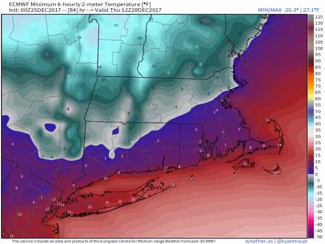
The snow ends Tuesday morning, but skies don’t start to clear out until Tuesday night when high pressure starts to build in. This results in a sunny but cold Wednesday. Clouds come right back in Wednesday night as a cold front starts to approach from the west. This will produce some showers on Thursday. The front will move through Thursday night, but the precipitation may linger into Friday morning. As the cold air moves in behind the front, the rain showers may change to snow showers before ending. Some models have tried to slow the front down and have a low pressure area ride along it. This would result in accumulating snow on Friday. While this is possible, most of the models have been trending away from this scenario, so it does not seem likely right now. Obviously, we’ll monitor this over the next few days.

High pressure returns later Friday into Saturday with dry and cold conditions once again. This brings us to Superb Owl Sunday. Another weak system will move across the region during the day. This will likely spread some light snow or rain into the area. Obviously it’s way too early to give amounts, but some accumulations are possible. If this becomes a threat, we’ll let you know later in the week.

GFS 50-STATES USA Mass & CT & RI Wind Chill Temperature 174
Heading outside after the Super Bowl Sunday night? The GFS is forecasting wind chills ranging from 0 to 20 below. Whether or not this verifies remains to be seen. Image provided by weathermodels.com

Monday: Cloudy and breezy, especially along the coast. Light snow developing late in the day, mainly south of Boston. High 33-40.

Monday night: Periods of light snow and snow showers, mainly south and east of Route 495. Accumulations range from a dusting outside of 128, to an inch or so from Boston to Providence, to 1-3 inches across southeastern Massachusetts and southern Rhode Island, and 3-5 inches across Cape Cod. Low 18-25.

Tuesday: Cloudy, snow showers ending by midday. High 27-34.

Tuesday night: Clearing and turning colder. Low 11-18.

Wednesday: Mostly sunny and chilly, clouds move back in late in the day and at night. High 25-32.

Thursday: Cloudy with some showers likely, changing to snow showers at night. High 38-45.

Friday: Snow showers ending early, some clearing late in the day. High 28-35 early, dropping in the afternoon.

Saturday: Partly to mostly sunny. High 20-27.

Sunday: Cloudy with a chance for some light snow or rain. High 33-40.

goats12
The G.O.A.T. has already tamed a Ram, Panther, Eagle, Seahawk, and Falcon to put them in his zoo. Expect a second Eagle to be there next week. Image provided by CBSBoston.

As for that game on Sunday, there’s an old saying – “Eagles may soar, but weasels don’t get sucked into jet engines.” Since most of the nation thinks that the Patriots are weasels, this quote actually applies to the game. The dynasty continues as Brady will hoist Lombardi Trophy #6 after a 27-23 victory over Philadelphia.

Weekly Outlook: January 22-28, 2018

Never in doubt, right? We all knew that the Patriots would come back to win that game, right? You know what is in doubt? What type of precipitation may fall across the interior during the day today.

A backdoor cold front will drop down across the region today, bringing much cooler conditions in. at the same time, moisture and warmer air will stream in aloft. This means we’ll be looking at some occasional showers and drizzle across the region today and tonight. Across interior portions of eastern Massachusetts into southern New Hampshire, temperatures will be near or a little below freezing through the morning, so anything that falls will be freezing drizzle or possibly some sleet. So, if you’ve got to go anywhere in the morning, like work or school, use some caution, as things could be a little slippery. Temperatures will rise into the middle to upper 30s this afternoon, changing everything to plain rain. However, by this evening, temperatures may drop back close to freezing from the Merrimack Valley northward, meaning we could be looking at some more freezing drizzle in spots.

index
Some locally heavy rainfall amounts are possible on Tuesday. This combined with melting snow could result in some flooding in some areas, especially ice jam flooding along some rivers. Image provided by WeatherModels.com

That backdoor cold front heads back northward as a warm front late tonight into Tuesday morning, but it will take its time. Temperatures will rise overnight fairly quickly from Boston southward, but points north and west will see temperatures slowly creep up until the front moves through later Tuesday morning. Once it moves through, temperatures will rise into the 40s north and west of Boston, lower to perhaps middle 50s from Boston southward. However, the warmer air will be accompanied by a batch of rain, some which could be locally heavy. Low pressure moving into southeastern Canada will drag a cold front across the region late in the day. This front produced severe weather across parts of the Southern Plains on Sunday. While we’re not expecting severe weather around here, it’s not out of the question that you may see a flash of lightning or hear a rumble of thunder Tuesday afternoon, mainly south of Boston.

That front moves through Tuesday evening, then high pressure builds in for Wednesday, Thursday, and Friday with sunshine along with windy and colder conditions. We’ll start to warm up again on Saturday, but clouds will also stream in ahead of the next storm system. That system will bring us some more rain and mild temperatures Saturday night into Sunday.

gfs_windchill_boston_19
Wind chills will be back into the single numbers Friday morning when you head out the door, so dress appropriately. Image provided by WeatherBell.

Monday: Some freezing rain/drizzle north and west of Boston in the morning, otherwise cloudy with periodic showers and drizzle. High 34-41.

Monday night: Freezing drizzle may return north and west of Boston in the evening, otherwise, occasional showers and drizzle continue. Low 30-37 in the evening, then temperatures slowly rise overnight.

Tuesday: Showers becoming steady rain, possibly heavy at times from late morning into late afternoon. A rumble of thunder can’t be ruled out, mainly south of Boston. Becoming windy, especially in eastern Massachusetts. High 48-55.

Tuesday night: Showers end in the evening, followed by clearing skies. Low 28-35.

Wednesday: Partly to mostly sunny, breezy, and colder. High 34-41.

Thursday: Sunshine and a few clouds, still breezy. High 23-30.

Friday: Mostly sunny, breezy, and chilly. High 27-34.

Saturday: Increasing clouds, breezy, and milder, with showers likely at night. High 41-48.

Sunday:  Showers ending early, followed by clearing. High 46-53.

Finally, just for entertainment purposes, you may recall that right after the Patriots won the Super Bowl in 2015, we had a fairly sizable snowstorm around here the next day. In 2017, right after the Patriots won the Super Bowl, we had another, smaller in scale, snowstorm 2 days later. Well, someone must have let the GFS know that the Patriots won today, because it suddenly has a snowstorm around here the day after the Super Bowl. Given that it’s 2 weeks away, we put absolutely zero stock in this forecast, but we thought you’d find it humorous.


Weekly Outlook: January 8-14, 2017

So, has the past week been cold enough for ya? Don’t worry, the cold air is finally departing, and we’ve even got some actual mild air in the forecast. We’ve also got the potential for a wintry mess too, so let’s get to the details.

MonthTDeptNRCC
The first week of January has seen temperatures average 15-25 degrees below normal across most of the Northeast. Image provided by the Northeast Regional Climate Center.

The week starts off with clouds and some snow showers (rain showers across Cape Cod) ahead of a cold front. Don’t worry, we’re not expecting much (if any) accumulation, but the bigger story will be temperatures actually getting into the 30s across the area. It’s going to feel downright balmy compared to the past week. The front moves through tonight, and the snow or rain showers end. High pressure builds in for Tuesday and Wednesday with drier conditions, but temperatures will remain close to where they should be in early January. After that, we jump on a bit of a rollercoaster.

Low pressure will head into the Great Lakes on Thursday while high pressure moves offshore. This means southwest winds will bring unseasonably mild air into the region. Temperatures will get well into the 40s in many locations. We’ll have plenty of clouds, but will anyone care with those temperatures? We didn’t think so. Friday looks to be even warmer, with upper 40s and 50s for much of the region, possibly even close to 60 if you believe one model (see below). It’ll be accompanied by rain and gusty winds, but again, is anyone going to care? It’s going to be mild!

GFS Fri Max
Yes, this is really the GFS forecast for Friday’s high temperatures. Image provided by Weathermodels.com

Saturday is where we get to the real problems. As that initial system moves by, a cold front trailing it will move towards the region while another system moves towards the Northeast from the Tennessee Valley. The question is, and it’s a fairly important one, when does that cold front move through the area?  One model says that it waits until Sunday morning, so Saturday would be another warm, but wet day. Another model brings the front through on Saturday, with cold air rapidly moving in, which means that we could have some freezing rain or a cold rain to deal with across much of the area.  So we could be in the 50s and raining, in the 20s with freezing rain, or somewhere in between. That’s a wide variety of options, and at this point, we’re not sure which way to go. Complicating matters is the fact that the Patriots play the Titans in a playoff game in Foxboro that evening, so the weather could impact the game. Things should start to get a little more clear as the week goes on. Conditions should improve on Sunday, behind the system.

gefs_ptype_ens_neng_26
The various members of the GFS Ensemble show a wide range of possibilities around here Saturday night. Everything is on the table – snow, sleet, freezing rain, rain, or nothing at all. Image provided by WeatherBell.

Monday: Cloudy and breezy at times with a few snow or rain showers possible. High 30-37.

Monday night: Mostly cloudy, some clearing takes place late at night. Low 22-29.

Tuesday: Becoming partly to mostly sunny and breezy. High 33-40.

Tuesday night: Clear skies. Low 10-17.

Wednesday: A sunny start, then skies cloud up in the afternoon. High 31-38.

Thursday: Mostly cloudy and milder with a chance for a few showers. High 44-51.

Friday: Breezy and mild with periods of rain likely. High 50-57.

Saturday: Mostly cloudy with a chance of……something. Quite frankly, that’s about the only thing we’re certain of at this point.

Sunday: Clearing, breezy, and colder. High 29-36.

Thursday Will Not Be a Fun Day

So, as you may have heard from the relentless media hype over the past few days, we’ve got a storm headed our way on Thursday. While this will be an extraordinary storm for places like Florida, Georgia, and the Carolinas, up here, we’ve seen a lot worse.

GFS SE Snow
Snowfall accumulations of 2-5 inches from northern Florida into eastern North Carolina? That doesn’t happen too often. Image provided by Weathermodels.com

Snow and sleet have been falling today across portions of northern Florida, Georgia, and South Carolina. Several inches are expected to fall today, especially along the coastline. Given how rarely this happens in some of these locations, it will probably bring the region to a halt, while those of us in the North point and laugh. Don’t worry, our time is coming tomorrow.

The storm that is producing the snow down South will move up the East Coast later today and Thursday, rapidly intensifying as it does so. You may have heard the terms “bombogenesis” or “weather bomb” used as part of the media hype in the last few days to describe this storm. These are terms that have been around for quite some time. Bombogenesis happens when the lowest pressure of a storm drops more than 24 millibar in a 24 hour period. This happens several times a year with storms off the East Coast. It is nothing out of the ordinary. The reason this storm is getting the attention, aside from the Southern snow, is that the pressures are much lower than a typical winter storm. This will be a strong storm system, but again, we’ve had powerful storms off the East Coast plenty of times before.

fd8d2f50-baa8-4cb1-8497-d04c48d4afb5
Definition of “bombogenesis”. It’s a fairly common occurrence. Image provided by Weather.com

As the storm gets cranked up off the East Coast, it will generate strong winds,, especially along the coast. While we’re looking at wind gusts to 40-50 mph, possibly even higher, things could be a lot worse. We don’t have a large high pressure system to our north (more on that in a minute). If we had a high to our north, increasing the pressure gradient between the storm and the high, winds would be even stronger. The tighter the gradient, the stronger the winds. This is why we can have strong winds with weaker systems, if there is a large high in place to the north.

Along with the winds, coastal residents also have to worry about coastal flooding. Since we’re just past the full moon, tides remain astronomically high. Add in strong onshore winds, and residents along north to northeast facing beaches could experience some coastal flooding around the midday/early afternoon high tide on Thursday. By the time we get to the high tide Thursday night, winds will have shifted into the west or northwest, thus limiting the flooding potential.

Back to the high pressure, or lack thereof, to our north. High pressure has been sitting to our north or northwest all week, which is why we’ve been frigid since before New Year’s. That high has shifted offshore now, allowing somewhat milder air to settle in today. Normally, to get heavy snow, we need that high pressure area to stay to our north or northwest, to lock the cold air into place. With that not the case this time, we’re going to have to deal with a rain/snow line. That seems hard to believe given how cold the past week has been, but it is the case. Water temperatures are still in the lower 40s off our coast, so a strong onshore wind will warm up the lowest layers of the atmosphere enough for a change to rain. This seems like across Cape Cod, but the question becomes, how far inland does that rain/snow line penetrate? The models have varying ideas on this, but a portion of southeastern Massachusetts may see a changeover.

26169151_1559673427444150_4898784041387586845_n
Winter Storm Warning are in effect for virtually the entire East Coast, with Blizzard Warnings (in red) for parts of coastal New England. Image provided by NOAA.

So, we’ve talked about strong winds, coastal flooding, and a rain/snow line. Now, for the only part that most of you are interested in – snow. First, we’ll talk about the timing. Snow should develop from south to north across the region between about 3 and 6am. So, by the time most of you wake up, it will likely be snowing. The snow will end between 7 and 10pm for most of us. The worst of the storm will be between about 9am and 4pm. Snow will be moderate to heavy at times, which combined with strong winds, will create whiteout or blizzard conditions, especially along the coast. If you don’t have to be out tomorrow morning/afternoon, we’d recommend staying where you area. Blizzard warnings have been posted for parts of eastern and southeastern Massachusetts, the NH Seacoast, as well as coastal and Downeast Maine. Remember, the amount of snowfall has absolutely nothing to do with blizzard conditions. You can have a blizzard with no snow falling at all. By definition, you have a blizzard when visibility is 1/4 mile or less due to falling or blowing snow and you have sustained winds or gusts to 35 mph or more for 3 consecutive hours or more.

So, how much snow are we looking at? There isn’t really one model that we completely agree with, so we’re going with a blend of the ideas. Because the storm will be moving along fairly quickly, we’re not looking at any blockbuster amounts. The trickiest part is where the rain/snow line sets up.  Right now, we’re thinking somewhere close to the Cape Cod Canal. As for amounts, here’s the breakdown:

Outer Cape Cod/Islands: 3-5″
Upper Cape Cod: 4-8″
Southeastern Massachusetts (south and east of I95): 8-14″
Northern RI/Interior Eastern Massachusetts/North Shore: 6-12″
Central Massachusetts/Merrimack Valley/Southern NH/Seacoast: 5-9″

The biggest wild card is Southeastern Massachusetts, especially the closer to Cape Cod you get. The farther the rain/snow line moves inland, the less accumulations will be. This is the area of biggest “bust potential”.

hrdps_snow_boston_49
The Canadian HRDPS model is probably closest to our thinking, but not exactly the same. Image provided by WeatherBell.

Once the storm moves by, we’ll slowly clear out on Friday, but gusty northwest to west winds will usher another arctic blast into the region. Saturday may be even colder than any of the days we’ve had over the past week. Especially with fresh snowcover, temperatures will plunge again, with the worst of it on Saturday, when high temperatures likely stay in the single digits. Sub-zero lows are likely across much of the region Saturday morning and especially Sunday morning.

Weekly Outlook: January 1-7, 2018

Well, 2018 is certainly starting on a rather chilly note. Believe it or not, before the week is out, it could get worse. We also may be dealing with a storm that could impact part of the region later in the week, but as we went into detail with last week, the models have not been very reliable with forecasts beyond 72 hours, so don’t believe the hype yet.

GFS WC 12zMon
Wind chills will be brutally cold if you’re out and about first thing in the morning on New Year’s Day. Image provided by Weathermodels.com


The week (and year) starts off the way the last one ended – with arctic high pressure keeping temperatures well below normal. Since we’ll still have a little bit of wind, wind chills will range from 10 to 25 below zero Monday morning. A weak disturbance may bring in a few clouds tonight, but then temperatures will start to moderate a bit for Tuesday and Wednesday. Oh, it’ll still be cold, just not ridiculously cold.

After that, we turn our attention to the potential for an ocean storm on Thursday. Many of the models are forecasting a rather powerful storm to develop off the East Coast and head north-northeastward, passing offshore, possibly well offshore. Obviously, the track will be critical in determining what impacts this system may have on the region.

gefs_slp_lows_east_16
There’s still a fairly wide range in solutions for the track of our mid-week storm system, as shown by the various members of the GFS Ensemble. Image provided by WeatherBell.


A track fairly close to the coast could result in heavy snow, possibly even changing to rain along the shoreline. A track well offshore could result in a miss entirely, or possibly just some snow right along the coast. Just as we said last week, we just can’t answer these questions yet. The upper-level energy that will help produce this system is still out over the Pacific Ocean, where observations are sparse. We do know this – because the storm is expected to be large, we will almost certainly be dealing with gusty winds, no matter how close the storm gets. Also, the middle of the week will feature some of the highest astronomical tides of the month, so some coastal flooding will be a possibility, especially along northeast and north-facing shorelines. As things come into sharper focus over the next few days, we’ll have a special blog post if there is a threat of the storm having a significant impact on the region.

gefs_snow_ens_neng_21
Even among the 21 members of the GFS Ensemble, there is a wide range in snowfall potential from the late-week storm system, ranging from zero in many cases, up to a foot or more in at least 1 or 2 of the solutions. Until these start to converge on a solution, any of them could be right. Image provided by WeatherBell.


Once the system pulls away, strong north to northwest winds behind it will usher another arctic blast into the region. This blast has the potential to be even colder than the current one, especially if we have fresh snow cover after Thursday.

us_model-en-087-0_modez_2018010100_132_519_218
Subzero lows are possible across much of the region again next weekend. Image provided by Weather.us


New Year’s Day: Mostly sunny and cold. High 6-13.

Monday night: Variably cloudy. Low -3 to +4.

Tuesday: A mix of sun and clouds. High 12-19.

Tuesday night: Clear to partly cloudy. Low 6-13.

Wednesday: Partly sunny. High 24-31.

Thursday: Cloudy and breezy with a chance of snow. High 26-33.

Friday: Partly sunny and breezy, and frigid again. High 6-13.

Saturday: Mostly sunny, breezy, and bitterly cold. High 1-8.

Sunday: Mostly sunny, breezy, and frigid. High 8-15.

cfs_anom_t2m_conus_2017123118_m2
Longer-range models, including the CFS (pictured), show the month of January having well below normal temperatures across the eastern two-thirds of the nation. Image provided by WeatherBell.

Weekly Outlook: December 25, 2017 – January 1, 2018

Yup, you read that headline right – 2018. We’ve entered the final week of 2017. Once we get through our Christmas storm, things are fairly simple (and fairly cold) for a few days. The end of the week and the weekend? That’s another story altogether.

The week starts off with a storm bringing some light to moderate snow to areas north and west of Boston, with rain possibly ending as some wet snow from Boston southward. Our thinking really hasn’t changed much since our blog post on Saturday, and by the time most of you read this the storm will be nearly or completely done, so we won’t waste too much time on it. As the storm moves into the Gulf of Maine, it will rapidly intensify, bringing strong winds to the area during the afternoon. While we’ll still have gusty winds for a few more days, they won’t be anywhere near as strong as we’re expecting today.

ecmwf_t2min_massachusetts_84
ECMWF forecast for low temperatures Thursday morning. Yeah, that’s chilly. Image provided by Weather.us

A weak upper-level disturbance moves through on Tuesday, but it’ll just produce some clouds and maybe a stray flurry or two, but the bulk of any snow shower activity will be confined to Northern New England. After that, high pressure builds in with dry and cold conditions. In fact, low temperatures will likely drop below zero for many of us either Wednesday or Thursday morning.

dumpster-fire
This is how the model forecasts look beyond 3 days at this time. In other words – anyone who tries to give you a forecast with any certainty beyond 3 days has no idea what they are talking about.


After Thursday? Well, there really are no definitive answers at this point. The forecast models are all over their place and their performance beyond 3 days lately could accurately be described as “flaming garbage.”  To give you an idea, here’s what the most recent run of some models show for the Friday through Monday period:

Model 1: A light to moderate snowstorm Friday night into Saturday and a moderate to heavy snowstorm Monday night into Tuesday.

Model 1 Ensemble Mean: A light snowstorm Friday night into Saturday, then high pressure builds in.

Model 2: A moderate to heavy snowstorm Saturday night into Sunday.

Model 2 Ensemble Mean: A light to moderate snowstorm on Saturday.

Model 3:  High pressure in control with no appreciable precipitation.

Model 3 Ensemble Mean: A light to moderate snowstorm Friday night into Saturday, then high pressure builds in.

As you can see, we’ve got many conflicting possibilities from just 3 models and their ensembles, so how are we supposed to make any sense from that? So, if you hear someone tell you that we’re getting a snowstorm on a certain day next weekend, don’t believe it. At least not yet. That is a low confidence forecast at best.

Monday: Snow ending by midday north and west of Boston, rain possibly changing to snow before ending around midday from Boston southward. Becoming windy in the afternoon with some clearing possible. High 30-37, except 38-45 across southeastern Massachusetts in the morning.

Monday night: Clearing and breezy. Low 15-22.

Tuesday: Sunshine and some afternoon clouds, slight chance for a flurry, continued breezy. High 21-28.

Tuesday night: Clear and cold. Low -3 to +7 north and west of Boston. 8-15 above from Boston southward.

Wednesday: Plenty of sunshine, breezy, and cold. High 14-21.

Thursday: Mostly sunny and frigid. High 8-15.

Friday through New Year’s Day: Some unsettled weather is possible, but as we mentioned above, trying to pinpoint any details, including which day, just can’t be done yet. Temperatures will remain below normal.


Bing’s Dream Will Be Reality for Most of Us.

We’ve all heard the opening line of the song more times than we can remember:

“I’m dreaming of a white Christmas, just like the ones I used to know”

Well, this year, it won’t be a dream for a large portion of the region, it’ll be reality. Across southeastern parts of New England, mainly south and east of I-95, – sorry, it’ll be a green Christmas for you, with mostly rain from the system.

Christmas Eve will actually be a fairly nice December day by New England standards. We’ll start the day with some sunshine, but clouds will move in during the afternoon as low pressure moves into the eastern Great Lakes. High temperatures will reach the upper 30s to lower 40s, which is right around normal for late December.

nam.refcmp_ptype.us_ne.2017122400-loop
The NAM model shows the progression of the system with the secondary area of low pressure developing off the New Jersey coast and crossing the Outer Cape. Loop provided by Pivotal Weather.

As we head into Sunday night, right around the time Santa is making his rounds, snow will break out across the region, with rain across southeastern Massachusetts and parts of Rhode Island. At the same time, a secondary area of low pressure will start to take shape off the Mid-Atlantic coastline. This low will start to head northeastward, likely passing very close to, or perhaps right over, the Outer Cape, on Christmas morning. As a result of this track, the rain/snow line will likely penetrate as far inland as a Boston-Providence line. Obviously, any variation in track will impact how far inland that warmer air penetrates, which will impact the snowfall forecast. The snow will come down at a steady pace for much of Christmas morning, tapering off and ending by midday as the storm moves into the Gulf of Maine, where it will really get cranked up (more on that in a moment).

So, how much are we looking at?

If you live south and east of a line that runs from Boston to Providence (roughly Interstate 95), probably just a brief dusting at the tail end of the storm as colder air comes back in as the precipitation is ending.

If you live just west of I-95, from Northern Rhode Island into the Boston area and Metro West, 1-3 inches.

Anywhere outside of there, especially the I-495 belt from Central Massachusetts into the Merrimack Valley, North Shore, Southern New Hampshire, and the New Hampshire Seacoast, 3-6 inches, with some isolated spots picking up as much as 8 inches.

ecmwf_acc_snow_massachusetts_60
The ECMWF is closest to our thinking for snowfall with the Christmas storm system. Image provided by Weather.us


As the system moves into the Gulf of Maine Monday night into Tuesday, gusty winds are likely behind it, ushering much colder air into the region. Low temperatures Tuesday morning will drop into the middle teens to lower 20s, but wind chills will be in the single numbers and even below zero in spots Tuesday morning. This is also bad news for places that had mainly rain during the day, as it will ice everything up in the evening, creating some slippery travel. This bitterly cold air looks to remain in place for much of the week as a large area of high pressure builds in. We’ll get into more detail in our Weekly Outlook Monday morning, but this high pressure area is good news, as it may help to deflect a potential storm later in the week off to our south (much to the chagrin of the Facebook Forecasters who were already trumpeting about a potential snowstorm a week in advance because some of the models showed it).

Big Changes for Friday/Saturday

In our Weekly Outlook this past Monday, we talked about a storm heading into the Great Lakes this weekend, with a warm front bringing rain and mild conditions on Saturday, but Friday would be cool as the warm front struggled to cross our area. Well, things have changed considerably, and not for the better.

Low pressure will still move into the Great Lakes Friday/Saturday, and a warm front will get hung up to our south. The problem is, that warm front may not make it any farther north than the South Coast. Even worse, we’re looking at precipitation streaming in on Friday, continuing more or less into Saturday afternoon. Cold air in place, precipitation moving in, warmer air eventually moving in aloft. If you’ve lived around here long enough, you that means we’re looking at a snow to freezing rain situation.

gfs_frz_rain_boston_15
Freezing rain could be a significant problem from northern Connecticut into central/western Massachusetts and southern New Hampshire Friday into Saturday. Image provided by WeatherBell.


Snow should develop across southern New Hampshire and northern Massachusetts around midday Friday, with a mix of snow, sleet and freezing rain moving into the Boston area during the afternoon, and rain, possibly mixed with a little snow south of Boston by late in the day. Eventually, a change to freezing rain will take place north and west of Boston Friday night as warmer air moves in aloft. The problem is, that cold air at the surface will be pretty tough to dislodge. Temperatures will slowly drift up, likely getting above freezing by Saturday morning inside Route 495. However, from the Merrimack Valley into southern New Hampshire, there is the chance that temperatures never reach 32, or if they do, it won’t be until late in the day, after most of the precipitation has fallen.

gfs_t2max_boston_15 (1)
The GFS is only forecasting high temperatures in the middle 30s from Boston northward and westward on Saturday. That may even be too optimistic. Image provided by WeatherBell.


Before the change to freezing rain, we are looking at some snow accumulation, mainly north and west of Boston. As much as 1-3″ could fall in the Merrimack Valley, with 3-5″ from the Seacoast over into southern New Hampshire. If the changeover takes even longer than we currently expect, then these totals could end up higher.

ecmwf_acc_snow_massachusetts_96
A few inches of snow is expected before the change to freezing rain late Friday into Saturday. The best chance for significant snow (6″+) would be in southern and central NH. Image provided by Weather.us


As for the potential for a White Christmas – we told you on Monday that the odds were low, but not zero, despite what some of the folks on TV were saying. Well, those odds have raised significantly. After a cold front moves through here late Saturday, it will stall offshore. Another wave of low pressure will ride along it on Christmas Day. Exactly where that front stalls is obviously key to the forecast. There’s still a large range in what the models are showing – anything from just a few flurries to heavy snow inland with rain along the coast, but it certainly seems like we’re in for *something* on Christmas Day. We’ll take a look at that in more detail once we get past the Friday/Saturday storm. Oh, and if you hear any hype for another storm next week – yes, the models are showing something, but it’s still over a week away. We don’t have to tell you that the forecasts can and will change several times before then, because you already knew that. Remember, it was just 2 days ago that we were talking about highs in the 50s on Saturday, not an ice storm.


Weekly Outlook: December 18-25, 2017

We’ve reached the week before Christmas, and the first day of astronomical winter is this week as well, so 2017 is nearly done. Winter officially starts at 11:28am on Thursday, but next weekend, it’s probably not going to feel like winter around here. That doesn’t mean we’re not going to have a White Christmas however.

The week starts off with a weak storm system impacting the region. It’s not going to have a lot of precipitation with it, but temperatures will be fairly close to freezing, so the morning commute could be impacted. Right now, it looks like some light snow, mainly less than an inch, could impact areas north and west of Boston for the Monday morning commute. Elsewhere, we’re looking at a little bit of rain. Occasional rain or snow showers are possible during the day, with some freezing drizzle possible, especially across the 495 belt and into southern New Hampshire. So, if you have to drive in these areas during the day, make sure you pay attention to the road conditions and drive carefully.

hires_ptype_acc_boston_30
While precipitation will be mostly rain from Boston southward on Monday, some freezing rain is possible from northeastern Massachusetts into southern New Hampshire. Image provided by WeatherBell.

By Tuesday, we’ll actually turn a bit milder before a cold front crosses the region. That front may bring in a few showers later on Tuesday, then colder air settles in behind the front for Wednesday and Thursday on gusty northwest winds. By Friday, a warm front will approach the region ahead of low pressure moving into the Great Lakes. The warm front may take its time moving through, so temperatures may stay on the cool side, especially north and west of Boston, but the warmer air should finally get in here by Saturday morning, along with some rain. In fact, Saturday afternoon could be quite mild. As the storm passes to our north and west, it drags a cold front across the area, with more seasonable conditions for Christmas Eve.

gfs_t2max_massachusetts_138
If you believe the GFS model, you might not need a coat for that last-minute Christmas shopping next Saturday (but you will need an umbrella). Image provided by Weather.us

So, right now, you’re thinking, it’s going to be warm and raining on Saturday, how could we have a White Christmas? Some of the models show another system impacting the region on Christmas Day. However, the models disagree on many of the details. Since it’s still a week away, pinning down any of these details is next to impossible right now, but there are some models that do show some snow for at least parts of the area. Of course, there are other models that have it warm and wet again. So, there’s still a chance for a White Christmas for some of you. We don’t think it’s a good chance, but it’s certainly not zero, especially north and west of Boston.

Monday: Cloudy with some light snow or freezing drizzle north and west of Route 128, a few rain showers elsewhere. High 30-37, perhaps a little warmer in southeastern Massachusetts.

Monday night: Any lingering precipitation ends in the evening, then skies remain partly to mostly cloudy overnight. Low 27-34.

Tuesday: Plenty of clouds with a few showers possible. Becoming windy. High 41-48.

Tuesday night: Clearing, windy. Low 28-35.

Wednesday: A mix of sun and clouds, breezy. High 33-40.

Thursday: Mostly sunny and cold. High 27-34.

Friday: Becoming cloudy and breezy. High 30-37. Temperatures likely rise at night.

Saturday: Windy with rain likely in the morning, tapering off in the afternoon. High 49-56.

Christmas Eve: Partly sunny. High 41-48.

Christmas Day:  Mostly cloudy with a chance of snow or rain. High 35-42.

Weekly Outlook: December 11-17, 2017

You survived the first snow event of the season. Granted, it wasn’t a big storm, but still, you cleaned your car, maybe you even shoveled your driveway. It’s done. It’s over. Feel better? Good, there’s more on the way.

Skurski-snow-shot-Bills-Colts-1260x800
Sure we had some snow on Saturday, but at least you weren’t in Buffalo on Sunday for the Bills and Colts game. Watching those two teams is bad enough, but in heavy lake-effect snow? No thanks. Image provided by The Buffalo News.

The week starts off with a weak disturbance moving through during the morning, which may produce a few snow showers. So, if you wake up and there’s a dusting on your car, that’s why. High pressure then briefly builds in with clearing and cool conditions for the rest of the day. Clouds quickly come back Monday night as an Alberta Clipper heads towards the region. It will pass north of us on Tuesday. That’s good news for many of you. Although we’ll see some snow develop during the morning, with the storm passing to our north, warmer air moves in, changing the snow quickly over to rain along the coastal plain. Farther inland, especially north and west of I-495, the changeover will take longer, but even there, it should take place during the afternoon, but not before we see some snowfall accumulations. How much accumulation? Right now, it looks like an inch or less in the Merrimack Valley, and 1-3 inches from the Seacoast into the Manchester/Nashua area. North of Manchester, especially up towards Concord and points north and west, we could be looking at 3-6 inches or more.

rgem.prateptype.us_ne.2017121100-loop
Snow may start during the morning commute on Tuesday, but the evening commute should be wet, not white. Loop provided by Pivotal Weather.

Once that system passes by, some of the coldest air so far this season flows in for Wednesday and Thursday. Gusty west to northwest winds will send wind chills into the single numbers and teens. Yeah, it’s gonna be chilly. At least the sun will be out, not that it’s going to help much.

gfs_windchill_boston_15
Planning to take that morning run on Thursday? Better layer up, because wind chills will be in the single numbers and teens. Image provided by WeatherBell.

Friday is the interesting day this week. A storm system is going to develop and pass offshore south and east of the region. The question is, how far to the south and east. Right now, the models bring the storm close enough for a period of light snow across southeastern Massachusetts and southern Rhode Island. Knowing how these models work and their normal biases and corrections, we have a hunch the storm will end up closer to the coastline, thus spreading snow farther inland. We’re not expecting a blockbuster storm here, but some light to possibly moderate snow is possible on Friday. We’ll obviously keep an eye on this during the week, and if the threat does materialize, we’ll update you. High pressure builds in behind that system with cool and dry conditions next weekend.

Monday: Chance for a morning snow shower, then becoming partly sunny. High 32-39.

Monday night: Clouding back up with some snow possible towards daybreak. Low 20-27.

Tuesday: Snow developing, quickly changing to rain across much of the region, except taking a bit longer north and west of I-495, where some accumulations are possible. High 35-42 north and west of I-495, 43-50 elsewhere.

Tuesday night: Rain ends in the evening, followed by clearing and windy conditions. Low 19-26.

Wednesday: A mix of sun and clouds, windy, and colder. High 23-30.

Thursday: Mostly sunny, still windy. High 23-30.

Friday: Becoming cloudy with a chance of snow, especially from Boston southward. High 27-34.

Saturday: A mix of sun and clouds, breezy.  High 30-37.

Sunday: Partly sunny. High 38-45.