So, as you may have heard from the relentless media hype over the past few days, we’ve got a storm headed our way on Thursday. While this will be an extraordinary storm for places like Florida, Georgia, and the Carolinas, up here, we’ve seen a lot worse.

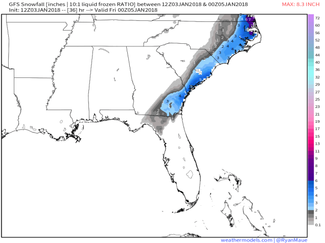
Snow and sleet have been falling today across portions of northern Florida, Georgia, and South Carolina. Several inches are expected to fall today, especially along the coastline. Given how rarely this happens in some of these locations, it will probably bring the region to a halt, while those of us in the North point and laugh. Don’t worry, our time is coming tomorrow.
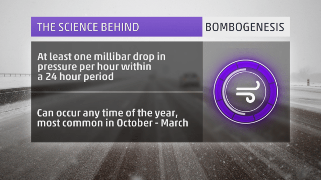
The storm that is producing the snow down South will move up the East Coast later today and Thursday, rapidly intensifying as it does so. You may have heard the terms “bombogenesis” or “weather bomb” used as part of the media hype in the last few days to describe this storm. These are terms that have been around for quite some time. Bombogenesis happens when the lowest pressure of a storm drops more than 24 millibar in a 24 hour period. This happens several times a year with storms off the East Coast. It is nothing out of the ordinary. The reason this storm is getting the attention, aside from the Southern snow, is that the pressures are much lower than a typical winter storm. This will be a strong storm system, but again, we’ve had powerful storms off the East Coast plenty of times before.

As the storm gets cranked up off the East Coast, it will generate strong winds,, especially along the coast. While we’re looking at wind gusts to 40-50 mph, possibly even higher, things could be a lot worse. We don’t have a large high pressure system to our north (more on that in a minute). If we had a high to our north, increasing the pressure gradient between the storm and the high, winds would be even stronger. The tighter the gradient, the stronger the winds. This is why we can have strong winds with weaker systems, if there is a large high in place to the north.
Along with the winds, coastal residents also have to worry about coastal flooding. Since we’re just past the full moon, tides remain astronomically high. Add in strong onshore winds, and residents along north to northeast facing beaches could experience some coastal flooding around the midday/early afternoon high tide on Thursday. By the time we get to the high tide Thursday night, winds will have shifted into the west or northwest, thus limiting the flooding potential.
Back to the high pressure, or lack thereof, to our north. High pressure has been sitting to our north or northwest all week, which is why we’ve been frigid since before New Year’s. That high has shifted offshore now, allowing somewhat milder air to settle in today. Normally, to get heavy snow, we need that high pressure area to stay to our north or northwest, to lock the cold air into place. With that not the case this time, we’re going to have to deal with a rain/snow line. That seems hard to believe given how cold the past week has been, but it is the case. Water temperatures are still in the lower 40s off our coast, so a strong onshore wind will warm up the lowest layers of the atmosphere enough for a change to rain. This seems like across Cape Cod, but the question becomes, how far inland does that rain/snow line penetrate? The models have varying ideas on this, but a portion of southeastern Massachusetts may see a changeover.

So, we’ve talked about strong winds, coastal flooding, and a rain/snow line. Now, for the only part that most of you are interested in – snow. First, we’ll talk about the timing. Snow should develop from south to north across the region between about 3 and 6am. So, by the time most of you wake up, it will likely be snowing. The snow will end between 7 and 10pm for most of us. The worst of the storm will be between about 9am and 4pm. Snow will be moderate to heavy at times, which combined with strong winds, will create whiteout or blizzard conditions, especially along the coast. If you don’t have to be out tomorrow morning/afternoon, we’d recommend staying where you area. Blizzard warnings have been posted for parts of eastern and southeastern Massachusetts, the NH Seacoast, as well as coastal and Downeast Maine. Remember, the amount of snowfall has absolutely nothing to do with blizzard conditions. You can have a blizzard with no snow falling at all. By definition, you have a blizzard when visibility is 1/4 mile or less due to falling or blowing snow and you have sustained winds or gusts to 35 mph or more for 3 consecutive hours or more.
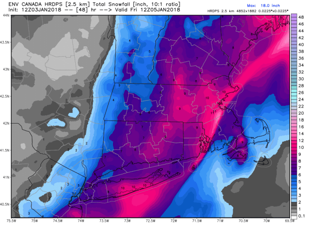
So, how much snow are we looking at? There isn’t really one model that we completely agree with, so we’re going with a blend of the ideas. Because the storm will be moving along fairly quickly, we’re not looking at any blockbuster amounts. The trickiest part is where the rain/snow line sets up. Right now, we’re thinking somewhere close to the Cape Cod Canal. As for amounts, here’s the breakdown:
Outer Cape Cod/Islands: 3-5″
Upper Cape Cod: 4-8″
Southeastern Massachusetts (south and east of I95): 8-14″
Northern RI/Interior Eastern Massachusetts/North Shore: 6-12″
Central Massachusetts/Merrimack Valley/Southern NH/Seacoast: 5-9″
The biggest wild card is Southeastern Massachusetts, especially the closer to Cape Cod you get. The farther the rain/snow line moves inland, the less accumulations will be. This is the area of biggest “bust potential”.

Once the storm moves by, we’ll slowly clear out on Friday, but gusty northwest to west winds will usher another arctic blast into the region. Saturday may be even colder than any of the days we’ve had over the past week. Especially with fresh snowcover, temperatures will plunge again, with the worst of it on Saturday, when high temperatures likely stay in the single digits. Sub-zero lows are likely across much of the region Saturday morning and especially Sunday morning.