Much of the weekend will feature unsettled conditions.
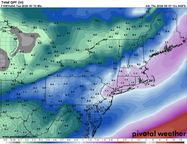
An upper-level low pressure system sitting over southeastern Canada will control our weather for the weekend. A cold front continues to push offshore tonight while high pressure builds in with dry and cool conditions. Friday starts off with sunshine, but with colder air aloft we’ll see clouds quickly popping up during the morning, and a few widely scattered showers possible during the afternoon. More clouds move in at night as a weak disturbance rotating around the upper-level low will generate a weak storm system that will bring in some rain Saturday afternoon and evening. High pressure briefly builds in behind the system with some drier and warmer for Sunday, but it won’t last long. Another disturbance rotating around the upper-level low will trigger another low pressure system over the Mid-Atlantic states that will pass south and east of New England on Monday. We’ll see rain return Sunday night, continuing on Monday with cooler weather returning once again.
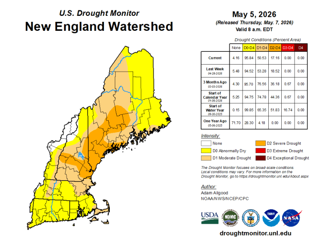
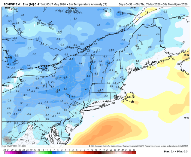
Unfortunately, this pattern, with upper level lows moving out and new ones moving in, will likely continue for at least the next few weeks, resulting in near to below normal temperatures and episode of showers every few days. We need the rain to help keep the brush fire danger low and put a dent in the drought, but aside from a nice day or two every now and then conditions will remain dreary for a while. There is some signs that a warmer pattern could move in for the end of the month, but how long it lasts, or if it even moves in, are yet to be determined.
Thursday night: Clear to partly cloudy, cool. Low 38-45.
Friday: Morning sun with afternoon clouds and a few widely scattered showers, breezy. High 55-62.
Friday night: Clear during the evening, clouds stream back in after midnight. Low 38-45.
Saturday: Cloudy and breezy with some rain moving in by early afternoon. High 56-63.
Saturday night: Mostly cloudy, showers ending by midnight. Low 45-52.
Sunday: Partly sunny, slight chance for an afternoon shower. High 65-72, cooler across the South Coast and Cape Cod.
Sunday night: Cloudy with showers developing after midnight. Low 45-52.
Monday: Rain likely. High 54-61.
