You survived the first snow event of the season. Granted, it wasn’t a big storm, but still, you cleaned your car, maybe you even shoveled your driveway. It’s done. It’s over. Feel better? Good, there’s more on the way.

The week starts off with a weak disturbance moving through during the morning, which may produce a few snow showers. So, if you wake up and there’s a dusting on your car, that’s why. High pressure then briefly builds in with clearing and cool conditions for the rest of the day. Clouds quickly come back Monday night as an Alberta Clipper heads towards the region. It will pass north of us on Tuesday. That’s good news for many of you. Although we’ll see some snow develop during the morning, with the storm passing to our north, warmer air moves in, changing the snow quickly over to rain along the coastal plain. Farther inland, especially north and west of I-495, the changeover will take longer, but even there, it should take place during the afternoon, but not before we see some snowfall accumulations. How much accumulation? Right now, it looks like an inch or less in the Merrimack Valley, and 1-3 inches from the Seacoast into the Manchester/Nashua area. North of Manchester, especially up towards Concord and points north and west, we could be looking at 3-6 inches or more.

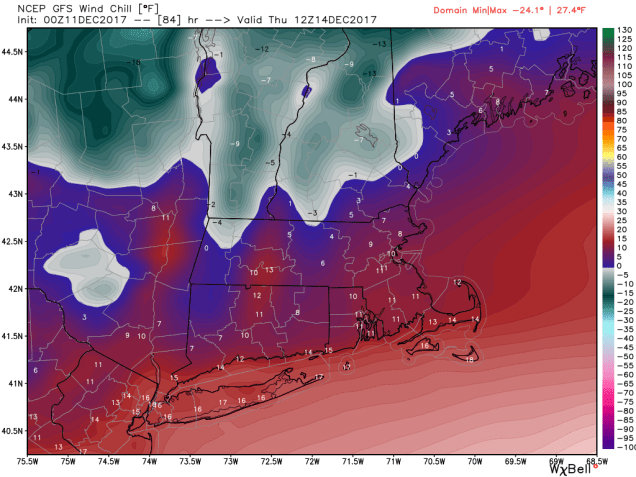
Once that system passes by, some of the coldest air so far this season flows in for Wednesday and Thursday. Gusty west to northwest winds will send wind chills into the single numbers and teens. Yeah, it’s gonna be chilly. At least the sun will be out, not that it’s going to help much.
Friday is the interesting day this week. A storm system is going to develop and pass offshore south and east of the region. The question is, how far to the south and east. Right now, the models bring the storm close enough for a period of light snow across southeastern Massachusetts and southern Rhode Island. Knowing how these models work and their normal biases and corrections, we have a hunch the storm will end up closer to the coastline, thus spreading snow farther inland. We’re not expecting a blockbuster storm here, but some light to possibly moderate snow is possible on Friday. We’ll obviously keep an eye on this during the week, and if the threat does materialize, we’ll update you. High pressure builds in behind that system with cool and dry conditions next weekend.
Monday: Chance for a morning snow shower, then becoming partly sunny. High 32-39.
Monday night: Clouding back up with some snow possible towards daybreak. Low 20-27.
Tuesday: Snow developing, quickly changing to rain across much of the region, except taking a bit longer north and west of I-495, where some accumulations are possible. High 35-42 north and west of I-495, 43-50 elsewhere.
Tuesday night: Rain ends in the evening, followed by clearing and windy conditions. Low 19-26.
Wednesday: A mix of sun and clouds, windy, and colder. High 23-30.
Thursday: Mostly sunny, still windy. High 23-30.
Friday: Becoming cloudy with a chance of snow, especially from Boston southward. High 27-34.
Saturday: A mix of sun and clouds, breezy. High 30-37.
Sunday: Partly sunny. High 38-45.
