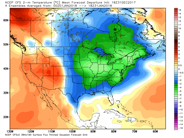
Well, 2018 is certainly starting on a rather chilly note. Believe it or not, before the week is out, it could get worse. We also may be dealing with a storm that could impact part of the region later in the week, but as we went into detail with last week, the models have not been very reliable with forecasts beyond 72 hours, so don’t believe the hype yet.
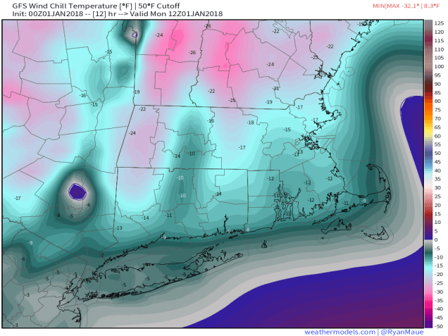
The week (and year) starts off the way the last one ended – with arctic high pressure keeping temperatures well below normal. Since we’ll still have a little bit of wind, wind chills will range from 10 to 25 below zero Monday morning. A weak disturbance may bring in a few clouds tonight, but then temperatures will start to moderate a bit for Tuesday and Wednesday. Oh, it’ll still be cold, just not ridiculously cold.
After that, we turn our attention to the potential for an ocean storm on Thursday. Many of the models are forecasting a rather powerful storm to develop off the East Coast and head north-northeastward, passing offshore, possibly well offshore. Obviously, the track will be critical in determining what impacts this system may have on the region.

A track fairly close to the coast could result in heavy snow, possibly even changing to rain along the shoreline. A track well offshore could result in a miss entirely, or possibly just some snow right along the coast. Just as we said last week, we just can’t answer these questions yet. The upper-level energy that will help produce this system is still out over the Pacific Ocean, where observations are sparse. We do know this – because the storm is expected to be large, we will almost certainly be dealing with gusty winds, no matter how close the storm gets. Also, the middle of the week will feature some of the highest astronomical tides of the month, so some coastal flooding will be a possibility, especially along northeast and north-facing shorelines. As things come into sharper focus over the next few days, we’ll have a special blog post if there is a threat of the storm having a significant impact on the region.

Once the system pulls away, strong north to northwest winds behind it will usher another arctic blast into the region. This blast has the potential to be even colder than the current one, especially if we have fresh snow cover after Thursday.

New Year’s Day: Mostly sunny and cold. High 6-13.
Monday night: Variably cloudy. Low -3 to +4.
Tuesday: A mix of sun and clouds. High 12-19.
Tuesday night: Clear to partly cloudy. Low 6-13.
Wednesday: Partly sunny. High 24-31.
Thursday: Cloudy and breezy with a chance of snow. High 26-33.
Friday: Partly sunny and breezy, and frigid again. High 6-13.
Saturday: Mostly sunny, breezy, and bitterly cold. High 1-8.
Sunday: Mostly sunny, breezy, and frigid. High 8-15.