As you have probably seen online or on television, there’s a storm on the way, and it could be a potent one.
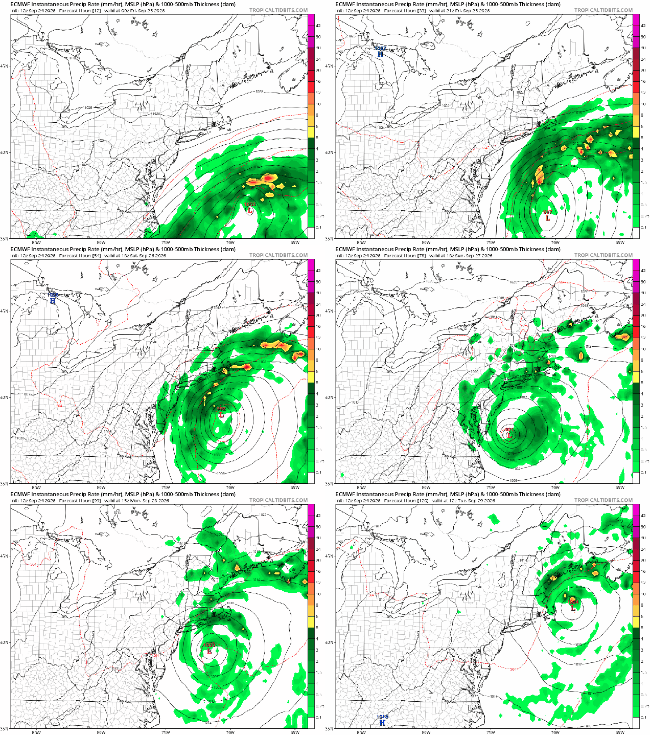
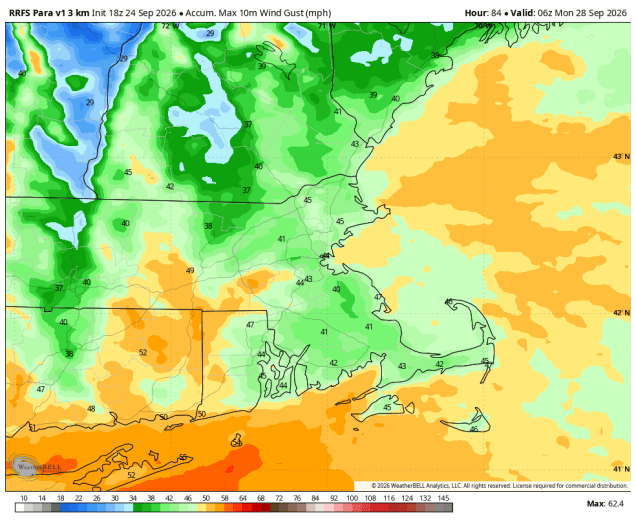
It’s a little early in the season for a Nor’easter, but one is on the way, and it will have some impacts, especially near the coastline. A large high pressure area currently over Quebec will slowly drift eastward for the next few days while low pressure begins organizing off the Mid-Atlantic coastline. We are looking at a very long duration storm, starting on Friday, with effects lingering into Monday. As the system lifts northward it will slow down, and drift westward south of Long Island, before eventually moving off toward the northeast, possibly right across Southern New England. We’re caught in between the high to the north and low to the south for now, resulting in gusty winds, which will only get stronger, especially near the coast, as the system intensifies. Sustained winds of 25-40 mph are likely, with gusts to 50-60 mph possible (maybe even stronger), mainly near the coast. A Wind Advisory is in effect for inland locations and a High Wind Warning along the coast from 8am Friday until 2am Sunday. With all the leaves still on the trees, this will increase the risk for downed limbs and power outages.
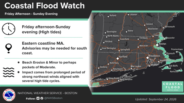
The persistent east to northeast winds are also creating rough seas, with increasingly large waves crashing into the coastline. With astronomical high tides this weekend, some areas of coastal flooding are likely, especially east and northeast facing coastlines. Coastal Flood Watches and High Surf Advisories have been issued for the eastern coast of Massachusetts, including Cape Cod and the Islands, from Friday afternoon into Sunday evening.
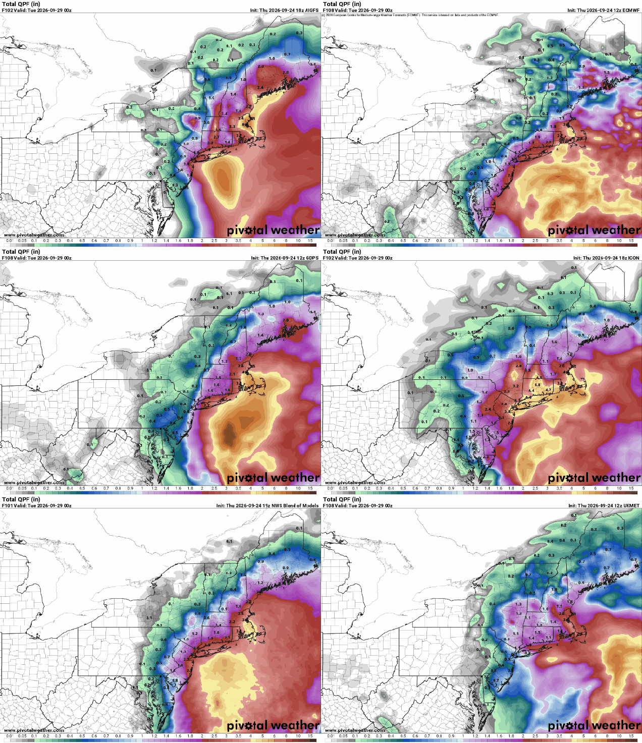
Aside from the wind and coastal threat, we’re also looking at some significant rainfall from this system. Some showers may develop during the day on Friday, but the high to the north should provide enough dry air to prevent much rain during the daytime hours. Steadier rain likely moves in at night from southeast to northwest, with rain continuing for most of Saturday, possibly heavy at times. Rain may taper off a bit on Sunday, but we’re still looking at occasional light rain, sometimes heavier for much of the day. Showers continue for Sunday night and a good chunk of Monday before the system finally starts to pull away. Widespread rainfall totals of 1-3 inches are likely, lesser amounts the farther west you go. Across eastern Massachusetts, even heavier totals are likely, with some models showing the potential for rainfall totals exceeding 5 inches. Because it is going to fall over the span of 48-72 hours, and it has been relatively dry again recently, widespread flooding is not expected, but areas of localized flooding are certainly expected.
Thursday night: Becoming mostly cloudy, breezy, especially near the coast. Low 46-53
Friday: Cloudy and breezy, showers possible in the afternoon, mainly across the South Coast and Cape Cod. High 61-68.
Friday night: Rain overspreading the region from southeast to northwest, windy, especially near the coast. Low 51-58.
Saturday: Wind-swept rain, possibly heavy at times. High 57-64.
Saturday night: Windy with more rain, possibly heavy. Low 50-57.
Sunday: Periods of rain and showers, still windy, especially along the coast. High 56-63.
Sunday night: Breezy with more showers and some periods of steady rain at times. Low 50-57.
Monday: More showers, gradually ending, winds diminish. High 56-63.

