Fall has begun and fall weather is arriving right on schedule.
Cooler weather is already filtering in behind the cold front that moves through earlier today, and gusty northwest winds on Friday will result in the coolest day across the region in the past several months. High pressure will bring plenty of sunshine, but temperatures may struggle to reach 60 across parts of the area. The high slides off to the east on Saturday, allowing temperatures to moderate a bit, but it will remain breezy. Sunday may start off with some sunshine, but clouds will quickly move in as the next system moves toward the area. Some showers are possible Sunday evening into Monday morning, but most of the daylight hours on Sunday should be dry. Most of Monday looks dry too, with the rain ending in the morning, then some sunshine may develop in the afternoon.

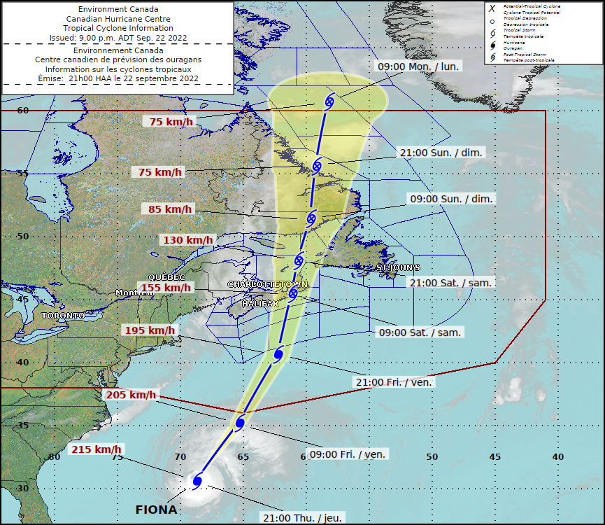
Meanwhile, Hurricane Fiona will remain a powerful storm in the Atlantic. It’ll pass west of Bermuda tonight, then start to weaken and become extratropical as it heads northward toward eastern Nova Scotia. When it moves inland late Saturday or early Sunday, it will be an incredibly strong storm, bringing strong winds and heavy rain to most of eastern Canada. Hurricane and Tropical Storm Watches are in effect for most of Atlantic Canada, and a High Wind Watch is in effect across eastern Maine. Around here, we may see some of the clouds on the western edge of the storm, but the bigger impact will be rough seas and large waves impacting the coast. A High Surf Advisory is in effect along the coast, with a Gale Warning for the coastal waters. Conditions should start to improve on Sunday as the storm moves into eastern Canada.
Thursday night: Clear to partly cloudy. Low 42-49.
Friday: Mostly sunny and windy. High 53-60.
Friday night: Clear skies, breezy. Low 40-47.
Saturday: Sunny and breezy. High 62-69.
Saturday night: Becoming partly cloudy. Low 42-49.
Sunday: Some morning sun, then becoming mostly cloudy, a few showers possible late in the day. High 65-72.
Sunday night: Mostly cloudy with some showers around. Low 53-60.
Monday: A few morning showers, then becoming partly sunny. High 67-74.
