While heat grips much of the nation, conditions will be a bit more pleasant around here this week:
A cold front will move offshore this morning, taking any lingering showers with it. High pressure then builds in later today into Wednesday with dry and seasonably warm conditions expected. Another cold front approaches later Thursday into Friday, with more showers and thunderstorms possible. Humid weather will return for those days as well, ahead of the front. Behind that front, high pressure builds in for next weekend with drier but still mild conditions.
Monday: Any lingering showers end this morning, skies clear out this afternoon. High 77-84.
Monday night: Clear skies. Low 54-61.
Tuesday: Plenty of sunshine with just a few afternoon clouds. High 79-86.
Tuesday night: Clear to partly cloudy. Low 55-62.
Wednesday: Partly to mostly sunny. High 73-80.
Thursday: Partly to mostly cloudy and breezy with showers and thunderstorms possible late in the day, more likely at night. High 77-84.
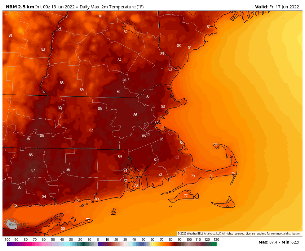
Friday: Showers and thunderstorms end in the morning, becoming partly sunny in the afternoon. High 81-88.
Saturday: Sunshine and a few clouds, breezy. High 72-79.
Sunday: A mix of sun and clouds. High 69-76.
