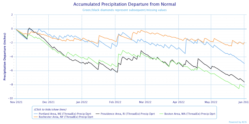
Some additional much-needed rain is on the way, but it shouldn’t disrupt your weekend plans too much.
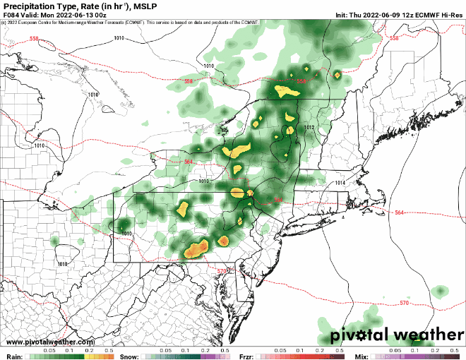
High pressure builds into the region for tonight and Friday, with drier and seasonably mild temperatures expected. Things get a little more complicated over the weekend. An upper-level low pressure system will move across the the Northeast this weekend. It may help produce a few showers or even a thunderstorm during the afternoon on Saturday, but they’ll be hit and miss, so if you’ll be outside, just keep an eye to the sky. A disturbance rotating around that upper-level low will move in later Sunday. This will provide some additional pop-up showers or thunderstorms, but again, they don’t look to be that widespread. Another low pressure system will move in on Monday, with plenty of clouds and a better chance for widespread showers and thunderstorms.
Thursday night: Clear skies. Low 51-58.
Friday: Sunshine and a few clouds. High 74-81.
Friday night: Increasing clouds. Low 53-60.
Saturday: More clouds than sun, chance for a shower or thunderstorm. High 73-80.
Saturday night: Partly to mostly cloudy. Low 53-60.
Sunday: More clouds than sun, a few showers or thunderstorms are possible, especially late in the day. High 72-79.
Sunday night: Mostly cloudy, showers possible, especially late at night. Low 55-62.
Monday: Partly sunny, chance for a few showers and thunderstorms, especially in the morning. High 72-79.
A couple of programming notes: 1. There will not be a Weekend Outlook published next Thursday. 2. When the Weekend Outlook resumes the following Thursday, we will be including the marine forecast for the remainder of the summer.
