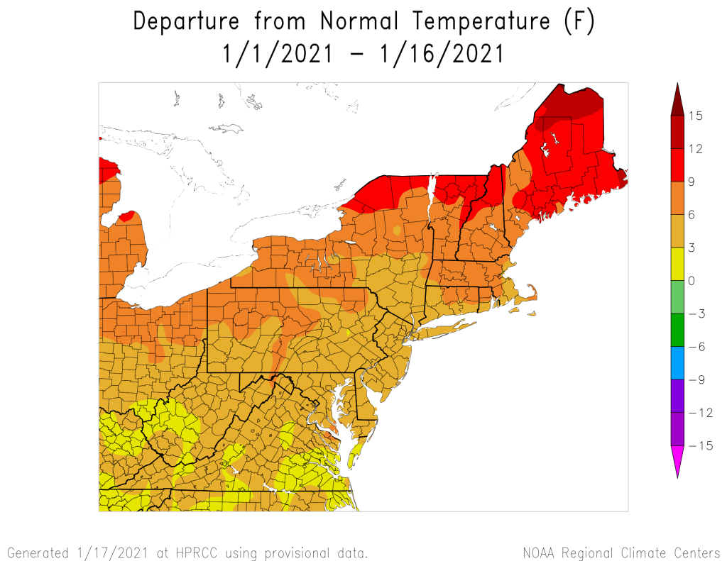
We’ve had an extended stretch of relatively mild weather for January, but that’s about to change.
Temperatures will remain mild compared to normal today, but we’ll have plenty of clouds once again as a weak upper-level disturbance moves across the region. It may produce a sprinkle or flurry in spots, but for the most part, we’ll remain dry. We’ll clear out tonight, then Tuesday will feature some sunshine and cooler temperatures as high pressure builds in. Some clouds will likely develop, because that’s just the way things have been this winter – we can’t seem to get a completely clear day, even when it looks like we should.

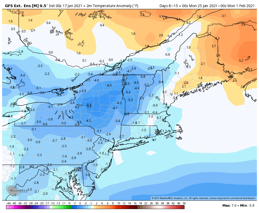
Another weak disturbances moves through Tuesday night and early Wednesday with more clouds and possibly a few snow showers, but even colder air will start to filter in behind this system. Some clearing is possible Wednesday afternoon as the system moves away, but another quickly system follows for Thursday into Friday. This may produce some snow showers, but right now, we’re only expecting light accumulations, if that. That system will strengthen as it moves into Atlantic Canada, producing gusty northwest winds around here over the weekend as high pressure builds in, which will result in much cooler weather moving in. It does look like the colder weather will hang around through much of next week, so it will start to feel like winter once again.
Monday: Some morning sun, then becoming mostly cloudy, chance for a sprinkle or a flurry, breezy. High 39-46.
Monday night: Clearing. Low 20-27.
Tuesday: A mix of sun and clouds. High 33-40.
Tuesday night: Partly to mostly cloudy with a few flurries possible. Low 22-29.
Wednesday: Plenty of clouds, maybe a few flurries in the morning and a few afternoon sunny breaks, breezy. High 29-36.
Thursday: Partly to mostly cloudy with scattered snow showers. High 28-35.
Friday: More clouds than sun. High 35-42.
Saturday: Partly to mostly sunny, windy, and colder. High 29-36.
Sunday: Sunshine and a few clouds, breezy. High 27-34.
