Your air conditioner has gotten a much-needed rest for the past few days, but it’s about to get a workout. Some typical summertime weather is coming up for the weekend with heat and humidity settling into New England.

High pressure remains in control today with mild temperatures (a little below normal for mid-July) and comfrtoable humidity levels, but that’s about to change. A warm front will send clouds into the region tonight, with some showers and thunderstorms likely on Friday. Most of the storms shouldn’t be that strong, but could contain some heavy downpours. We’re not expecting much, if any, severe weather. Temperatures will remain a little below normal, but it will be breezy and significantly more humid.
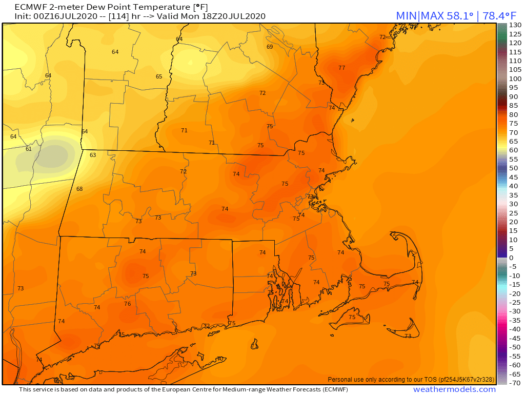
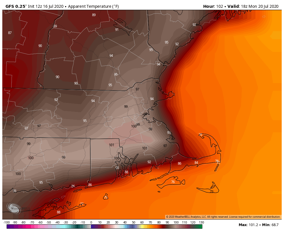
High pressure builds in for the weekend and with it comes the heat and humidity. Temperatures will be near or above 90 on Saturday, and should be in the 90s away from the South Coast for Sunday and Monday. Dewpoints will likely get above 70 for Sunday and Monday as well, so it will be quite uncomfortable if you’re outside for any length of time, as the heat index will be apporoaching (or even exceeding) 100 in some spots. We may get a little relief Monday afternoon as a weak disturbance moves through, triggering a few showers and thunderstorms, but that’s about it.
Thinking about heading to the beach or out on a boat? Temperatures will be in the upper 70s to lower 80s at beaches along the South Coast and lower to middle 80s at beaches along the east coast this weekend. You’ll have south winds 10-15 mph on Friday, becoming southwest over the weekend, and seas generally 1-3 feet. With a UV Index in the very high range, you’ll start to get a sunburn in just 15 minutes or so, so make sure you put on sunscreen!
Thursday night: Becoming mostly cloudy, a few showers are possible towards daybreak. Low 56-63.
Friday: Plenty of clouds with scattered showers and thunderstorms. High 71-78.
Friday night: Clearing. Low 63-70.
Saturday: Sunshine and a few afternoon clouds, humid. High 86-93.
Saturday night: Clear skies. Low 65-72.
Sunday: Mostly sunny, hot, and humid. High 90-97, a little cooler right at the coast.
Sunday night: Clear to partly cloudy. Low 71-78.
Monday: Partly to mostly sunny, hot, and humid, chance for a few showers and thunderstorms. High 90-97, a little cooler right at the coast.
