Weekly Outlook: November 7-13, 2022

Fall is a time for change, and we’ll have some changes coming this week.

Our unseasonably warm air remains in place for one more day today. A few showers are possible this morning as a cold front crosses the region, then we’ll have a sunny a warm afternoon. The colder air lags a bit behind the front, but it will start to move in late in the day. High pressure then builds inf for Tuesday and Wednesday with sunshine and much cooler temperatures, though they’ll actually be fairly close to normal for early November. As the high slides off to the east, well warm back up for Thursday and Friday. While it won’t be as warm as it was over the weekend, it’ll still be rather mild for the first half of November. After that, the changes really start.

More record highs are possible across the Northeast today. Image provided by Weathermodels.com.

An area of low pressure is slowly organizing east of the Bahamas. It will likely become a tropical depression soon (possibly even before you read this). It will likely become a tropical storm or the next day or so, and could even become a hurricane. While it may seem unusual for a hurricane this late in the year, Hurricane Season doesn’t end until November 30 for a reason. This system will likely head westward, passing close to or over the northern Bahamas before heading for the east coast of central Florida. Eventually, the storm will turn northward as a deepening trough of low pressure moves toward the East Coast. When this turn occurs is still a bit of a question, and while it will have a significant impact for Florida and the Southeast, for us up here, it doesn’t make too much of a difference (more on that in a bit). A turn before reaching Florida would obviously spare the state from the worst of the impact, delaying the turn until it crosses the state and moves into the Gulf increases the threat to western Florida and possibly the Panhandle. The most likely scenario though is a northward turn shortly after landfall, bringing it up Florida and into the Southeast. This brings heavy rain and strong winds to much of the state, while storm surge also an issue for the east coast of Florida.
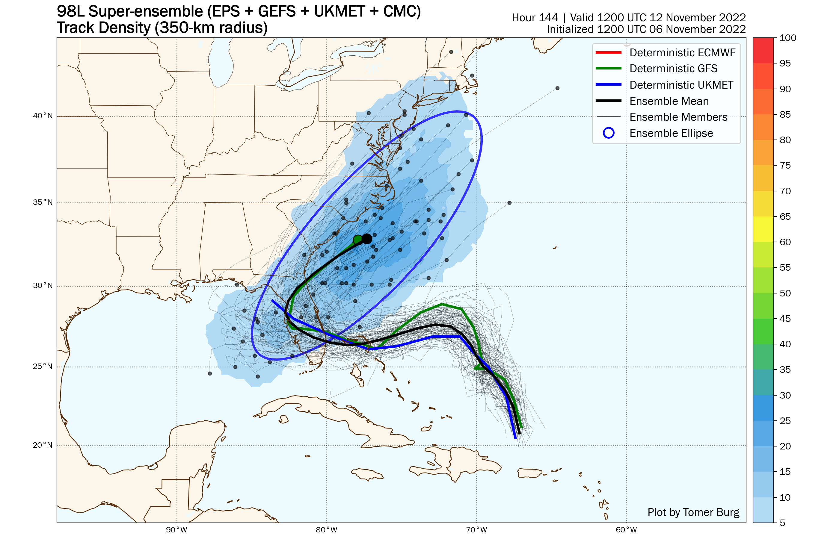
Ensemble forecasts for the track of a disturbance north of Puerto Rico. Image provided by Tomer Burg.

Once it makes that turn, it will turn more toward the northeast, likely moving back offshore off the coast of Georgia, and passing close to or just off the Carolina coastline. After that it will head up the coast, passing south and east of New England on Saturday. It won’t be tropical any more at this point, but it will still be a potent nor’easter. As a result, we’ll have some rain, likely heavy, from Friday night into late Saturday. Gusty winds are also likely near the coast. Some of the models are trying to bring a tremendous amount of rain into eastern New England, and given the system’s tropical roots, this is certainly a possibility. However, we’ve seen time and time again the models forecast some very heavy rain several days in advance, and slowly back off those totals as the system gets closer.
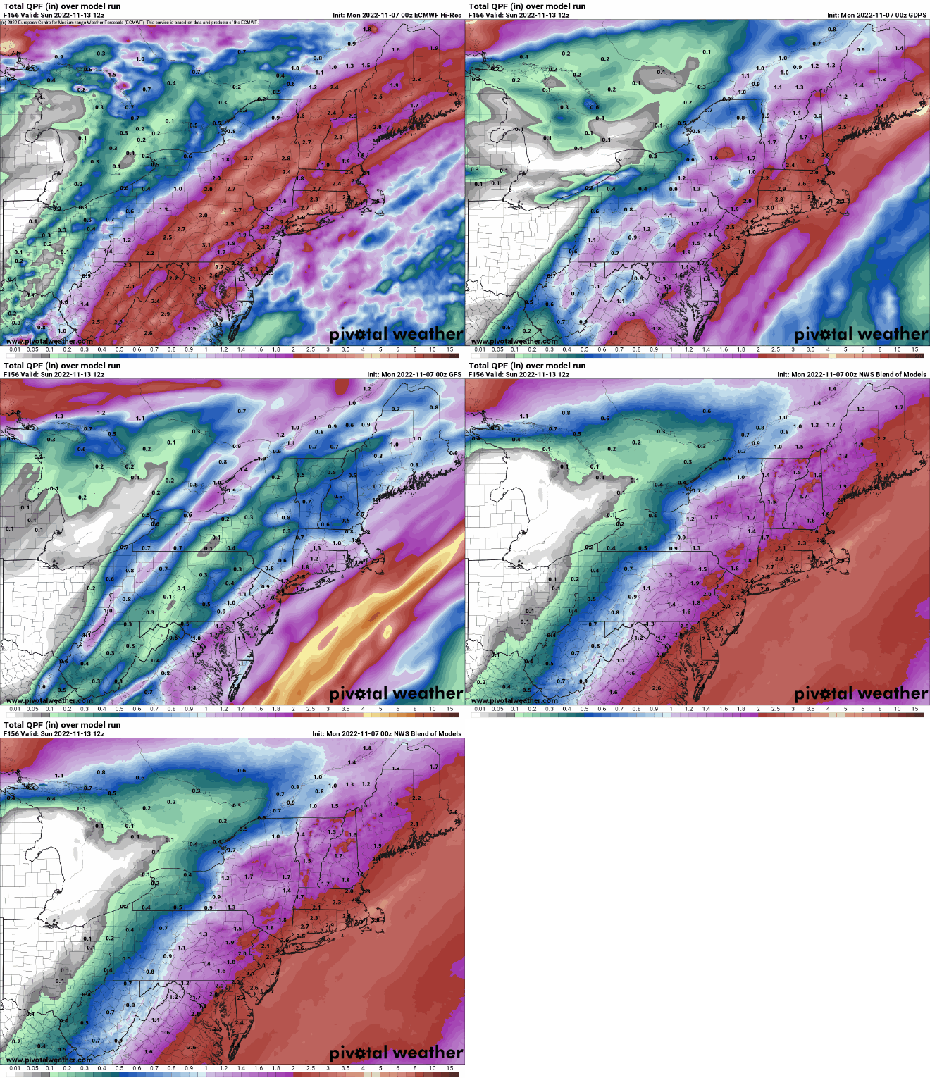
Most of the models show some heavy rain for the end of the week, but differ on how heavy. Images provided by Pivoral Weather.

As the system moves away, a strong cold front will move through. Behind it, we’ll clear out on Sunday, but much cooler air will settle into the region with high pressure building in. In fact, a much cooler pattern is shaping up for next week, with temperatures likely below normal for a good chunk of the week.

Most of next week looks to feature below normal temperatures across the Northeast. Image provided by WeatherBell.

Monday: Cloudy, breezy, and mild with a shower possibly early, then skies clear out in the afternoon. High 71-78.

Monday night: Clear skies (Perfect for viewing the total lunar eclipse late at night). Low 37-44.

Tuesday: Plenty of sunshine, breezy, much cooler. High 48-55.

Tuesday night: Clear skies. Low 28-35.

Wednesday: More sunshine. High 47-54.

Thursday: Sunshine and a few afternoon clouds, milder. High 59-66.

Friday: Increasing and thickening clouds, showers possible late in the day, steady rain develops at night. High 63-70.

Saturday: Cloudy and breezy with periods of rain, possibly heavy at times, ending at night. High 61-68.

Sunday: A mix of sun and clouds, breezy, and much cooler. High 46-53.

Weekend Outlook: November 4-7, 2022

The calendar says November, but it sure won’t feel like it this weekend.

High pressure controls our weather right into Monday. Temperatures will be well above normal, with highs topping 70 in many locations for each of the next few afternoon. Friday will feature sunshine, but some clouds will start to move in on Saturday, and be more prevalent on Sunday as a weak front tries to approach from the west. That front likely never gets here, so we’ll clear out again on Monday. However, a backdoor cold front will drop southward later Monday. There won’t be much in the way of cloudcover with the front, but it will mark the end of our warm spell, with cooler weather slowly returning next week.

A few record highs are possible across the region on Sunday. Image provided by WeatherBell.

Thursday night: Clear to partly cloudy, a little patchy fog may develop in a few spots. Low 41-48.

Friday: Sunshine and a few clouds. High 65-72.

Friday night: Partly cloudy. Low 51-58.

Saturday: A mix of sun and clouds. High 68-75.

Saturday night: Partly to mostly cloudy. Low 59-66.

Sunday: Intervals of clouds and sunshine. High 69-76.

Sunday night: Partly cloudy. Low 57-64.

Monday: Becoming mostly sunny. High 70-77.

Weekly Outlook: October 31 – November 6, 2022

As we flip the calendar to November, it certainly won’t feel like the final month of fall for a good portion of the week.

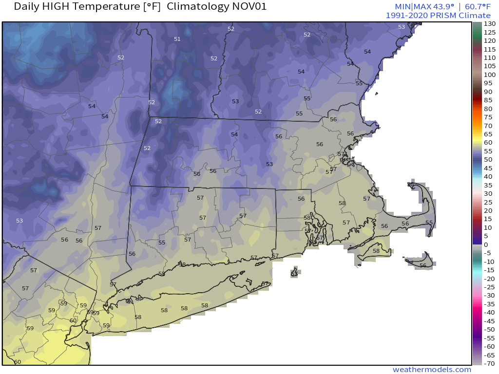
Normal high temperatures are in the middle 50s as we begin November. Image provided by Weathermodels.com

We start the week off with low pressure moving from the Tennessee Valley into the eastern Great Lakes. It will spread clouds into the region today, with a few showers likely tonight into early Tuesday. Once that system moves by, high pressure builds in with drier conditions for Wednesday right through to Saturday. Temperatures will be mild for the most part, and next weekend could see temperatures get into the 70s away from the coastline. By Sunday, a cold front will drop down from the north with some showers, but temperatures will be dependent on the timing of the front. The later it moves through, the more likely it is that we have another warm day.

Next Sunday could be very warm across the region. Image provided by WeatherBell.

Monday: Plenty of clouds with some sunny breaks at times. High 60-67.

Monday night: Mostly cloudy, chance for a few showers. Low 50-57.

Tuesday: Chance for a few showers early, some clearing may take place late in the day. High 62-69.

Tuesday night: Becoming clear. Low 48-55.

Wednesday: Plenty of sunshine. High 61-68.

Thursday: Sun, sun, sun! High 56-63.

Friday: Partly sunny. High 62-69.

Saturday: Intervals of clouds and sun. High 65-72.

Sunday: Partly to mostly cloudy with showers possible. High 65-72.

Weekend Outlook: October 28-31, 2022

An extended stretch of dry weather is coming up, but it probably won’t last through Halloween.

High pressure provides the region with dry weather into early Sunday. Some clouds will be around on Friday as an upper-level disturbance moves through, otherwise, we’ll generally have clear skies. Temperatures will be on the cool side through Friday night, but will start to moderate on Saturday as high pressure moves off to the east. Clouds start to stream in on Sunday ahead of a low pressure system moving up from the southwest. That system will bring in some showers for Monday afternoon and into Tuesday. For any local towns that still do trick-or-treating on Halloween itself, it’s look rather damp right now.

Saturday morning could be rather chilly in some locations. Image provided by WeatherBell.

Thursday night: Clear and cool, breezy through the evening. Low 34-41.

Friday: A mix of sun and clouds. High 51-58.

Friday night: Becoming mostly clear. Low 29-36.

Saturday: Plenty of sunshine. High 55-62.

Saturday night: Clear skies. Low 30-37.

Sunday: Sunshine during the morning, clouds start to increase during the afternoon. High 58-65.

Sunday night: Mostly cloudy. Low 41-48.

Monday: Cloudy with showers likely, mainly during the afternoon and evening. High 61-68.

Weekly Outlook: October 24-30, 2022

Over the past few months, we’ve had numerous weeks during which we have enjoyed extended stretches of dry weather. The first half of this week won’t be one of them.

A weak low pressure system moving up from the south will bring in more showers today, tapering off to drizzle this evening. Occasional showers may linger into Tuesday and Wednesday as an upper-level system moves in from the west, before a cold front finally moves across the region. Drier air moves in for Thursday, but temperatures will remain warm. High pressure then builds in for the end of the week with drier and more seasonable conditions.

Parts of the region could receive a decent amount of rainfall today. Image provided by WeatherBell.

Monday: Cloudy with occasional showers and fog. High 59-66.

Monday night: A few more showers along with some drizzle and fog. Low 51-58.

Tuesday: Plenty of clouds with a shower or two possible. High 64-71.

Tuesday night: Cloudy with a few showers, more fog may develop. Low 55-62.

Wednesday: Scattered showers. High 61-68.

Thursday: A mix of sun and clouds. High 64-71.

Friday: Partly sunny and cooler. High 52-59.

Saturday: Intervals of clouds and sun. High 53-60.

Sunday: Partly sunny. High 56-63.

Weekend Outlook: October 21-24, 2022

We’ve got a couple of nice days coming up, and a couple of not-so-nice days coming up.

After dealing with a drought for most of the summer, rainfall is above to well above normal over the past 60 days for most of the region. Image provided by WeatherBell.

High pressure remains in control through Saturday with sunshine both Friday and Saturday afternoon along with moderating temperatures. So, if you’ve got outdoor plans, you’re in good shape. Clouds will start to move in from the south late Saturday and Saturday night as low pressure starts moving up the coastline. This will be a fairly weak storm, but it will have plenty of moisture. Rain will develop during the day on Sunday, likely reaching the South Coast during the morning, the Mass Pike corridor by early afternoon, and the Merrimack Valley and Southern New Hampshire by late afternoon. Sunday night will be fairly wet, as the rain may be heavy at times. On Monday, the rain will taper off to showers during the morning, with the steadiest rain ending by early afternoon. However, occasional showers and drizzle may linger well into the evening, which could make for a damp night in Foxborough for the Patriots Monday Night Football game with the Bears.

Some heavy rain is possible across parts of the region Sunday into Monday. Images provided by Pivotal Weather.

Thursday night: Clear and chilly again. Low 36-43.

Friday: Plenty of sunshine. High 57-64.

Friday night: Clear skies. Low 37-44.

Saturday: Sunshine through early afternoon, then high clouds start to stream in. High 61-68.

Saturday night: Increasing and thickening clouds. Low 41-48.

Sunday: Rain developing from south to north. High 57-64.

Sunday night: Periods of rain, possibly heavy. Low 47-54.

Monday: Rain tapers off to showers early, showers drizzle through the afternoon. High 59-66.

Weekly Outlook: October 17-23, 2022

The week starts off unsettled, but a warmup is in the way.

Normal high temperatures for mid-October are in the lower 60s across the region. Image provided by Weathermodels.com

A strong cold front will approach the region today, with some showers developing ahead of it. Those showers will continue off -and-on into Tuesday morning before the front finally pushes offshore. It does not look like we’ll have the heavy rain that the models were advertising a few days ago, but any rain will help to continue to put a dent into the drought. Skies start to clear out late in the day as high pressure starts to build in. While temperatures will turn cooler for Tuesday and Wednesday, the core of the cold air will stay off to our west. In fact, some lake-effect snow is possible downwind of the Great Lakes over the next few days. We’ll have temperatures that are below normal, but highs should still be in the 50s. By the end of the week and the weekend, the high slides off to the east, allowing temperatures to moderate to above normal levels for Friday into Sunday.

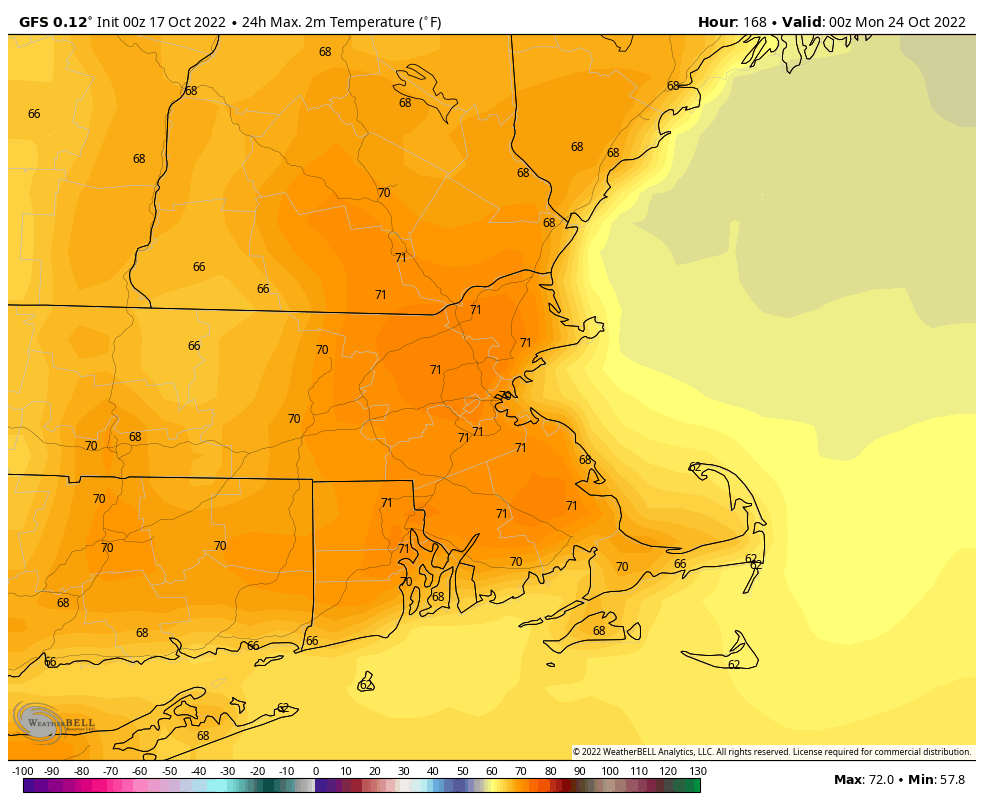
Temperatures could reach 70 degrees next weekend. Image provided by WeatherBell.

Monday: Mostly cloudy, showers develop in the afternoon. High 57-64.

Monday night: Cloudy with occasional showers. Low 46-53.

Tuesday: Showers ending by early afternoon, gradual clearing late in the day. High 56-63.

Tuesday night: Becoming clear. Low 34-41.

Wednesday: Sunshine and a few clouds. High 51-58.

Thursday: Plenty of sunshine, breezy. High 50-57.

Friday: Mostly sunny. High 56-63.

Saturday: Sunshine and some afternoon clouds. High 62-69.

Sunday: A mix of sun and clouds. High 63-70.

Weekend Outlook: October 14-17, 2022

We’ve got some unsettled weather to start and end the weekend, but in between, it should be rather nice.

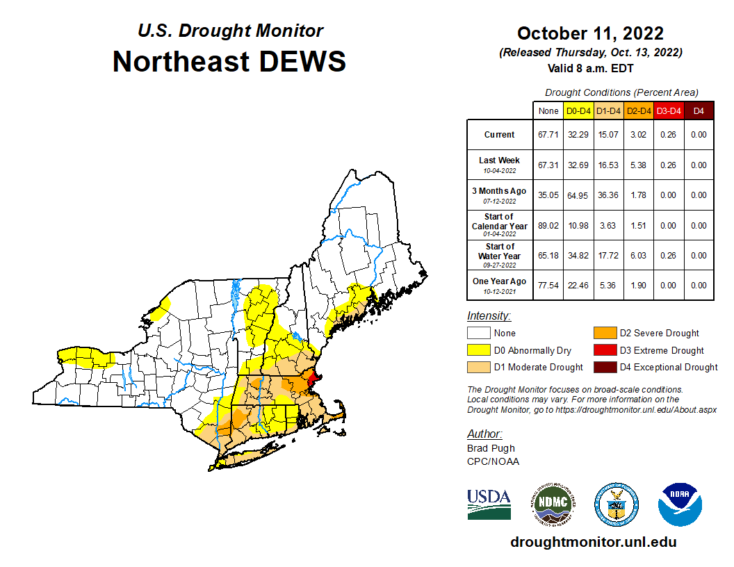
The drought continues across the region, but we’ll put another big dent in it this weekend. Image provided by the National Drought Mitigation Center.

A cold front is approaching the region, and we’ll have some rain and gusty winds ahead of it tonight into Friday. Some of the heavy could be heavy, especially from central Massachusetts into southern New Hampshire, where flood watches are in effect. The rain tapers off to showers Friday morning, ending from west to east during the afternoon and evening. Skies clear out Friday night, then high pressure builds in for Saturday with sunshine and mild temperatures. Sunday also looks mild, but clouds will start to increase ahead of the next system moving toward the region. That system will bring in showers and cooler weather for Monday into Tuesday. In fact, much of next week is looking cool at this point.

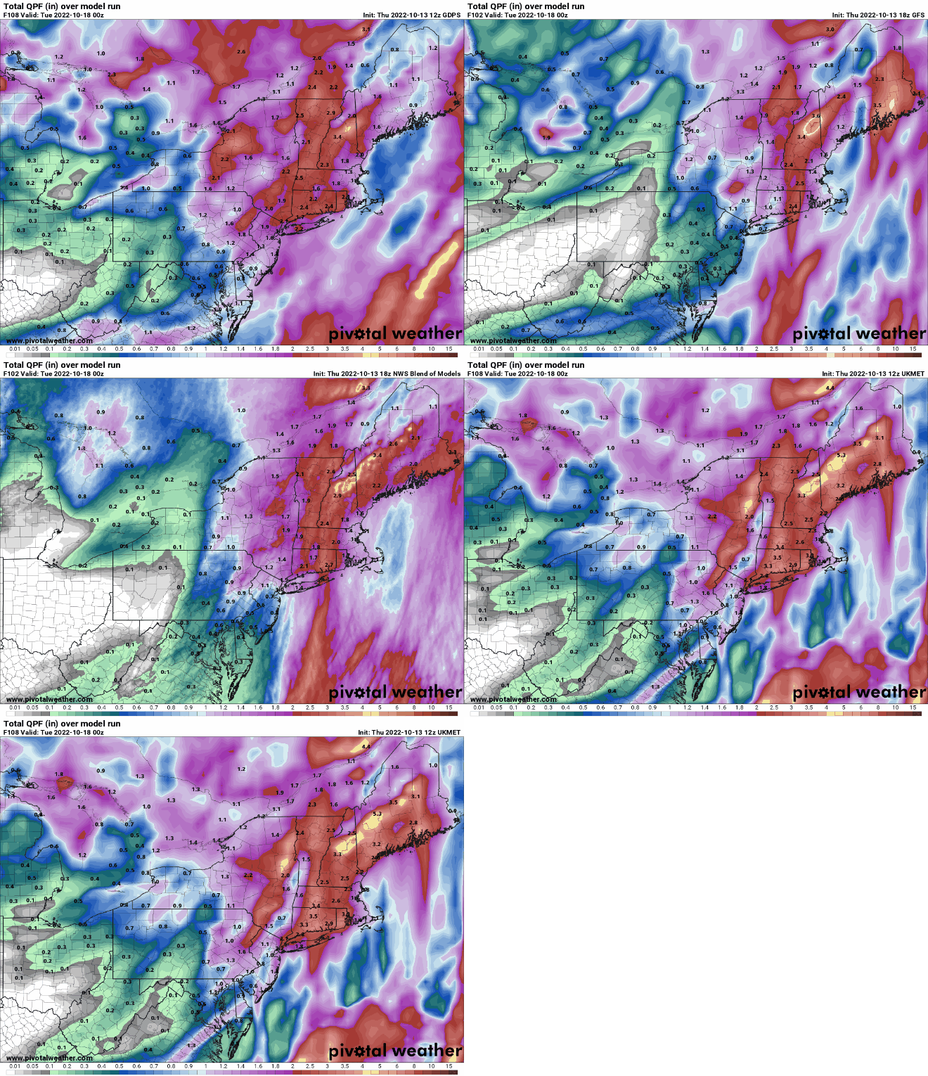
Between tonight and Monday, we’re expecting quite a bit of rain around here. Images provided by Pivotal Weather.

Thursday night: Breezy with periods of rain, possibly heavy at times. Low 57-64.

Friday: Rain tapers off to showers, ending during the afternoon. Winds diminish in the morning. High 65-72.

Friday night: Any lingering showers end during the evening, then skies clear out. Low 44-51.

Saturday: Sunny and mild. High 62-69.

Saturday night: Clear to partly cloudy. Low 45-52.

Sunday: A mix of sun and clouds. High 63-70.

Sunday night: Becoming cloudy. Low 43-50.

Monday: Scattered showers. High 56-63.

Weekly Outlook: October 10-16, 2022

High pressure will be in control for much of the upcoming week, but there is some unsettled weather on the way.

Normal high temperatures for mid-October are still in the middle 60s. Image provided by Weathermodels.com

Another cool day to start off the week with a weak frontal system moving through, but only producing some clouds. High pressure will be in in control with moderating temperatures for Tuesday through Thursday with dry weather. Clouds will start to move in later Wednesday and Thursday as a strong cold front starts to approach the region. That front will bring in a period of rain and showers for Thursday night and early Friday, along with some gusty winds at times. Behind the front, high pressure builds back in with cooler weather for next weekend.

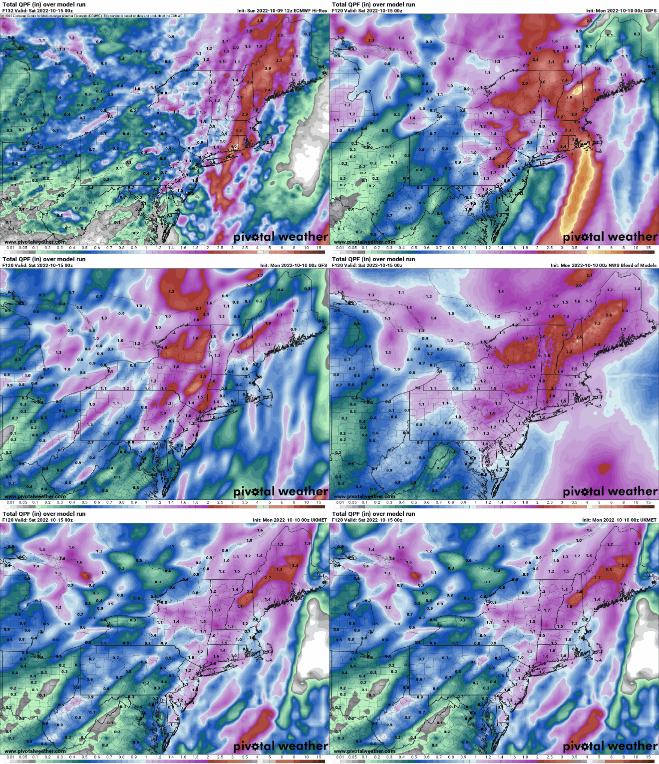
Some models are showing the potential for heavy rain Thursday into Friday. Images provided by Pivotal Weather.

Monday: Partly sunny, just a slight chance for an afternoon sprinkle, mainly north of Boston. High 59-66.

Monday night: Clear skies. Low 38-45.

Tuesday: Plenty of sunshine. High 60-67.

Tuesday night: Clear skies. Low 40-47.

Wednesday: A mix of sun and clouds. High 65-72.

Thursday: Becoming mostly cloudy and breezy with showers developing in the afternoon, possibly becoming a period of rain at night. High 65-72.

Friday: Showers end in the morning, then becoming partly sunny. High 64-71.

Saturday: Plenty of sunshine. High 59-66.

Sunday: Sunshine and some afternoon clouds. High 59-66.

Weekend Outlook: October 7-10, 2022

We’ve got one more mild day coming up but fall weather really arrives.

We’ll have some clouds across the region tonight as a weak upper-level disturbance crosses the Northeast, but Friday is shaping up to be another fantastic early October day with mostly sunny skies and mild temperatures, with many locations topping 70. However, a strong cold front will slice across the region late in the day. It will be accompanied by some clouds and possibly a few showers, but for the most part, it’ll have little fanfare. Behind it, you’ll notice a big difference. High pressure builds in for the weekend with sunshine for Saturday through Monday, but temperatures will be significantly cooler. Many locations may fail to top 60 on Saturday despite ample sun, and some frost is possible Saturday night as temperatures tumble into the 30s in some of the normally cooler locations. Temperatures will moderate a bit for Sunday and Monday, but will still be near or a little below normal for early October.

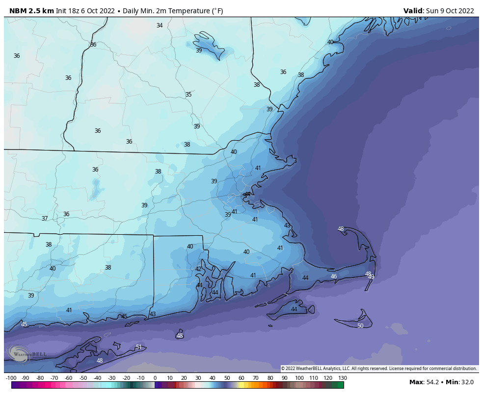
Saturday morning is looking quite chilly. Image provided by WeatherBell.

Thursday night: Partly to mostly cloudy. Low 50-57.

Friday: Becoming partly to mostly sunny, chance for a few late-day showers. High 69-76.

Friday night: Gradual clearing. Low 40-47.

Saturday: Sunny and cool. High 54-61.

Saturday night: Clear and chilly. Low 35-42.

Sunday: Plenty of sunshine. High 56-63.

Sunday night: Clear skies. Low 38-45.

Monday: Sunshine and some afternoon clouds. High 57-64.