Weekly Outlook: July 23-29, 2018

The calendar says July, and it’s going to be warm and humid all week long, but our first hints of fall will be showing up this week. Many of you will rejoice at this. That’s right – the Patriots are back! Training camp opens this week. Before you know it, the leaves will be falling, pumpkin-flavored everything will be available everywhere, and we’ll be spending every Sunday in front of the TV watching football. Until then, we’ve got this humidity to deal with.

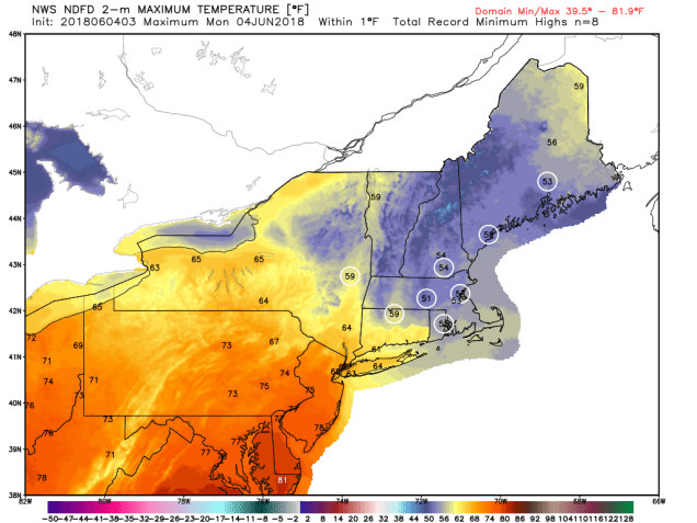
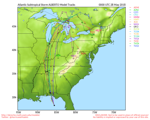
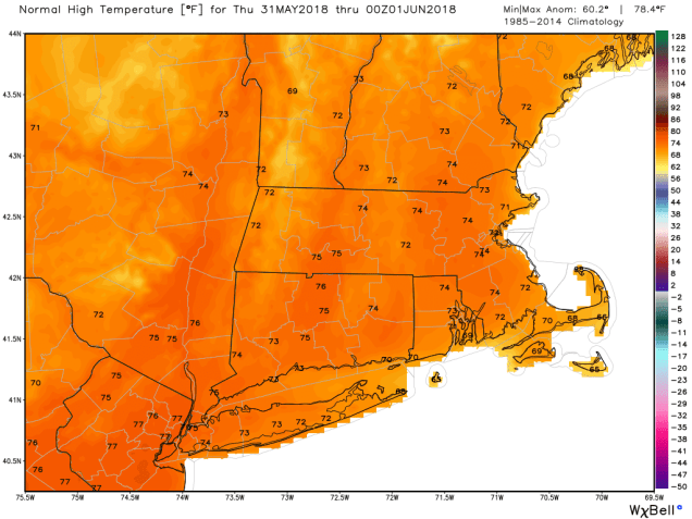
Before we start, we’re going to rant a little bit. Above you’ll see a random sampling of 3 forecasts that we pulled off the web late Sunday night. You’ll notice that they all have an icon and a temperature for each day. We don’t do that here at StormHQ. There are many times, especially here in New England, where an icon doesn’t tell you the whole story. Take for example, a winter day around here. It can start off with sunshine in the morning, then clouds move in, snow develops in the afternoon, it mixed with sleet, freezing rain, and changes to rain before dinner time. It’s happened plenty of times, and will again. Exactly what icon would you use to convey that info? This is why we try to explain everything. An icon doesn’t work all the time. This week, that will be the case nearly every day. But hey, if you just want a quick forecast without any details, there are a million websites and apps out there for you, most of them will just regurgitate the models because they are computer-generated or run by people who think they are meteorologists because they can read the models. If you want to actually find out what the forecast is, ignore the app and check with an actual meteorologist.

9-km ECMWF USA Cities East Coast USA Precipitable Water
It’s not quote the “atmospheric river” they get in California in the winter, but we’ve got a steady stream of moisture moving up the East Coast from the tropics for the next week or more. Loop provided by Weathermodels.com

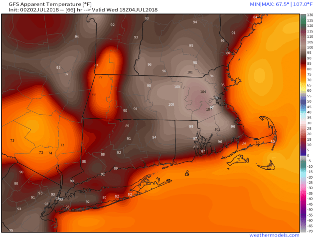
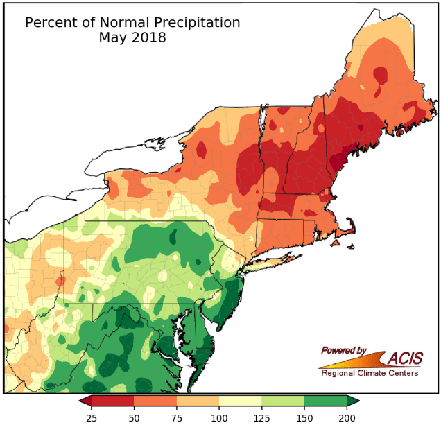
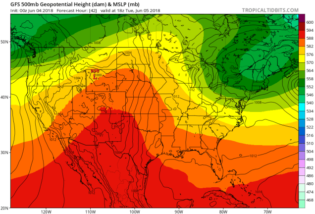
As for the forecast for this week, the big picture is relatively simple, but the details aren’t as east. As we wrote in our post this past Friday, a rather humid airmass has settled into the region, and it isn’t going away any time soon. We’ve got high pressure anchored off the East Coast, and an upper-level trough of low pressure generally centered across the Midwest. As a result, southerly winds will pump warm and humid air northward from the tropics to most of the East Coast. Dewpoints will generally be in the upper 60s and 70s all week, so expect numerous bad hair days, unless of course, you are bald.

my-hairstylist-is-humidity-ee-cards-20449193
Humidity? Yeah, we’re going to have it this week.

With warm and humid air in place, we’ll have showers and thunderstorms popping up, some of which will produce heavy rainfall in spots.  As you can see in the icons above, those showers and storms are possible every day. That doesn’t mean it’s going to rain everywhere each day. Some days will feature only isolated activity as the high pressure area drifts westward. Some days will feature more widespread activity. We’ll try our best to figure out which days are likely to be wetter than others, but as we already mentioned, each day likely has a chance for at least a few showers or storms in some locations.

us_model-en-087-0_modez_2018072212_192_519_220
While this model is showing widespread rainfall totals of 1-3 or more inches over the next 7 days, in reality, those amounts could be highly localized. Image provided by Weather.us

Monday: Early clouds and a few showers, then becoming partly sunny, with a chance for some more showers and thunderstorms in the afternoon, mainly from MetroWest and points north and westward. High 77-84.

Monday night: Partly to mostly cloudy. Low 66-73.

Tuesday: Partly to mostly sunny, just a slight chance for a pop-up shower or two. High 80-87.

Tuesday night: Becoming partly to mostly cloudy again. Low 67-74.

Wednesday: More clouds than sunshine, scattered showers and thunderstorms possible. High 79-86.

Thursday: Cloudy early, some sunshine returns in the afternoon, showers and thunderstorms may develop. High 77-84.

Friday: Partly sunny, slight chance for a pop-up shower or two.  High 83-90.

Saturday: Early clouds, maybe a shower, then becoming partly to mostly sunny.  High 80-87.

Sunday: Intervals of clouds and sun, slight chance for a shower or thunderstorm. High 79-86.

And finally, for our friends at the Franklin Yacht Club, here’s the preliminary forecast for the 3rd annual Regatta and celebration on Saturday: A cloudy start. maybe even a few showers in the morning, with sunshine developing as we head into the afternoon. Southwest winds at 5-10 knots in the morning increase to 10-15 knots in the afternoon. Seas may be a little rough but shouldn’t be that bad. Temperatures will start the day in the middle 70s, and rise into the lower 80s during the afternoon. At least check, water temperatures from a buoy near the Fall River end of the Braga Bridge were reading 75 degrees.

Weekly Outlook: July 16-22, 2018

Good day eh? Welcome to the blog. This week it’s coming to you from the Great White North. Well, it’s North, and it’s Great, but it won’t be White for at least a few months.

great-white-north
We’re, like, on vacation, but still forecasting, eh?

The week starts off with a hot and humid day on Monday with high pressure in control. Well, it’ll start off with some fog in a few places, THEN it’ll become hot and humid. A cold front then approaches on Tuesday. It’ll trigger some showers and thunderstorms across the region. With a hot and humid airmass still in place, (how hot will depend on how much sunshine we get on Tuesday eh), some of the storms could become strong to severe. This shouldn’t be a widespread severe outbreak, but a few storms could contain gusty winds and heavy downpours. We really need any rain we can get, as we are quickly slipping into drought conditions across much of the region.

90dPNormNRCC
Over the past 90 days, rainfall totals have been well below normal across much of New England and New York. Image provided by the Northeast Regional Climate Center.

A few showers may linger into Wednesday morning, then high pressure builds in with sunshine, seasonable temperatures, and low humidity.  The weekend, however, is when things get interesting. An upper-level low pressure system will settle into the Midwest. This gives us a southwesterly flow aloft, sending warm and humid air back into the region. However, as impulses of energy ride around that low, they’ll help to bring showers and thunderstorms into the area. The timing is still uncertain, and it doesn’t look like an organized area of low pressure will impact us. Nor does it look like both days will be washouts. They might not be beach days either, you hosers. We’ve got plenty of time to worry about that.

Monday: Sunshine and some afternoon clouds. Just a slight chance for a pop-up shower or thunderstorm. High 85-92.

Monday night: Partly to mostly cloudy. Low 66-73.

Tuesday: Some sunny breaks early, otherwise plenty of clouds with showers and thunderstorms likely. High 83-90.

Tuesday night: Mostly cloudy, showers and thunderstorms gradually taper off. Low 62-69.

Wednesday: Early clouds, maybe a lingering shower or two, then becoming partly to mostly sunny. High 78-85.

Thursday: Lots of sunshine. High 79-86.

Friday: Partly to mostly sunny. High 82-89.

Saturday: Partly sunny, chance for some showers and thunderstorms. High 79-86.

Sunday: More clouds than sun, additional showers and thunderstorms are possible. High 76-83.

This blog was written in 3B – three beers – and it looks good, eh? We’re heading over for a double-double and some Timbits now. Until next week, Take Off, eh?

Weekly Outlook: July 9-15, 2018

We’ve got a little bit of everything in this week’s forecast. We’ll have some heat, some days with low humidity, some days with high humidity, sunshine, showers, and thunderstorms, an offshore hurricane. Wait, what?

snow-coming-soon-to-a-street-near-you1
OK, maybe we don’t have a little bit of EVERYTHING in the forecast.

Despite all the different things involved, we actually have a fairly straightforward forecast again this week. We start off with high pressure in control. While this morning won’t be as cooler as the last couple were, it will still be refreshing, as we’ll start the day in the 50s for much of the region. With plenty of sunshine expected, combined with low humidity, temperatures will quickly jump into the 80s this afternoon, with some lower 90s expected as well.

Tuesday will be a different story. Humidity levels will increase, but not to the levels we had last week. It will be hot though, with temperatures well into the 80s and lower 90s again. We’ll also have a cold front moving in from the northwest. This front may trigger some showers and thunderstorms during the afternoon and evening. We’re not expecting much in the way of severe weather with these storms, in fact, we’re not expecting the storms to be that widespread.

nam3km_mslp_pcpn_frzn_neus_fh36-60
Thunderstorm development is not expected to be widespread across the region late Tuesday into Tuesday night. Loop provided by Tropical Tidbits.

Behind the front, high pressure returns for Thursday and Friday with sunshine, low humidity, and seasonably warm temperatures. That high pressure settles offshore over the weekend, which in turn brings southwesterly winds to the region. Southwest winds will bring hot and humid air back in, but we’ll also have the chance for showers and thunderstorms both days.

download (1)
Satellite loop of Tropical Storm Chris spinning off the coast of North Carolina late Sunday night and early Monday morning. Loop provided by NOAA.

OK, back to that offshore hurricane that we mentioned. It’s actually not a hurricane yet (as of when this post was written), but it should become one on Monday. Tropical Storm Chris has been meandering around off the coast of North Carolina for the past day or two, slowly gathering strength. As that cold front approaches from the northwest on Tuesday, it should provide the nudge that Chris needs to start moving northeastward. It will pass well south and east of New England towards the middle of the week. While it will generate some rough surf along the coast, and large waves offshore, unless you are planning to take your boat (or someone else’s) out, then the impacts here will be negligible.

9-km ECMWF USA Cities New England Precip Type & MSLP 102
The ECMWF model brings Chris closest to New England, but it keeps the rainfall offshore, with gusty winds confined to Cape Cod and Southeastern Massachusetts, Image provided by Weathermodels.com

While we’re discussing the tropics, we’ll also mention former Hurricane Beryl. Beryl was a tiny system from the start, and quickly dissipated as it moved across the Lesser Antilles Sunday night. It will bring some gusty winds and heavy rain to parts of Puerto Rico and the Virgin Islands today. Just when they need as many parts of the area are still trying to recover from the double whammy of Irma and Maria last year, right? So why are we mentioning it? Well, a few of the models are showing the potential for what’s left of Beryl to regenerate after it crosses Hispaniola and moves into the Bahamas towards the middle of the week. After that, some of them have it move up the coast as a very weak system. While the odds of this happening seem low right now, they’re not zero. We’re not expecting it to regenerate, but we’re also not completely ruling it out yet either.

Monday: Sunshine, sunshine, and more sunshine. High 86-93, cooler along the South Coast.

Monday night: Clear skies, just a few high clouds at times. Low 60-67.

Tuesday: Sunshine to start, then clouds move in with a few late-day showers or thunderstorms possible. High 88-95, cooler along the South Coast.

Tuesday night: Partly to mostly cloudy with showers and thunderstorms possible, mainly during the evening. Low 62-69.

Wednesday: A mix of sunshine and clouds, less humid. High 77-84, cooler along the coast.

Thursday: Sunshine and some high clouds. It may be a bit breezy along the coast. High 80-87, cooler along the coast.

Friday: Partly to mostly sunny. High 82-89, cooler along the South Coast.

Saturday: A mix of sun and clouds, slight chance for a shower or thunderstorm. High 83-90.

Sunday:  Partly sunny, some showers and thunderstorms are possible. High 84-91.

Weekly Outlook: July 2-8, 2018

Remember the winter? You know, when it was snowing, or temperatures were in the single digits with sub-zero wind chills? Good times, right? No? You sure? Well, then, have we got a forecast that you’ll like!

gfs_z500_mslp_us_11
A ridge of high pressure will be in place aloft, and that means it’s going to be hot for the next several days. Image provided by Tropical Tidbits.

The forecast for this week is actually fairly simple. With high pressure both at the surface and aloft, we’re going to have mainly hot, humid, and dry conditions for the next several days. That means daytime highs mainly in the 90s and nighttime lows mainly in the upper 60s and 70s. The exception will be along the coast, where a seabreeze will bring some relief, but it likely won’t penetrate too far inland.

gfs_heatindex_massachusetts_66
Don’t get cooked at a Fourth of July Cookout! Temperatures will feel like they are over 100 during the afternoon across much of the region away from the coast. Image provided by Weathermodels.com.

We may also have a few pop-up thunderstorms to deal with during the afternoon hours of Tuesday, Wednesday, and Thursday. We’re not expecting these to be widespread, in fact, there may not be any at all during some of these days. The ones that do form could produce some heavy downpours and gusty winds, which will also cool things off fairly quickly.

hires_ref_boston_48
At least one model is showing a few pop-up thunderstorms Tuesday afternoon. Image provided by WeatherBell.

By Friday, things start to change. A cold front starts to approach from the Northwest. Ahead of this front, it’ll be hot and humid again, so we’re expecting showers and thunderstorms to develop. With the front providing some the lift, and an unstable airmass in place, thunderstorms should be more widespread, and they could be quite strong, possibly even severe. We’ve got several days to see what happens, but things could get interesting Friday afternoon and evening. High pressure returns next week with drier and somewhat cooler conditions.

Monday: Sunshine and a few clouds, humid. High 89-96, cooler along the coast.

Monday night: Clear to partly cloudy. Low 67-74.

Tuesday: Partly to mostly sunny, chance for an afternoon shower or thunderstorm, humid. High 91-98, cooler along the coast.

Tuesday night: Partly cloudy. Low 68-75.

Independence Day: Plenty of sunshine, slight chance for a late-day shower or thunderstorm, humid. High 90-97, cooler along the coast.

Thursday: Partly to mostly sunny, humid, a late-day shower or thunderstorm can’t be ruled out. High 89-96, cooler along the coast.

Friday: A mix of sun and clouds with showers and thunderstorms possible during the afternoon and evening. High 84-91.

Saturday: Becoming mostly sunny. High 76-83, a little cooler along the coast.

Sunday:  Sunshine and some afternoon clouds. High 78-85.

Weekly Outlook: June 25 – July 1, 2018

You’ve heard us say it in some shape or form before – the computer models are tools that help with forecasting, but they shouldn’t be used as the entire forecast. They all have limitations and biases, and none of them are perfect. There are plenty of amateurs out there across Facebook and Twitter (we won’t name names) that think that because they can read the models, that they can forecast the weather too. This is especially true in the winter with snowstorms. So, why are we bringing this up now? For the past several days, many of the models have been forecasting a heat wave to settle into New England around the start of July. Some of the models aren’t going for just any heat wave though, they are going for an extreme heat wave. How extreme? Here’s an example:

gfs_t2max_boston_36
GFS forecast from early Sunday morning for high temperatures next Monday – July 2. Image provided by WeatherBell.

Yes, that is a real model forecast for high temperatures, not heat index, for next Monday, from a trusted model. Obviously, this is utterly ridiculous. A high of 112 in Taunton? 111 in Lawrence? 108 in Boston? To put some perspective on that. Boston’s all-time record high is 104, set on July 4, 1911. The Massachusetts state record is 107, set in August 2, 1975 in New Bedford and Chester. We’re supposed to believe that these records are going to get beaten by 4-5 degrees? Yes, we expect it to get hot next weekend, but not THIS hot. We’ll get to how hot a little later in this forecast.

The week actually starts off with low pressure pulling away from the region and high pressure building in. However, an upper-level disturbance will be moving through, so we’ll still have plenty of clouds and maybe even a few showers today. We should clear out for Tuesday as high pressure settles in, with seasonable temperatures.

Another system starts to approach on Wednesday, with showers and some thunderstorms likely for late Wednesday into Thursday. This is a good thing, because we need the rainfall. We haven’t had a lot of rain since the beginning of May, and we’re starting to head towards a drought if that trend continues.

60dPNormNRCC
Rainfall across most of New England and New York is well below normal over the past 60 days. Image provided by the Northeast Regional Climate Center.

High pressure builds in behind that system on Friday, and the warmup begins. High pressure builds in both at the surface and aloft, which will allow temperatures to skyrocket as we flip the calendar from June to July. No, we don’t expect widespread readings of 100 degrees or more, but much of the region should get into the 90s, perhaps well into the 90s. Could a few locations reach 100? Sure, it’s possible.

gfs_z500_mslp_us_29
With a large ride of high pressure setting up in the Northeast, some hot weather is expected next weekend. Image provided by Tropical Tidbits.

It won’t be just blue skies and blazing heat though. With the ridge of high pressure centered just to our west, we’ll have northwest winds aloft. As complexes of thunderstorms form in the Plains and the Midwest, they’ll ride up and over that ridge, and head towards New England. Now, they may dry up before reaching here, but they may also send cloudcover our way, which could help to keep temperatures down a bit. This is exactly what happened last Monday, when most of the models and the TV talking heads were going for highs in the upper 90s, and most places stayed in the upper 80s to lower 90s (our forecast of 90-97 north and west of Boston worked out fairly well as most places made 90-92, but nobody got close to the 97). We also could have some showers and thunderstorms develop around here each afternoon as well, with a hot and humid airmass in place. Depending on how far west that ridge sets up, we may also have to contend with a backdoor cold front bringing an abrupt end to the heat across eastern areas, especially towards Tuesday or Wednesday. These are details that we’ll worry about later in the week, as things become a bit more clear. For now, just get ready to fire up the BBQ, clean the pool, and stock up on sunscreen, because you’re going to need it by the weekend.

Monday: Partly sunny, chance for a few showers, maybe even a rumble of thunder. High 70-77, perhaps a little cooler along the coast.

Monday night: Becoming mostly clear. Low 48-55.

Tuesday: Sunshine dimmed by afternoon high clouds. High 74-81.

Tuesday night: Becoming partly to mostly cloudy. Low 54-61.

Wednesday: Plenty of clouds with a few sunny breaks, showers and thunderstorms possible late in the day and especially at night. High 75-82.

Thursday: Cloudy and breezy with scattered showers and thunderstorms. High 73-80.

Friday: Becoming partly to mostly sunny, slight chance for a shower or thunderstorm.  High 85-92.

Saturday: Plenty of sun with a few clouds around, slight chance for a shower or thunderstorm. High 88-95, cooler along the south coast.

Sunday:  Sunshine and some high clouds. High 91-98, cooler along the south coast.

Weekly Outlook: June 18-24, 2018

The heat is definitely on, and so is the humidity, but it’s not going to last. Oh don’t worry, we’re not looking at any “cool” weather, just a return to seasonably warm temperatures.

ndfd_record_hi_neng_1
Some record highs may be broken today across the Northeast as temperatures soar into the 90s. Image provided by WeatherBell.

High pressure is sitting off the East Coast, but a cold front will start to approach from the northwest today. In between those two, southwest winds will pump hot and humid air into the region. Temperatures should soar into the 90s this afternoon away from the south coast. When you factor in the humidity, with dewpoints in the 60s to lower 70s, the heat index will rise into the 90s or lower 100s this afternoon, especially in the northern and western suburbs of Boston. So, if you’ve got outdoor plans, drink plenty of water, wear some sunscreen, and try to get inside to the air conditioning as much as possible.

wrf3_heatindex_boston_19
The heat index will be well into the 90s and lower 100s across much of the area this afternoon. Image provided by Weathermodels.com

If you do have outdoor plans today, we have another piece of advice for you – keep an eye to the sky. With that cold front approaching from the northwest, showers and thunderstorms will likely develop ahead of it this afternoon and evening. Some of the storms may contain heavy downpours and gusty winds along with frequent lightning. Getting a sunburn from being outside too long on a hot day is bad enough, but it’s nothing compared to being struck by lightning. As the saying goes “When thunder roars, stay indoors.”

download
WRF model forecast showing the forecast timing of the arrival of showers and thunderstorms today. Loop provided by Weathermodels.com

The front finally pushes through early Tuesday morning, then high pressure builds in later Tuesday into Wednesday with drier and more seasonable conditions. However, another weak system may spread more clouds and possibly some showers into the region, especially south of Boston, Wednesday night into early Thursday. This shouldn’t be anything major, and we’re not completely convinced that there will be any rainfall at all. Since we’re not ready to rule it out either, we figured we’d mention the possibility.

This brings us to Thursday, specifically Thursday morning – 6:07am to be precise. That is the time of the summer solstice, the beginning of astronomical summer, and it should end up as a rather nice summer day. We may have some clouds around in the morning, but with high pressure building in, sunshine will return during the day. In fact, high pressure should remain in control through Saturday. Sunday, however, will probably not be as nice. Low pressure will pass to the north, bringing another cold front across the region. This will likely bring us more showers and some thunderstorms.

us_model-en-087-0_modez_2018061712_180_519_220
We’re not looking at a lot of rainfall through Sunday evening, with less than half an inch for much of the region, which won’t do much to slow down the developing drought. Image provided by weather.us

Monday: A mix of sun and clouds, breezy, showers and thunderstorms are possible late in the day. Humid. High 90-97, except 79-89 along the south coast and a short distance inland.

Monday night: Mostly cloudy with scattered showers and thunderstorms. Low 66-73.

Tuesday: Some early clouds, then becoming partly to mostly sunny and less humid. High 79-86.

Tuesday night: Clear to partly cloudy. Low 54-61.

Wednesday: A sunny start, some clouds move in late in the day. A few showers are possible at night, mainly south of Boston. High 80-87, cooler right along the south coast.

Thursday: Chance for an early shower, then skies become partly to mostly sunny. High 75-82, cooler right along the coast.

Friday: Plenty of sunshine with just some high clouds in the afternoon. High 77-84.

Saturday: Sunshine fades behind increasing and thickening clouds in the afternoon. High 78-85.

Sunday: Mostly cloudy with scattered showers and possibly some thunderstorms. High 74-81.

Weekly Outlook: June 11-17, 2018

Perception vs Reality. In many cases, they are not the same, and in fact, are quite opposite. For example:

Perception: Since joining the Red Sox, David Price has been a mediocre pitcher.
Reality: In two and a half years in a Red Sox uniform, David Price is 30-16 with a 3.87 ERA, a 1.21 WHIP, and has a 376/104 K/BB ratio in 379 innings. That is much better than mediocre (but not what people expected for a guy making what he does).

Another example, this one is more to the point we’re making:

Perception: May was a very wet month around here.
Reality: Rainfall was actually below to well below normal around here.

mppct_northeast_may18
Rainfall was below normal across nearly all of New England during the month of May. Image provided by the Northeast Regional Climate Center.

Now that we’ve got that fact established, we can also tell you that there’s not much rainfall in this week’s forecast. Many of you will rejoice at that news, but your lawns and gardens will not. It’s not a full-fledged drought yet, but it’s the start of one. The longer we go without significant rainfall, the more likely it is that we settle into a drought.

20180605_1_cat
The latest drought monitor update shows abnormally dry conditions from northern Massachusetts into southern Maine. Image provided by the US Drought Monitor.

The week starts off with high pressure building in from the north, bringing sunshine into the region. However, with a frontal system stalled out well to the south, we’ll still have some high clouds around, especially south of the Mass Pike. With the high to the north, we’ll have easterly winds across the region. Since water temperatures are still only in the 50s to lower 60s, that means coastal locations will still quite cool, with warmer temperatures the farther inland you get. The high slides off to the east on Tuesday, so sunshine will continue, but a wind shift into the southwest will result in a warmer day across most of the area.

By Wednesday, a cold front approaches the region, with clouds returning along with some showers and thunderstorms. This is not going to be the widespread heavy rain that we actually need. In fact , many locations might not see any rain at all from this system. Skies will be partly sunny behind the front on Thursday, before another weak front moves through. This one will pass through with little fanfare, as it will be starved for moisture, with only a few stray showers possible. High pressure then builds in for Friday and the weekend with sunshine and another warming trend.

9-km ECMWF USA Cities Boston Total Precipitation 168
Some of the models aren’t too enthusiastic about our chances for rainfall this week. Image provided by Weathermodels.com

Monday: A mix of sunshine and clouds. High 66-73, coolest along the coast.

Monday night: Clear skies. Low 46-53.

Tuesday: Partly to mostly sunny, breezy.  High 75-82, cooler along the south coast.

Tuesday night: Clear to partly cloudy. Low 54-61.

Wednesday: Becoming partly to mostly cloudy and breezy with some showers or thunderstorms during the afternoon and evening. High 76-83, cooler along the south coast.

Thursday: Partly to mostly sunny and breezy. High 78-85.

Friday: A mix of sun and clouds. High 72-79, cooler along the coast.

Saturday: Sunshine and a few clouds. High 79-86.

Sunday: Plenty of sunshine. High 81-88, cooler along the coast.

Beyond that, a few of the models are showing the possibility that next week could start off with 1 or 2, maybe even 3 days with temperatures near or above 90 degrees around here.

fv3gfs_t2max_massachusetts_216
At least one model is showing some real heat moving in early next week. We’ll see if that forecast changes at all in the coming days. Image provided by Weathermodels.com

Weekly Outlook: June 4-10, 2018

Summer is here, or it will be soon. It depends on how you define summer. Climatological summer (also known as meteorological summer) started on June 1. Astronomical summer starts with the summer solstice on June 21. No matter how you define summer, this week is going to start off miserably, by almost any definition.

gfs_z500_mslp_us_8
An upper-level low pressure system will cross the Northeast during the first half of the week. That’s probably not going to lead to beach weather. Image provided by Tropical Tidbits.

The week starts off with low pressure moving off the Mid-Atlantic coastline early Monday, moving northeastward, passing south and east of New England during the day. This will bring us rain, possibly heavy at times, along with gusty winds and unseasonably cool conditions. It will feel more like the middle of April than early June. We do need the rain, as May was rather dry, but that probably won’t make you feel much better if you need to venture outside on Monday. High temperatures will only be in the 50s (possibly even upper 40s), which is 15 to 25 degrees below normal. Add in winds of 10-20 mph, with gusts to 30 mph, especially along the coast, and well, Baseball Hall-of-Fame pitcher Dennis Eckersley said it best – “Yuck.”

ndfd_record_minhi_neng_1
High temperatures in the 50s will likely set new records for the lowest high temperature for the day. Afternoon readings may even be in the 40s across parts of the area. Image provided by WeatherBell.

The coastal low pulls away Monday night and the rain tapers off, so everything gets better on Tuesday, right? As ESPN college football announcer Lee Corso is fond of saying:

giphy

Sure, the system will pull away, but an upper-level low pressure system will slowly move across the Northeast Tuesday into Wednesday. As impulses of energy rotate around that upper-level, another surface low-pressure system may even spin up. Whether that happens or not, we’re looking at plenty of clouds along with more showers and drizzle into midweek. Temperatures will remain below normal, but not as chilly as today will be.

NAM-WRF 3-km undefined undefined 60
Most of the region could see 1-2 inches of much-needed rain between Monday and Wednesday. Image provided by Weathermodels.com

By Thursday we really do see some improvement. The upper-level low moves out, and high pressure starts to build in, both aloft and at the surface. That means sunshine returns, and temperatures get back closer to normal. Friday should also feature sunshine and warm temperatures. That brings us to the weekend.

Saturday may actually turn out to be a decent day, though a cold front will move through, with some showers or even a thunderstorm possible. The front stalls out just south of the region later in the day, and a wave of low pressure will ride along it. Right now, it looks like that wave will bring in more rain and cool conditions Saturday night into Sunday. Obviously, this isn’t locked in yet, but given the way weekends have gone for the past month or so, would you really be shocked if we had another less-than-optimal weekend? We will break that pattern eventually.

Will the rest of summer feature weather like this? Will it be a scorcher? Or somewhere in between. Our colleagues at Hometown Forecast Services (official employer of StormHQ), issued their summer outlook a few days ago. If you’re interested, give it a read.

Monday: Cloudy and windy with periods of rain, heavy at times. High 50-57.

Monday night: Mostly cloudy, winds diminishing in the evening. Low 44-51.

Tuesday: Some sunshine early, but clouds quickly return by midday, with some showers popping up in the afternoon. Breezy at times. High 62-69, a little cooler along the coast.

Tuesday night: Mostly cloudy and breezy with occasional showers and drizzle. Low 45-52.

Wednesday: Morning clouds and drizzle, some sunshine may develop during the afternoon, still breezy, especially south of Boston. High 57-64.

Thursday: A mix of sun and clouds, breezy at times. High 68-75.

Friday: A sunny start, clouds increase during the afternoon. High 74-81.

Saturday: Some sunshine early, but clouds thicken up during the day. Rain and showers possible at night. High 75-82, cooler right along the coast.

Sunday: Cloudy with showers possible. High 68-75.

Weekly Outlook: May 28 – June 3, 2018

Memorial Day has arrived – the traditional start of summer. While much of the upcoming week will feel like summer, today will feel like Spring, which of course, it still is.

al012018
Alberto should continue on a general northerly track for the next few days, quickly weakening once it moves inland. Image provided by the University of Wisconsin.

We’ll start off this forecast with a quick update on Alberto. As of 11pm Sunday, subtropical storm Alberto was centered about 95 miles south-southwest of Apalachicola, Florida, moving toward the northwest at 9 mph. Maximum sustained winds were near 65 mph. Landfall is expected near or just east of Fort Walton Beach, Florida Monday morning. While gusty winds and storm surge will be threats along the coastline, the much bigger threat will be heavy rain and flooding across much of the Southeast over the next few days, spreading into the Tennessee and Ohio Valley towards midweek. Alberto, or what’s left of it, could impact our weather late in the week (More on that in a bit).

Up here, the forecast is fairly easy for much of the week. High pressure starts to build into the region today. We’ll start the day off with some clouds and cool temperatures, but sunshine will develop, and temperatures will actually warm up close to where they should be in late May. After that, with high pressure in control, sunny and warm conditions are expected for Tuesday through Thursday.

ndfd_t2max_climo_massachusetts_4
Average high temperatures for the last few days of May are in the lower to middle 70s across the region. Image provided by WeatherBell.

At the end of the week is where things get interesting. What’s left of Alberto heads towards the St. Lawrence Valley on Friday, sending clouds and showers into the region, but it should remain warm. The bigger questions come during the weekend. A secondary area of low pressure will form, possibly bringing some steadier and heavier rain to the region. The question that the models haven’t resolved yet is “where does it form?” One model suggests it forms right over the Northeast, then moves offshore before stalling out, which would mean a rainy Saturday, but improving conditions on Sunday. Another model suggests that it forms to the south, which means a rainy and warm Saturday and a rainy and much cooler Sunday. Yet another model also says that it forms to the south, but so far south that high pressure builds in on Sunday, so after a rainy Saturday, we’d have clearing but also chilly temperatures on Sunday. At this point, we’re not sure which way to go, so we’ll play the middle ground (yeah, it’s a cop-out, but it’s also a week away, so give us a break).

GFS 50-STATES USA undefined undefined 174
At least one models thinks that next Sunday could be another chilly day. We’re not convince it will be this chilly yet. Image provided by Weathermodels.com

Memorial Day: A cloudy start, maybe a little drizzle as well, then skies become partly to mostly sunny in the afternoon. High 60-67 along the coast, 68-75 inland.

Monday night: Clear to partly cloudy. Low 53-60.

Tuesday: Partly to mostly sunny. High 80-87.

Tuesday night: Clear skies. Low 50-57.

Wednesday: Plenty of sunshine. High 72-79, coolest along the coast.

Thursday: A mix of sunshine and clouds. A few showers are possible at night. High 78-85, cooler along the south coast.

Friday: Mostly cloudy with a chance of showers. High 76-83.

Saturday: Cloudy and breezy with showers likely, possibly a period of steady rain. High 70-77.

Sunday: Partly to mostly cloudy and breezy with a chance of showers. High 63-70.

Weekly Outlook: May 21-28, 2018

Can you believe that this coming weekend is Memorial Day Weekend? That’s right, the traditional start of summer is just about here. It seems like just yesterday we were shoveling snow.  None of that this week, just weather that is fairly typical of late May.

GFS 50-STATES USA Mass & CT & RI 2-m Dew Point 21
Dewpoints will only be in the 30s and 40s this afternoon? It doesn’t get much drier than that at this time of year. Image provided by Weathermodels.com

The week starts off with a terrific day as high pressure builds in. We’ll have sunshine, warm temperatures and low humidity. What more could you want in late May? Clouds move in at night though as a weak system moves towards the region. This will spread in some showers on Tuesday, but the day shouldn’t be a washout. High pressure returns on Wednesday with partial sunshine, and slightly cooler temperatures. Plenty of sunshine is expected on Thursday and Friday with high pressure in control once again.

This brings us to the part of the forecast that most of you are interested in – Memorial Day Weekend. Unfortunately, it’s also the part where uncertainty reigns right now. Low pressure will pass by to the north, bring a frontal system towards the region. This will bring in clouds and a few showers on Saturday. Once again, we’re not expecting a washout, so don’t go cancelling any plans just yet. That front stalls out somewhere near the region, which has a big impact on the Sunday forecast. We’ll likely have more showers, but the temperature forecast will be highly dependent on where the front stalls out. If it stalls out across central or northern New England, we’ll still have temperatures in the 70s, possibly even the 80s if we can get some sunshine. However, if it stalls out near or just south of Southern New England, we may get stuck in the 60s or even 50s on Sunday. We’re leaning towards the milder side right now, but wouldn’t be surprised in the least if Sunday ends up a cool, damp day.

GFS 50-STATES USA Mass & CT & RI 2-m Maximum Temperature 144 (2)
Could some parts of the region reach 90 degrees on Saturday? At least 1 model is showing the potential. Image provided by Weathermodels.com

As for Memorial Day itself, things get even more complicated. The front should lift northward, resulting in a warm and humid day. We’re fairly confident on that point right now. However, we’ll likely have more showers maybe even some thunderstorms. The fly in the ointment is some tropical moisture that will likely be flowing up the Eastern Seaboard. For quite some time now, at least one model has been trying to show the development of a tropical system in the western Caribbean which would then head towards the Gulf Coast or Florida. We’ve ignored that for a while because only one model was showing it, and it always seemed to be about two weeks out never any closer than that. Well, now it’s getting closer, and other models are showing something similar. No, we’re not expecting a tropical storm or hurricane to come up the East Coast. We’re still not completely convinced that anything will actually develop. However, we are fairly confident that the upper-level pattern will allow the moisture to flow from the Caribbean right up the East Coast. As a result, we could be looking at some locally heavy rain on Memorial Day. Keep in mind, this is still 7 days away, and a lot can change, so don’t go altering any plans just yet. If the system doesn’t develop/move out of the Caribbean, or if the front lifts much farther north, we could end up with a nice day with little to no rainfall. We’ll keep tabs on this during the week to see how things start to develop.

850td.conus
Upper-level winds are expected to blow from south to north, transporting plenty of moisture from the Caribbean up the East Coast next weekend. Image provided by Pivotal Weather.


Monday: Plenty of sunshine. High 73-80.

Monday night: Increasing clouds. Low 50-57.

Tuesday: Cloudy and cooler with a chance of showers. High 62-69.

Tuesday night: Mostly cloudy with a few lingering showers possible. Low 51-58.

Wednesday: A mix of sunshine and clouds. High 74-81.

Thursday: Sunshine and a few clouds. High 69-76, cooler along the coast.

Friday: Mostly sunny and breezy. Clouds start to filter in late in the day. High 79-86.

Saturday: Intervals of clouds and sunshine, chance for a few showers. High 78-85.

Sunday: Mostly cloudy and cooler with more showers possible. High 70-77.

Memorial Day: Cloudy and breezy with a chance for more showers, some of which could be heavy. High 71-78.