Perception vs Reality. In many cases, they are not the same, and in fact, are quite opposite. For example:
Perception: Since joining the Red Sox, David Price has been a mediocre pitcher.
Reality: In two and a half years in a Red Sox uniform, David Price is 30-16 with a 3.87 ERA, a 1.21 WHIP, and has a 376/104 K/BB ratio in 379 innings. That is much better than mediocre (but not what people expected for a guy making what he does).
Another example, this one is more to the point we’re making:
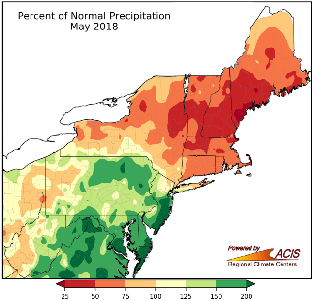
Perception: May was a very wet month around here.
Reality: Rainfall was actually below to well below normal around here.
Now that we’ve got that fact established, we can also tell you that there’s not much rainfall in this week’s forecast. Many of you will rejoice at that news, but your lawns and gardens will not. It’s not a full-fledged drought yet, but it’s the start of one. The longer we go without significant rainfall, the more likely it is that we settle into a drought.

The week starts off with high pressure building in from the north, bringing sunshine into the region. However, with a frontal system stalled out well to the south, we’ll still have some high clouds around, especially south of the Mass Pike. With the high to the north, we’ll have easterly winds across the region. Since water temperatures are still only in the 50s to lower 60s, that means coastal locations will still quite cool, with warmer temperatures the farther inland you get. The high slides off to the east on Tuesday, so sunshine will continue, but a wind shift into the southwest will result in a warmer day across most of the area.
By Wednesday, a cold front approaches the region, with clouds returning along with some showers and thunderstorms. This is not going to be the widespread heavy rain that we actually need. In fact , many locations might not see any rain at all from this system. Skies will be partly sunny behind the front on Thursday, before another weak front moves through. This one will pass through with little fanfare, as it will be starved for moisture, with only a few stray showers possible. High pressure then builds in for Friday and the weekend with sunshine and another warming trend.

Monday: A mix of sunshine and clouds. High 66-73, coolest along the coast.
Monday night: Clear skies. Low 46-53.
Tuesday: Partly to mostly sunny, breezy. High 75-82, cooler along the south coast.
Tuesday night: Clear to partly cloudy. Low 54-61.
Wednesday: Becoming partly to mostly cloudy and breezy with some showers or thunderstorms during the afternoon and evening. High 76-83, cooler along the south coast.
Thursday: Partly to mostly sunny and breezy. High 78-85.
Friday: A mix of sun and clouds. High 72-79, cooler along the coast.
Saturday: Sunshine and a few clouds. High 79-86.
Sunday: Plenty of sunshine. High 81-88, cooler along the coast.
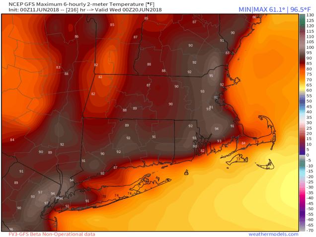
Beyond that, a few of the models are showing the possibility that next week could start off with 1 or 2, maybe even 3 days with temperatures near or above 90 degrees around here.