It’s Going to get Hot, Hot, Hot! (Not Around Here Though)

A ridge of high pressure over the Plains states will slowly shift westward over the next few days, with intense heat across the Plains heading for the Desert Southwest.

High temperatures soared well into the 90s across the Southern Plains on Wednesday, but when the humidity was factored in, the heat index exceeded 100-110 degrees in parts of the nation’s midsection.  Only a few showers and thunderstorms provided scattered relief to the region. On Thursday, with similar conditions expected across much of the Southern Plains and parts of the Mississippi Valley, heat advisories have been posted for much of the region. High temperatures will be well into the 90s once again with some triple digit readings expected. When the humidity is factored in, heat index values will be in the 100-115 degree range across the region.

gfs_hindex_tx_6
Forecast for heat index values for Thursday afternoon. Image provided by WeatherBell

While the nation’s midsection has been enduring the heat, a trough of low pressure has been keeping the West cool for the past few days. Temperatures have been as much as 10 to 20 degrees below normal, especially across the Pacific Northwest. Across the higher elevations of the Cascades, several inches of snow has been reported.

500hv.conus
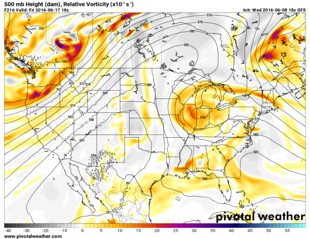
Forecast for 500mb heights for Sunday June 19. Image provided by Pivotal Weather.

While the Northwest will remain cool into the weekend, much warmer weather will move into the Southwest as a ridge of high pressure builds westward. By Saturday, temperatures will be 10-20 degrees above normal in the Desert Southwest. For a place that is “normally” hot, anomalies that big can break records. In Phoenix, high temperatures could approach 120 degrees on Sunday. The record high for that day is 115, set in 1968.

gfs_t2max_lower48_14
High temperature forecast from the GFS model for Saturday June 18. Image provided by WeatherBell.
gfs_t2max_lower48_18
High temperature forecast from the GFS model for Sunday June 19. Image provided by WeatherBell.

Excessive heat watches have been posted for much of the Southwest from Saturday through Tuesday. The hottest days look to be Sunday and Monday, when high temperatures will likely exceed 110 degrees in Las Vegas, and could approach 120 degrees in Phoenix and Yuma. In Death Valley, California, high temperatures on Sunday and Monday could approach 125 degrees.

Even at night, there will be little relief, as low temperatures may only drop into the 80s to lower 90s across the area. In Death Valley, temperatures may only drop below 100 degrees for a couple of hours.

While temperatures may drop a few degrees later in the week, the ridge of high pressure is expected to remain in place across the Southwest right through the end of the month, keep temperatures above to well above normal.

Here in New England, high pressure will keep us dry and seasonably warm right into the start of next week. Temperatures could get well into the 80s Monday and Tuesday, but no sustained heat is expected for at least the next 10 days.

Here Comes the Heat (Except for You New England)

A large ridge of high pressure will shift from the West Coast into the Nation’s midsection over the next few days, bringing with it some of the hottest weather so far this year to the Plains states.

ncep_cfsv2_120_t2anom_usa
Temperature anomalies for the past 30 days across the nation. Image provided by WeatherBell.

A persistent ridge of high pressure has been anchored across the West for the past few weeks, keeping temperatures well above normal for much of May and early June. Numerous records were set across the region, even in normally hot locations like the Desert Southwest, where temperatures exceeded 110 degrees several times. In Death Valley, California, which is frequently the nation’s hotspot, the first 8 days of June have averaged 10.6 degrees above normal, with high temperatures exceeding 115 degrees each day.

While the West has been baking, temperatures across the Plains states have been 1 to 3 degrees below normal for the past month. That is about to change as the ridge slides eastward. By the end of the week and the weekend, the ridge will be centered across the Plains and doesn’t look to move that much right through next week.

500hv.conus (1)
Map showing heights at the 500mb level across the United states on Sunday June 12. Image provided by Pivotal Weather.

500hv.conus (2)

With the ridge of high pressure in place, temperatures will soar well into the 90s across the Plains states and adjacent portions of the Mississippi Valley for much of the remainder of the week, with some triple-digit heat possible across parts of the Dakotas, especially Friday and Saturday.

Some relief will settle into the Northern Plains in the form of a cold front early next week, but the heat will continue from the Southern Plains and Texas eastward into the Southeast. Across these areas, humidity levels will be higher, with dewpoints rising into the 60s and 70s. The result will be heat index values well over 100 degrees across parts of these areas.

gfs_t2max_mw_14
High temperature forecast based off of the GFS model for Saturday June 11. Image provided by WeatherBell

The ridge will also act to suppress thunderstorm activity across the Plains states for much of the remainder of the week. Cluster of thunderstorms may develop across the Northern Rockies and ride over the Ridge and into the Great Lakes and eventually the Northeast later in the week. One of these clusters could produce some severe weather across the Eastern Great Lakes and Mid-Atlantic states on Saturday.

While the heat settles in across the Plains temperatures will remain cool across the Northeast. An upper-level low pressure system will only slowly move eastward across southern Canada over the next few days, moving into the Gulf of Maine by early next week. While temperatures surge into the 90s and lower 100s across the Dakotas on Friday, temperatures will only be in the 60s to lower 70s across the Northeast, with parts of Northern New England staying in the 50s. A few showers may pop up during the afternoon, and across some of the higher peaks of the region, some wet snowflakes could mix in with the rain.

There are signs that things could change in New England, but not until the end of next week. Some of the forecast models are indicating the possibility that the upper-level low finally moves out, allowing the heat to finally spread eastward. The latter half of June could feature much warmer conditions if this does come to pass.

gefs_t2ma_5d_noram_63
Temperature anomalies forecast by the GFS Ensemble for the period June 19 through June 24. Image provided by WeatherBell.